Map of Quinhagak city

Map of Quinhagak city

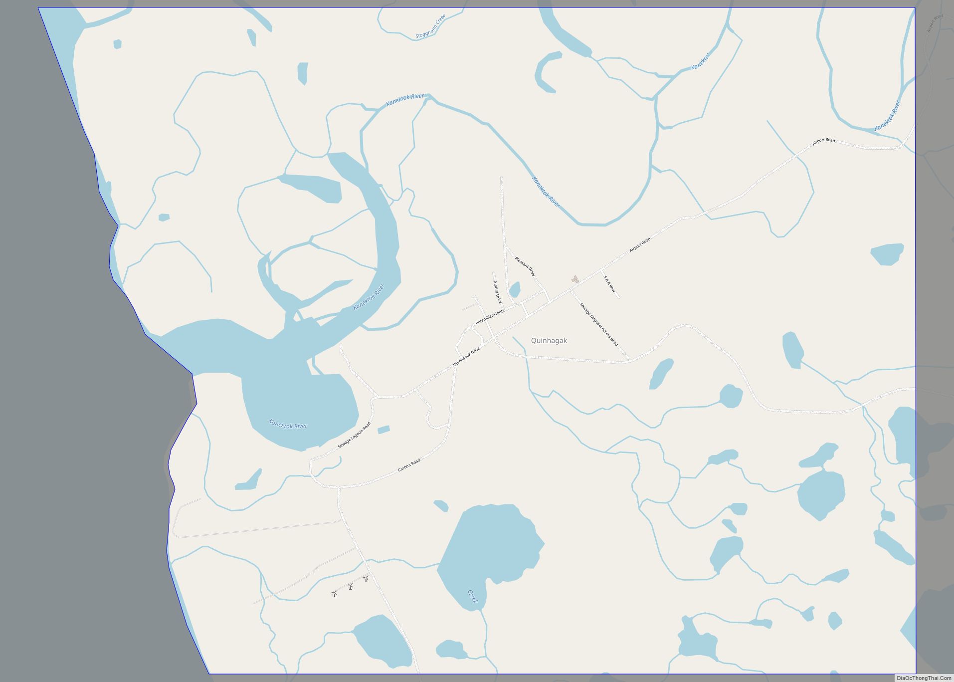
Quinhagak (/ˈkwɪnəhɑːk/; Central Yupik: Kuinerraq; Russian: Куинагак) is a city in Bethel Census Area, Alaska, United States. As of the 2010 census, the population of the city is 669, up from 555 in 2000. The Yupik name for the village is Kuinerraq, meaning “new river channel.” It has been dated to at least 1000 AD. … Read more

Map of Prudhoe Bay CDP

Map of Prudhoe Bay CDP

Prudhoe Bay /ˈpruːdoʊ/ is a census-designated place (CDP) located in North Slope Borough in the U.S. state of Alaska. As of the 2010 census, the population of the CDP was 2,174 people, up from just five residents in the 2000 census; however, at any given time, several thousand transient workers support the Prudhoe Bay oil … Read more

Map of Primrose CDP

Map of Primrose CDP, Alaska

Primrose is a census-designated place (CDP) in Kenai Peninsula Borough, Alaska, United States. The population was 78 at the 2010 census, down from 93 at the 2000 census. Primrose is one of a number of small communities located north of Seward along the Seward Highway. Primrose CDP overview: Name: Primrose CDP LSAD Code: 57 LSAD … Read more

Map of Red Dog Mine CDP

Map of Red Dog Mine CDP

Red Dog Mine is a census-designated place (CDP) in the Northwest Arctic Borough of the U.S. state of Alaska. The population was 5 at the 2020 census, down from 309 in 2010. Red Dog Mine CDP overview: Name: Red Dog Mine CDP LSAD Code: 57 LSAD Description: CDP (suffix) State: Alaska County: Northwest Arctic Borough … Read more

Map of Red Devil CDP

Map of Red Devil CDP

Red Devil is a census-designated place (CDP) in Bethel Census Area, Alaska, United States. The population was 23 at the 2010 census, down from 48 in 2000. Their post office was founded in 1957. Red Devil CDP overview: Name: Red Devil CDP LSAD Code: 57 LSAD Description: CDP (suffix) State: Alaska County: Bethel Census Area … Read more

Map of Rampart CDP

Map of Rampart CDP

Rampart (Dleł Taaneets [t͡ɬəɬ tʰæːniːt͡sʰ] in Koyukon) is a census-designated place (CDP) in Yukon-Koyukuk Census Area, Alaska, United States. The population was 24 at the 2010 census, down from 45 in 2000. Rampart CDP overview: Name: Rampart CDP LSAD Code: 57 LSAD Description: CDP (suffix) State: Alaska County: Yukon-Koyukuk Census Area Total Area: 169.90 sq mi (440.04 km²) … Read more

Map of Russian Mission city

Map of Russian Mission city

Russian Mission (Central Yupik: Iqugmiut; Russian: Икогмют – Ikogmiut, now Рашен-Мишен) is a city in Kusilvak Census Area, Alaska. It was the location of a fur trading post of the Russian-American Company in 1842. After the sale of Russian-American possessions to the United States in 1867, it was officially named Russian Mission in the early … Read more

Map of Ruby city

Map of Ruby city, Alaska

Ruby (Koyukon: Tl’aa’ologhe) is an incorporated town in central western Alaska, situated on the south bank of the Yukon River at the northwesternmost tip of the Nowitna National Wildlife Refuge. It is accessible only by boat or air. A formerly sizeable gold-mining and lumbering town servicing the region, at the 2010 census the population was … Read more

Map of Ridgeway CDP

Map of Ridgeway CDP, Alaska

Ridgeway is a census-designated place (CDP) in Kenai Peninsula Borough, Alaska, United States. At the 2020 census the population was 2,136, up from 2,022 in 2010. Ridgeway CDP overview: Name: Ridgeway CDP LSAD Code: 57 LSAD Description: CDP (suffix) State: Alaska County: Kenai Peninsula Borough Elevation: 187 ft (57 m) Total Area: 17.68 sq mi (45.80 km²) Land Area: 16.79 sq mi … Read more

Map of Sand Point city

Map of Sand Point city

Sand Point, also known as Popof Island, is a city in Aleutians East Borough, Alaska, United States. At the 2010 census the population was 976, up from 952 in 2000, but by the 2020 Census this had reduced to 578. It is on northwestern Popof Island, one of the Shumagin Islands, off the Alaska Peninsula. … Read more

Map of Salcha CDP

Map of Salcha CDP

Salcha (Tanana: Soł Chaget, Tanacross: Saagescheeg) is a census-designated place (CDP) in Fairbanks North Star Borough in the U.S. state of Alaska. It is part of the Fairbanks, Alaska Metropolitan Statistical Area. The population was 1,095 at the 2010 census, up from 854 in 2000. Salcha CDP overview: Name: Salcha CDP LSAD Code: 57 LSAD … Read more

Map of Salamatof CDP

Map of Salamatof CDP

Salamatof (Dena’ina: Ken Dech’etl’t) is a census-designated place (CDP) in Kenai Peninsula Borough, Alaska, United States. The population was 1,078 at the 2020 census, up from 980 in 2010. Salamatof is the location for the former Wildwood Air Force Station, which operated from 1965 to 1972 (from 1951 to 1965, it was an Army Station). Today, … Read more