Map of Bear Creek CDP

Map of Bear Creek CDP, Alaska

Bear Creek is a census-designated place (CDP) in Kenai Peninsula Borough, Alaska, United States. At the 2020 census the population was 2,129 up from 1,956 in 2010. Bear Creek is a few miles north of Seward near the stream of the same name and its source, Bear Lake. Bear Creek CDP overview: Name: Bear Creek … Read more

Map of Badger CDP

Map of Badger CDP, Alaska

Badger is a census-designated place (CDP) in the Fairbanks North Star Borough of Alaska. It was one of the CDPs created in 2010 out of small suburbs and outskirts of Fairbanks. It has an area of 66.71 sq. mi, 65.63 of land and 1.08 of water. The population of the CDP was 19,031 as of … Read more

Map of Attu Station CDP

Map of Attu Station CDP

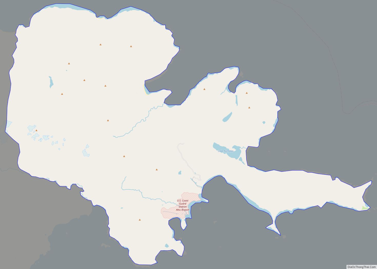
Attu Station is a census-designated place (CDP) located on Attu Island in the Aleutians West Census Area in the U.S. state of Alaska. The population was 21 at the 2010 census, consisting entirely of coast guard personnel who resided and worked at Casco Cove Coast Guard Station, but left the island when the station was … Read more

Map of Bethel city

Map of Bethel city, Alaska

Bethel (Central Yupik: Mamterilleq) is a city in Bethel Census Area, Alaska, United States. It is the largest community on the Kuskokwim River, located approximately 50 mi (80 km) upriver from where the river flows into Kuskokwim Bay. It is also the largest city in western Alaska and in the Unorganized Borough, as well as the eighth-largest … Read more

Map of Beluga CDP

Map of Beluga CDP

Beluga is a census-designated place (CDP) in Kenai Peninsula Borough, Alaska, United States. The population was 20 at the 2010 census, down from 32 in 2000. Beluga CDP overview: Name: Beluga CDP LSAD Code: 57 LSAD Description: CDP (suffix) State: Alaska County: Kenai Peninsula Borough Elevation: 112 ft (34 m) Total Area: 99.84 sq mi (258.58 km²) Land Area: 99.13 sq mi … Read more

Map of Beaver CDP

Map of Beaver CDP, Alaska

Beaver (Ts’aahudaaneekk’onh Denh in Koyukon) is a census-designated place (CDP) in Yukon-Koyukuk Census Area, Alaska, United States. At the 2010 census the population was 84, unchanged from 2000. Beaver CDP overview: Name: Beaver CDP LSAD Code: 57 LSAD Description: CDP (suffix) State: Alaska County: Yukon-Koyukuk Census Area Total Area: 21.04 sq mi (54.51 km²) Land Area: 20.52 sq mi (53.14 km²) … Read more

Map of Big Lake CDP

Map of Big Lake CDP, Alaska

Big Lake (Dena’ina: K’enaka Bena)is a census-designated place (CDP) in Matanuska-Susitna Borough, Alaska, United States. It is part of the Anchorage, Alaska Metropolitan Statistical Area. The population was 3,833 at the 2020 census, up from 3,350 in 2010. Big Lake CDP overview: Name: Big Lake CDP LSAD Code: 57 LSAD Description: CDP (suffix) State: Alaska … Read more

Map of Big Delta CDP

Map of Big Delta CDP

Big Delta is a census-designated place (CDP) in Southeast Fairbanks Census Area, Alaska, United States. The population was 591 at the 2010 census, down from 749 in 2000. Big Delta is at the confluence of the Delta River and the Tanana River and gets its name from the huge river delta formed by the confluence. … Read more

Map of Bettles city

Map of Bettles city

Bettles (Kk’odlel T’odegheelenh Denh in Koyukon; Atchiiniq in Iñupiaq) is a city in Yukon-Koyukuk Census Area, Alaska, United States. It is near Gates of the Arctic National Park and Preserve. The population was 23 at the 2020 census, up from 12 in 2010. It is the second smallest incorporated city in the state. Bettles city overview: … Read more

Map of Buckland city

Map of Buckland city, Alaska

Buckland (Inupiaq: Kaŋiq) is a city in Northwest Arctic Borough, Alaska, United States. At the 2010 census the population was 416, up from 406 in 2000. Buckland city overview: Name: Buckland city LSAD Code: 25 LSAD Description: city (suffix) State: Alaska County: Northwest Arctic Borough Incorporated: June 6, 1966 Elevation: 13 ft (4 m) Total Area: 1.00 sq mi … Read more

Map of Brevig Mission city

Map of Brevig Mission city

Brevig Mission (Inupiaq: Sitaisaq, Sitaisat, or Sinauraq) is a city in Nome Census Area, Alaska. The population was 388 at the 2010 census, up from 276 in 2000. It is named for the Norwegian Lutheran pastor Tollef L. Brevig, who served at the mission that would later bear his name. First settled in 1900, the … Read more

Map of Birch Creek CDP

Map of Birch Creek CDP

Birch Creek (Łiteet’aii in Gwich’in) is a census-designated place (CDP) in Yukon-Koyukuk Census Area, Alaska, United States. The population was 33 at the 2010 census, up from 28 in 2000. Birch Creek CDP overview: Name: Birch Creek CDP LSAD Code: 57 LSAD Description: CDP (suffix) State: Alaska County: Yukon-Koyukuk Census Area Total Area: 8.28 sq mi (21.45 km²) … Read more