Bethel (Central Yupik: Mamterilleq) is a city in Bethel Census Area, Alaska, United States. It is the largest community on the Kuskokwim River, located approximately 50 mi (80 km) upriver from where the river flows into Kuskokwim Bay. It is also the largest city in western Alaska and in the Unorganized Borough, as well as the eighth-largest in the state. Bethel has a population of 6,325 as of the 2020 census, up from 6,080 in 2010.
Annual events in Bethel include the Kuskokwim 300, a dogsled race; Camai, a Yup’ik dance festival held each spring; and the Bethel Fair held in August.
| Name: | Bethel city |
|---|---|
| LSAD Code: | 25 |
| LSAD Description: | city (suffix) |
| State: | Alaska |
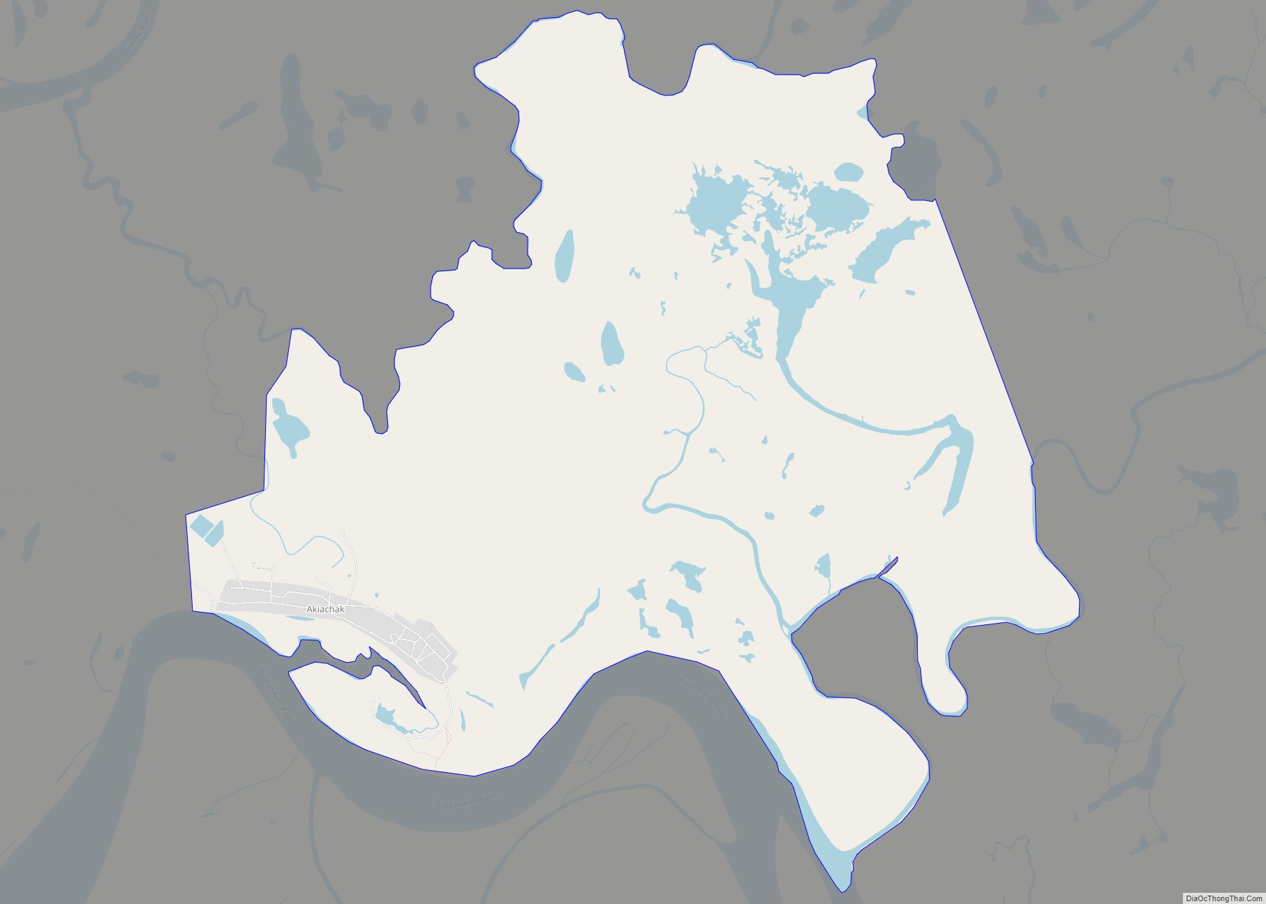
| County: | Bethel Census Area |
| Incorporated: | August 1957 |
| Elevation: | 3 ft (1 m) |
| Total Area: | 50.11 sq mi (129.78 km²) |
| Land Area: | 44.51 sq mi (115.27 km²) |
| Water Area: | 5.60 sq mi (14.51 km²) |
| Total Population: | 6,325 |
| Population Density: | 142.11/sq mi (54.87/km²) |
| ZIP code: | 99559 |
| Area code: | 907 |
| FIPS code: | 0206520 |
| GNISfeature ID: | 1398908 |
| Website: | cityofbethel.org |
Online Interactive Map
Click on ![]() to view map in "full screen" mode.
to view map in "full screen" mode.
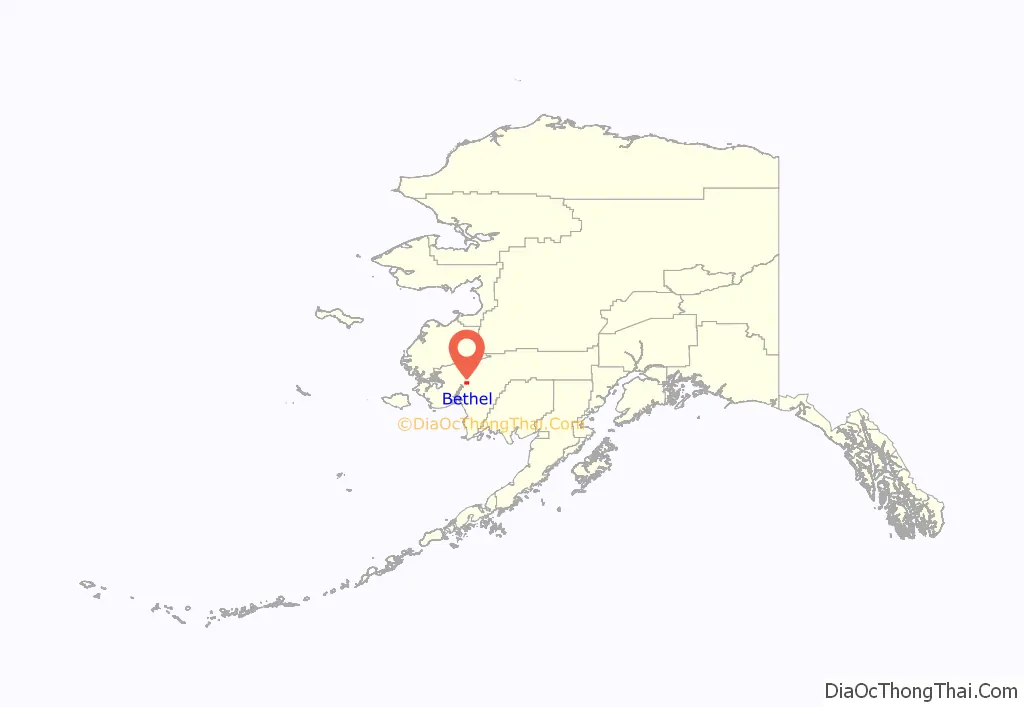
Bethel location map. Where is Bethel city?
History
Southwestern Alaska has been the homelands of Yup’ik peoples and their ancestors for thousands of years. The residents of what became Bethel were called the Mamterillermiut, meaning “Smokehouse People”, after their nearby fish smokehouse. In the late 19th century, the Alaska Commercial Company established a trading post in the town, called Mumtrekhlogamute, which had a population of 41 people by the 1880 census.
In 1885, the Moravian Church established a mission in the area under the leadership of Rev. William Weinland and Caroline (born Yost) and John Henry Kilbuck, Jr., a Lenape, and his wife Edith, a daughter and granddaughter of Moravian missionaries in Kansas. They both learned Yup’ik, which aided them in their missionary work. He made Yup’ik the language of the Moravian Church in the community and region, and helped translate the Christian Bible into the language. The missionaries moved Bethel from Mamterillermiut to its present location on the west side of the Kuskokwim River. A United States post office was opened in 1905.
Alaska Natives in this area have had a long Christian history, in part from Russian Orthodox, Catholic and Moravian influence. As in many Indian villages in Alaska, Christian tradition has become interwoven with the people’s original culture.
Development came to the area during and after World War II, causing a great social change among the Alaska Indians.
In 1971, Bethel established a community radio station KYUK, which has been a strong influence in the redevelopment and revival of Yup’ik culture and self-definition in the modern world. It was the first Native-owned and operated radio station in the US. Similar stations were soon started in Kotzebue, and by 1990, there were 10 stations in communities of fewer than 3,500 people.
On February 19, 1997, a school shooting attracted widespread media attention to Bethel when 16-year-old Evan Ramsey, a student at Bethel Regional High School, shot and killed his principal and one student and wounded two others, for which he later received a 210-year prison sentence.
In 2009, Bethel opted out of status as a “Local Option” community, theoretically opening the door to allowing alcohol sales in the city; residents and city officials maintained that all liquor license requests would be actively opposed. In October 2015, though, a vote for allowing alcohol sales in Bethel passed and two liquor licenses were approved for existing stores in the city.
In 2012, Bethel received worldwide coverage after some pranksters distributed flyers falsely announcing the launch of a Taco Bell restaurant, prompting Taco Bell to send a helicopter to the remote town, bearing a Taco Bell truck, which was itself bearing ingredients for 10,000 tacos.
On November 3, 2015, the Kilbuck building housing both the Ayaprun Elitnaurviat Yup’ik immersion school and the Kuskokwim Learning Academy caught fire, destroying the immersion school and damaging the boarding school. Fire fighters demolished part of the building in an effort to save a media center containing Yup’ik artifacts and elder interviews.
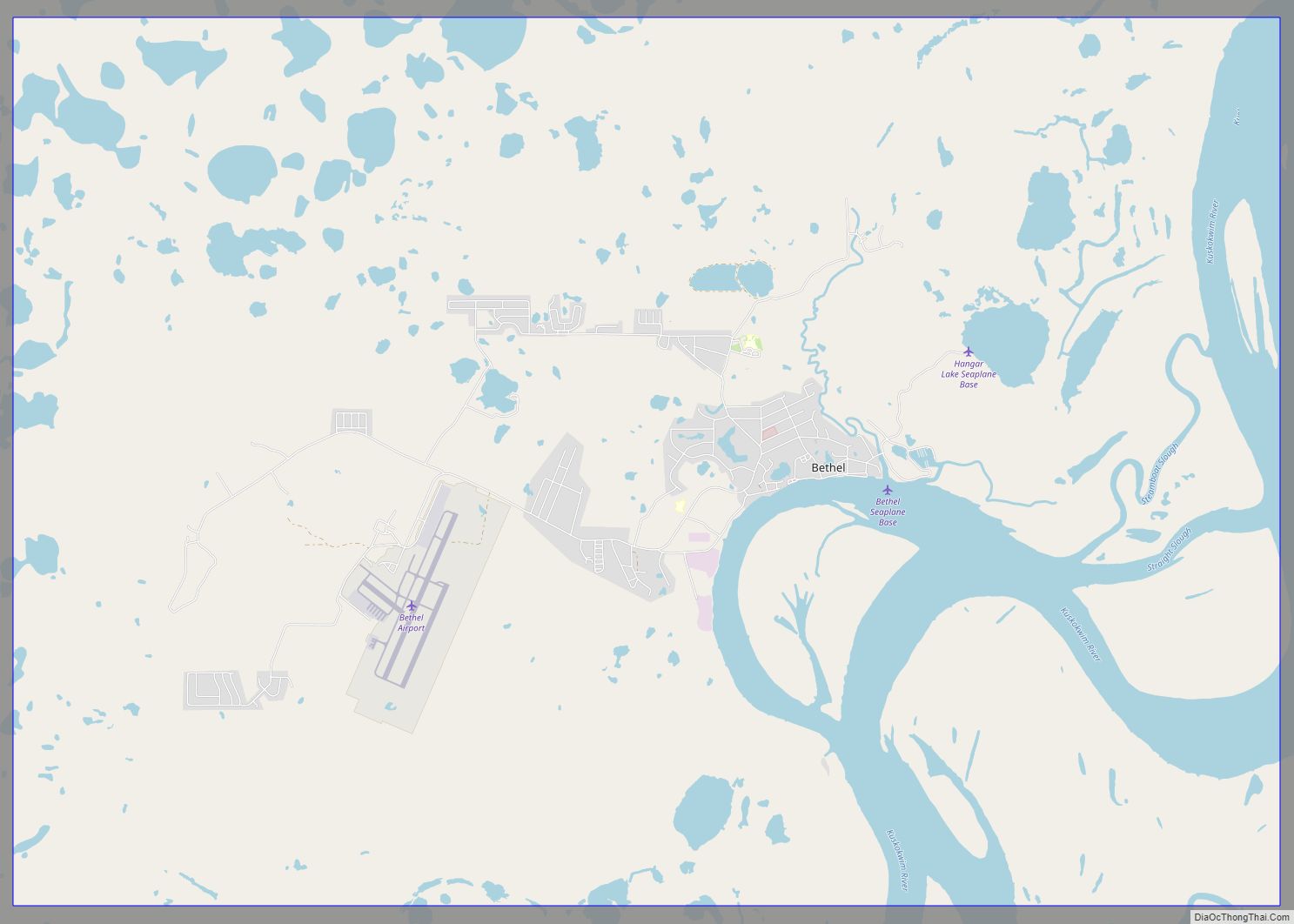
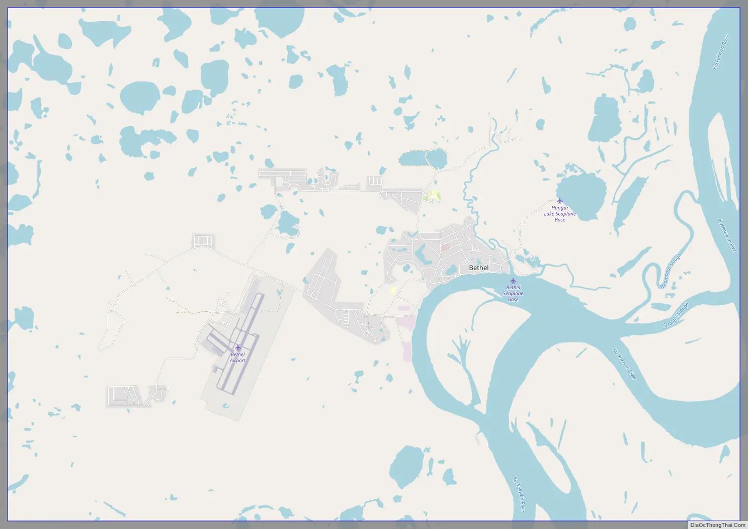
Bethel Road Map
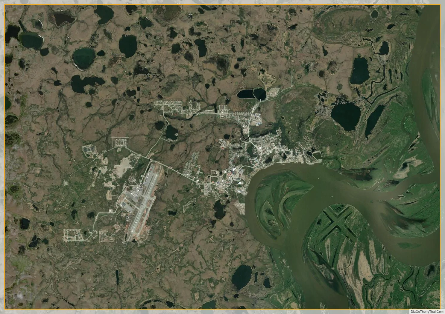
Bethel city Satellite Map
Geography
Bethel is located at 60°47′32″N 161°45′21″W / 60.79222°N 161.75583°W / 60.79222; -161.75583 (60.792222, −161.755833). According to the United States Census Bureau, the city has a total area of 48.7 square miles (126.1 km), of which 43.2 square miles (111.8 km) is land and 5.5 square miles (14.3 km), or 11.34%, is water.
Though the region is flat and generally treeless, Bethel lies inside the Yukon Delta National Wildlife Refuge, the second largest wildlife refuge in the United States.
Climate
Bethel has a subarctic climate (Köppen: “Dfc”), with long, somewhat snowy, and cold winters, and short, mild summers. Normal monthly mean temperatures range from 6.6 °F (−14.1 °C) in January to 56.1 °F (13.4 °C) in July, with an annual mean of 30.7 °F (−0.7 °C). Warm days of above 70 °F (21 °C) can be expected on 14 days per summer. Precipitation is both most frequent and greatest during the summer months, averaging 18.5 inches (470 mm) per year. Snowfall usually falls in light bouts, and is actually greater in November and December (before the sea freezes) than in January and February, averaging 45 inches (114 cm) a season. Extreme temperatures have ranged from −52 °F (−47 °C) on January 18-19 and 25, 1947 up to 90 °F (32 °C) on June 17, 1926.
See also
Map of Alaska State and its subdivision:- Aleutians East
- Aleutians West
- Anchorage
- Bethel
- Bristol Bay
- Denali
- Dillingham
- Fairbanks North Star
- Haines
- Juneau
- Kenai Peninsula
- Ketchikan Gateway
- Kodiak Island
- Lake and Peninsula
- Matanuska-Susitna
- Nome
- North Slope
- Northwest Arctic
- Prince of Wales-Outer Ketchi
- Sitka
- Skagway-Yakutat-Angoon
- Southeast Fairbanks
- Valdez-Cordova
- Wade Hampton
- Wrangell-Petersburg
- Yukon-Koyukuk
- Alabama
- Alaska
- Arizona
- Arkansas
- California
- Colorado
- Connecticut
- Delaware
- District of Columbia
- Florida
- Georgia
- Hawaii
- Idaho
- Illinois
- Indiana
- Iowa
- Kansas
- Kentucky
- Louisiana
- Maine
- Maryland
- Massachusetts
- Michigan
- Minnesota
- Mississippi
- Missouri
- Montana
- Nebraska
- Nevada
- New Hampshire
- New Jersey
- New Mexico
- New York
- North Carolina
- North Dakota
- Ohio
- Oklahoma
- Oregon
- Pennsylvania
- Rhode Island
- South Carolina
- South Dakota
- Tennessee
- Texas
- Utah
- Vermont
- Virginia
- Washington
- West Virginia
- Wisconsin
- Wyoming