Map of Sierra Vista city

Map of Sierra Vista city

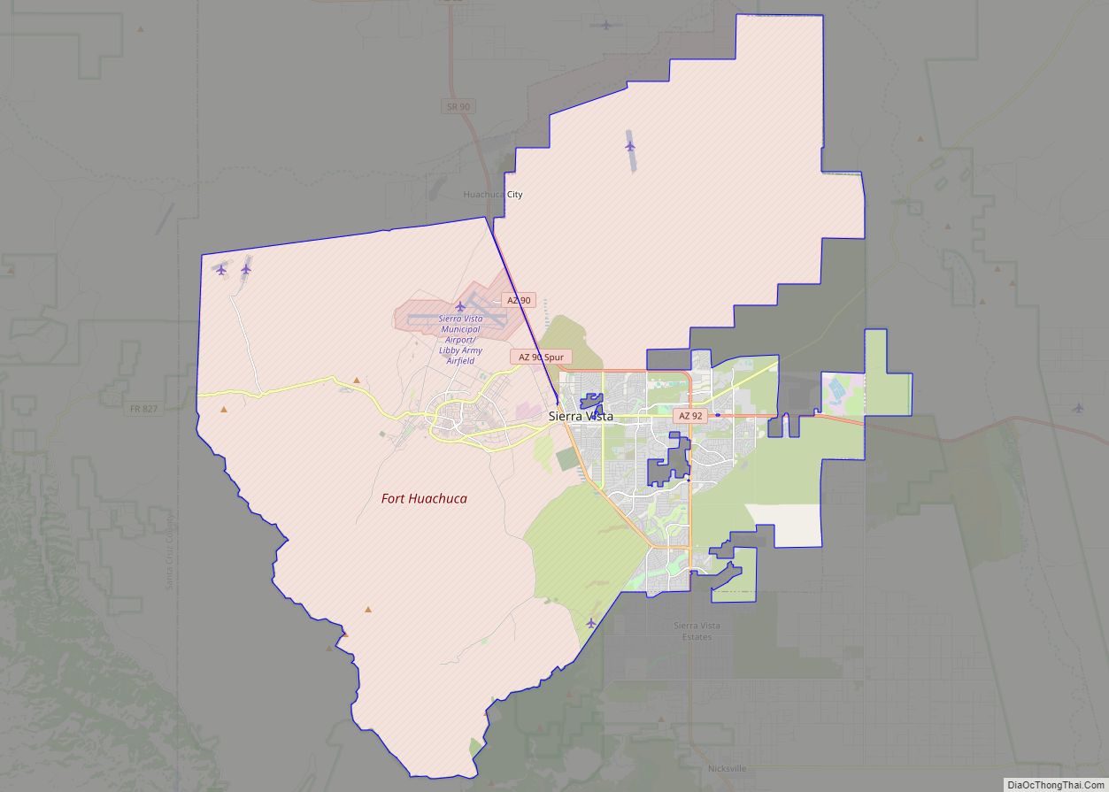
Sierra Vista is a city in Cochise County, Arizona, United States. According to the 2020 Census, the population of the city is 45,308, and is the 27th most populous city in Arizona. The city is part of the Sierra Vista-Douglas Metropolitan Area, with a 2010 population of 131,346. Fort Huachuca, a U.S. Army post, has … Read more

Map of Prescott city, Arizona

Map of Prescott city, Arizona

Prescott (/ˈprɛskət/ PRESS-kət) is a city in Yavapai County, Arizona, United States. According to the 2020 Census, the city’s population was 45,827. The city is the county seat of Yavapai County. In 1864, Prescott was designated as the capital of the Arizona Territory, replacing the temporary capital of Fort Whipple. The Territorial Capital was moved … Read more

Map of Ajo CDP

Map of Ajo CDP

Ajo (/ˈɑːhoʊ/ AH-hoh) is an unincorporated community in Pima County, Arizona, United States. It is the closest community to Organ Pipe Cactus National Monument. The population was 3,304 at the 2010 census. Ajo is located on State Route 85 just 43 miles (69 km) from the Mexican border. Ajo CDP overview: Name: Ajo CDP LSAD Code: … Read more

Map of Aguila CDP

Map of Aguila CDP

Aguila is an unincorporated community and census-designated place (CDP) in Maricopa County, Arizona, United States. It is located on U.S. Route 60, 25 miles (40 km) west of Wickenburg and 22 miles (35 km) northeast of Wenden. Major economic activities include cantaloupe farming and formerly included mining. It uses the same street numbering system as Phoenix. As … Read more

Map of Alamo Lake CDP

Map of Alamo Lake CDP

Alamo Lake is a census-designated place in La Paz County, Arizona, United States. Its population was 4 as of the 2020 census. The community includes Alamo Lake State Park. Alamo Lake CDP overview: Name: Alamo Lake CDP LSAD Code: 57 LSAD Description: CDP (suffix) State: Arizona County: La Paz County Elevation: 1,316 ft (401 m) Total Area: … Read more

Map of Ak Chin CDP

Map of Ak Chin CDP

Ak Chin, is a rural native village and a census-designated place on the Tohono Oʼodham Reservation, in Pima County, Arizona, United States. It had a population of 30 as of the 2010 U.S. Census and an estimated population of 31 as of July 1, 2015. Ak Chin has an estimated elevation of 1,854 feet (565 m) … Read more

Map of Ak-Chin Village CDP

Map of Ak-Chin Village CDP

Ak-Chin Village (O’odham: ʼAkĭ Ciñ) is a census-designated place (CDP) in Pinal County, Arizona, United States on the Ak-Chin (Maricopa) Reservation. The population was 862 at the 2010 census, up from 669 in 2000. Ak-Chin Village CDP overview: Name: Ak-Chin Village CDP LSAD Code: 57 LSAD Description: CDP (suffix) State: Arizona County: Pinal County Elevation: … Read more

Map of Ali Chukson CDP

Map of Ali Chukson CDP

Ali Chukson is a populated place and census designated place in Pima County, Arizona, United States. Its population was 113 as of the 2020 census. It is not to be confused with another village on the reservation, Ali Chuk. Ali Chukson CDP overview: Name: Ali Chukson CDP LSAD Code: 57 LSAD Description: CDP (suffix) State: … Read more

Map of Ali Chuk CDP

Map of Ali Chuk CDP

Ali Chuk is a populated place and census designated place in Pima County, Arizona, United States. Its population was 161 as of the 2010 census, and it has a land area of 1.44 sq mi (3.7 km). It has an estimated elevation of 1,762 feet (537 m) above sea level. It is located adjacent to the border with Mexico. … Read more

Map of Ali Molina CDP

Map of Ali Molina CDP

Ali Molina is a census designated place located in Pima County, Arizona, United States. It has a land area of 0.77 sq mi (2.0 km), and as of July 1, 2015, it had a population of 71. It is also unofficially known as Magdalena. Ali Molina is located within the Tohono O’odham Indian Reservation. It has an estimated … Read more

Map of Anegam CDP

Map of Anegam CDP

Anegam (O’odham) name translates as “Desert Willow”, is a populated place and census-designated place (CDP), situated on the Tohono O’odham Indian Reservation, in Pima County, Arizona, United States. Its population was 151 as of the 2010 census, and 154 as of July 1, 2015. It has an estimated elevation of 1,762 feet (537 m) above sea … Read more

Map of Amado CDP

Map of Amado CDP

Amado is a census-designated place (CDP) in Santa Cruz County, Arizona, United States. The population was 295 at the 2010 census. Amado CDP overview: Name: Amado CDP LSAD Code: 57 LSAD Description: CDP (suffix) State: Arizona County: Santa Cruz County Elevation: 3,097 ft (944 m) Total Area: 5.21 sq mi (13.50 km²) Land Area: 5.20 sq mi (13.45 km²) Water Area: 0.02 sq mi (0.04 km²) … Read more