Prescott (/ˈprɛskət/ PRESS-kət) is a city in Yavapai County, Arizona, United States. According to the 2020 Census, the city’s population was 45,827. The city is the county seat of Yavapai County.
In 1864, Prescott was designated as the capital of the Arizona Territory, replacing the temporary capital of Fort Whipple. The Territorial Capital was moved to Tucson in 1867. Prescott again became the Territorial Capital in 1877, until Phoenix became the capital in 1889.
Prescott has a rich history as a frontier gold and silver mining town. Mining and settlers brought frequent conflict with native American tribes in the area, including the Yavapai and Apache. Prescott was the home to Fort Whipple from its inception, which acted as a base for campaigns against natives. Prescott was a stereotypical “wild west” town during the latter half of the 19th century; famous residents included Doc Holliday and Virgil Earp of the gunfight at the O.K. Corral. The makeshift wooden town burned to the ground several times in the first decade of the 20th century, which finally resulted in the town being rebuilt in brick. The modern city subsists off of tourism, especially around its storied past. It is host to the self-proclaimed “World’s Oldest Rodeo”, running continuously since 1888. The rodeo, one of the most famous in the United States, draws some 35,000 tourists a year.
The towns of Prescott Valley, 7 miles (11 km) east; Chino Valley, 16 miles (26 km) north; Dewey-Humboldt, 13 miles (21 km) east, and Prescott comprise what is locally known as the “Quad-City” area. This also sometimes refers to central Yavapai County in general, which would include the towns of: Mayer, Paulden, Wilhoit, and Williamson Valley. Combined with these smaller communities, the area had a population of 103,260 as of 2007. Prescott is the center of the Prescott Metropolitan Area, defined by the U.S. Census Bureau as all of Yavapai County.
The Yavapai-Prescott Indian Tribe reservation is adjacent to and partially within the borders of Prescott.
Prescott is in the Granite Creek watershed and contains the convergence of Miller Creek and Granite Creek on its north side.
| Name: | Prescott city |
|---|---|
| LSAD Code: | 25 |
| LSAD Description: | city (suffix) |
| State: | Arizona |
| County: | Yavapai County |
| Incorporated: | 1881 |
| Elevation: | 5,367 ft (1,636 m) |
| Land Area: | 44.97 sq mi (116.47 km²) |
| Water Area: | 0.24 sq mi (0.62 km²) |
| Population Density: | 1,019.08/sq mi (393.47/km²) |
| ZIP code: | 86300–86399 |
| Area code: | 928 |
| FIPS code: | 0457380 |
| GNISfeature ID: | 33189 |
| Website: | www.prescott-az.gov |
Online Interactive Map
Click on ![]() to view map in "full screen" mode.
to view map in "full screen" mode.
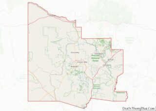
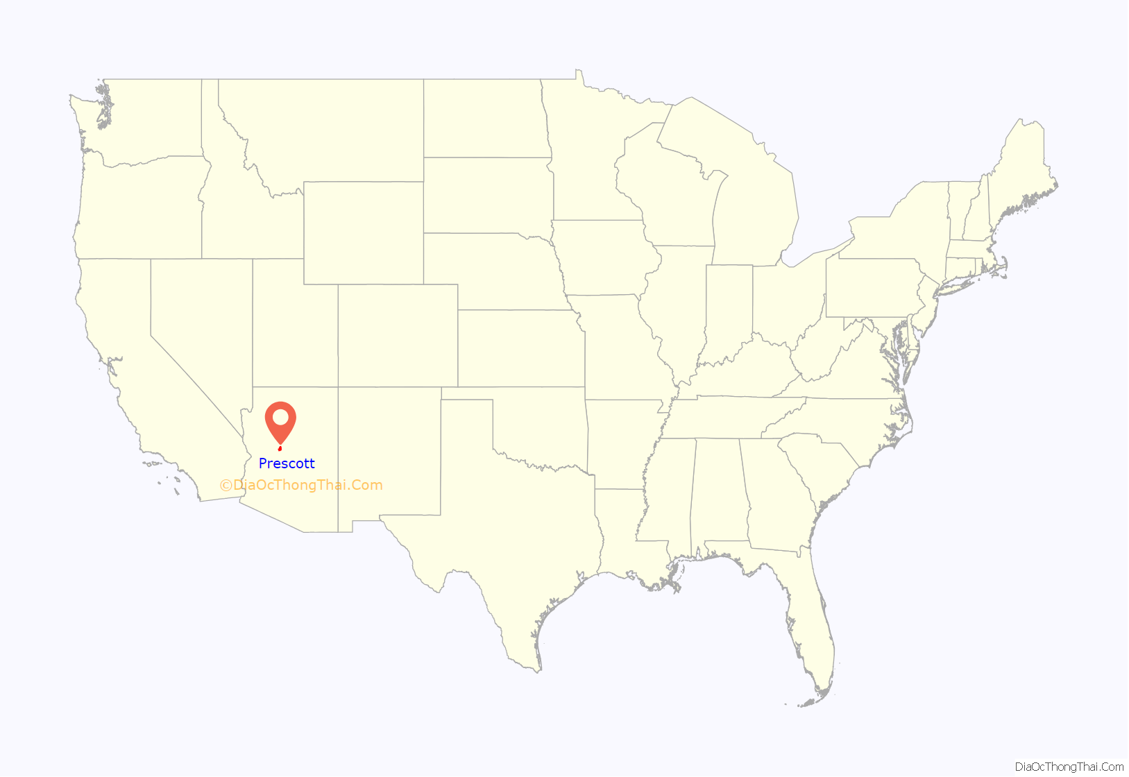
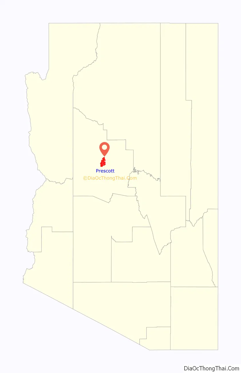
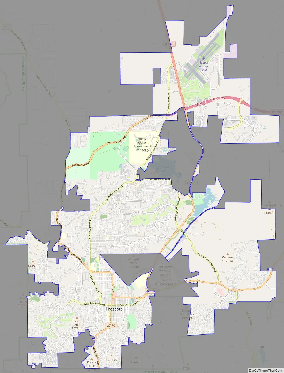
Prescott location map. Where is Prescott city?
History
Prescott was originally inhabited by the indigenous Yavapai, who had split off from Patayan groups around 1300 AD. The first recorded European contact with the Yavapai was made by Spaniard Antonio de Espejo in 1583, who was looking for gold. Until the 1860s, there was no permanent European presence. The territory was explored by the Walker Party in 1862 and 1863. Walker and his men discovered gold at Hassayampa Creek, just south of Prescott, in 1863. Further gold was struck at nearby Lynx Creek, Weaver Creek, and Big Bug. With the backing of Ohio railroad magnates, the Arizona Organic Act establishing the Arizona Territory was pushed through in February 1863. The land was now open to settlers. Fort Whipple was established the same year near present day Chino Valley. The fort was also made the territorial capital.
The fort was moved to more mountainous terrain 20 miles (32 km) south the next year. Arizona Territorial Governor John Noble Goodwin selected the site of Prescott following his first tour of the new territory. Goodwin replaced Governor John A. Gurley, appointed by Abraham Lincoln, who died before taking office. Downtown streets in Prescott are named in honor of both of them. Goodwin selected a site south of the temporary capital on the east side of Granite Creek near a number of mining camps. The new town was named in honor of historian William H. Prescott during a public meeting on May 30, 1864. Robert W. Groom surveyed the new community, and an initial auction sold 73 lots on June 4, 1864. By July 4, 1864, 232 lots had been sold within the new community. Prescott was incorporated in 1881.
The mineral wealth of Prescott included a good quantity of both gold and silver, and made the hamlet the most important city in northern Arizona. It also escalated the American Indian Wars, as pioneers and natives increasingly attacked the other, in ever bloodier reprisals. Tribes also chose sides against each other, with the Maricopa and O’odham fighting alongside American and Mexican settlers against the Yavapai and Apache in brutal campaigns. The Hualapai War broke out in northern Arizona in 1865, which brought a period of guerilla warfare, though few pitched battles. Not until 1935 were the Yavapai given a reservation in Prescott, and at first only a mere 75 acres (30 ha) directly adjacent to Fort Whipple. An extra 1,320 acres (530 ha) were provided in 1956.
The mining camps brought much prosperity, but also much racism. On July 12, 1863, the miners of Lynx Creek passed a resolution banning Asian and Mexican miners. Similar resolutions were passed in the other mining districts. Since there was no extant Mexican population, there was little to temper the racism of new Anglos from the Eastern United States. There were also very few women on the frontier at the time; an 1864 census found just 40. 31 were Mexican, which, combined with the racism of the territory, led to frequent allegations of sexual promiscuity. By the 1870s, as Prescott became increasingly “civilized”, it took on the values of Victorian society, including its sexual standards. There were exceptions, however. Mary DeCrow, a white woman, arriving around 1863, had a relationship with a black Texan, breaking taboos around miscegenation. She later married a Mexican blacksmith, starting a boarding house with him; public opinion calmed down after this and she eventually became much loved. Another legendary Prescott woman, Mary Sawyer, wore men’s clothes, drank hard, swore hard, and worked a mining claim. Sawyer’s breaking of gender norms however resulted in her 1877 institutionalization in an insane asylum, in which she remained until her death in 1902.
Prescott served as capital of Arizona Territory until November 1, 1867, when the capital was moved to Tucson by act of the 4th Arizona Territorial Legislature. The capital was returned to Prescott in 1877 by the 9th Arizona Territorial Legislature. The capital was finally moved to Phoenix on February 4, 1889, by the 15th Arizona Territorial Legislature. The three Arizona Territory capitals reflected the changes in political influence of different regions of the territory as they grew and developed.
Prescott also holds a place in the larger history of the American southwest. Both Virgil Earp (brother of Wyatt Earp) and Doc Holliday lived in Prescott before their now infamous gunfight at the O.K. Corral. Virgil Earp lived in Prescott starting in 1878 as a constable/watchman. Doc Holliday was there for a while in the summer of 1880 and even appears in the 1880 census records.
The Sharlot Hall Museum houses much of Prescott’s territorial history, and the Museum of Indigenous People (formerly the Smoki museum) and Phippen Museum also maintain local collections. Whiskey Row in downtown Prescott boasts many historic buildings, including The Palace, Arizona’s oldest restaurant and bar. Many other buildings have been converted to boutiques, art galleries, bookstores, and restaurants. Prescott is home to the Arizona Pioneers’ Home. The Home opened during territorial days, February 1, 1911.
After several major fires in the early part of the century, downtown Prescott was rebuilt with brick. The central courthouse plaza, a lawn under huge old elm trees, is a gathering and meeting place. Cultural events and performances take place on many nights in the summer on the plaza.
Barry Goldwater, the 1964 Republican nominee for president, launched his presidential campaign from the steps of Prescott’s Yavapai County Courthouse.
Notable wildfires
Yarnell Hill Fire: Nineteen members of the Granite Mountain Hotshots, part of the Prescott Fire Department, died on Sunday, June 30, 2013, while battling the wildfire that had ignited two days earlier south of Prescott.
Goodwin Fire: The wildfire ignited in the Bradshaw Mountains south of Prescott on Saturday, June 24, 2017. The fire eventually led to the evacuations of Mayer and Walker a few days later. State Route 69 was partially closed between the towns of Mayer and Dewey-Humboldt.
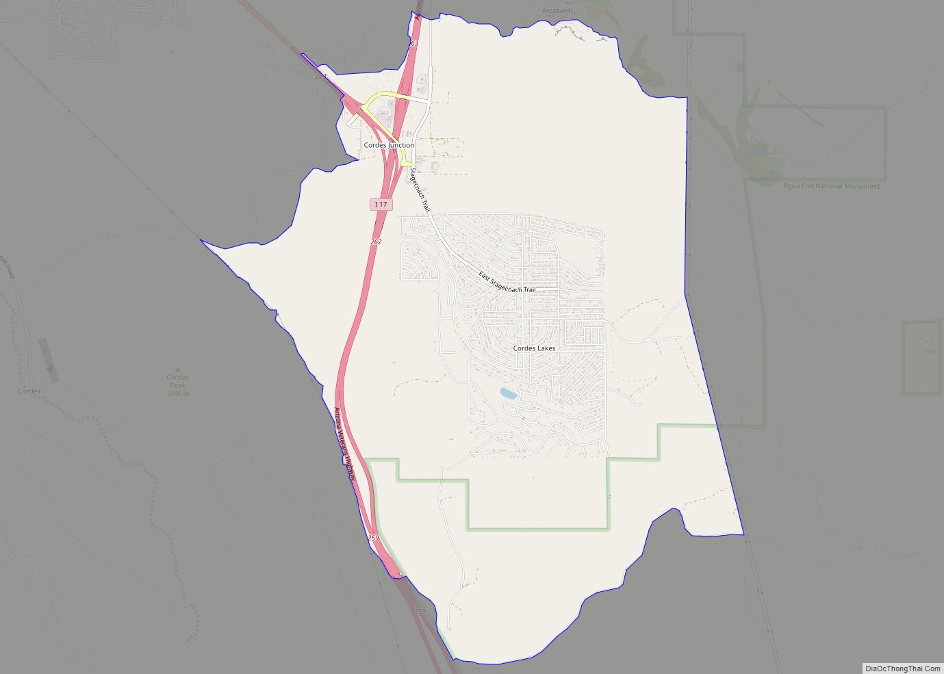
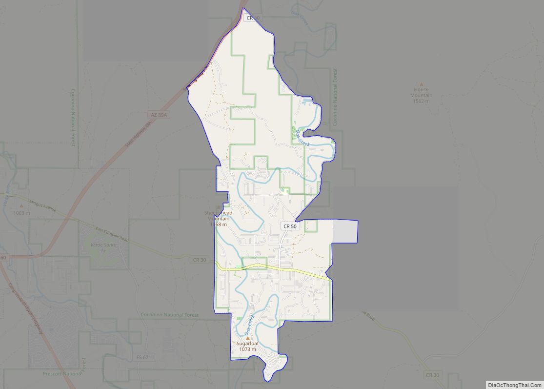
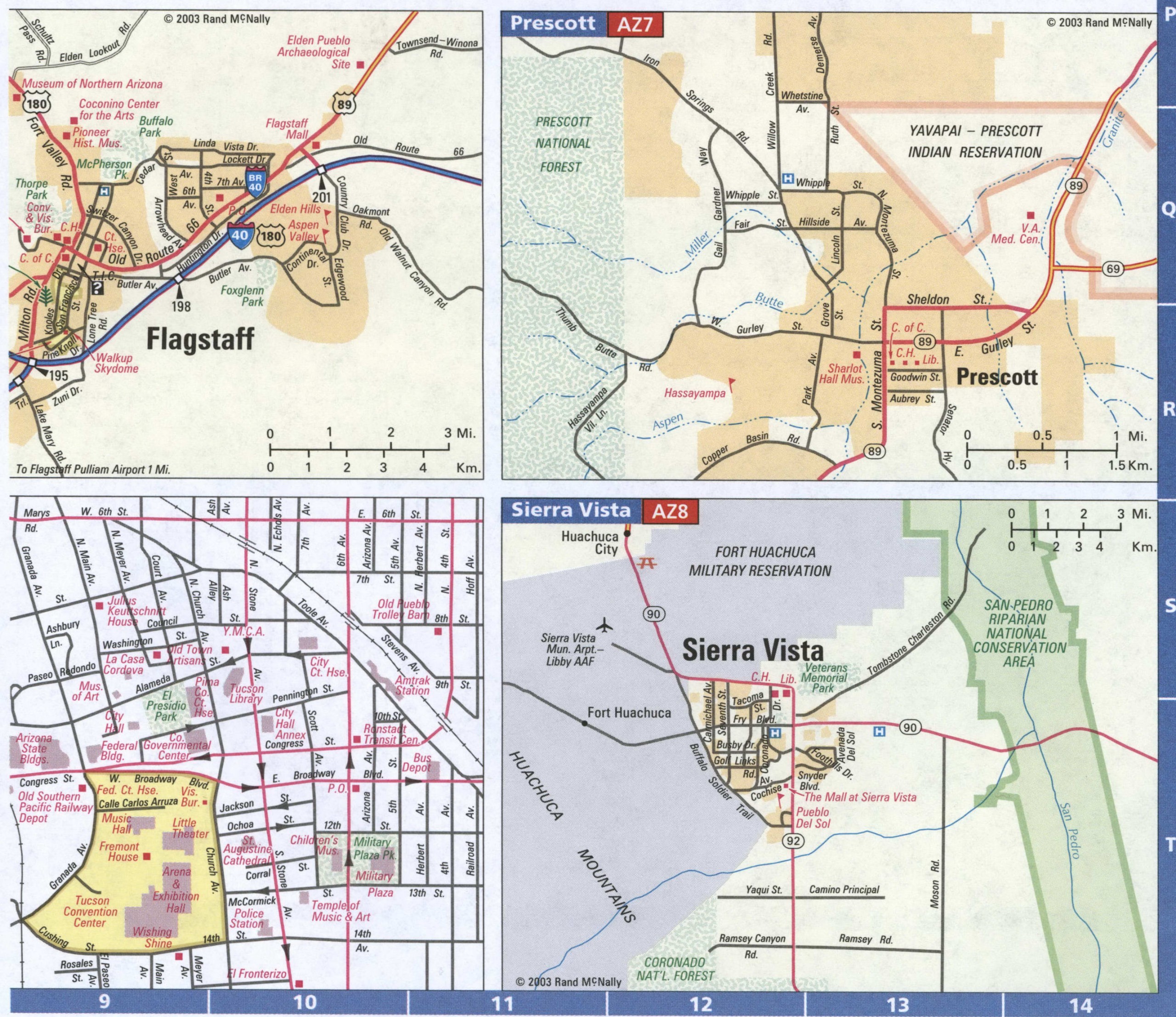
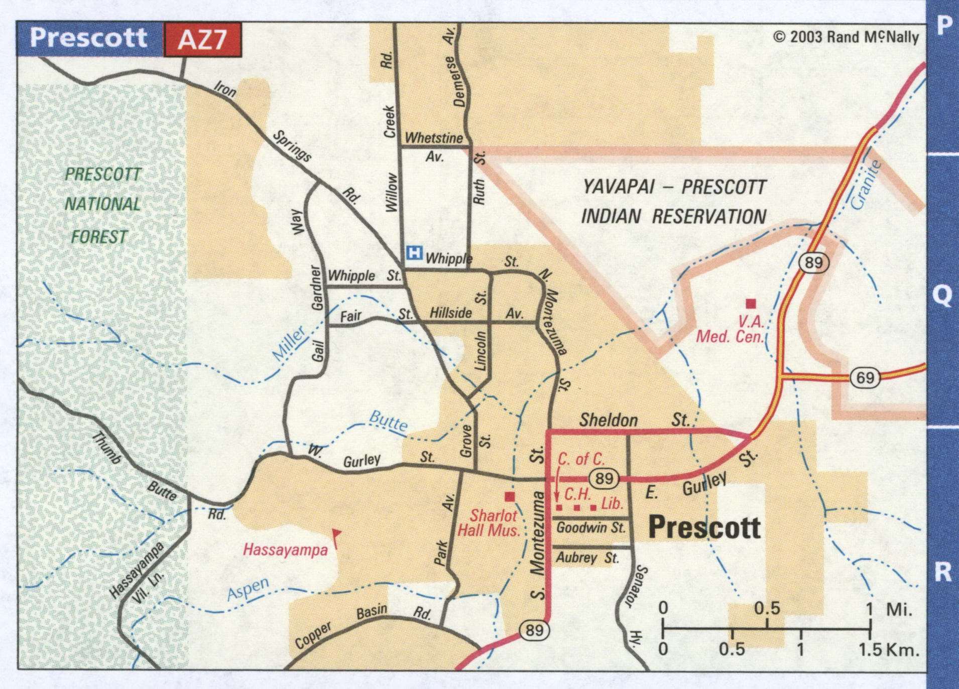
Prescott Road Map
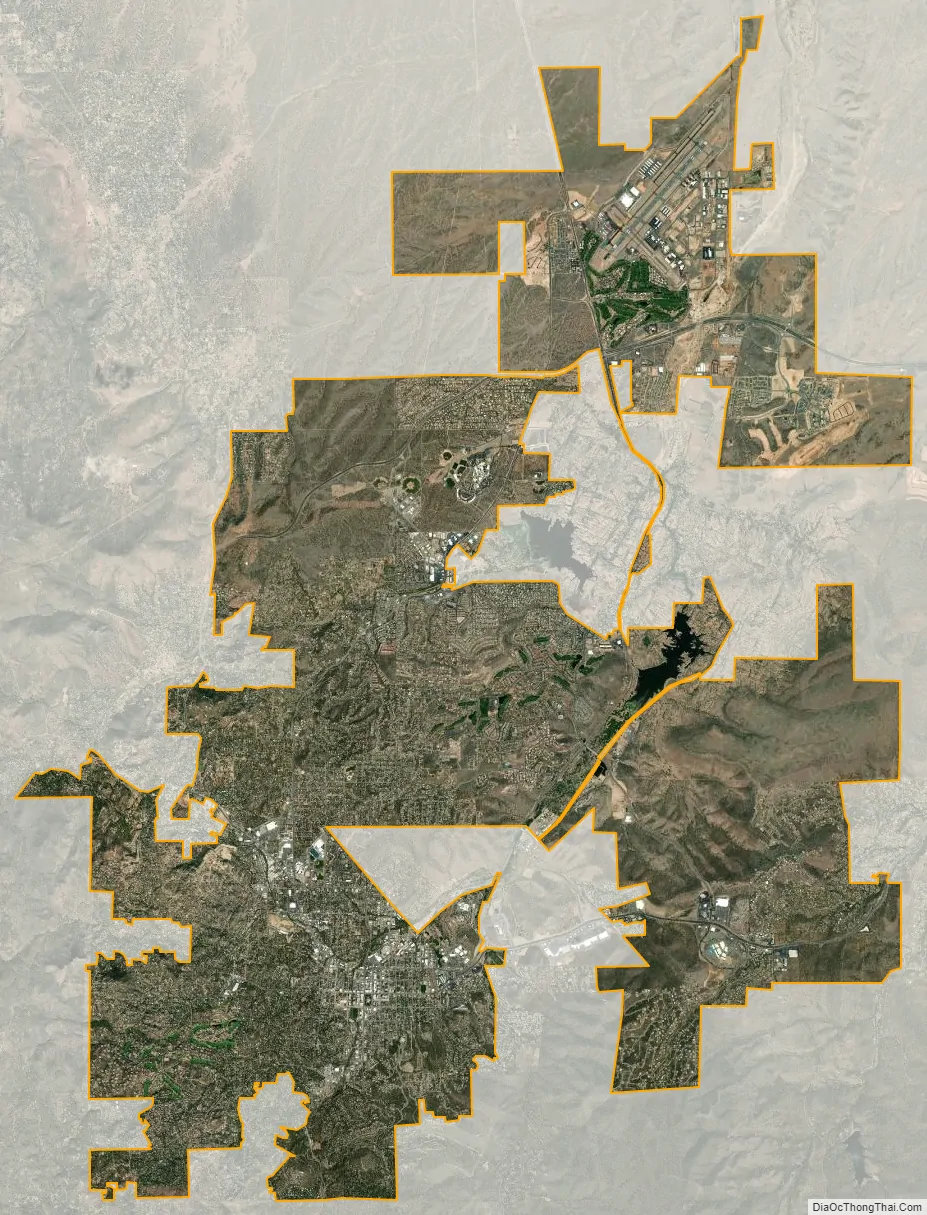
Prescott city Satellite Map
Geography
Prescott is 55 mi (89 km) west-northwest of the State of Arizona’s geographic center.
According to the United States Census Bureau, the city has a total area of 41.5 sq mi (107.5 km), of which 40.7 sq mi (105.4 km) is land and 0.81 sq mi (2.1 km) is water.
Prescott is considered part of North Central Arizona, sitting just north of the Bradshaw Mountains and east of the Sierra Prieta range. The Granite Dells, often called ‘The Dells’, lies just north of the Prescott city center and is known for its large boulder outcroppings of granite that have eroded into a spectacular appearance of bumpy rock features. Within ‘The Dells’ are Watson and Willow Lakes, which are two small, man-made reservoirs. Here a number of hiking trails connect to the Peavine Trail. The Peavine National Recreation Trail follows what was the former rail bed of the Santa Fe. This railroad traveled from Prescott to Phoenix through the Granite Dells. The “Peavine” got its name from the winding portion of this railroad that twists and curves, resembling the vine on which peas grow. The Peavine trail connects to the Iron King Trail, which was the route of the old Prescott Railroad through the Granite Dells. Other lakes include Lynx, Granite Basin and Goldwater, all surrounding different areas of this rustic community. Goldwater Lake, by Goldwater Park, is 4 miles (6.4 km) from downtown Prescott, has 15 acres (6.1 ha) of water surface, and is a popular destination for park recreation and picnic facilities. Lynx Lake is another lake close to Prescott in tall ponderosa pines, and gets some 125,000 visitors every year. This 55-acre (22 ha) lake offers visitors recreational activities, boating, camping, fishing, hiking, mountain biking, picnicking and a small, seasonal restaurant with a view of the lake. Finally, there is the smallest of the natural lakes with 5 acres (2.0 ha) of surface water at Granite Basin Lake. None of these lakes permit swimming due to a history of water quality problems, however all are popular recreational destinations near Prescott.
Granite Creek flows generally north from the Bradshaw Mountains through the city, the Granite Dells, and the Little Chino Valley to the Verde River.
Climate
Prescott is in the Bradshaw Mountains of central Arizona, at an elevation of 5,400 feet (1,600 m). The city has a Mediterranean climate (Köppen Csa) bordering on a Humid subtropical climate (Köppen Cwa); however, unlike most other locations in this climate class, there is a pronounced summer wet season due to the North American Monsoon.
Average annual precipitation for 1991-2020 was 16.46 inches (418 mm), with spring and early summer the driest times of the year. Snowfall is typically light and snow cover usually melts away quickly; the average seasonal total was 10.2 inches (26 cm).The largest portion of precipitation falls during the July–September monsoon season. Average daytime temperatures remain above 50 °F (10 °C) the entire year, but diurnal temperature variation is large throughout the year, averaging nearly 30 °F (17 °C) annually. On average, temperatures reach 90 °F (32 °C) on 44 days annually, though 100 °F (38 °C)+ readings are uncommon and occur only 1–2 days per year on average, much unlike the Sonoran Desert to the south and Mojave Desert to the west. The average season for freezing temperatures is October 21 through May 1.
Temperature extremes are fairly widespread. The warmest measured temperature in Prescott is 105 °F (41 °C) on two separate occasions (1925 and 2021). The coldest low was measured in 1937 and stood at −21 °F (−29 °C). Due to the large diurnal temperature variation, cold winter days are rare, but being far inland causes a variability which occasionally leads to ice days. The coldest maximum on record is 20 °F (−7 °C) in February 1905 and a normal year between 1991 and 2020 saw the coldest day of the year not rise above 33 °F (1 °C). Warm summer nights are rare due to being on an elevated plain, but happen on occasion. The warmest on record is 79 °F (26 °C) in August 1904, whereas a normal year has a more modest 69 °F (21 °C) for the highest low.
There was a severe drought from 1999 to 2009, seen from the lack of snowpack in the Bradshaw Mountains. Local creeks do not contain water except immediately after the rare rains. Nevertheless, at the start of 2007 lakes were reported as full. The winter of 2005–06 had less than 3 inches (7.6 cm) of snow, compared to an average snowfall of 12.8 inches (33 cm).
Monsoon season
Prescott is affected each year by the North American Monsoon. Monsoon season is June 15–Sept. 15, and brings significant rain, wind, hail, thunderstorms, and flooding to the area. In spite of the dangers of flash floods and wildfires, many locals enjoy monsoon season for the relief of cooler temperatures, which commonly result from storms during the height of summer heatwaves.
Arizona receives half of its annual rainfall during monsoon season, but this can be misleading. Monthly averages in precipitation can give the false impression that rains are confined to monsoon season, while single-day annual rainfall records have been set far outside of monsoon season, repeatedly. The area is prone to weather extremes and often, monthly rainfall records are actually the result of one or two dramatic rain events.
Flood risk
Prescott area residents have faced the challenges of extreme rain and flash flooding since the first prospectors arrived in search of gold in the late 1800s. In 1863 Joseph R. Walker’s original mining camp on the banks of Lynx Creek was completely swept away in a flash flood less than a year after arriving in Prescott. In the late 1880s, floods destroyed the first dam on Lynx creek near present-day SR-69. 1891 brought the heaviest flooding on record across Arizona (a record broken in 1993), carving lasting changes to the Verde river drainage, bordering Prescott. The Verde, which has in some years been completely dry, gushed with 4,284 cubic meters per second of water on Feb 24, 1891, or about half the size of the Columbia river.
Tropical Storm Octave, in 1983, brought 14.5″ of rain to parts of Prescott in less than forty-eight hours. Damages included the Santa Fe Railway, which was washed out in so many places it was completely abandoned the following year. Two Prescott area college students died in Granite Creek during flooding in 2004, which brought an official state of emergency declaration from state governor Napolitano. Significant flooding has been recorded as recently as 2018, prompting the evacuation of nearby Mayer in August.
A large number of homes in Prescott are located within FEMA designated “high risk flood zones A and AE”. The City of Prescott recently updated Flood Insurance Rate Maps in response to increased construction and notable flooding for several consecutive years.
See also
Map of Arizona State and its subdivision: Map of other states:- Alabama
- Alaska
- Arizona
- Arkansas
- California
- Colorado
- Connecticut
- Delaware
- District of Columbia
- Florida
- Georgia
- Hawaii
- Idaho
- Illinois
- Indiana
- Iowa
- Kansas
- Kentucky
- Louisiana
- Maine
- Maryland
- Massachusetts
- Michigan
- Minnesota
- Mississippi
- Missouri
- Montana
- Nebraska
- Nevada
- New Hampshire
- New Jersey
- New Mexico
- New York
- North Carolina
- North Dakota
- Ohio
- Oklahoma
- Oregon
- Pennsylvania
- Rhode Island
- South Carolina
- South Dakota
- Tennessee
- Texas
- Utah
- Vermont
- Virginia
- Washington
- West Virginia
- Wisconsin
- Wyoming