Map of Lake Hamilton CDP

Map of Lake Hamilton CDP, Arkansas

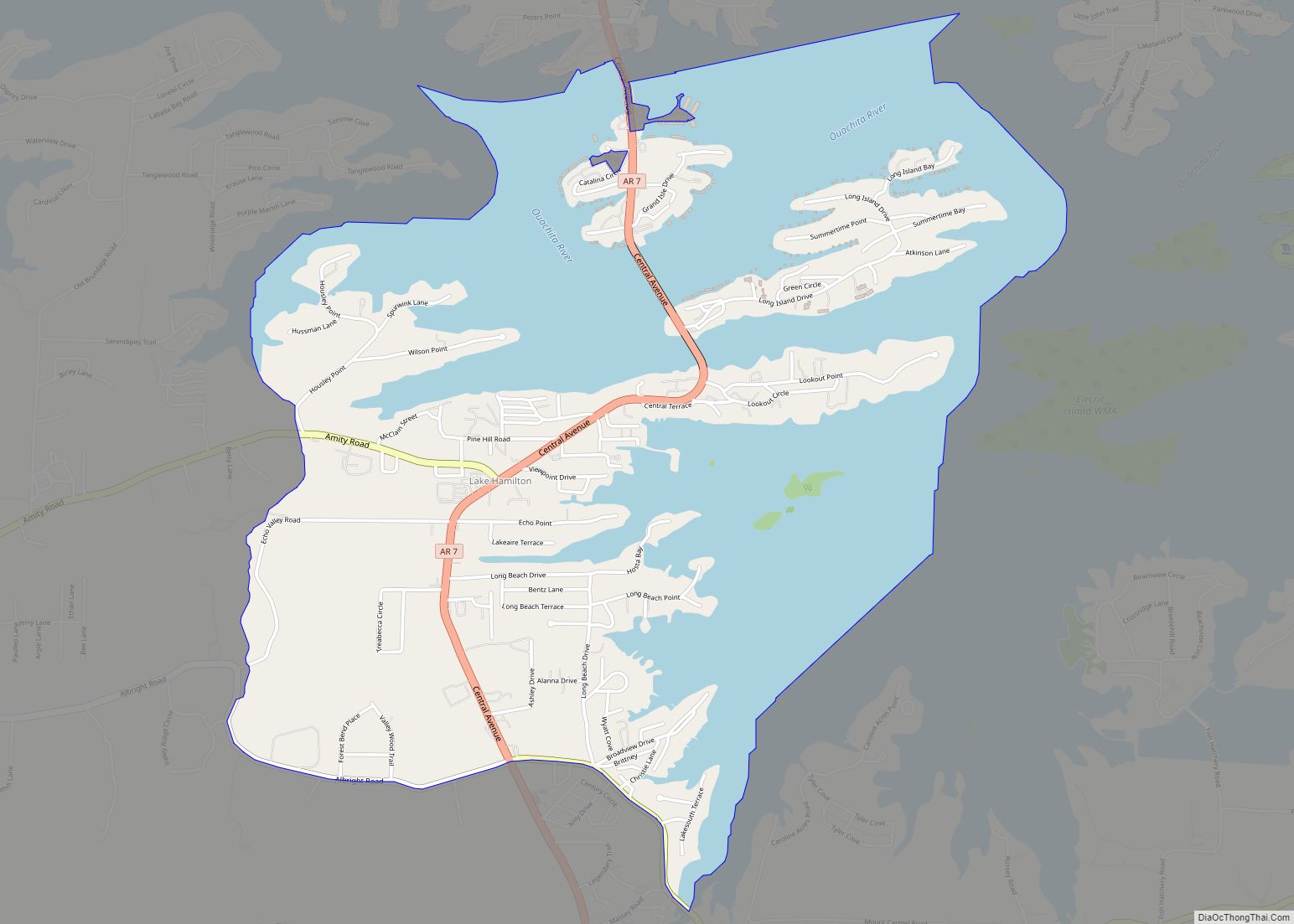
Lake Hamilton is a census-designated place (CDP) in Garland County, Arkansas, United States. It is part of the Hot Springs Metropolitan Statistical Area. The population was 2,135 at the 2010 census. It is named after Lake Hamilton, one of the area’s man-made lakes. Lake Hamilton CDP overview: Name: Lake Hamilton CDP LSAD Code: 57 LSAD … Read more

Map of Lake City city

Map of Lake City, Arkansas

Lake City is a city in Craighead County, Arkansas, United States, along the St. Francis River. Lake City is one of two county seats in Craighead County. The population was 2,326 as of the 2020 census. It is included in the Jonesboro, Arkansas Metropolitan Statistical Area. Lake City overview: Name: Lake City LSAD Code: 25 … Read more

Map of Lamar city

Map of Lamar city, Arkansas

Lamar is a city in Johnson County, Arkansas, United States. The population was 1,605 at the 2010 census, up from 1,415 at the 2000 census. Lamar city overview: Name: Lamar city LSAD Code: 25 LSAD Description: city (suffix) State: Arkansas County: Johnson County Elevation: 430 ft (130 m) Total Area: 4.64 sq mi (12.03 km²) Land Area: 4.62 sq mi (11.95 km²) Water … Read more

Map of Lakeview city, Arkansas

Map of Lakeview city, Arkansas

Lakeview is a city in Baxter County, Arkansas, United States. The population was 741 at the 2010 census. Lakeview city overview: Name: Lakeview city LSAD Code: 25 LSAD Description: city (suffix) State: Arkansas County: Baxter County Elevation: 787 ft (240 m) Total Area: 1.04 sq mi (2.69 km²) Land Area: 1.04 sq mi (2.69 km²) Water Area: 0.00 sq mi (0.00 km²) Total Population: 775 Population … Read more

Map of Lake Village city

Map of Lake Village city, Arkansas

Lake Village is a city in and the county seat of Chicot County, Arkansas, United States. The population was 2,575 at the 2010 census. It is located in the Arkansas Delta. Lake Village is named for its location on Lake Chicot, an oxbow lake formed by the Mississippi River. Lake Village city overview: Name: Lake … Read more

Map of Leachville city

Map of Leachville city

Leachville is a city in Mississippi County, Arkansas, United States. The population was 2,039 at the 2020 census. Leachville was incorporated in 1916. Leachville city overview: Name: Leachville city LSAD Code: 25 LSAD Description: city (suffix) State: Arkansas County: Mississippi County Elevation: 233 ft (71 m) Total Area: 4.40 sq mi (11.40 km²) Land Area: 4.40 sq mi (11.40 km²) Water Area: 0.00 sq mi … Read more

Map of Lavaca city

Map of Lavaca city

Lavaca (/ləˈvɑːkə/ (listen)) is a city in Sebastian County, Arkansas, United States. It is part of the Fort Smith, Arkansas–Oklahoma Metropolitan Statistical Area. As of the 2010 Census the population was 2,289. Lavaca was incorporated in 1919. Lavaca city overview: Name: Lavaca city LSAD Code: 25 LSAD Description: city (suffix) State: Arkansas County: Sebastian County … Read more

Map of Landmark CDP

Map of Landmark CDP

Landmark (formerly known as Parkers-Iron Springs) is a census-designated place (CDP) in Pulaski County, Arkansas, United States. Per the 2020 census, the population was 3,585. It is part of the Little Rock–North Little Rock–Conway Metropolitan Statistical Area. Landmark CDP overview: Name: Landmark CDP LSAD Code: 57 LSAD Description: CDP (suffix) State: Arkansas County: Pulaski County … Read more

Map of Lepanto city

Map of Lepanto city

Lepanto is a city in Poinsett County, Arkansas, United States. The population was 1,893 at the 2010 census. It is included in the Jonesboro, Arkansas Metropolitan Statistical Area. Lepanto was named for the Greek seaport of Lepanto, site of a great crusade sea battle in 1571. Lepanto was a site for the filming of the … Read more

Map of Leola town

Map of Leola town, Arkansas

Leola is a town in Grant County, Arkansas, United States. The population was 501 at the 2010 census. It is the southernmost municipality within the Central Arkansas region. Leola town overview: Name: Leola town LSAD Code: 43 LSAD Description: town (suffix) State: Arkansas County: Grant County Elevation: 269 ft (82 m) Total Area: 0.85 sq mi (2.21 km²) Land Area: … Read more

Map of Lead Hill town

Map of Lead Hill town

Lead Hill is a town in Boone County, Arkansas, United States. The population was 271 at the 2010 census. It is part of the Harrison Micropolitan Statistical Area. Lead Hill town overview: Name: Lead Hill town LSAD Code: 43 LSAD Description: town (suffix) State: Arkansas County: Boone County Elevation: 853 ft (260 m) Total Area: 0.66 sq mi (1.72 km²) … Read more

Map of Lewisville city

Map of Lewisville city, Arkansas

Lewisville is a city in Lafayette County, Arkansas, United States. The population was 1,280 at the 2010 census. It is the county seat of Lafayette County. Lewisville city overview: Name: Lewisville city LSAD Code: 25 LSAD Description: city (suffix) State: Arkansas County: Lafayette County Elevation: 292 ft (89 m) Total Area: 2.18 sq mi (5.65 km²) Land Area: 2.15 sq mi (5.56 km²) … Read more