Map of Carlisle city

Map of Carlisle city, Arkansas

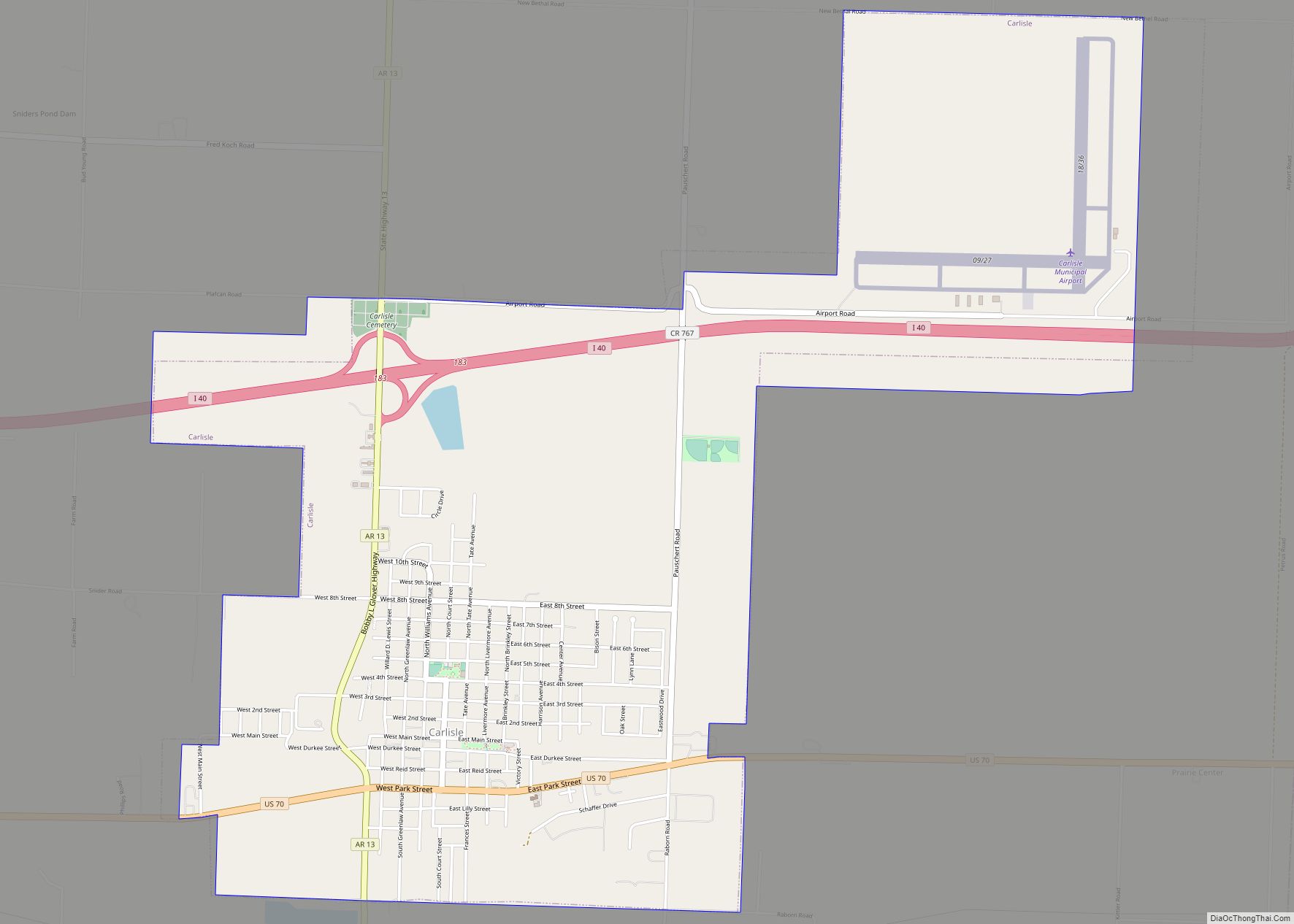
Carlisle is a city in Lonoke County, Arkansas, United States. It is the easternmost municipality within the Little Rock–North Little Rock–Conway Metropolitan Statistical Area. Carlisle was incorporated in 1878. As of the 2010 census it had a population of 2,214. Carlisle city overview: Name: Carlisle city LSAD Code: 25 LSAD Description: city (suffix) State: Arkansas … Read more

Map of Caraway city

Map of Caraway city

Caraway is a city in Craighead County, Arkansas, United States. The population was 1,279 at the 2010 census. It is included in the Jonesboro, Arkansas Metropolitan Statistical Area. Caraway city overview: Name: Caraway city LSAD Code: 25 LSAD Description: city (suffix) State: Arkansas County: Craighead County Incorporated: 1923 Elevation: 226 ft (69 m) Total Area: 2.31 sq mi (5.98 km²) … Read more

Map of Caulksville town

Map of Caulksville town

Caulksville is a town in Logan County, Arkansas, United States. The population was 213 at the 2010 census. Caulksville town overview: Name: Caulksville town LSAD Code: 43 LSAD Description: town (suffix) State: Arkansas County: Logan County Elevation: 394 ft (120 m) Total Area: 1.36 sq mi (3.53 km²) Land Area: 1.35 sq mi (3.49 km²) Water Area: 0.01 sq mi (0.04 km²) Total Population: 154 Population … Read more

Map of Cash town

Map of Cash town

Cash is a city in western Craighead County, Arkansas, United States. The population was 342 at the 2010 census. Cash Arkansas population was of mostly white with 99.8% and partial Puerto Rican ethnicity. It is included in the Jonesboro, Arkansas Metropolitan Statistical Area. The name “Cash” is a corruption of the Cache River. Cash town … Read more

Map of Casa town

Map of Casa town

Casa is a town in Perry County, Arkansas, United States. Located in Central Arkansas, the town initially grew due to the mining of coal, harvesting of timber and cultivation of cotton. The Great Depression reduced the population greatly, and the community’s economy never recovered. The population was 171 at the 2010 census. Casa is about … Read more

Map of Cedarville city

Map of Cedarville city, Arkansas

Cedarville is a city in Crawford County, Arkansas, United States. It is part of the Fort Smith, Arkansas–Oklahoma Metropolitan Statistical Area. The population was 1,410 at the 2020 census. Cedarville city overview: Name: Cedarville city LSAD Code: 25 LSAD Description: city (suffix) State: Arkansas County: Crawford County Elevation: 860 ft (260 m) Total Area: 8.89 sq mi (23.01 km²) Land … Read more

Map of Cave Springs city

Map of Cave Springs city

Cave Springs is a city in Benton County, Arkansas. The population was 5,495 at the time of the 2020 census, up from 1,729 in 2010 census. It is part of the Northwest Arkansas metropolitan area. In June 2022, Cave Springs was named the 3rd highest average home values in the state of Arkansas. Cave Springs … Read more

Map of Cave City city

Map of Cave City, Arkansas

Cave City is a city in Independence and Sharp counties in the U.S. state of Arkansas. The population was 1,904 at the 2010 census. The city was named for a large cave underneath the Crystal River Tourist Camp, which is the oldest motor court in Arkansas. Cave City is known for its award-winning “world’s sweetest” … Read more

Map of Central City town

Map of Central City town, Arkansas

Central City is a city in Sebastian County, Arkansas, United States. It is part of the Fort Smith, Arkansas–Oklahoma Metropolitan Statistical Area. At the 2010 Census, the population of Central City was 502. According to the 2018 US Census Bureau estimates, Central City had a population of 497. Central City town overview: Name: Central City … Read more

Map of Centerton city

Map of Centerton city

Centerton is a city in Benton County, Arkansas, United States. Located west of Bentonville on Highway 102, Centerton has grown from a railroad stop and fruit orchard community in the early 20th century into a suburban bedroom community within the rapidly growing Northwest Arkansas (NWA) region. The city’s population has grown from 491 in 1990 … Read more

Map of Center Ridge CDP

Map of Center Ridge CDP

Center Ridge is an unincorporated census-designated place in Conway County, Arkansas, United States. Per the 2020 census, the population was 2,235. Center Ridge CDP overview: Name: Center Ridge CDP LSAD Code: 57 LSAD Description: CDP (suffix) State: Arkansas County: Conway County Elevation: 728 ft (222 m) Total Area: 9.52 sq mi (24.67 km²) Land Area: 9.47 sq mi (24.53 km²) Water Area: 0.05 sq mi … Read more

Map of Cherokee Village city

Map of Cherokee Village city

Cherokee Village is a city in Fulton and Sharp counties in the U.S. state of Arkansas. The population was 4,671 at the 2010 census, with an estimated population of 4,661 in 2019. Cherokee Village city overview: Name: Cherokee Village city LSAD Code: 25 LSAD Description: city (suffix) State: Arkansas County: Fulton County, Sharp County Elevation: … Read more