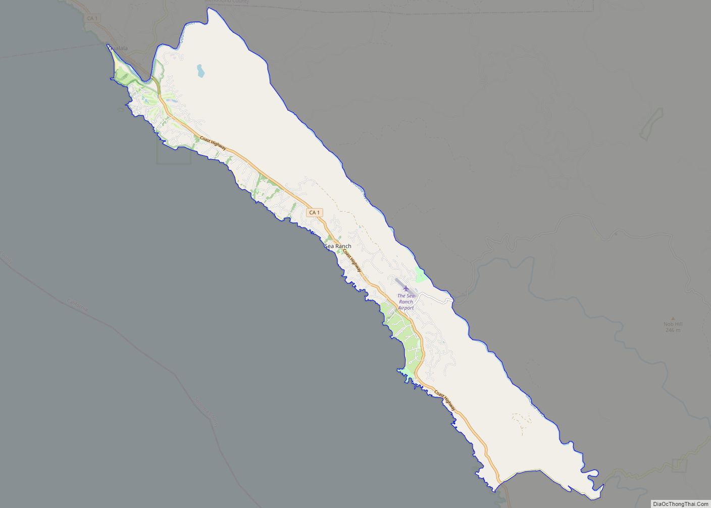
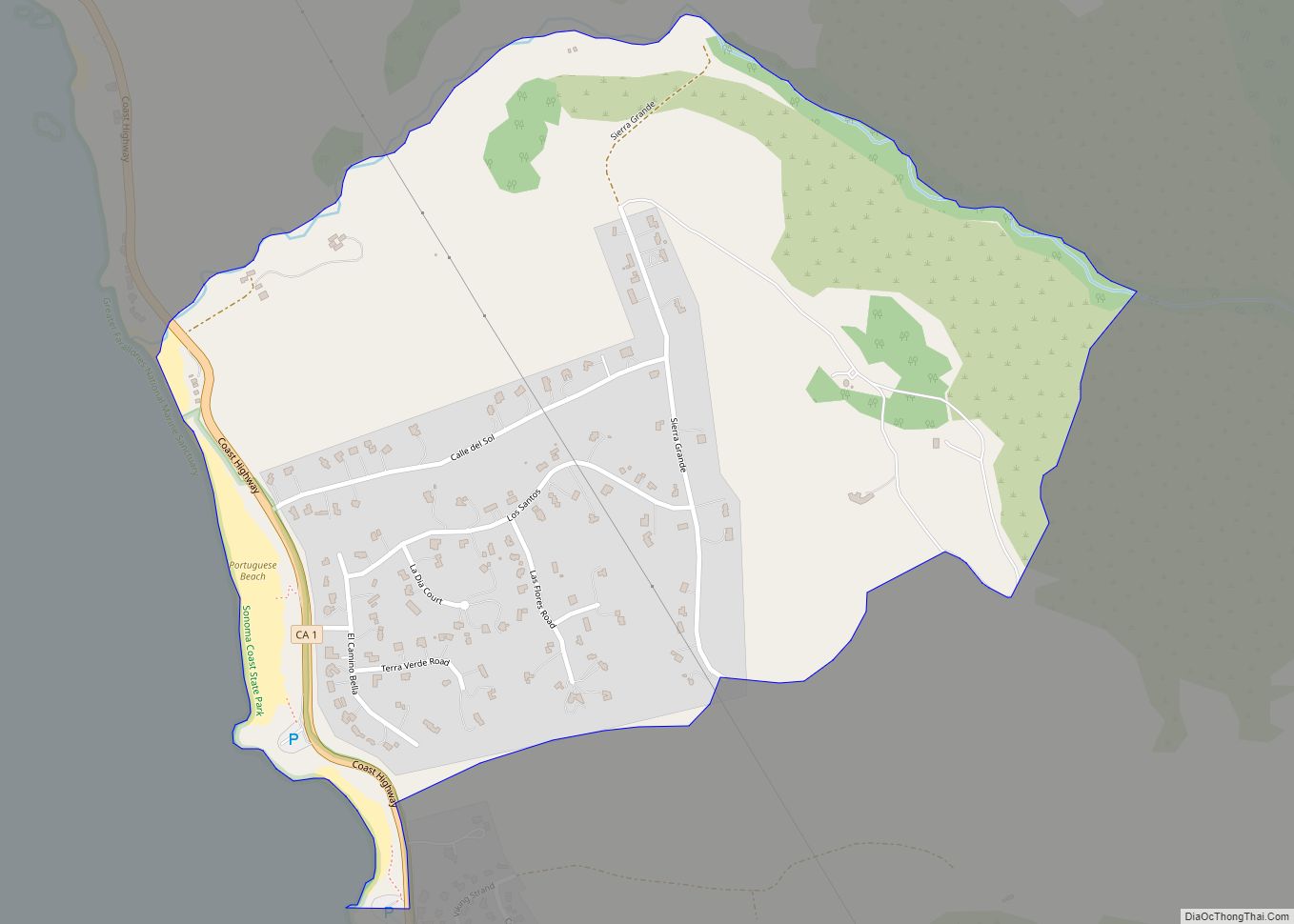
Map of Sebastopol city

Map of Sebastopol city, California

Sebastopol (/sɪˈbæstəpoʊl, -puːl/ sib-AST-ə-pohl, -⁠pool) is a city in Sonoma County, in California with a recorded population of 7,521, per the 2020 U.S. Census. Sebastopol was once primarily a plum and apple-growing region. Today, wine grapes are the predominant agriculture crop, and nearly all lands once used for orchards are now vineyards. The creation of … Read more

Map of Seaside city

Map of Seaside city, California

Seaside, formerly East Monterey, is a city in Monterey County, California, United States, with a population of 32,366 as of the 2020 census. It is located 2.25 miles (3.6 km) east-northeast of Monterey, at an elevation of 33 feet (10 m), and is the home of California State University, Monterey Bay (CSUMB), UC MBEST Center, and the … Read more

Map of Searles Valley CDP

Map of Searles Valley CDP

Searles Valley is a census-designated place (CDP) in the Searles Valley of the Mojave Desert, in northwestern San Bernardino County, California. Searles Valley CDP overview: Name: Searles Valley CDP LSAD Code: 57 LSAD Description: CDP (suffix) State: California County: San Bernardino County Total Area: 10.494 sq mi (27.180 km²) Land Area: 10.494 sq mi (27.180 km²) Water Area: 0 sq mi (0 km²)  0% … Read more

Map of Sequoia Crest CDP

Map of Sequoia Crest CDP

Sequoia Crest is a census-designated place (CDP) in Tulare County, California.The community of Sequoia Crest contains more than 150 Giant Sequoias scattered throughout the subdivision. Sequoia Crest sits at an elevation of 7,008 feet (2,136 m). The 2020 United States census reported Sequoia Crest’s population was 24, up from 10 at the 2010 census. Sequoia Crest … Read more

Map of Selma city, California

Map of Selma city, California

Selma is a city in Fresno County, California. The population was 23,319 at the 2010 census, up from 19,240 at the 2000 census. Selma is located 16 miles (26 km) southeast of Fresno, at an elevation of 308 feet (94 m). Selma city overview: Name: Selma city LSAD Code: 25 LSAD Description: city (suffix) State: California … Read more

Map of Seeley CDP

Map of Seeley CDP

Seeley is a census-designated place (CDP) in Imperial County, California. Seeley is located 7.5 miles (12 km) west of El Centro. The population was 1,823 at the 2010 census, up from 1,624 in 2000. It is part of the El Centro Metropolitan Area. Seeley CDP overview: Name: Seeley CDP LSAD Code: 57 LSAD Description: CDP (suffix) … Read more

Map of Seville CDP

Map of Seville CDP, California

Seville is a census-designated place in Tulare County, California, United States. Seville is located along California State Route 201 4.5 miles (7.2 km) southeast of Cutler and 8.5 miles (13.7 km). northwest of Woodlake. The population was 480 at the 2010 census. Seville CDP overview: Name: Seville CDP LSAD Code: 57 LSAD Description: CDP (suffix) State: California … Read more

Map of Sereno del Mar CDP

Map of Sereno del Mar CDP

Sereno del Mar (Spanish for “Serene of the Sea”) is a census-designated place (CDP) in Sonoma County, California. Sereno del Mar sits at an elevation of 190 feet (58 m). The 2020 United States census reported Sereno del Mar’s population was 107. Sereno del Mar CDP overview: Name: Sereno del Mar CDP LSAD Code: 57 LSAD … Read more

Map of Shafter city

Map of Shafter city

Shafter is a city in Kern County, California, United States. It is located 18 miles (29 km) west-northwest of Bakersfield. The population was 16,988 at the 2010 census, up from 12,736 at the 2000 census. The city is located along State Route 43. Suburbs of Shafter include Myricks Corner, North Shafter, Smith Corner, and Thomas Lane. … Read more

Map of Shasta CDP

Map of Shasta CDP

Shasta is a census-designated place (CDP) in Shasta County, California, United States. Shasta sits at an elevation of 843 feet (257 m). Its population is 1,043 as of the 2020 census, down from 1,771 from the 2010 census. Shasta State Historic Park located at Shasta is a ghost town and California State Historic Park. Shasta CDP … Read more

Map of Shasta Lake city

Map of Shasta Lake city

The City of Shasta Lake, known as Central Valley or CV prior to incorporation, is a city in Shasta County, California, United States. It is the closest settlement to Shasta Dam and Shasta Lake reservoir, which are popular tourist destinations. Its population is 10,371 as of the 2020 census, up from 10,164 from the 2010 … Read more

Map of Shandon CDP

Map of Shandon CDP

Shandon is a village and census-designated place (CDP) in San Luis Obispo County, California, United States. The population was 1,295 at the 2010 census, up from 986 at the 2000 census. Shandon lies by the San Juan River. Shandon CDP overview: Name: Shandon CDP LSAD Code: 57 LSAD Description: CDP (suffix) State: California County: San … Read more