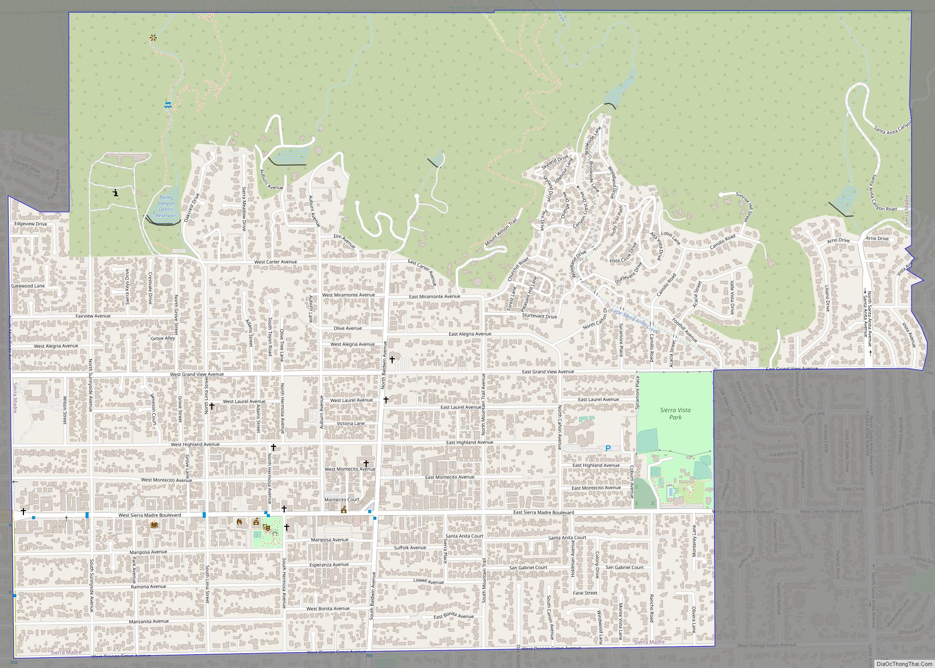
Map of Silver Lakes CDP

Map of Silver Lakes CDP

Silver Lakes CDP overview: Name: Silver Lakes CDP LSAD Code: 57 LSAD Description: CDP (suffix) State: California County: San Bernardino County FIPS code: 0671964 Online Interactive Map Silver Lakes online map. Source: Basemap layers from Google Map, Open Street Map (OSM), Arcgisonline, Wmflabs. Boundary Data from Database of Global Administrative Areas. Silver Lakes location map. … Read more

Map of Silver City CDP

Map of Silver City CDP, California

Silver City is a census-designated place (CDP) in the mountainous area of central Tulare County, California. Silver City sits at an elevation of 6,732 feet (2,052 m). It lies 72 km ENE of Visalia, California, within the boundary of Sequoia National Park. The 2010 United States census reported Silver City was uninhabited. Silver City is the name … Read more

Map of Signal Hill city

Map of Signal Hill city

Signal Hill is a city 2.2 sq mi (5.7 km) in area in Los Angeles County, California. Located high on a hill, the city is an enclave completely surrounded by the city of Long Beach. Signal Hill was incorporated on April 22, 1924, roughly three years after oil was discovered there. As of the 2010 census, the city … Read more

Map of Sky Valley CDP

Map of Sky Valley CDP, California

Sky Valley is a census-designated place in Riverside County, California. Sky Valley sits at an elevation of 994 feet (303 m). The 2010 United States census reported Sky Valley’s population was 2,406. Sky Valley CDP overview: Name: Sky Valley CDP LSAD Code: 57 LSAD Description: CDP (suffix) State: California County: Riverside County Elevation: 994 ft (303 m) Total … Read more

Map of Sisquoc CDP

Map of Sisquoc CDP

Sisquoc (Chumash for “quail”) is a census-designated place in Santa Barbara County, California located east of U.S. Route 101 about 15 miles (24 km) southeast of Santa Maria and 5 miles (8.0 km) south of Garey. The ZIP Code is 93454, and the community is inside area code 805. Sisquoc has a fire station, a church, a … Read more

Map of Silverado Resort CDP

Map of Silverado Resort CDP

Silverado Resort CDP overview: Name: Silverado Resort CDP LSAD Code: 57 LSAD Description: CDP (suffix) State: California County: Napa County FIPS code: 0671927 Online Interactive Map Silverado Resort online map. Source: Basemap layers from Google Map, Open Street Map (OSM), Arcgisonline, Wmflabs. Boundary Data from Database of Global Administrative Areas. Silverado Resort location map. Where … Read more

Map of Smith Corner CDP

Map of Smith Corner CDP

Smith Corner is a census-designated place in Kern County, California. It is located 1.5 miles (2.4 km) south of Shafter, at an elevation of 331 feet (101 m). The population was 524 at the 2010 census. Smith Corner CDP overview: Name: Smith Corner CDP LSAD Code: 57 LSAD Description: CDP (suffix) State: California County: Kern County Elevation: … Read more

Map of Smartsville CDP

Map of Smartsville CDP

Smartsville is a census-designated place in Yuba County, California, United States, in the foothills of the Sierra Nevada. It is one of the many historic towns in California’s gold country, and is today a California Historical Landmark. Located at an altitude of 669 feet (204 m), Smartsville lies about 15 miles (24 km) east-northeast of Marysville, along … Read more

Map of Sleepy Hollow CDP

Map of Sleepy Hollow CDP, California

Sleepy Hollow is a census-designated place in Marin County, California, United States. It is located 7 miles (11 km) south of downtown Novato at an elevation of 177 feet (54 m). Its population as of the 2020 census was 2,401. Sleepy Hollow CDP overview: Name: Sleepy Hollow CDP LSAD Code: 57 LSAD Description: CDP (suffix) State: California … Read more

Map of Soda Bay CDP

Map of Soda Bay CDP

Soda Bay is a census-designated place in Lake County, California. It is located on Clear Lake 7.5 miles (12 km) east-southeast of Lakeport, at an elevation of 1,398 feet (426 m). The population was 1,016 at the 2010 census. A resort at the place, called Soda Bay Springs, could by 1910 accommodate 150 guests. Soda Bay CDP … Read more

Map of Snelling CDP

Map of Snelling CDP, California

Snelling (formerly Snelling’s Ranch) is an unincorporated community and census-designated place (CDP) in Merced County, California, United States. It is located on the north bank of the Merced River 17 miles (27 km) north of Merced, at an elevation of 256 feet (78 m). The population was 238 at the 2020 census. Snelling CDP overview: Name: Snelling … Read more

Map of Smith River CDP

Map of Smith River CDP

Smith River (Tolowa: Kaa-nvsh) is a town and census-designated place in Del Norte County, California, located near the Oregon border. Smith River is the headquarters of the Tolowa Dee-ni’ Nation, a federally recognized tribe of Tolowa people. As of the 2020 census, the population was 906. It is bordered by the Smith River National Recreation … Read more