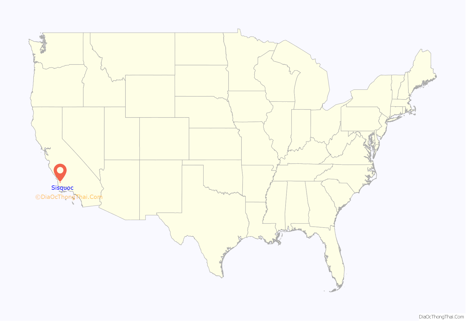
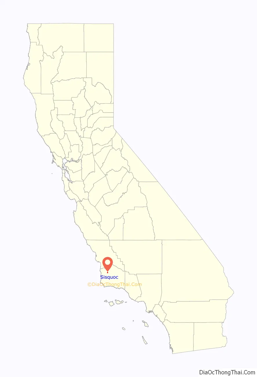
Sisquoc (Chumash for “quail”) is a census-designated place in Santa Barbara County, California located east of U.S. Route 101 about 15 miles (24 km) southeast of Santa Maria and 5 miles (8.0 km) south of Garey. The ZIP Code is 93454, and the community is inside area code 805. Sisquoc has a fire station, a church, a Preschool-8 school and a store. It has a micro-climate with mild weather year-round. The population was 183 at the 2010 census.
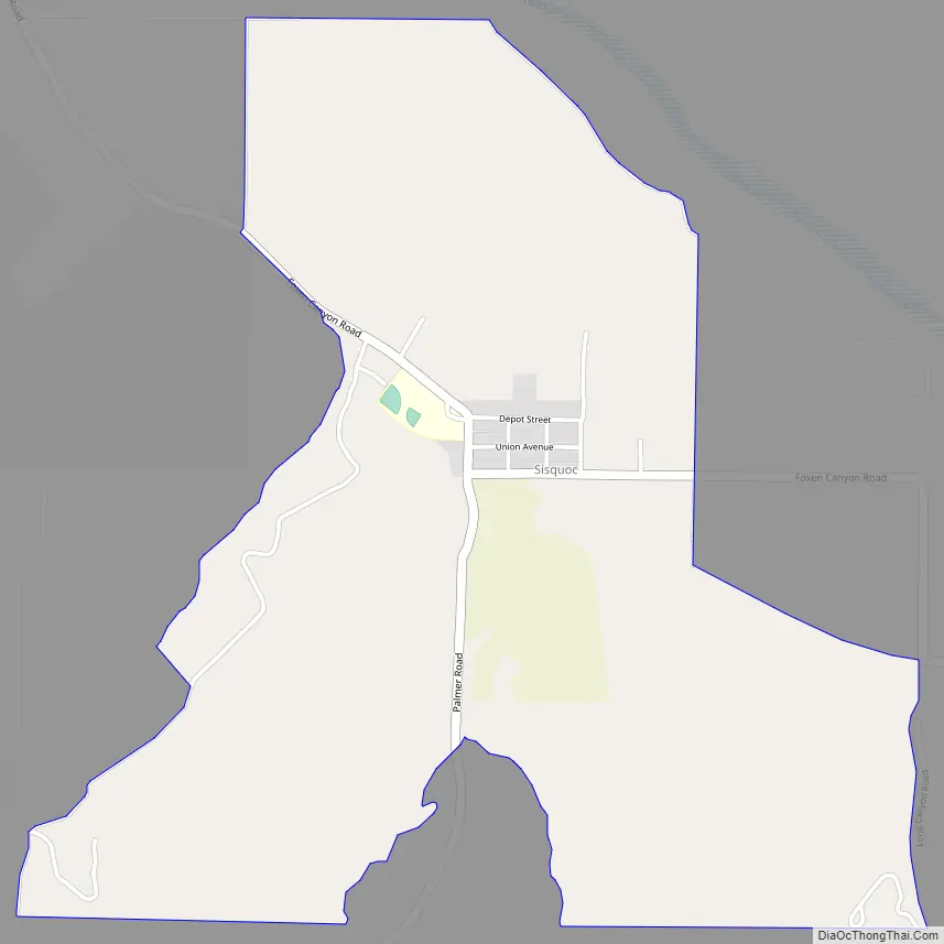
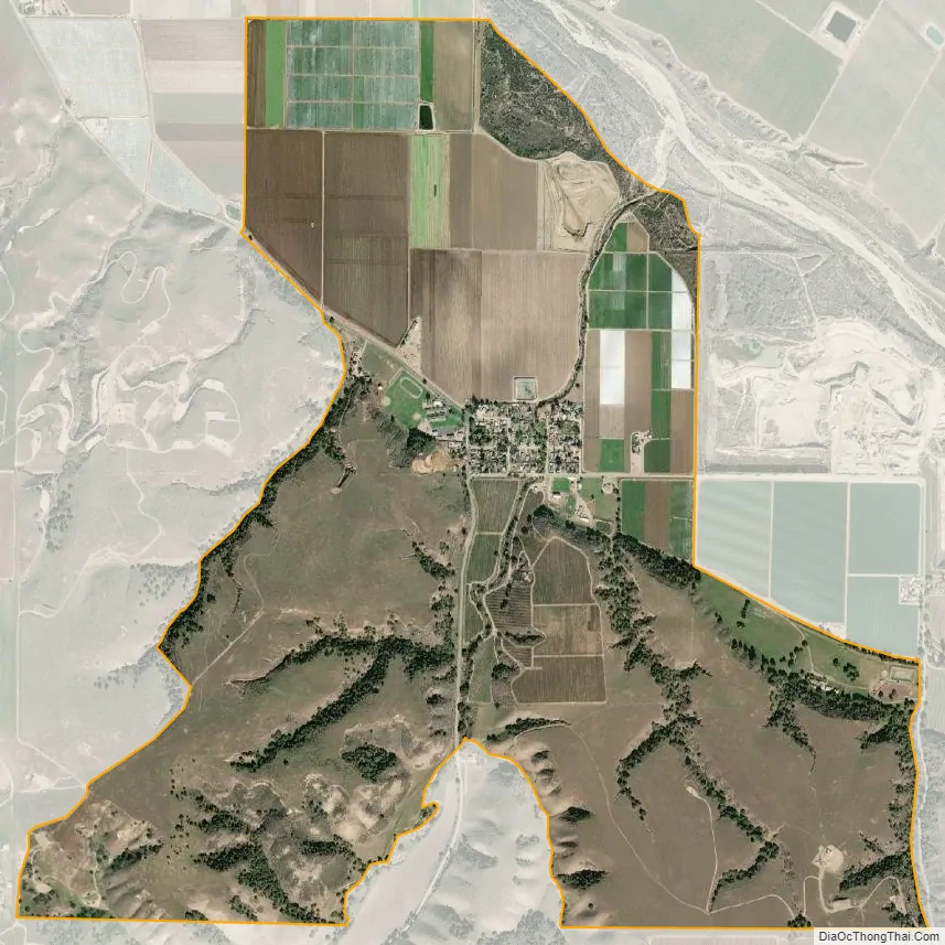
The town is at the intersection of Palmer Road and Foxen Canyon Road, at the southwestern edge of the floodplain of the Sisquoc River. The predominant land use on the plain is agriculture, while the hills to the south and west contain the Cat Canyon Oil Field, with Greka Energy and ERG Resources, LLC being the largest operators.
Sisquoc is an agricultural area. It is well known for vineyards and strawberry fields. The terrain is hilly, and there are mountains in the distance. Wildlife near Sisquoc includes bobcats, coyotes, mountain lions, rabbits, and gophers.
There is one closed store in town called the Sisquoc store, and a fire station. There is one school in town called Benjamin Foxen, home of the Bobcats. Benjamin Foxen is the only remaining school of 5 in the Blochman School District. The Blochman School PTA (Parent Teacher Association) was established in 1960. The school has a library in need of more books. Students and teachers at Blochman run a school garden, and fresh produce from the garden is served in the cafeteria.
| Name: | Sisquoc CDP |
|---|---|
| LSAD Code: | 57 |
| LSAD Description: | CDP (suffix) |
| State: | California |
| County: | Santa Barbara County |
| Elevation: | 456 ft (139 m) |
| Total Area: | 2.234 sq mi (5.786 km²) |
| Land Area: | 2.230 sq mi (5.775 km²) |
| Water Area: | 0.004 sq mi (0.011 km²) 0.18% |
| Total Population: | 183 |
| Population Density: | 82/sq mi (32/km²) |
| ZIP code: | 93454 |
| Area code: | 805 |
| FIPS code: | 0672086 |
| GNISfeature ID: | 2583144 |
Online Interactive Map
Click on ![]() to view map in "full screen" mode.
to view map in "full screen" mode.
Sisquoc location map. Where is Sisquoc CDP?
Sisquoc Road Map
Sisquoc city Satellite Map
Geography
According to the United States Census Bureau, the CDP covers an area of 2.2 square miles (5.8 km), 99.82% of it land, and 0.18% of it water.
See also
Map of California State and its subdivision:- Alameda
- Alpine
- Amador
- Butte
- Calaveras
- Colusa
- Contra Costa
- Del Norte
- El Dorado
- Fresno
- Glenn
- Humboldt
- Imperial
- Inyo
- Kern
- Kings
- Lake
- Lassen
- Los Angeles
- Madera
- Marin
- Mariposa
- Mendocino
- Merced
- Modoc
- Mono
- Monterey
- Napa
- Nevada
- Orange
- Placer
- Plumas
- Riverside
- Sacramento
- San Benito
- San Bernardino
- San Diego
- San Francisco
- San Joaquin
- San Luis Obispo
- San Mateo
- Santa Barbara
- Santa Clara
- Santa Cruz
- Shasta
- Sierra
- Siskiyou
- Solano
- Sonoma
- Stanislaus
- Sutter
- Tehama
- Trinity
- Tulare
- Tuolumne
- Ventura
- Yolo
- Yuba
- Alabama
- Alaska
- Arizona
- Arkansas
- California
- Colorado
- Connecticut
- Delaware
- District of Columbia
- Florida
- Georgia
- Hawaii
- Idaho
- Illinois
- Indiana
- Iowa
- Kansas
- Kentucky
- Louisiana
- Maine
- Maryland
- Massachusetts
- Michigan
- Minnesota
- Mississippi
- Missouri
- Montana
- Nebraska
- Nevada
- New Hampshire
- New Jersey
- New Mexico
- New York
- North Carolina
- North Dakota
- Ohio
- Oklahoma
- Oregon
- Pennsylvania
- Rhode Island
- South Carolina
- South Dakota
- Tennessee
- Texas
- Utah
- Vermont
- Virginia
- Washington
- West Virginia
- Wisconsin
- Wyoming


