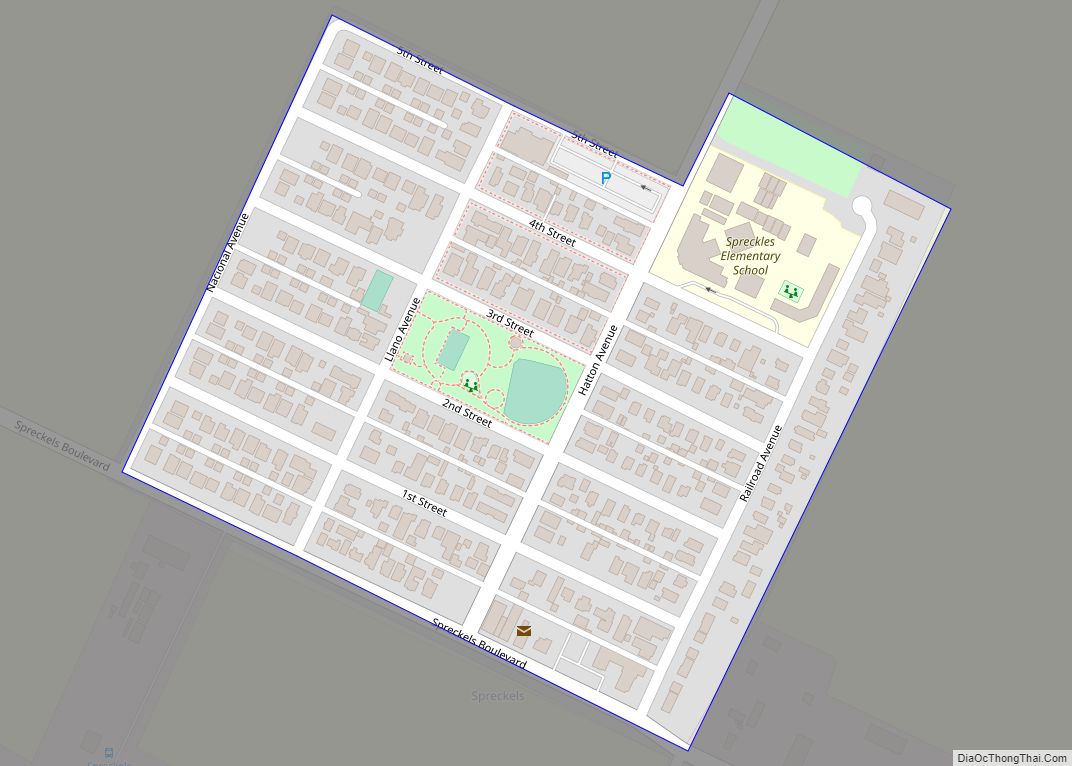
Map of Squaw Valley CDP

Map of Squaw Valley CDP

Yokuts Valley (/ˈjoʊkəts/ YOH-kəts; formerly Squaw Valley) is a census-designated place located in Fresno County, California, at the foothills of the Sierra Nevada on State Route 180 just below Kings Canyon National Park. As of the 2010 census, the CDP had a total population of 3,162, up from 2,691 at the 2000 census. Yokuts Valley … Read more

Map of Springville CDP, California

Map of Springville CDP, California

Springville is a census-designated place (CDP) in Tulare County, California, United States. The population was 967 at the 2020 census, up from 934 at the 2010 census. Springville CDP overview: Name: Springville CDP LSAD Code: 57 LSAD Description: CDP (suffix) State: California County: Tulare County Elevation: 1,024 ft (312 m) Total Area: 4.200 sq mi (10.878 km²) Land Area: 4.183 sq mi … Read more

Map of Spring Valley CDP, California

Map of Spring Valley CDP, California

Spring Valley is a census-designated place (CDP) in the East County region of San Diego County, California. The population was 28,205 at the 2010 census. From 1970 through 1990, Spring Valley included what is now the La Presa CDP to the south; La Presa is still popularly considered to be a part of Spring Valley. … Read more

Map of Stallion Springs CDP

Map of Stallion Springs CDP

Stallion Springs is a census-designated place (CDP) in the Tehachapi Mountains, in Kern County, California, USA. The population was 2,488 at the 2010 census, up from 1,522 at the 2000 census. Stallion Springs is located in the greater Tehachapi Area. Stallion Springs CDP overview: Name: Stallion Springs CDP LSAD Code: 57 LSAD Description: CDP (suffix) … Read more

Map of St. Helena city

Map of St. Helena city, California

St. Helena (/həˈliːnə/ hə-LEE-nə) is a city in Napa County, California, United States. Located in the North Bay region of the San Francisco Bay Area, the population was 5,438 at the 2020 census. St. Helena is a popular tourist destination, owing to its vineyards and culinary scene. The city is the center of St. Helena … Read more

Map of Squirrel Mountain Valley CDP

Map of Squirrel Mountain Valley CDP

Squirrel Mountain Valley is a census-designated place (CDP) in the southern Sierra Nevadas, in Kern County, California, United States. Squirrel Mountain Valley is located in the Lake Isabella area 5 miles (8 km) northeast of Bodfish, at an elevation of 2,900 feet (883.9 m). The population was 547 at the 2010 census, up from 498 at the … Read more

Map of Stanton city

Map of Stanton city, California

Stanton is a city in northern Orange County, California, part of the Los Angeles metropolitan area. The population was 37,962 at the 2020 United States Census. The city was incorporated in 1956 and operates under the council–manager form of government, providing a full range of municipal services. Stanton is bounded by Cypress on the west, … Read more

Map of Stanford CDP

Map of Stanford CDP, California

Stanford is a census-designated place (CDP) in the northwest corner of Santa Clara County, California, United States. It is the home of Stanford University. The population was 21,150 at the 2020 census. Stanford is an unincorporated area of Santa Clara County and is adjacent to the city of Palo Alto. The place is named after … Read more

Map of Stevenson Ranch CDP

Map of Stevenson Ranch CDP

Stevenson Ranch is an unincorporated community in the Santa Clarita Valley of Los Angeles County, California. Stevenson Ranch is set in the foothills of the Santa Susana Mountains and lies west of Interstate 5 and the city of Santa Clarita. Stevenson Ranch encompasses about 6.4 square miles (17 km). About 1,000 acres (4.0 km) are set aside … Read more

Map of Stirling City CDP

Map of Stirling City CDP

Stirling City is a census-designated place in Butte County, California, located on Paradise Ridge in the western foothills of the Sierra Nevada. Contrary to its name, Stirling City is not a city. Its ZIP Code is 95978 and area code 530. It lies at an elevation of 3570 feet (1088 m). Stirling City had a … Read more

Map of Stinson Beach CDP

Map of Stinson Beach CDP

Stinson Beach is an unincorporated community and census-designated place (CDP) in Marin County, California, on the west coast of the United States. Stinson Beach is located 2.5 miles (4 km) east-southeast of Bolinas, at an elevation of 26 feet (8 m). The population of the Stinson Beach CDP was 541 at the 2020 census. Stinson Beach is … Read more

Map of Stevinson CDP

Map of Stevinson CDP

Stevinson is an unincorporated community and census-designated place in Merced County, California. It is located 21 miles (34 km) west of Merced at an elevation of 85 feet (26 m). The population was 275 at the 2020 census, down from 313 at the 2010 census. The Stevinson post office opened in 1907. The name honors James J. … Read more