Stanton is a city in northern Orange County, California, part of the Los Angeles metropolitan area. The population was 37,962 at the 2020 United States Census. The city was incorporated in 1956 and operates under the council–manager form of government, providing a full range of municipal services. Stanton is bounded by Cypress on the west, Anaheim on the north, and east, and Garden Grove on the east and south.
| Name: | Stanton city |
|---|---|
| LSAD Code: | 25 |
| LSAD Description: | city (suffix) |
| State: | California |
| County: | Orange County |
| Founded: | 1911 |
| Incorporated: | June 4, 1956 |
| Elevation: | 66 ft (20 m) |
| Total Area: | 3.10 sq mi (8.03 km²) |
| Land Area: | 3.10 sq mi (8.03 km²) |
| Water Area: | 0.00 sq mi (0.00 km²) 0% |
| Total Population: | 37,962 |
| Population Density: | 12,213.55/sq mi (4,715.07/km²) |
| ZIP code: | 90680 |
| Area code: | 657/714 |
| FIPS code: | 0673962 |
| GNISfeature ID: | 1661501 |
| Website: | www.stantonca.gov |
Online Interactive Map
Click on ![]() to view map in "full screen" mode.
to view map in "full screen" mode.
Stanton location map. Where is Stanton city?


History
The Tongva people are the Indigenous people of the Stanton area. The villages of Hutukunga and Puvunga were the nearest villages to the present-day site of Stanton.
On November 4, 1905, the Los Angeles Interurban Railway started service on the Santa Ana Line. It ran along an almost perfectly straight line between Watts and Santa Ana. Access to transportation allowed the population of the rural area to grow. This area is now Stanton and West Anaheim.
Stanton was named for Philip A. Stanton, a Republican assemblyman for Los Angeles from 1903 to 1909.
In 1908, the privately owned Pacific Electric Railway leased the Santa Ana Line and took over the service, extending its regional light-rail system. By 1928, the impressive thousand-mile system allowed the residents to conveniently travel throughout Los Angeles and Orange Counties. See 1928 Map. Passenger service to Santa Ana was discontinued in 1950, shortly after the railway was taken over by the Metropolitan Transportation Agency. Today, the easement still is owned by the Orange County Transportation Authority (OCTA). It crosses the intersections of Beach Boulevard/Pacific Street and Cerritos Avenue/Western Avenue.
The first City of Stanton was incorporated in 1911 and was then the largest city in Orange County by area. The main motivation for incorporation was the City of Anaheim’s plan to build a “sewage farm” to the west of their city. Former Speaker of the California State Assembly Phillip Ackley Stanton assisted in the incorporation and the city was named Stanton in his honor. In 1924, the residents voted to dis-incorporate to avoid the cost of building roads in the city.
In the early 1950s, the area had experienced a post-war population boom and the neighboring cities rapidly annexed land. In May 1956, the citizens responded by re-incorporating into today’s City of Stanton.
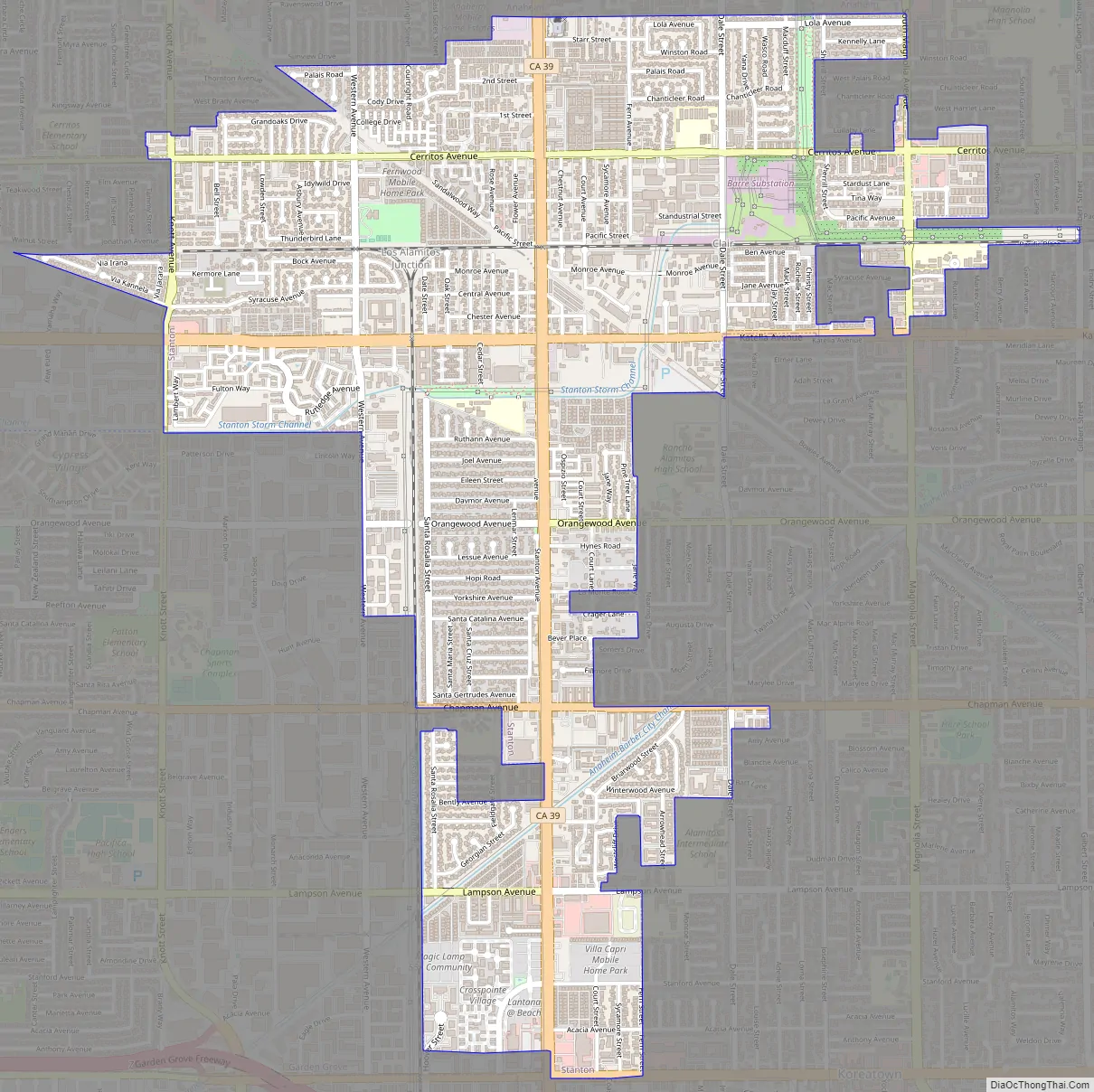
Stanton Road Map
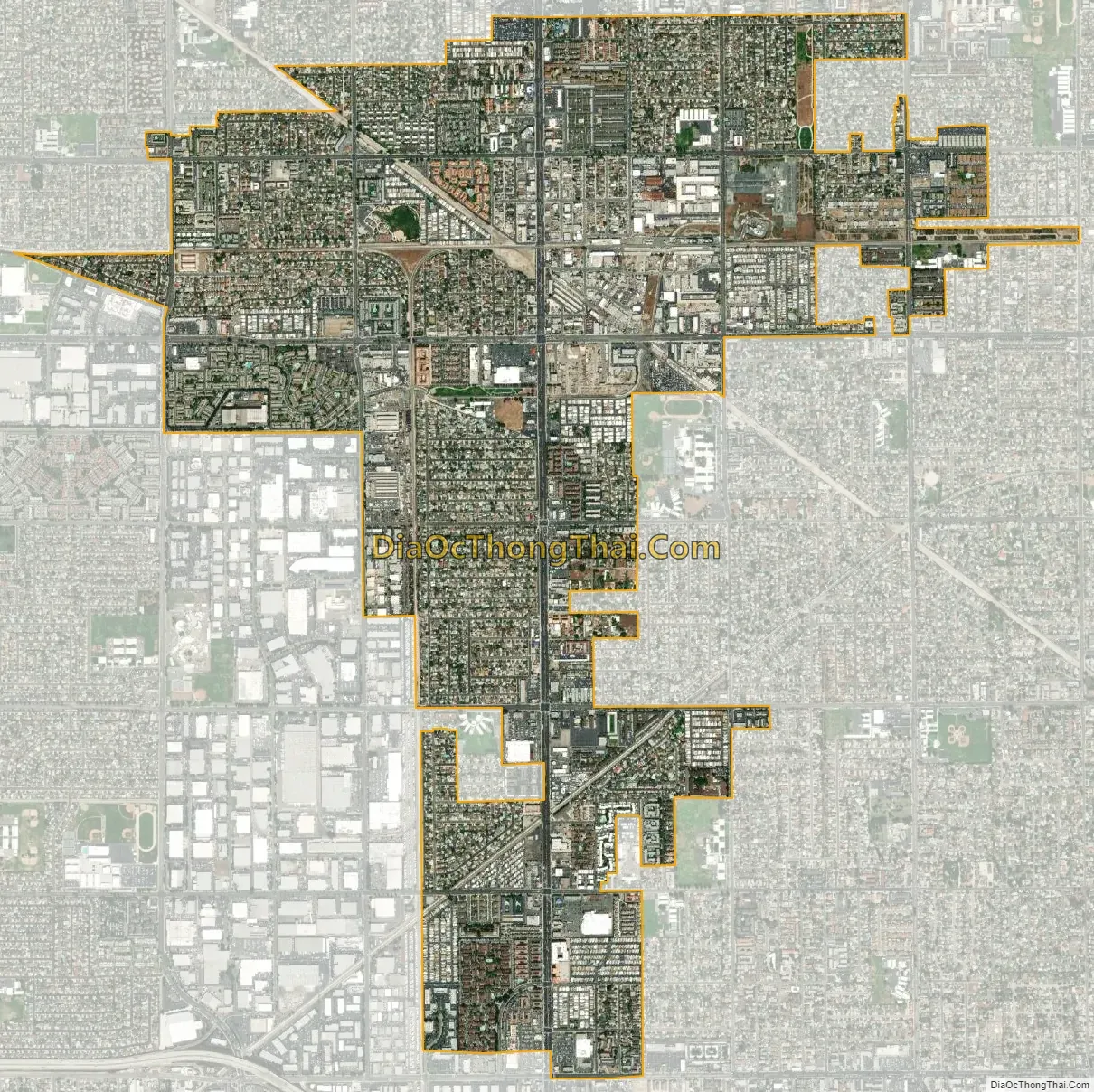
Stanton city Satellite Map
Geography
Stanton is directly bordered by Anaheim to the north and Cypress to the west. A southern salient of the city largely bisects the city of Garden Grove from its West Garden Grove neighborhood, making the city as a whole a neighbor of Stanton to the east, south, and west.
According to the United States Census Bureau, the city has a total area of 3.15 square miles (8.2 km), all land.
Climate
See also
Map of California State and its subdivision:- Alameda
- Alpine
- Amador
- Butte
- Calaveras
- Colusa
- Contra Costa
- Del Norte
- El Dorado
- Fresno
- Glenn
- Humboldt
- Imperial
- Inyo
- Kern
- Kings
- Lake
- Lassen
- Los Angeles
- Madera
- Marin
- Mariposa
- Mendocino
- Merced
- Modoc
- Mono
- Monterey
- Napa
- Nevada
- Orange
- Placer
- Plumas
- Riverside
- Sacramento
- San Benito
- San Bernardino
- San Diego
- San Francisco
- San Joaquin
- San Luis Obispo
- San Mateo
- Santa Barbara
- Santa Clara
- Santa Cruz
- Shasta
- Sierra
- Siskiyou
- Solano
- Sonoma
- Stanislaus
- Sutter
- Tehama
- Trinity
- Tulare
- Tuolumne
- Ventura
- Yolo
- Yuba
- Alabama
- Alaska
- Arizona
- Arkansas
- California
- Colorado
- Connecticut
- Delaware
- District of Columbia
- Florida
- Georgia
- Hawaii
- Idaho
- Illinois
- Indiana
- Iowa
- Kansas
- Kentucky
- Louisiana
- Maine
- Maryland
- Massachusetts
- Michigan
- Minnesota
- Mississippi
- Missouri
- Montana
- Nebraska
- Nevada
- New Hampshire
- New Jersey
- New Mexico
- New York
- North Carolina
- North Dakota
- Ohio
- Oklahoma
- Oregon
- Pennsylvania
- Rhode Island
- South Carolina
- South Dakota
- Tennessee
- Texas
- Utah
- Vermont
- Virginia
- Washington
- West Virginia
- Wisconsin
- Wyoming


