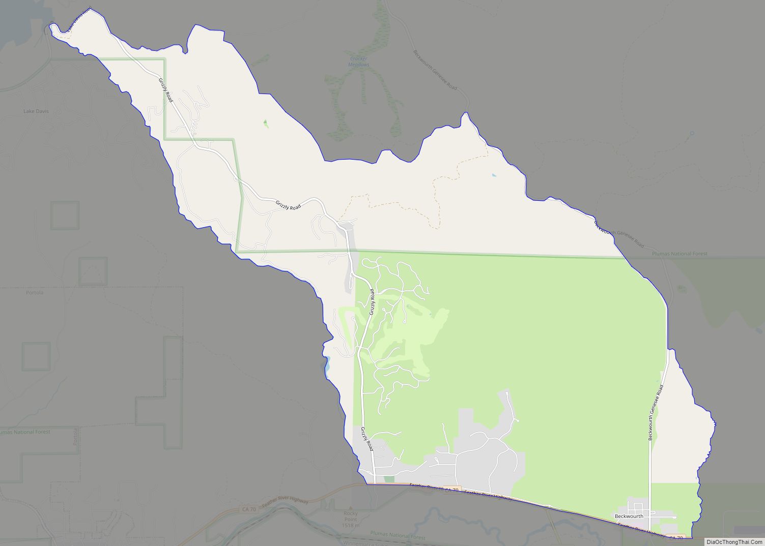
Map of Bella Vista CDP, California

Map of Bella Vista CDP, California

Bella Vista (Spanish for “Beautiful View”) is a census-designated place (CDP) in Shasta County, California. Bella Vista is a small, rural community about 9 miles (14 km) northeast of Redding, and about 5 miles (8.0 km) north of Palo Cedro. Its population is 3,641 as of the 2020 census, up from 2,781 from the 2010 census. Historically, … Read more

Map of Bell city

Map of Bell city, California

Bell is an incorporated city in Los Angeles County, California, near the center of the former San Antonio Township (abolished after 1960). Its population was 35,477 at the 2010 census, down from 36,664 in the 2000 census. Bell is located on the west bank of the Los Angeles River and is a suburb of the … Read more

Map of Bell Gardens city

Map of Bell Gardens city

Bell Gardens is a city in the U.S. state of California in the Los Angeles metropolitan area. Located in Los Angeles County, the city’s population was 42,072 at the 2010 census, down from 44,054 at the 2000 census. Bell Gardens is part of the Gateway Cities Region, a largely urbanized region located in southeastern Los … Read more

Map of Belvedere city

Map of Belvedere city, California

Belvedere is a residential incorporated city located on the San Francisco Bay in Marin County, California, United States. Consisting of two islands and a lagoon, it is connected to the Tiburon Peninsula by two causeways. At the 2020 census, the population was 2,126. The per-capita (per person) income of Belvedere residents in the year 2000 … Read more

Map of Belmont city

Map of Belmont city, California

Belmont is a city in San Mateo County in the U.S. state of California. It is in the San Francisco Bay Area, on the San Francisco Peninsula about halfway between San Francisco and San Jose. Known for its wooded hills, views of the San Francisco Bay and stretches of open space, Belmont is a quiet … Read more

Map of Bellflower city

Map of Bellflower city, California

Bellflower is a city located in southeast Los Angeles County, California, in the Los Angeles metropolitan area. It was founded in 1906 and incorporated on September 3, 1957. As of the 2020 census, the city had a total population of 79,190, up from 76,616 at the 2010 census. This made it the 65th most densely … Read more

Map of Bend CDP

Map of Bend CDP, California

Bend is a census-designated place in Tehama County, California, United States. Bend is located on the Sacramento River 6 miles (9.7 km) north-northeast of Red Bluff. Bend had a post office from 1897 to 1935. The community was originally known as Horsethief Bend; the name was changed to Sander’s Bend and later shortened to Bend. The … Read more

Map of Benbow CDP

Map of Benbow CDP

Benbow is a census-designated place in Humboldt County, California, located beside the South Fork Eel River. It is located 2 miles (3.2 km) south-southeast of Garberville, at an elevation of 440 feet (134 m). Its population is 422 as of the 2020 census, up from 321 from the 2010 census. Benbow CDP overview: Name: Benbow CDP … Read more

Map of Ben Lomond CDP, California

Map of Ben Lomond CDP, California

Ben Lomond is a census-designated place (CDP) in Santa Cruz County, California, United States, and also the name of the mountain to the west. The CDP includes the communities of Glen Arbor and Brackney. The population was 6,337 at the 2020 census. Ben Lomond CDP overview: Name: Ben Lomond CDP LSAD Code: 57 LSAD Description: … Read more

Map of Bermuda Dunes CDP

Map of Bermuda Dunes CDP

Bermuda Dunes is a census-designated place (CDP) in Riverside County, California. The population was 7,282 at the 2010 census. Bermuda Dunes is located near Indio and 19 miles (31 km) east of Palm Springs. The community’s former name was Myoma. The Bermuda Dunes Country Club was developed in 1958 by Ernie Dunlevie and Ray Ryan; it … Read more

Map of Benton CDP, California

Map of Benton CDP, California

Benton (formerly Benton Station) is a census-designated place (CDP) in Mono County, California, United States. It includes the unincorporated communities of Benton and Benton Hot Springs and is 32 miles (51 km) north of the community of Bishop, at an elevation of 5,387 feet (1,642 m). The population of the CDP was 279 at the 2020 census. … Read more

Map of Benicia city

Map of Benicia city

Benicia (/bəˈniːʃə/ bə-NEE-shə, Spanish: [beˈnisja]) is a waterside city in Solano County, California, located in the North Bay region of the San Francisco Bay Area. It served as the capital of California for nearly thirteen months from 1853 to 1854. The population was 26,997 at the 2010 United States Census. The city is located along the … Read more