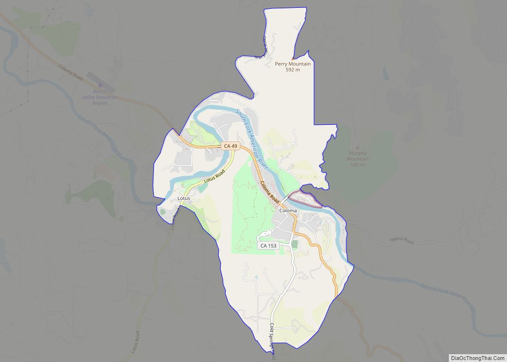
Map of Comptche CDP

Map of Comptche CDP

Comptche (Pomo: Compatche, meaning “In the valley among the hills”) is an unincorporated community and census-designated place (CDP) in Mendocino County, California, United States. It is located 17 miles (27 km) southeast of Fort Bragg at an elevation of 187 feet (57 m). There is a K–3 primary school serving the town, as well as a small … Read more

Map of Commerce city

Map of Commerce city, California

Commerce is a city located in southeast Los Angeles County, California, United States. The population was 12,823 at the 2010 census, up from 12,568 at the 2000 census. It is usually referred to as the City of Commerce to distinguish it from the common noun. It is bordered by Vernon on the west, Los Angeles … Read more

Map of Colusa city

Map of Colusa city

Colusa is a city and county seat of Colusa County, California, located in the Sacramento Valley region of the Central Valley. The population was 5,971 at the 2010 census, up from 5,402 at the 2000 census. Colusi originates from the local Coru Native American tribe, who in the 1840s lived on the opposite side of … Read more

Map of Contra Costa Centre CDP

Map of Contra Costa Centre CDP

Contra Costa Centre is an unincorporated community and census-designated place in Contra Costa County, California. Contra Costa Centre sits at an elevation of 92 feet (28 m). The 2010 United States census reported Contra Costa Centre’s population was 5,364. Contra Costa Centre is served by the Pleasant Hill / Contra Costa Centre BART station. It … Read more

Map of Concow CDP

Map of Concow CDP

Concow (Maidu: Koyoom Kʼawi, meaning “Meadow”) is an unincorporated community and census-designated place (CDP) in the Sierra Nevada foothills covering eastern Butte County, California. Due to a decline in employment and repeated wildfires, over the past hundred years the population declined from several thousand to several dozen. On November 8, 2018, a wildfire, the Camp … Read more

Map of Compton city

Map of Compton city, California

Compton is a city in southern Los Angeles County, California, United States, situated south of downtown Los Angeles. Compton is one of the oldest cities in the county and, on May 11, 1888, was the eighth city in Los Angeles County to incorporate. As of the 2010 United States Census, the city had a total … Read more

Map of Corning city, California

Map of Corning city, California

Corning is a city in Tehama County, California, that is located about 19 miles (31 km) south of Red Bluff and about 100 miles (160 km) north of Sacramento. The population was 8,244 at the 2020 census, up from 7,663 at the 2010 census. Corning city overview: Name: Corning city LSAD Code: 25 LSAD Description: city (suffix) State: California … Read more

Map of Corcoran city

Map of Corcoran city, California

Corcoran is a city in Kings County, California. Corcoran is located 17 miles (27 km) south-southeast of Hanford, at an elevation of 207 ft (63 m). It is part of the Hanford–Corcoran Metropolitan Statistical Area. The population was 24,813 (2010 census), up from 14,458 (2000 census). The California Department of Finance estimated that Corcoran’s population was 21,960 in … Read more

Map of Copperopolis CDP

Map of Copperopolis CDP

Copperopolis is an unincorporated town and census-designated place (CDP) in Calaveras County, California, United States. The population was 3,671 at the 2010 census, up from 2,363 at the 2000 census. The town is located along State Route 4 and is registered as California Historical Landmark #296. Copperopolis CDP overview: Name: Copperopolis CDP LSAD Code: 57 … Read more

Map of Corralitos CDP

Map of Corralitos CDP

Corralitos (Spanish for “Small pens”) is a census-designated place (CDP) in Santa Cruz County, California, United States. It is a rural area known for its agriculture of apples and strawberries, and its notable Corralitos Market and Sausage Co. Moreover, its location near the Pacific Ocean optimizes viticulture. The population was 2,326 at the 2010 census. … Read more

Map of Coronita CDP

Map of Coronita CDP

Coronita (Spanish for “Small crown”) is a census-designated place in Riverside County, California. Coronita sits at an elevation of 630 feet (190 m). The 2010 United States census reported Coronita’s population was 2,608. Coronita CDP overview: Name: Coronita CDP LSAD Code: 57 LSAD Description: CDP (suffix) State: California County: Riverside County Elevation: 630 ft (190 m) Total Area: … Read more

Map of Coronado city

Map of Coronado city

Coronado (Spanish for “Crowned”) is a resort city located in San Diego County, California, United States, across the San Diego Bay from downtown San Diego. It was founded in the 1880s and incorporated in 1890. Its population was 20,192 in 2020, down from 24,697 in 2010. Coronado is a tied island which is connected to … Read more