Corralitos (Spanish for “Small pens”) is a census-designated place (CDP) in Santa Cruz County, California, United States. It is a rural area known for its agriculture of apples and strawberries, and its notable Corralitos Market and Sausage Co. Moreover, its location near the Pacific Ocean optimizes viticulture.
The population was 2,326 at the 2010 census.
| Name: | Corralitos CDP |
|---|---|
| LSAD Code: | 57 |
| LSAD Description: | CDP (suffix) |
| State: | California |
| County: | Santa Cruz County |
| Elevation: | 269 ft (82 m) |
| Total Area: | 8.92 sq mi (23.10 km²) |
| Land Area: | 8.91 sq mi (23.07 km²) |
| Water Area: | 0.01 sq mi (0.04 km²) 0.16% |
| Total Population: | 2,342 |
| Population Density: | 262.97/sq mi (101.53/km²) |
| ZIP code: | 95076 |
| Area code: | 831 |
| FIPS code: | 0616434 |
| GNISfeature ID: | 1658321 |
Online Interactive Map
Click on ![]() to view map in "full screen" mode.
to view map in "full screen" mode.
Corralitos location map. Where is Corralitos CDP?

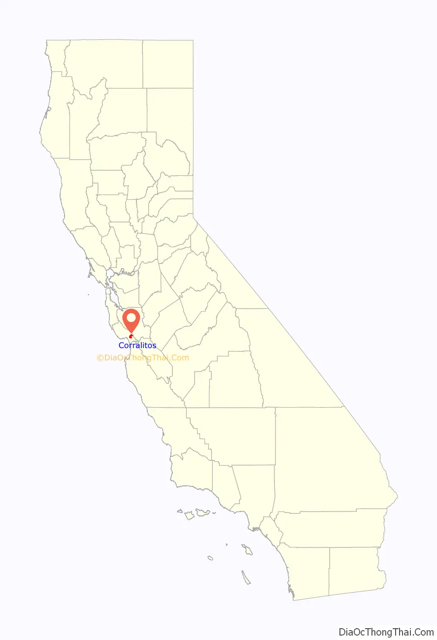
Corralitos Road Map

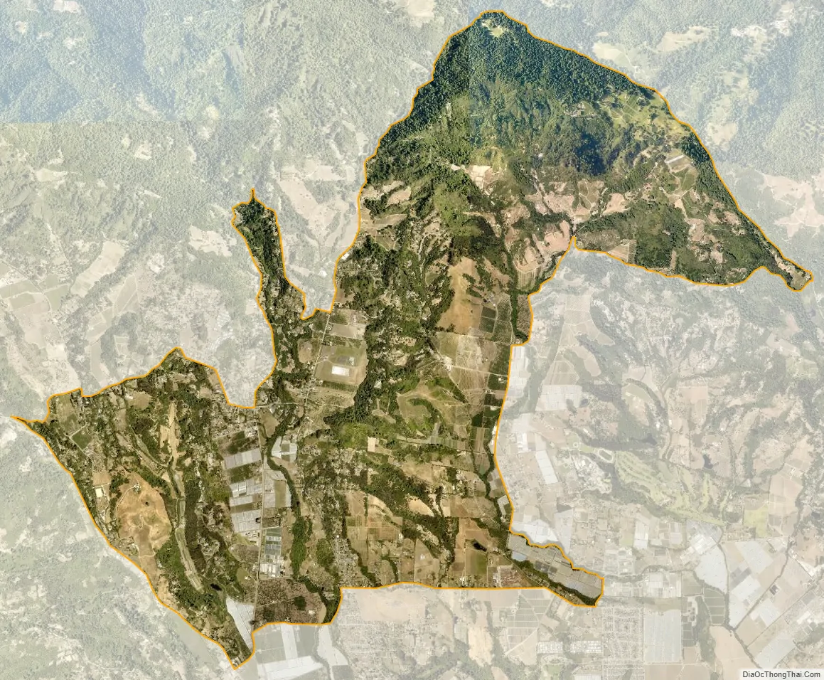
Corralitos city Satellite Map
Geography
Corralitos is located at 36°59′29″N 121°48′7″W / 36.99139°N 121.80194°W / 36.99139; -121.80194 (36.991303, -121.802013). It is located on Corralitos Creek, a tributary of Salsipuedes Creek which is in turn the lowest tributary of the Pajaro River.
According to the United States Census Bureau, the CDP has a total area of 9.0 square miles (23 km), of which, 9.0 square miles (23 km) of it is land and 0.16% is water.
See also
Map of California State and its subdivision:- Alameda
- Alpine
- Amador
- Butte
- Calaveras
- Colusa
- Contra Costa
- Del Norte
- El Dorado
- Fresno
- Glenn
- Humboldt
- Imperial
- Inyo
- Kern
- Kings
- Lake
- Lassen
- Los Angeles
- Madera
- Marin
- Mariposa
- Mendocino
- Merced
- Modoc
- Mono
- Monterey
- Napa
- Nevada
- Orange
- Placer
- Plumas
- Riverside
- Sacramento
- San Benito
- San Bernardino
- San Diego
- San Francisco
- San Joaquin
- San Luis Obispo
- San Mateo
- Santa Barbara
- Santa Clara
- Santa Cruz
- Shasta
- Sierra
- Siskiyou
- Solano
- Sonoma
- Stanislaus
- Sutter
- Tehama
- Trinity
- Tulare
- Tuolumne
- Ventura
- Yolo
- Yuba
- Alabama
- Alaska
- Arizona
- Arkansas
- California
- Colorado
- Connecticut
- Delaware
- District of Columbia
- Florida
- Georgia
- Hawaii
- Idaho
- Illinois
- Indiana
- Iowa
- Kansas
- Kentucky
- Louisiana
- Maine
- Maryland
- Massachusetts
- Michigan
- Minnesota
- Mississippi
- Missouri
- Montana
- Nebraska
- Nevada
- New Hampshire
- New Jersey
- New Mexico
- New York
- North Carolina
- North Dakota
- Ohio
- Oklahoma
- Oregon
- Pennsylvania
- Rhode Island
- South Carolina
- South Dakota
- Tennessee
- Texas
- Utah
- Vermont
- Virginia
- Washington
- West Virginia
- Wisconsin
- Wyoming


