Corcoran is a city in Kings County, California. Corcoran is located 17 miles (27 km) south-southeast of Hanford, at an elevation of 207 ft (63 m). It is part of the Hanford–Corcoran Metropolitan Statistical Area. The population was 24,813 (2010 census), up from 14,458 (2000 census). The California Department of Finance estimated that Corcoran’s population was 21,960 in 2019.
Corcoran is most notable as the site of the California State Prison, Corcoran. It was home to notable inmates Rodney Alcala, Charles Manson, John Albert Gardner, and Juan Corona. The California Substance Abuse Treatment Facility and State Prison, Corcoran is a separate facility that is also located in the city. As of January 1, 2015, the two prisons held a combined total of 9,592 inmates. Inmates are counted as city residents by both the United States Census and the California Department of Finance. Thus, the incarcerated people in the two prisons comprise just over 43% of the total population of Corcoran.
| Name: | Corcoran city |
|---|---|
| LSAD Code: | 25 |
| LSAD Description: | city (suffix) |
| State: | California |
| County: | Kings County |
| Incorporated: | August 11, 1914 |
| Elevation: | 207 ft (63 m) |
| Total Area: | 7.46 sq mi (19.32 km²) |
| Land Area: | 7.46 sq mi (19.32 km²) |
| Water Area: | 0.00 sq mi (0.00 km²) 0% |
| Total Population: | 22,339 |
| Population Density: | 2,995.31/sq mi (1,156.55/km²) |
| ZIP code: | 93212 |
| Area code: | 559 |
| FIPS code: | 0616224 |
| GNISfeature ID: | 1652690 |
| Website: | www.cityofcorcoran.com |
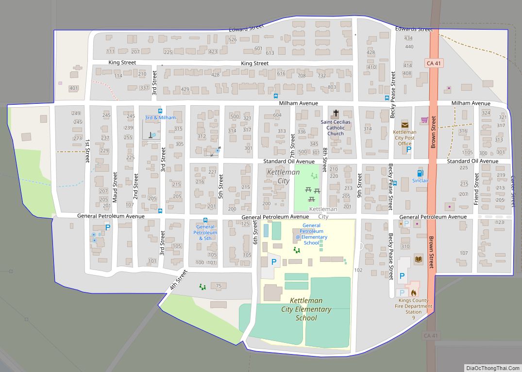
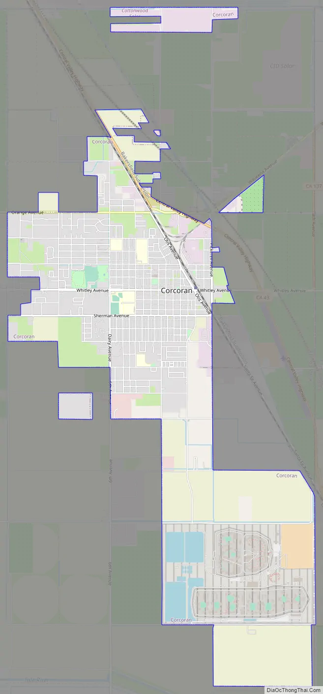
Online Interactive Map
Click on ![]() to view map in "full screen" mode.
to view map in "full screen" mode.
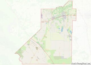
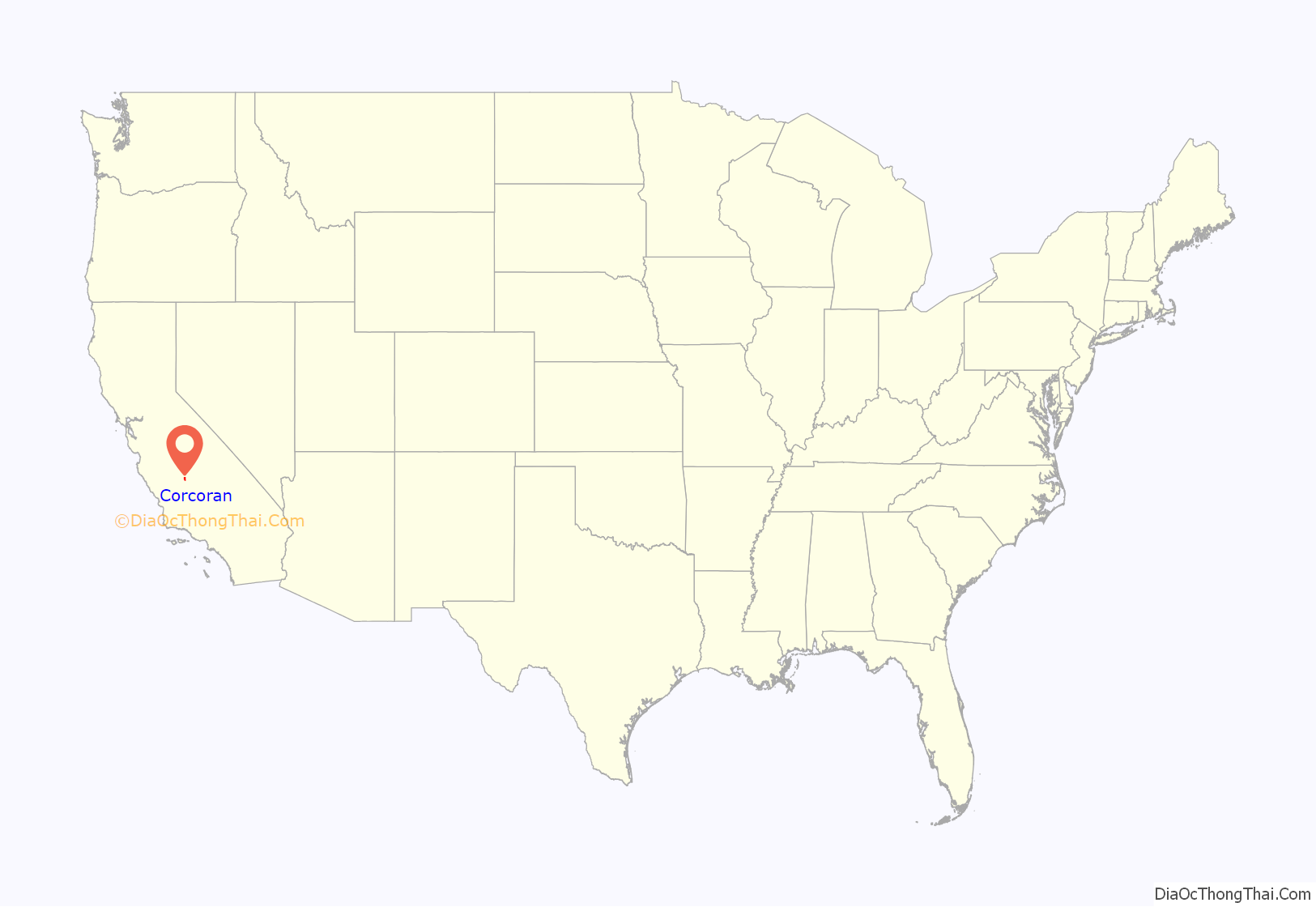
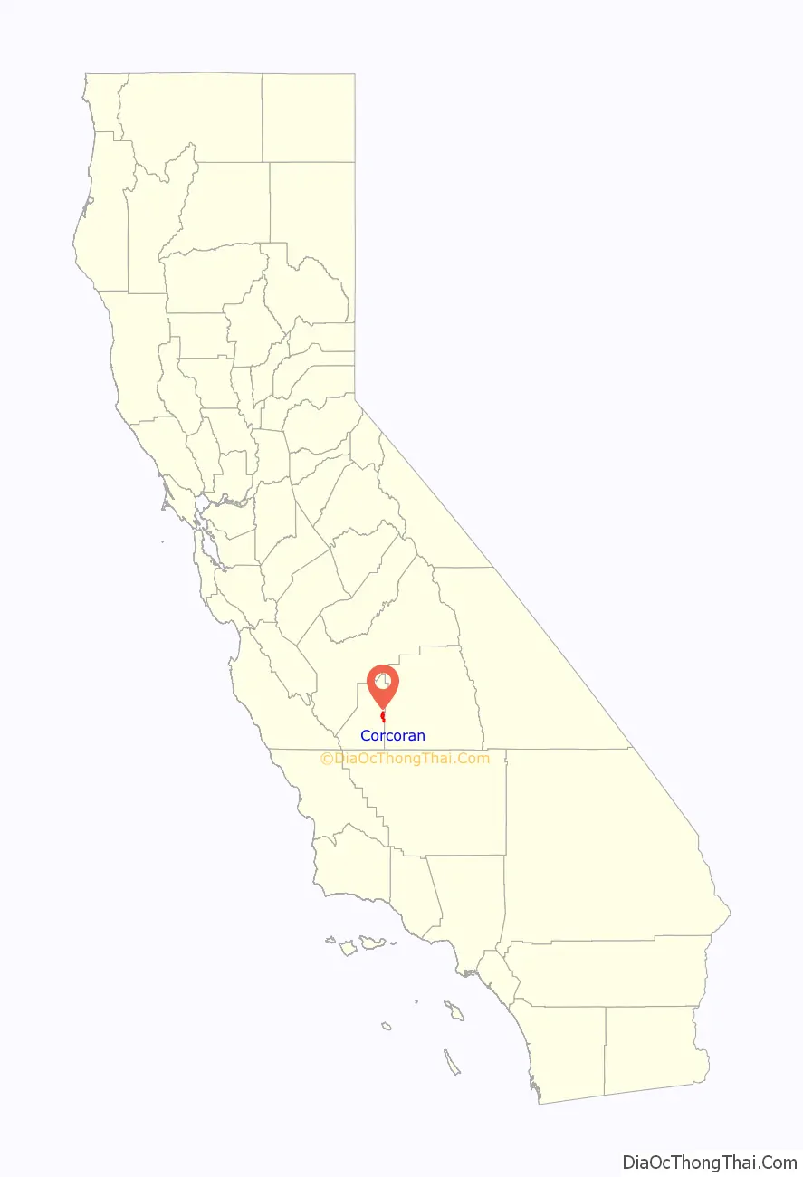
Corcoran location map. Where is Corcoran city?
History
Corcoran was founded by Hobart Johnstone Whitley, a prominent land developer from southern California, who took the lead in building Corcoran (the main street of the community is named in his honor). Liking what he saw during a visit to the area in 1905 (a blacksmith shop, small store, scattered homes and a lush, untapped vista with herds of grazing wild hogs, horses and steers) Whitley purchased 32,000 acres (130 km) to start development. Much like in the San Fernando Valley (Van Nuys and Canoga Park his “creations”), Whitley “leveraged” his holdings with the support of important Los Angeles businessmen. Whitley first intended the town be named “Otis”, after Harrison Gray Otis of the Los Angeles Times, and streets as Otis, Sherman, Letts (the Broadway store) and Ross (after his son, Ross Whitley) show the connections. Whitley, it is claimed, purchased and platted some 150 towns over the American West—and Corcoran is one of his last.
Whitley moved a member of his real estate firm, J. W. Guiberson, to the area. Guiberson became one of the many pioneers of the community, building the first home and business structure in Corcoran. His family also helped establish the first church in the community, an event which helped lead to the town’s incorporation on August 14, 1914.
The basis of Corcoran’s economy then and now is agriculture. Initially, the most successful crops were grains, alfalfa and sugar beets.
In 1933, more than 12,000 workers went on strike against cotton farmers, one of the largest California agricultural strikes of 1933. Strikers in Corcoran created a tent city that eventually held more than 3,000 people, more than double the town’s population. Its lack of water or sewage systems created waves of illness. Streets were staked out in the tent city, and committees of workers governed the camp.
The J. G. Boswell Company was established in Corcoran in 1921 and remains a major employer in the city.
The first post office opened in 1901.
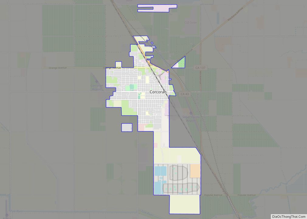
Corcoran Road Map
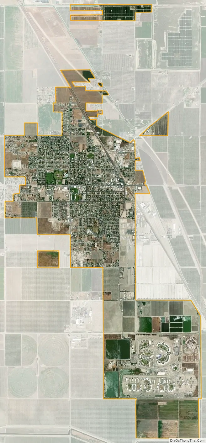
Corcoran city Satellite Map
Geography
Corcoran is located at 36°05′53″N 119°33′37″W / 36.09806°N 119.56028°W / 36.09806; -119.56028.
According to the United States Census Bureau, the city has a total area of 6.4 square miles (17 km), all of it land.
The ground under Corcoran is subsiding due to withdrawal of groundwater by agricultural interests. There has been up to 11.5 feet (3.5 meters) of subsidence over the past 14 years.
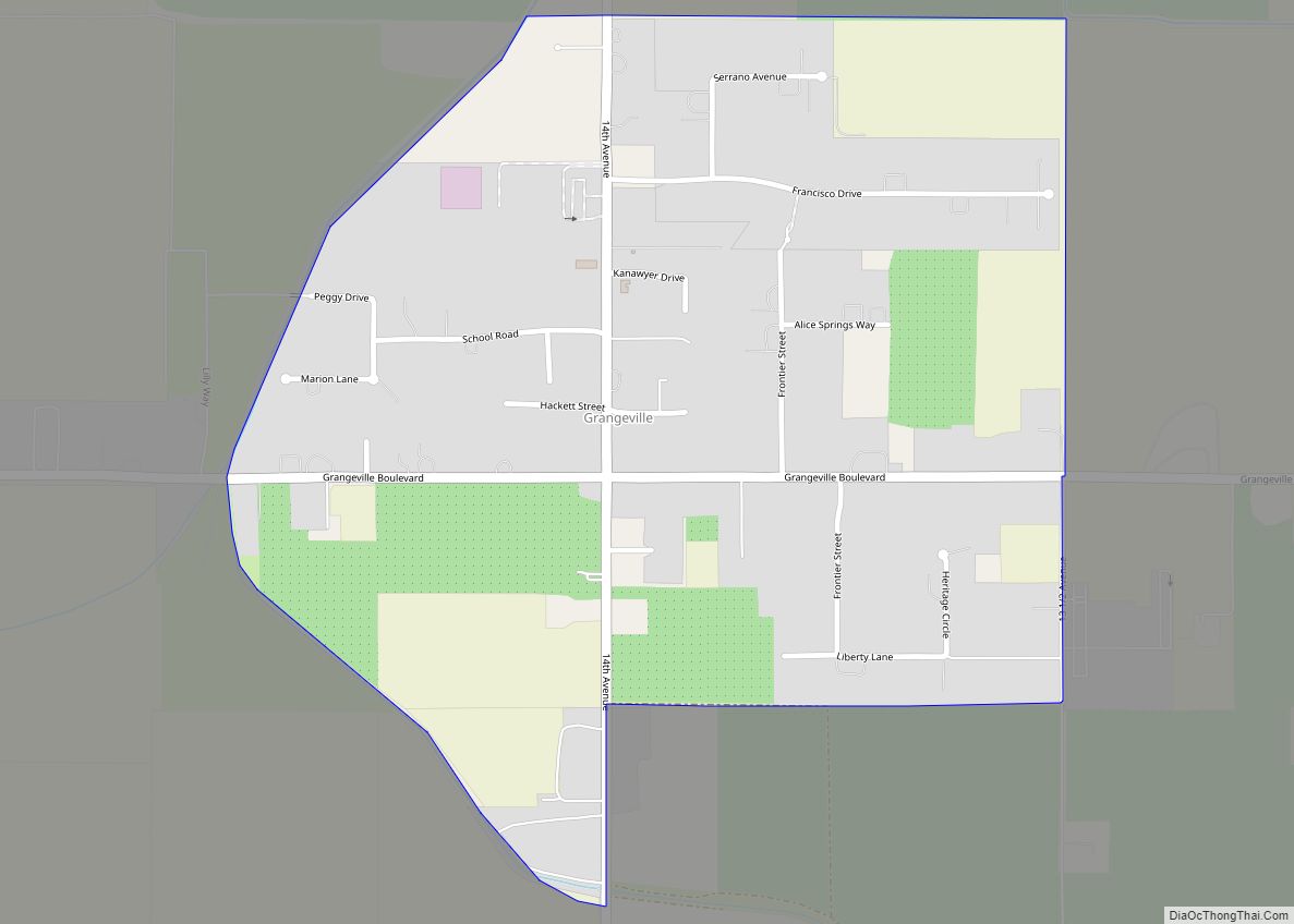
Soils around Corcoran are somewhat poorly drained to poorly drained loam or fine sandy loam which is often saline as in the widespread Lakeside series. Other important soil series include the Armona, Gambogy, Grangeville, Kimberlina, and Lemoore. Corcoran is occasionally subject to areal flooding due to its position in a basin. Notable flood years include 1983 and 2023.
Climate
See also
Map of California State and its subdivision:- Alameda
- Alpine
- Amador
- Butte
- Calaveras
- Colusa
- Contra Costa
- Del Norte
- El Dorado
- Fresno
- Glenn
- Humboldt
- Imperial
- Inyo
- Kern
- Kings
- Lake
- Lassen
- Los Angeles
- Madera
- Marin
- Mariposa
- Mendocino
- Merced
- Modoc
- Mono
- Monterey
- Napa
- Nevada
- Orange
- Placer
- Plumas
- Riverside
- Sacramento
- San Benito
- San Bernardino
- San Diego
- San Francisco
- San Joaquin
- San Luis Obispo
- San Mateo
- Santa Barbara
- Santa Clara
- Santa Cruz
- Shasta
- Sierra
- Siskiyou
- Solano
- Sonoma
- Stanislaus
- Sutter
- Tehama
- Trinity
- Tulare
- Tuolumne
- Ventura
- Yolo
- Yuba
- Alabama
- Alaska
- Arizona
- Arkansas
- California
- Colorado
- Connecticut
- Delaware
- District of Columbia
- Florida
- Georgia
- Hawaii
- Idaho
- Illinois
- Indiana
- Iowa
- Kansas
- Kentucky
- Louisiana
- Maine
- Maryland
- Massachusetts
- Michigan
- Minnesota
- Mississippi
- Missouri
- Montana
- Nebraska
- Nevada
- New Hampshire
- New Jersey
- New Mexico
- New York
- North Carolina
- North Dakota
- Ohio
- Oklahoma
- Oregon
- Pennsylvania
- Rhode Island
- South Carolina
- South Dakota
- Tennessee
- Texas
- Utah
- Vermont
- Virginia
- Washington
- West Virginia
- Wisconsin
- Wyoming