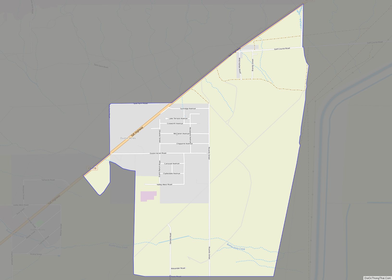
Map of East Hemet CDP

Map of East Hemet CDP

East Hemet is a census-designated place (CDP) in Riverside County, California, United States, located east of Hemet. East Hemet is in an unincorporated area outside the city limits of Hemet. The population was 17,418 at the 2010 census, up from 14,823 at the 2000 census. East Hemet CDP overview: Name: East Hemet CDP LSAD Code: … Read more

Map of East Foothills CDP

Map of East Foothills CDP

East Foothills is a census-designated place (CDP) in Santa Clara County, California, United States and a neighborhood of San Jose. The population was 8,269 at the 2010 census and it is located about 4 miles east of downtown San Jose. East Foothills CDP overview: Name: East Foothills CDP LSAD Code: 57 LSAD Description: CDP (suffix) … Read more

Map of Earlimart CDP

Map of Earlimart CDP

Earlimart is an unincorporated community in Tulare County, California, United States. At the 2010 census, the CDP population was 8,537, up from 6,583 at the 2000 census. For statistical purposes, the Census Bureau defines Earlimart as a census-designated place (CDP). Earlimart CDP overview: Name: Earlimart CDP LSAD Code: 57 LSAD Description: CDP (suffix) State: California … Read more

Map of East Nicolaus CDP

Map of East Nicolaus CDP

East Nicolaus is a census-designated place (CDP) in Sutter County, California. East Nicolaus sits at an elevation of 43 feet (13 m). The 2010 United States census reported East Nicolaus’s population was 225. It is home to East Nicolaus High School (ENHS), a public school that serves grades nine through twelve. The ENHS mascot is the … Read more

Map of East Los Angeles CDP

Map of East Los Angeles CDP

East Los Angeles (Spanish: Este de Los Ángeles), or East L.A., often referred to by locals as “East Los“, is an unincorporated area in Los Angeles County, California, United States. For statistical purposes, the United States Census Bureau regards East Los Angeles as a census-designated place (CDP). As of the 2020 census it had a … Read more

Map of East Oakdale CDP

Map of East Oakdale CDP

East Oakdale is an unincorporated census-designated place (CDP) on the Stanislaus River, located east of the city of Oakdale in Stanislaus County, California. It is part of the Modesto Metropolitan Statistical Area in the San Joaquin Valley. The population was 2,762 at the 2010 census. East Oakdale CDP overview: Name: East Oakdale CDP LSAD Code: … Read more

Map of East Pasadena CDP

Map of East Pasadena CDP

East Pasadena (pronunciation) is an unincorporated community in Los Angeles County, California, United States. The population was 6,144 at the 2010 census, up from 6,045 at the 2000 census. For statistical purposes, the United States Census Bureau has defined East Pasadena as a census-designated place (CDP). East Pasadena CDP overview: Name: East Pasadena CDP LSAD … Read more

Map of East Palo Alto city

Map of East Palo Alto city

East Palo Alto (abbreviated E.P.A.) is a city in San Mateo County, California, United States. As of the 2020 census, the population of East Palo Alto was 30,034. It is situated on the San Francisco Peninsula, roughly halfway between the cities of San Francisco and San Jose. To the north and east is the San … Read more

Map of East Orosi CDP

Map of East Orosi CDP

East Orosi is a unincorporated community in Tulare County, California, United States. The population was 495 at the 2010 census, up from 426 in 2000. For statistical purposes, the United States Census Bureau has defined East Orosi as a census-designated place (CDP). East Orosi CDP overview: Name: East Orosi CDP LSAD Code: 57 LSAD Description: … Read more

Map of East Rancho Dominguez CDP

Map of East Rancho Dominguez CDP

East Rancho Dominguez, (pronunciation) also known as East Compton, is an unincorporated community and census-designated place (CDP) located in southern Los Angeles County, California. The population was 15,135 at the 2010 census, up from 9,286 at the 2000 census. East Rancho Dominguez is an accepted city name according to the USPS, and shares the 90221 … Read more

Map of East Quincy CDP

Map of East Quincy CDP

East Quincy is a census-designated place (CDP) in Plumas County, California, United States. The population was 2,489 at the 2010 census, up from 2,398 at the 2000 census. East Quincy CDP overview: Name: East Quincy CDP LSAD Code: 57 LSAD Description: CDP (suffix) State: California County: Plumas County Elevation: 3,491 ft (1,064 m) Total Area: 12.107 sq mi (31.357 km²) … Read more

Map of East Porterville CDP

Map of East Porterville CDP

East Porterville is an unincorporated community in Tulare County, California, United States. Adjacent to the city of Porterville, the community lies by the Sierra Nevada foothills. The population was 7,331 at the 2010 census, up from 6,730 at the 2000 census. For statistical purposes, the United States Census Bureau has defined East Porterville as a … Read more