East Los Angeles (Spanish: Este de Los Ángeles), or East L.A., often referred to by locals as “East Los“, is an unincorporated area in Los Angeles County, California, United States. For statistical purposes, the United States Census Bureau regards East Los Angeles as a census-designated place (CDP). As of the 2020 census it had a population of 118,786, a drop of 6.1% from 2010, when the population was 126,496.
The area is notable for its high Hispanic/Latino population, which, at over 95%, is the highest proportion of Hispanic/Latino Americans of any city or census-designated place in the United States outside of Puerto Rico.
| Name: | East Los Angeles CDP |
|---|---|
| LSAD Code: | 57 |
| LSAD Description: | CDP (suffix) |
| State: | California |
| County: | Los Angeles County |
| Elevation: | 200 ft (61 m) |
| Total Area: | 7.46 sq mi (19.31 km²) |
| Land Area: | 7.45 sq mi (19.30 km²) |
| Water Area: | 0.00 sq mi (0.01 km²) 0.06% |
| Total Population: | 118,786 |
| Population Density: | 15,938.01/sq mi (6,153.58/km²) |
| ZIP code: | 90022, 90063 |
| Area code: | 213 and 323 |
| FIPS code: | 0620802 |
| GNISfeature ID: | 1660583 |
Online Interactive Map
Click on ![]() to view map in "full screen" mode.
to view map in "full screen" mode.
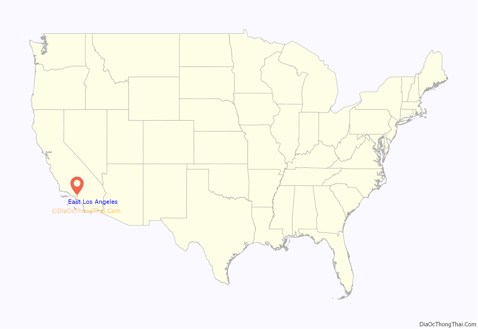
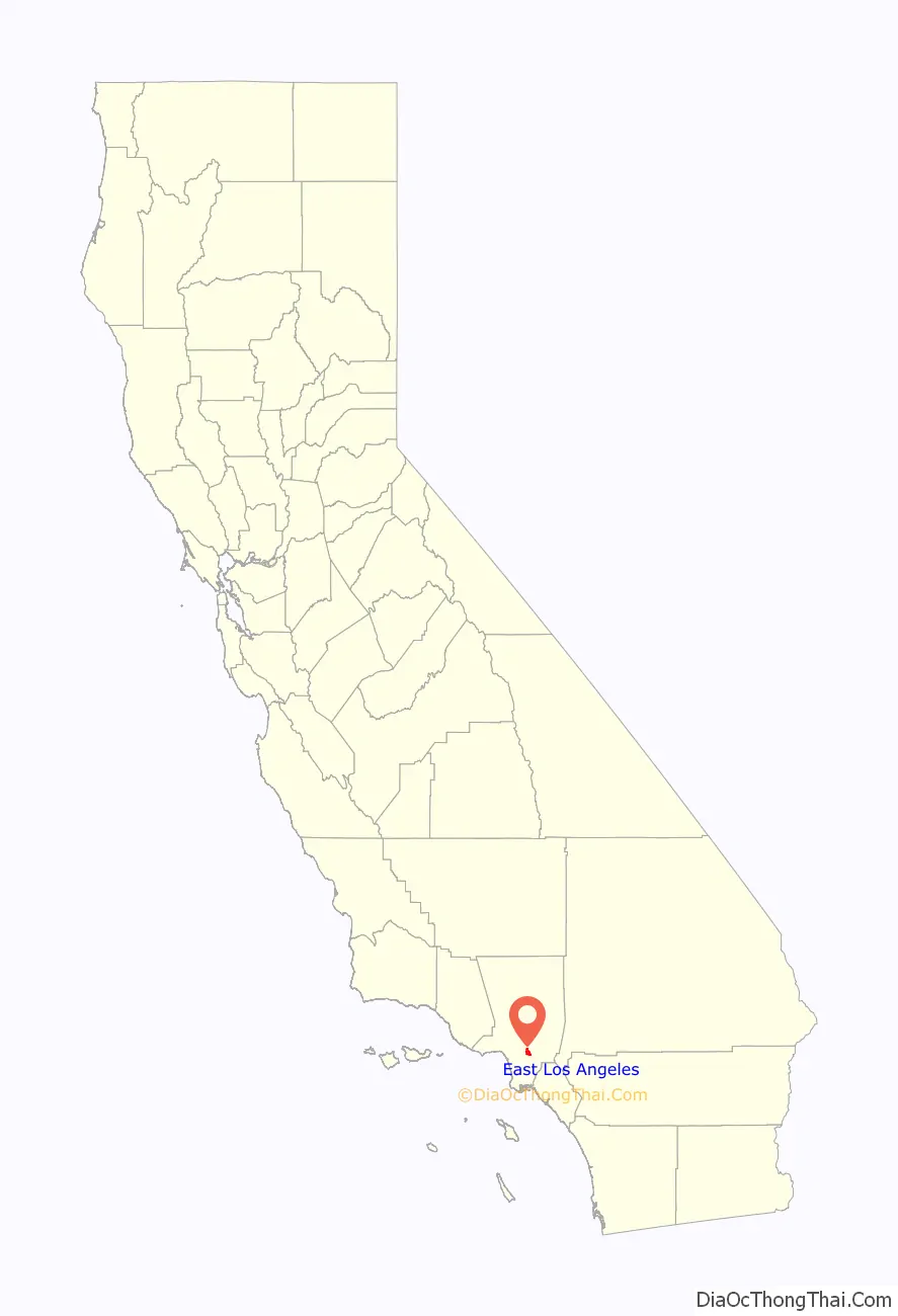
East Los Angeles location map. Where is East Los Angeles CDP?
History
Original East Los Angeles
Historically, when it was founded in 1873, the neighborhood northeast of downtown known today as Lincoln Heights was originally named East Los Angeles, but in 1917 residents voted to change the name to its present name. Today it is considered part of L.A.’s Eastside, the geographic region east of the Los Angeles River that includes three neighborhoods within the city of Los Angeles (Boyle Heights, El Sereno and Lincoln Heights) and the unincorporated community in Los Angeles County known today as “East Los Angeles”. Lincoln Heights is 4 miles (6 km) northwest of present-day East Los Angeles. When Lincoln Heights, the first east-side subdivision created in 1873, changed its name in 1917, Belvedere (Belvedere Gardens and Belvedere Heights) and surrounding unincorporated county areas were given the moniker of East Los Angeles. By the 1930s, most maps had started to label the Belvedere area as “East Los Angeles”.
Belvedere
The cornerstone of the first building of Occidental College was laid in September 1887 on Rowan Street. In 1896, the building was destroyed by fire.
On April 2, 1905, it was reported that the Janss Investment Company would be developing an area “on Boyle Heights” (later, Boyle Heights would refer only to a smaller area to the west, i.e. the neighborhood now called Boyle Heights within the Los Angeles city limits). The 170-acre (0.69 km) tract was located at the eastern terminus of the Los Angeles Railway’s “R” streetcar line. Originally known as “Hazard’s Eastside Extension”, was to be named Highland Villa, but would later be rechristened Belvedere Heights. Belvedere Heights, at its launch in 1905, extended from the L.A. city limits (Indiana Av.) on the west to Rowan Av. on the east, from Aliso St. on the south to Wabash Av. on the north, the northwestern portion of today’s East Los Angeles, thus including the lower portions of what today is called City Terrace.
By the early 1920s, workers in the sprouting industrial district to the south were seeking nearby housing. At the time, the unincorporated region was undeveloped and or preserved for agriculture and oil extraction. Belvedere township included the territory that in 1902 became the city of Montebello.
By 1922 Janss advertised that it had sold 6000 lots there and that 35,000 people lived in Belvedere Heights. Buildings that were described as being in Belvedere Heights included the junior high school on Record between Brooklyn and Michigan, now called Belvedere Middle School.
In February 1921 Janss announced that it had purchased 150 acres (61 ha) adjacent to the end of the streetcar line on Stephenson Avenue, now Whittier Boulevard, south of Belvedere Heights, and divided the empty land into housing lots of square-mile grid cells. Janss called the new tract Belvedere Gardens, an area still found today on maps for the area east of the Long Beach Freeway.
New name: East Los Angeles
In 1932 local business leaders gave the name East Los Angeles to Belvedere and adjacent areas (that had been known as Belvedere Gardens, Belvedere Heights, Laguna, etc.) However, in 1937 the Automobile Club of Southern California put up three large signs, “Belvedere Gardens”. This led to the business leaders uprooting the signs, with a “burial ceremony” for the signs with 150 state, county and city officials attending, and rechristening the area, East Los Angeles. Several county buildings were renamed in line with the new appellation. At that time the area had 75,000 residents and was “declared to be the largest unincorporated locality in the world.”
East Los Angeles was a significant site during the Chicano Movement, which included the East L.A. Walkouts in 1968 and the National Chicano Moratorium, in which Ruben Salazar was killed.
Multiple campaigns by residents have been made for cityhood for East Los Angeles, such as in 2010.
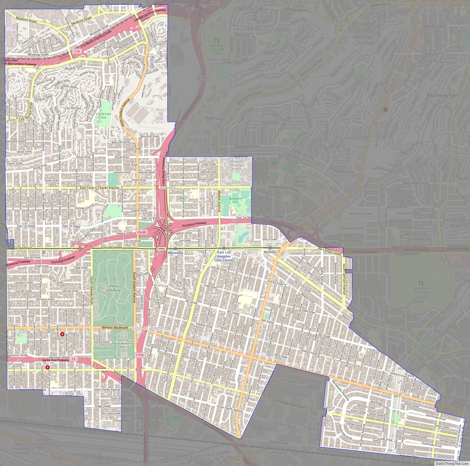
East Los Angeles Road Map
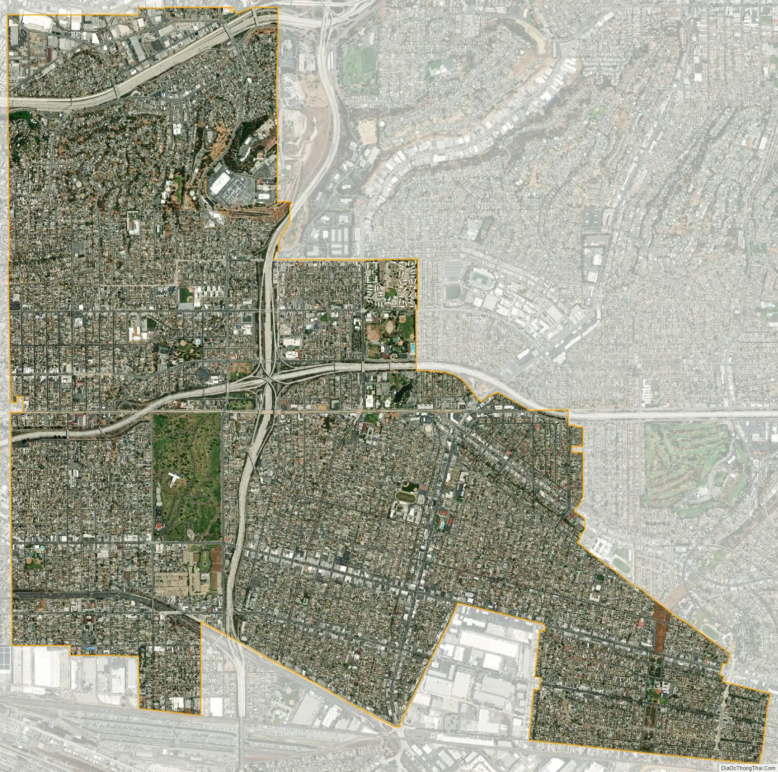
East Los Angeles city Satellite Map
Geography
East L.A. is located immediately east of the Boyle Heights district of Los Angeles, south of the El Sereno district of Los Angeles, north of the city of Commerce, and west of the cities of Monterey Park and Montebello.
The unincorporated area known as City Terrace occupies the northern part of the CDP. The Census Bureau definition of the area may not precisely correspond to the local understanding of the community.
Climate
East L.A. has a very warm hot-summer Mediterranean climate.
See also
Map of California State and its subdivision:- Alameda
- Alpine
- Amador
- Butte
- Calaveras
- Colusa
- Contra Costa
- Del Norte
- El Dorado
- Fresno
- Glenn
- Humboldt
- Imperial
- Inyo
- Kern
- Kings
- Lake
- Lassen
- Los Angeles
- Madera
- Marin
- Mariposa
- Mendocino
- Merced
- Modoc
- Mono
- Monterey
- Napa
- Nevada
- Orange
- Placer
- Plumas
- Riverside
- Sacramento
- San Benito
- San Bernardino
- San Diego
- San Francisco
- San Joaquin
- San Luis Obispo
- San Mateo
- Santa Barbara
- Santa Clara
- Santa Cruz
- Shasta
- Sierra
- Siskiyou
- Solano
- Sonoma
- Stanislaus
- Sutter
- Tehama
- Trinity
- Tulare
- Tuolumne
- Ventura
- Yolo
- Yuba
- Alabama
- Alaska
- Arizona
- Arkansas
- California
- Colorado
- Connecticut
- Delaware
- District of Columbia
- Florida
- Georgia
- Hawaii
- Idaho
- Illinois
- Indiana
- Iowa
- Kansas
- Kentucky
- Louisiana
- Maine
- Maryland
- Massachusetts
- Michigan
- Minnesota
- Mississippi
- Missouri
- Montana
- Nebraska
- Nevada
- New Hampshire
- New Jersey
- New Mexico
- New York
- North Carolina
- North Dakota
- Ohio
- Oklahoma
- Oregon
- Pennsylvania
- Rhode Island
- South Carolina
- South Dakota
- Tennessee
- Texas
- Utah
- Vermont
- Virginia
- Washington
- West Virginia
- Wisconsin
- Wyoming


