East Palo Alto (abbreviated E.P.A.) is a city in San Mateo County, California, United States. As of the 2020 census, the population of East Palo Alto was 30,034. It is situated on the San Francisco Peninsula, roughly halfway between the cities of San Francisco and San Jose. To the north and east is the San Francisco Bay, to the west is the city of Menlo Park, and to the south the city of Palo Alto. Despite being called “East” Palo Alto, the city is directly north of Palo Alto. While often incorrectly assumed to be part of the city of Palo Alto, East Palo Alto has always been a separate entity since its founding as an unincorporated community and its incorporation in July 1983. It is also in San Mateo County, while Palo Alto is in Santa Clara County. The two cities are separated only by San Francisquito Creek and, largely, the Bayshore Freeway (the vast majority of East Palo Alto is northeast of the freeway, while all of the residential part of Palo Alto is southwest of the freeway). The revitalization projects in 2000, and high income high-tech professionals moving into new developments, including employees from Google and Facebook, have begun to eliminate the cultural and economic differences between the two cities. East Palo Alto and Palo Alto share both telephone area codes and postal ZIP codes.
In 1990, 43% of East Palo Alto’s residents were African Americans, which was the result of redlining practices and racial deed restrictions in Palo Alto. As of 2020, Latinos constitute about 66% of the total population, while the proportion of African Americans has decreased to about 11%. A small minority of Pacific Islanders also reside in East Palo Alto, most of Tongan, Samoan and Fijian origin.
The prosperity that benefited the Silicon Valley during the dot-com boom of the late 1990s largely bypassed East Palo Alto. The Ravenswood City School District, which serves East Palo Alto and part of adjoining Menlo Park, has struggled with low academic performance. Eventually, however, the Peninsula’s shortage of land and soaring property prices meant that even East Palo Alto became an option for urban regeneration. Until recently, gentrification has been rare in East Palo Alto.
East Palo Alto also includes a small piece of land across the Bayshore Freeway (U.S. Route 101) from the shopping center, a roughly triangular area between US 101 and San Francisquito Creek, formerly the site of a two-block-long retail business district known as Whiskey Gulch. The name dates back to the time when Stanford University, on the other side of Palo Alto to the west, was dry and prohibited alcohol sales within a radius of one-mile (1.6 km) from the campus. Whiskey Gulch, which was just outside these limits, became home to a number of liquor stores, bars, and music venues. Long after the university had relaxed its prohibition rules, the neighborhood still retained this character until 2000, when the city tore down Whiskey Gulch and replaced it with the University Circle office complex. A 200-room Four Seasons hotel opened in University Circle in 2006.
Over 25% of East Palo Alto (400+ acres) has been bulldozed and replaced with brand new housing and brand-name retail establishments over the last 10–15 years (since approximately 1997), including IKEA, Target, Home Depot, Nordstrom Rack, Togo’s, Starbucks, Office Depot, Mi Pueblo Food Center, PGA Tour Superstore, 6 to 9 Dental and Jamba Juice, attracting an entirely new demographic. The University Square community has become particularly appealing to young high-tech professionals and high-income couples, including many employees from Google, Facebook, Sun Microsystems, Yahoo!, and various other software and startup companies.
| Name: | East Palo Alto city |
|---|---|
| LSAD Code: | 25 |
| LSAD Description: | city (suffix) |
| State: | California |
| County: | San Mateo County |
| Incorporated: | July 1, 1983 |
| Elevation: | 20 ft (6 m) |
| Total Area: | 2.64 sq mi (6.85 km²) |
| Land Area: | 2.53 sq mi (6.55 km²) |
| Water Area: | 0.12 sq mi (0.30 km²) 4.11% |
| Population Density: | 11,000/sq mi (4,400/km²) |
| ZIP code: | 94303 |
| Area code: | 650 |
| FIPS code: | 0620956 |
| GNISfeature ID: | 1658461 |
| Website: | www.cityofepa.org |
Online Interactive Map
Click on ![]() to view map in "full screen" mode.
to view map in "full screen" mode.
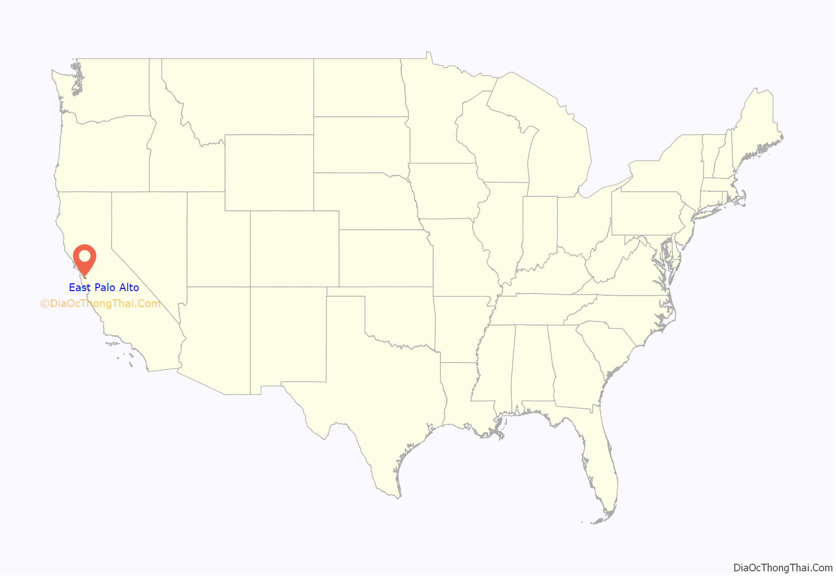
East Palo Alto location map. Where is East Palo Alto city?

History
The Ohlone tribe of Native Americans inhabited this area at least by 1500 to 1000 BC. One tumulus was discovered in 1951 during development of the University Village subdivision near today’s Costaño School. After a year-long excavation of 60 graves and 3,000 artifacts, researchers concluded Native Americans had utilized the area as a cemetery and camp, rather than as a permanent settlement. In later years another mound was found near Willow Road and the railroad right-of-way.
From the 1850s through the 1940s, the area which was to become East Palo Alto went through many changes. In 1849, Isaiah Churchill Woods (1825–1880) attempted to make the area around what is now Cooley Landing in the northeast of the current city a major shipping town and named the area Ravenswood. In 1868, after Woods’ investments failed he sold the wharf to Lester Phillip Cooley (1837–1882), who leased the land to the brick factory Hunter and Schakleford. When the brick factory left the landing in 1884, the land around the landing was reverted to a ranch.
With the outbreak of World War I, the north side of East Palo Alto became a military training ground, of which only the Veterans Administration Hospital in Menlo Park still exists (now as part of the VA Sierra Pacific Network). In the 1940s, East Palo Alto was a farming community with many Japanese residents. During the war, the Japanese were forced out, many to relocation centers, and did not return after the war.
In the 1950s the farms were built over with cheap housing and many African-American families moved in, the result of redlining housing policies. In particular, in 1954 the then-president of the California Real Estate Association, Floyd Lowe, implemented a strategy that turned a neighborhood on the East side of Palo Alto from predominantly white to predominantly black in a very short amount of time. He did this by “blockbusting,” which is a strategy that was employed all over the country to similar results. Blockbusting involves instilling panic in white neighborhoods by warning of a “Negro invasion” when a black family considers purchasing a house in an area, in order to produce white flight and an ensuing drop in property values, which can then be purchased at a heavy discount and sold or rented to African Americans for a profit. In 1954, Lowe alerted the neighborhood that a “Negro invasion” was imminent, and as intended, white flight ensued. Lowe profited due to the low prices at which the white families fleeing were willing to sell their homes, and within a few years, the demographics of the area had flipped. As white-owned businesses fled the area, it became poorer and overcrowded – a legacy that has persisted. This segregationist act was never questioned by the government, and it led to many of the demographic and socioeconomic differences that exist between Palo Alto and East Palo Alto today.
These differences in demographics and wealth perversely accelerated with the introduction of the Community Reinvestment Act of 1977, which banned redlining. Home prices doubled by 1979, and many of the more educated and upwardly mobile African Americans took advantage of their newfound freedom to move into wealthier communities with more amenities, leaving the remaining community even poorer and with less access to home ownership than had been the case before the Act.
During the civil rights movement of the 1960s there was a renewed interest in African history, one expression of which was a fad for Swahili. In 1968 the area was almost renamed Nairobi, after the center of the Swahili-speaking area, to reflect the population’s African roots. Critics of the change pointed out that Nairobi was the capital of Kenya, in East Africa, and had little to do with the cultural roots of most black Americans. In the end, the change was not made.
Historically East Palo Alto had relatively little shopping and business compared to surrounding areas, and most of it constituted an unincorporated “island” within San Mateo County, depending on county government for services and on the San Mateo County Sheriff for police protection and ineligible for many revenue benefits requiring city status. After several years of pro-incorporation campaigning by local community groups, including Barbara A. Mouton and East Palo Alto’s Senior Citizen Center president Ruth I. Myers, 1982 ballot measure that was stopped by a lawsuit, and a subsequent election the next year, East Palo Alto became a city on July 1, 1983, with Barbara A. Mouton as its first Mayor. However, because of subsequent legal challenges to the last ballot measure, it was not until 1987 that the city was officially recognized as such. The legal challenges were led by former U.S. Congress member Pete McCloskey, who represented one of the real-estate brokers whose original blockbusting campaign had turned EPA into a mostly black town. The final tally was 1,777 for and 1,764 against, a margin of 13 votes and a majority of 50.2%.
In the 1980s, large numbers of Hispanics moved into East Palo Alto and by 1990, the city had lost its Black majority population which declined from 60 percent in 1980 to 41.5 percent in 1990 while the Hispanic population increased from 14 percent to 36 percent.
Significant gentrification occurred in East Palo Alto from around the founding of Facebook, with the construction of a large shopping center named Ravenswood 101—including a Home Depot, a Best Buy, and an IKEA store—and several upscale housing communities intended for high-earning Silicon Valley workers. This development faced opposition from some residents, who charged that it priced locals out of one of the region’s only affordable communities while providing only low-paying retail jobs and consuming disproportionate land area (2.2 square miles). Supporters pointed to an increased tax base.
In 2008, after twenty years without a supermarket, East Palo Alto individuals and organizations established the East Palo Alto Community Farmers’ Market. In November 2009, the Mi Pueblo Food Center grocery store opened in the Ravenswood 101 shopping center in the location of the former Circuit City store. Mi Pueblo was the city’s first full-service supermarket in 23 years.
Starting in 2006, a large real estate investor, Page Mill Properties, purchased almost the entire west side of East Palo Alto and contested most of the city’s rent control laws in what some claimed was a ‘predatory equity scheme’. Page Mill left East Palo Alto in the fall of 2009 after defaulting on a $240-million bank loan.
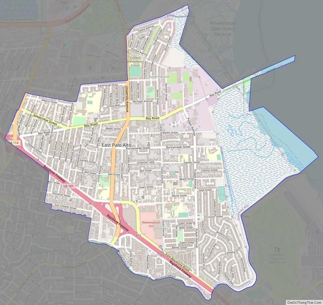
East Palo Alto Road Map
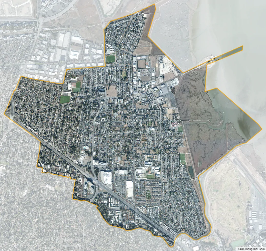
East Palo Alto city Satellite Map
Geography
East Palo Alto is located in San Mateo County. Despite its name, it lies almost entirely north, and not east of Palo Alto. It is bordered on the west by Menlo Park, to the south by Palo Alto, and to the east by the San Francisco Bay. The San Francisquito Creek defines its southern edge. To the north are Ravenswood Point and the western end of the Dumbarton Bridge in Menlo Park.
According to the United States Census Bureau, the city has a total area of 2.6 square miles (6.7 km), of which 2.5 square miles (6.5 km) is land and 0.1 square miles (0.26 km) of it (4.11%) is water.
See also
Map of California State and its subdivision:- Alameda
- Alpine
- Amador
- Butte
- Calaveras
- Colusa
- Contra Costa
- Del Norte
- El Dorado
- Fresno
- Glenn
- Humboldt
- Imperial
- Inyo
- Kern
- Kings
- Lake
- Lassen
- Los Angeles
- Madera
- Marin
- Mariposa
- Mendocino
- Merced
- Modoc
- Mono
- Monterey
- Napa
- Nevada
- Orange
- Placer
- Plumas
- Riverside
- Sacramento
- San Benito
- San Bernardino
- San Diego
- San Francisco
- San Joaquin
- San Luis Obispo
- San Mateo
- Santa Barbara
- Santa Clara
- Santa Cruz
- Shasta
- Sierra
- Siskiyou
- Solano
- Sonoma
- Stanislaus
- Sutter
- Tehama
- Trinity
- Tulare
- Tuolumne
- Ventura
- Yolo
- Yuba
- Alabama
- Alaska
- Arizona
- Arkansas
- California
- Colorado
- Connecticut
- Delaware
- District of Columbia
- Florida
- Georgia
- Hawaii
- Idaho
- Illinois
- Indiana
- Iowa
- Kansas
- Kentucky
- Louisiana
- Maine
- Maryland
- Massachusetts
- Michigan
- Minnesota
- Mississippi
- Missouri
- Montana
- Nebraska
- Nevada
- New Hampshire
- New Jersey
- New Mexico
- New York
- North Carolina
- North Dakota
- Ohio
- Oklahoma
- Oregon
- Pennsylvania
- Rhode Island
- South Carolina
- South Dakota
- Tennessee
- Texas
- Utah
- Vermont
- Virginia
- Washington
- West Virginia
- Wisconsin
- Wyoming


