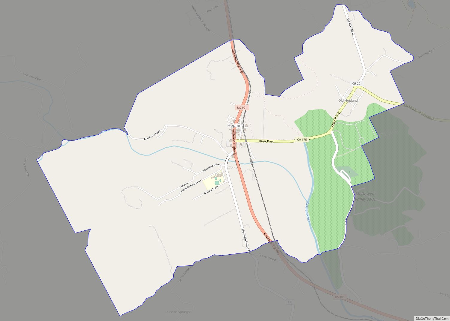
Map of Huntington Park city

Map of Huntington Park city

Huntington Park is a city located in the south central region of Los Angeles County, California. As of the 2010 census, the city had a total population of 58,114, of whom 97% are Hispanic/Latino and about half were born outside the U.S. In 2019, Huntington Park was ranked lowest in California and 10th-worst nationally on … Read more

Map of Humboldt Hill CDP

Map of Humboldt Hill CDP

Humboldt Hill is a census-designated place (CDP) in Humboldt County, California, United States. Humboldt Hill rises to an elevation of 636 feet (194 m). The population was 3,414 at the 2010 census, up from 3,246 at the 2000 census. The area is in the 95503 zip code and part of unincorporated Eureka. Humboldt Hill CDP overview: … Read more

Map of Hughson city

Map of Hughson city

Hughson is a city in Stanislaus County, California, United States. It is part of the Modesto Metropolitan Statistical Area. The population was 7,481 at the 2020 census, up from 6,640 at the 2010 census. Hughson city overview: Name: Hughson city LSAD Code: 25 LSAD Description: city (suffix) State: California County: Stanislaus County Incorporated: December 9, … Read more

Map of Hydesville CDP

Map of Hydesville CDP

Hydesville is a census-designated place (CDP) in Humboldt County, California, United States. Hydesville is located 4.5 miles (7.2 km) southeast of Fortuna, at an elevation of 364 feet (111 m). The population was 1,237 at the 2010 census, up from 1,209 at the 2000 census. Hydesville CDP overview: Name: Hydesville CDP LSAD Code: 57 LSAD Description: CDP … Read more

Map of Hyampom CDP

Map of Hyampom CDP

Hyampom (Wintun: Xaayin-pom) is a census-designated place (CDP) in Trinity County, California, US. Hyampom is at an elevation of 1,503 feet (458 m) in the Trinity Mountains. Its population is 241 as of the 2020 census, remaining the same from the 2010 census. Hyampom CDP overview: Name: Hyampom CDP LSAD Code: 57 LSAD Description: CDP (suffix) … Read more

Map of Huron city

Map of Huron city, California

Huron is a small city in Fresno County, California, in the United States. As of the 2010 census, the population was 6,754, up from 6,306 at the 2000 census. During the harvest season, the population swells to over 15,000 people due to the influx of migrant farm workers. Huron is located 15 miles (24 km) east-northeast … Read more

Map of Imperial Beach city

Map of Imperial Beach city

Imperial Beach is a residential beach city in San Diego County, California, with a population of 26,137 at the 2020 United States census, down from 26,324 at the 2010 census. The city is the southernmost city in California and the West Coast of the United States. It is in the South Bay area of San … Read more

Map of Idyllwild-Pine Cove CDP

Map of Idyllwild-Pine Cove CDP

Idyllwild, Pine Cove, and Fern Valley are three adjacent unincorporated communities in the San Jacinto Mountains in Riverside County, California, United States. Idyllwild is the largest of the three. For statistical purposes, the United States Census Bureau has defined Idyllwild–Pine Cove as a census-designated place (CDP). The CDP’s population was 3,874 at the 2010 census, … Read more

Map of Idlewild CDP

Map of Idlewild CDP

Idlewild is a census-designated place (CDP) in Tulare County, California. Idlewild sits at an elevation of 3,766 feet (1,148 m). The 2020 United States census reported Idlewild’s population was 32, down from 43 at the 2010 census. Idlewild CDP overview: Name: Idlewild CDP LSAD Code: 57 LSAD Description: CDP (suffix) State: California County: Tulare County Elevation: … Read more

Map of Indian Falls CDP

Map of Indian Falls CDP

Indian Falls is a census-designated place (CDP) in Plumas County, California, United States. The population was 54 at the 2010 census, up from 37 at the 2000 census. Indian Falls CDP overview: Name: Indian Falls CDP LSAD Code: 57 LSAD Description: CDP (suffix) State: California County: Plumas County Elevation: 3,258 ft (993 m) Total Area: 1.842 sq mi (4.770 km²) … Read more

Map of Independence city

Map of Independence CDP, California

Independence is a census-designated place in Inyo County, California. Independence is located 41 miles (66 km) south-southeast of Bishop, at an elevation of 3930 feet (1198 m). It is the county seat of Inyo County, California. The population of this census-designated place was 669 at the 2010 census, up from 574 at the 2000 census. Independence … Read more

Map of Imperial city

Map of Imperial city, California

Imperial is a city in Imperial County, California, 4 miles (6.4 km) north of El Centro. As of the 2010 census, the city had a population of 14,758. It is part of the El Centro metropolitan area. In 2016, Imperial was the fourth fastest-growing city in the state, gaining 4.1 percent more residents from January 1, … Read more