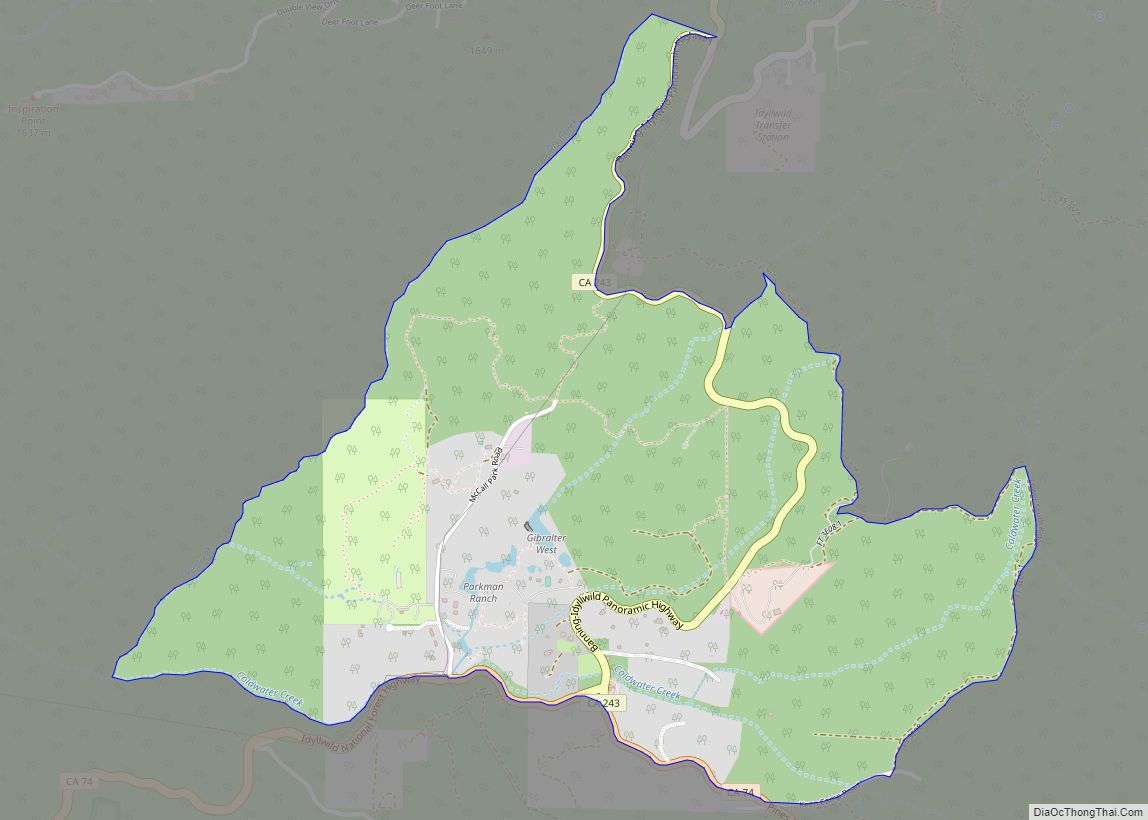
Map of Mountain View Acres CDP

Map of Mountain View Acres CDP

Mountain View Acres is a census-designated place (CDP) in the Victor Valley of the Mojave Desert, within San Bernardino County, California. Mountain View Acres CDP overview: Name: Mountain View Acres CDP LSAD Code: 57 LSAD Description: CDP (suffix) State: California County: San Bernardino County Elevation: 3,074 ft (937 m) Total Area: 1.571 sq mi (4.069 km²) Land Area: 1.571 sq mi (4.069 km²) … Read more

Map of Mountain Ranch CDP

Map of Mountain Ranch CDP

Mountain Ranch (formerly, El Dorado and El Dorado Town) is a census-designated place (CDP) in Calaveras County, California, United States. The population was 1,628 at the 2010 census, up from 1,557 at the 2000 census. The town is registered as California Historical Landmark #282. The town center is quite small with fewer than 50 people … Read more

Map of Mountain Mesa CDP

Map of Mountain Mesa CDP

Mountain Mesa (often shortened to Mt. Mesa) is a census-designated place (CDP) in Kern County, California, United States. Mountain Mesa is located 2 miles (3.2 km) west of South Lake at an elevation of 2,641 feet (805 m). The population was 777 at the 2010 census, up from 716 at the 2000 census. Mountain Mesa CDP overview: … Read more

Map of Muir Beach CDP

Map of Muir Beach CDP

Muir Beach is a census designated place (CDP), unincorporated community, and beach on the Pacific Ocean. The community is located 16.5 miles (26.6 km) northwest of San Francisco in western Marin County, California, United States. Unlike many other entities in the area, it is not named directly in honor of conservationist John Muir; instead, it was … Read more

Map of Mountain View CDP, California

Map of Mountain View CDP, California

Mountain View is a census designated place (CDP) in Contra Costa County, California, United States. The population was 2,372 at the 2010 census. Mountain View CDP overview: Name: Mountain View CDP LSAD Code: 57 LSAD Description: CDP (suffix) State: California County: Contra Costa County Elevation: 112 ft (34 m) Total Area: 0.3 sq mi (0.8 km²) Land Area: 0.3 sq mi (0.8 km²) … Read more

Map of Murphys CDP

Map of Murphys CDP

Murphys, originally Murphys New Diggings then Murphy’s Camp, is an unincorporated village located in the foothills of the Sierra Nevada mountains in Calaveras County, California, United States. The population was 2,213 at the 2010 census, up from 2,061 at the 2000 census. A former gold mining settlement, the main street today is lined with over … Read more

Map of Myrtletown CDP

Map of Myrtletown CDP

Myrtletown is a census-designated place (CDP) in Humboldt County, California, United States. Myrtletown lies at an elevation of 112 feet (34 m). Myrtletown is a part of the Eureka, California metropolitan area. The population was 4,675 at the 2010 census, up from 4,459 at the 2000 census. Myrtletown CDP overview: Name: Myrtletown CDP LSAD Code: … Read more

Map of Myers Flat CDP

Map of Myers Flat CDP

Myers Flat (formerly Myers) is a census-designated place in Humboldt County, California. It is located 4.5 miles (7.2 km) south-southeast of Weott, at an elevation of 203 feet (62 m). The ZIP Code is 95554. The population was 146 at the 2010 census. Originally called Myers from the Grant Myers Ranch, “Flat” was added to the … Read more

Map of Muscoy CDP

Map of Muscoy CDP

Muscoy is a census-designated place (CDP) in San Bernardino County, California, United States. The population was 10,644 at the 2010 census, up from 8,919 at the 2000 census. Muscoy shares ZIP code 92407 with the communities of Verdemont, Devore Heights, Rosena Ranch and Arrowhead Farms in northwestern San Bernardino. Residents enjoy a semi-rural setting with … Read more

Map of Needles city

Map of Needles city

Needles is a city in San Bernardino County, California, in the Mojave Desert region of Southern California. Situated on the western banks of the Colorado River, Needles is located near the California border with Arizona and Nevada. The city is accessible via Interstate 40 and U.S. Route 95. The population was 4,959 at the 2020 … Read more

Map of National City city

Map of National City

National City is a city located in the South Bay region of the San Diego metropolitan area, in southwestern San Diego County, California. The population was 56,173 at the 2020 United States census, down from 58,582 at the 2010 census. National City is the second-oldest city in San Diego County, having been incorporated in 1887. … Read more

Map of Napa city

Map of Napa city

Napa is the largest city and county seat of Napa County and a principal city of Wine Country in Northern California. Located in the North Bay region of the Bay Area, the city had a population of 77,480 as of the end of 2021. Napa is a major tourist destination in California, known for its … Read more