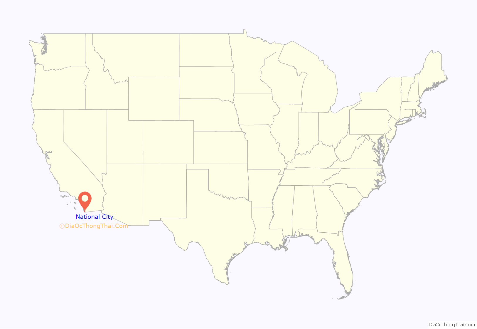
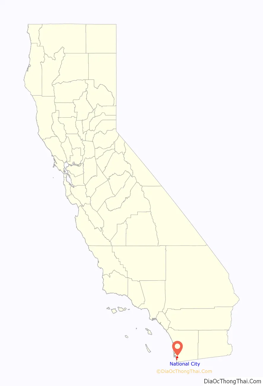
National City is a city located in the South Bay region of the San Diego metropolitan area, in southwestern San Diego County, California.
The population was 56,173 at the 2020 United States census, down from 58,582 at the 2010 census. National City is the second-oldest city in San Diego County, having been incorporated in 1887.
| Name: | National City city |
|---|---|
| LSAD Code: | 25 |
| LSAD Description: | city (suffix) |
| State: | California |
| County: | San Diego County |
| Founded: | July 7, 1868 |
| Incorporated: | September 17, 1887 |
| Elevation: | 66 ft (20 m) |
| Total Area: | 9.12 sq mi (23.61 km²) |
| Land Area: | 7.29 sq mi (18.89 km²) |
| Water Area: | 1.82 sq mi (4.73 km²) 20.17% |
| Total Population: | 56,173 |
| Population Density: | 6,200/sq mi (2,400/km²) |
| ZIP code: | 91950 |
| Area code: | 619 |
| FIPS code: | 0650398 |
| Website: | www.nationalcityca.gov |
Online Interactive Map
Click on ![]() to view map in "full screen" mode.
to view map in "full screen" mode.
National City location map. Where is National City city?
History
Human presence within the modern city limits of National City may have begun as early as 130,000 years ago, as allegedly evidenced at the Cerutti Mastodon site. Archaic period sites have been found along Sweetwater River which runs through the city limits of modern-day National City. Before the entry of Spanish into the area which modern day National City occupies was part of the territory of the Diegueño tribe, also known as Kamai, and later Kumeyaay. Later in the late eighteenth and early nineteenth century there was a Kumeyaay village, north of the modern National City boundaries, on Chollas Creek.
The Spanish named the 26,000 acres (11,000 ha) of land El Rancho del Rey (the Ranch of the King), used by Spanish soldiers to graze horses. After independence from Spain, in 1810, the Mexican government renamed it Rancho de la Nación (Ranch of the Nation). Governor Pío Pico granted Rancho de la Nación to his brother-in-law John (Don Juan) Forster in 1845. President Andrew Johnson, in issuing the land patent, listed the name as simply “The National Ranch”, the English translation of the land grant name, “Rancho de la Nación”.
In 1868, Frank Kimball and his brothers Warren and Levi, contractors and builders from San Francisco, purchased the entire rancho and thus began the foundation of the city, retaining the National name.
Frank Kimball first brought novelty and change to the area by building his personal residence. His home included a bathtub as well as hot running water, making it the first modern house in the entire county. However, it was more than his personal innovative endeavors that allowed the region to flourish. By constructing the first roads and railroad in what is now National City, Frank and his brothers most notably were responsible for introducing modern transportation to the residents of the community. The brothers also implemented the area’s first post office and a wharf for sea-bound imports and exports. These large ventures, coupled with smaller personal missions, both contributed to the overall goal of creating a community unparalleled to the times. A lasting mark of the Kimballs was the trees they imported and planted from Europe and Asia, accomplished via a partnership with the U.S. Department of Agriculture. These trees can be found dotted throughout the city to this very day. It was the passion and influence of the Kimballs as well as other early pioneers that made way for the city’s incorporation on September 17, 1887.
In the mid-20th century, businesses on National Avenue catered to the entertainment of sailors stationed at Naval Base San Diego, and became known as the “Mile of Bars”. In the late 20th century, the city, seeking to end the association of the street with drinking culture, urged the growth of automobile dealerships, transforming the area to be known as the “Mile of Cars”. Part of the change of business types was the closure of a Pussycat Theater in 1999. The last of the bars that was on the “Mile of Bars” was the Trophy Lounge, which lasted until at least 2004. In the early 21st century, the city began to utilize eminent domain to create new developments; this met some criticism, to include on Reason TV in a video narrated by Drew Carey.
Immigrant sanctuary
National City is home to an estimated 25,000 immigrants and refugees, or two out of every five residents.
Former Mayor Nick Inzunza declared National City an immigrant sanctuary city on September 30, 2006 in a proclamation he presented to immigrants’ rights activists during dueling rallies that brought about 400 people to City Hall. This was the result of a statement Mayor Inzunza made on National Public Radio on September 8, 2006. This proclamation divided the city between the stance of the ex-mayor and the federal and state regulations regarding this matter.
On November 7, 2006, Ron Morrison was elected mayor of National City. On November 28, 2006, Mayor Morrison appeared on the KPBS program Full Focus with Gloria Penner and was asked if National City will continue to be a sanctuary city for illegal immigrants. Morrison responded, “absolutely not.”
More recently, on June 19, 2017, the National City Council voted unanimously to adopt a Compassionate City resolution in support of immigrants, a reversal of former Mayor Ron Morrison’s stance, and a callback to former Mayor Nick Inzunza’s position on the issue.
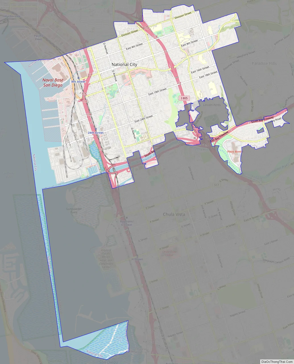
National City Road Map
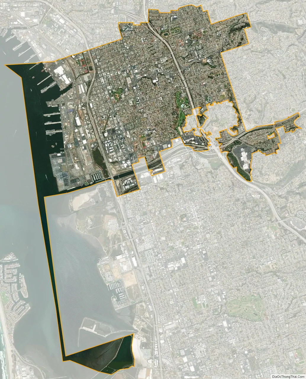
National City city Satellite Map
Geography
According to the United States Census Bureau, the city has a total area of 9.1 square miles (24 km). 7.3 square miles (19 km) of it is land and 1.8 square miles (4.7 km) of it (20.17%) is water. National City is bounded by San Diego to the north and northeast, Bonita to the southeast, and Chula Vista to the south across the Sweetwater River. San Diego Bay lies to the immediate west of the city. Also, within the boundaries of National City on the eastern side of town is the unincorporated area of San Diego County known as Lincoln Acres. National City is 15 minutes away from the US–Mexico Border (Tijuana).
National City has road access by the Interstate 5, Interstate 805, and California State Route 54, in addition to surface streets. National City Blvd, which once served as part of the historic U.S. Route 101, still serves as a north–south arterial street parallel to Highland Ave. Plaza Blvd and 30th Street/Sweetwater Road serve as east–west arterial routes. It has rail access through the San Diego Trolley’s Blue Line. The nearest commercial airport is San Diego International Airport.
In 2012, National City was honored as the most walkable city in San Diego County. It currently holds a walk score of 71, among the highest scores for cities of similar size. However, its current score also puts National City among bigger cities like Seattle, Washington (74) and Portland, Oregon (66). San Diego’s current walk score is 56.
Communities
Although there are no specific communities identified by the city of National City, certain areas have self-identified as communities. The Old Town community is bordered by McKinley Ave. (to the west) and National City Blvd. (to the east), and 24th Street (to the south) and 8th Street (to the north). While Lincoln Acres is an unincorporated area of San Diego County, it is located wholly within the boundaries of the incorporated city of National City and both share the postal code (91950). The South Port Business Center, an industrial park in which many businesses operate, is bordered by I-5 to the west, National City Blvd. to the east Mile of Cars Way (24th St.) to the north, and W. 28th St. to the south. The residents near Las Palmas and El Toyon Parks have neighborhood councils where they can voice their concerns with the city’s elected officials.
The Neighborhood Council Program was developed in an effort to improve communication with the community and to bring services directly to National City residents. The program helps to unify neighbors to further enhance the image of the city, instilling civic pride into neighborhoods. Regular monthly meetings are held in each of the three Neighborhood Councils. Agenda topics are driven by resident requests, current events, and a desire by city officials to keep residents abreast of new programs and upcoming developments. Meetings are usually attended by police and fire officials, as well as members of the City Council.
Besides attending regular meetings, Neighborhood Council participants assist the city in improving their neighborhoods by volunteering during clean-up and beautification events and by helping to reduce crime. Residents also participate in family events sponsored by the Neighborhood Council Program such as National Night Out and Movies in the Park, as well as other city-sponsored events.
Climate
National City’s climate is characterized by warm, dry summers and mild winters, with most of the annual precipitation falling between December and March. The city has a mild climate year-round, with an average of 201 days above 72 °F (22 °C) and low rainfall (9–13 inches [23–33 centimetres] annually). Frequently, particularly during the “May gray/June gloom” period, a thick “marine layer” of cloud cover will keep the air cool and damp within a few miles of the coast.
On average, the warmest month is August. The highest recorded temperature was 108 °F in September 1988. On average, the coolest month is December. The lowest recorded temperature was 15 °F in April 2003. The maximum average precipitation occurs in February.
Ecology
Like most of Southern California and the San Diego County region, the majority of National City’s current area was originally occupied by chaparral, a plant community made up mostly of drought-resistant shrubs. National City’s broad city limits encompass the San Diego National Wildlife Refuge and the most northern area of the Sweetwater Marsh National Wildlife Refuge. The Sweetwater River runs from the Cuyamaca Mountains, through National City and Chula Vista via a flood control channel (natural route as opposed to a canal) and empties into the San Diego Bay. Most of west National City is flat with an average elevation of 72 feet (22 m), which made it historically desirable and well suited for the Spanish to graze their horses. The eastern areas of National City tend to have canyons and ridges with an existing wildlife.
See also
Map of California State and its subdivision:- Alameda
- Alpine
- Amador
- Butte
- Calaveras
- Colusa
- Contra Costa
- Del Norte
- El Dorado
- Fresno
- Glenn
- Humboldt
- Imperial
- Inyo
- Kern
- Kings
- Lake
- Lassen
- Los Angeles
- Madera
- Marin
- Mariposa
- Mendocino
- Merced
- Modoc
- Mono
- Monterey
- Napa
- Nevada
- Orange
- Placer
- Plumas
- Riverside
- Sacramento
- San Benito
- San Bernardino
- San Diego
- San Francisco
- San Joaquin
- San Luis Obispo
- San Mateo
- Santa Barbara
- Santa Clara
- Santa Cruz
- Shasta
- Sierra
- Siskiyou
- Solano
- Sonoma
- Stanislaus
- Sutter
- Tehama
- Trinity
- Tulare
- Tuolumne
- Ventura
- Yolo
- Yuba
- Alabama
- Alaska
- Arizona
- Arkansas
- California
- Colorado
- Connecticut
- Delaware
- District of Columbia
- Florida
- Georgia
- Hawaii
- Idaho
- Illinois
- Indiana
- Iowa
- Kansas
- Kentucky
- Louisiana
- Maine
- Maryland
- Massachusetts
- Michigan
- Minnesota
- Mississippi
- Missouri
- Montana
- Nebraska
- Nevada
- New Hampshire
- New Jersey
- New Mexico
- New York
- North Carolina
- North Dakota
- Ohio
- Oklahoma
- Oregon
- Pennsylvania
- Rhode Island
- South Carolina
- South Dakota
- Tennessee
- Texas
- Utah
- Vermont
- Virginia
- Washington
- West Virginia
- Wisconsin
- Wyoming


