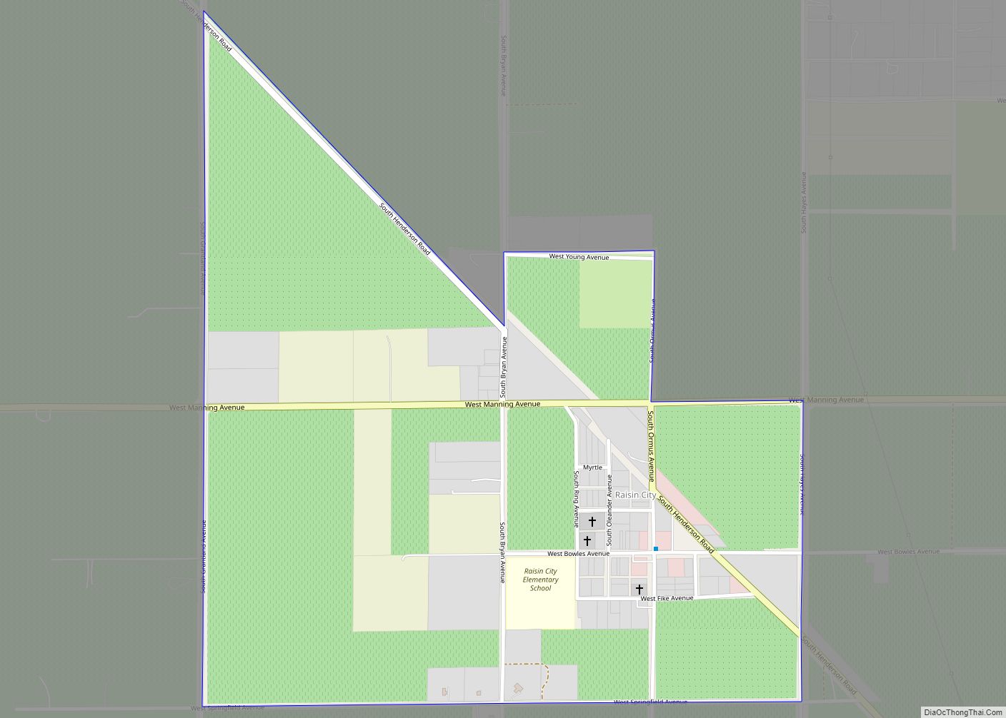
Raisin City (formerly, Raisin) is a census-designated place (CDP) in Fresno County, California, United States. The population was 380 at the 2010 census, up from 165 at the 2000 census. Raisin City is located 13 miles (21 km) south-southwest of downtown Fresno, at an elevation of 236 feet (72 m). Raisin City CDP overview: Name: Raisin ... Read more
California Cities and Places
Rancho Murieta is a census-designated place (CDP) and guard-gated community in Sacramento County, California, United States. It is part of the Sacramento–Arden-Arcade–Roseville Metropolitan Statistical Area. The population was 5,488 at the 2010 census, up from 4,193 at the 2000 census. It is located in the foothills of the Sierra Nevada range, about 25 miles (40 km) ... Read more
Rancho Mirage is a city in Riverside County, California, United States. The population was 17,218 at the 2010 census, up from 13,249 at the 2000 census, but the seasonal (part-time) population can exceed 20,000. Incorporated in 1973 and located between Cathedral City and Palm Desert, it is one of the nine cities of the Coachella ... Read more
Rancho Cordova is a city in Sacramento County, California, United States which was incorporated in 2003. It is part of the Sacramento Metropolitan Area. The population was 64,776 at the 2010 census. In 2010 and 2019, Rancho Cordova was named as a winner of the All-America City Award. Rancho Cordova city overview: Name: Rancho Cordova ... Read more
Rancho Santa Fe is a census-designated place (CDP) in San Diego County, California, United States, within the San Diego metropolitan area. The population was 3,156 at the 2020 census. The CDP is primarily residential with a few shopping blocks, a middle and elementary school, and several restaurants. Rancho Santa Fe borders the Fairbanks Ranch gated ... Read more
Rancho San Diego is a census-designated place (CDP) in the East County region of San Diego County, California. The population was 21,858 at the 2020 census, up from 21,208 at the 2010 census. The area was developed as subdivisions beginning in the 1970s. Rancho San Diego CDP overview: Name: Rancho San Diego CDP LSAD Code: ... Read more
Rancho Palos Verdes (Spanish for “Green Sticks Ranch”) is a coastal city located in Los Angeles County, California atop the bluffs of the Palos Verdes Peninsula, neighboring three other cities in the Palos Verdes Hills, consisting of Palos Verdes Estates, Rolling Hills, and Rolling Hills Estates. Rancho Palos Verdes is known for its dramatic views ... Read more
Rancho Santa Margarita is a city in Orange County, California, United States. One of Orange County’s youngest cities, Rancho Santa Margarita is a master-planned community. The population was 47,853 at the 2010 census, up from 47,214 at the 2000 census. Although it is named for Rancho Santa Margarita y Las Flores, which was in San ... Read more
Randsburg (formerly Rand Camp) is a census-designated place (CDP) in Kern County, California, United States. Randsburg is located 17 miles (27 km) south of Ridgecrest, at an elevation of 3,504 feet (1,068 m). The population was 69 in the 2010 census, down from 77 in the 2000 census. Randsburg CDP overview: Name: Randsburg CDP LSAD Code: 57 ... Read more
Rancho Tehama Reserve CDP overview: Name: Rancho Tehama Reserve CDP LSAD Code: 57 LSAD Description: CDP (suffix) State: California County: Tehama County FIPS code: 0659604 Online Interactive Map Rancho Tehama Reserve online map. Source: Basemap layers from Google Map, Open Street Map (OSM), Arcgisonline, Wmflabs. Boundary Data from Database of Global Administrative Areas. Rancho Tehama ... Read more
Redcrest is a census-designated place in Humboldt County, California. It is located 5.5 miles (8.9 km) north of Weott, at an elevation of 377 feet (115 m). The population was 89 at the 2010 census. The Redcrest post office was established in 1965. The greater Redcrest area includes the Holmes flat, Englewood and Larabee areas. Redcrest ... Read more
Red Corral is a census-designated place in Amador County, California. Red Corral sits at an elevation of 2710 feet (826 m). The 2010 United States census reported Red Corral’s population was 1,413. Red Corral CDP overview: Name: Red Corral CDP LSAD Code: 57 LSAD Description: CDP (suffix) State: California County: Amador County Elevation: 2,710 ft (830 m) ... Read more