Rancho Mirage is a city in Riverside County, California, United States. The population was 17,218 at the 2010 census, up from 13,249 at the 2000 census, but the seasonal (part-time) population can exceed 20,000. Incorporated in 1973 and located between Cathedral City and Palm Desert, it is one of the nine cities of the Coachella Valley (Palm Springs area).
It is home to and has been home to a number of celebrities, including Don Sutton, Frank Sinatra, Dean Martin, Bing Crosby, Sammy Davis Jr., Lucille Ball, Bob Hope, Billie Dove and Gerald and Betty Ford. It is a low-density desert-resort community with resorts, golf courses, and country clubs in the Coachella Valley within the Colorado Desert section of the Sonoran Desert. It is nestled along the foothills of the Santa Rosa Mountains in the south and is located between the cities of Palm Springs and Palm Desert. It is adjacent to Cathedral City, Palm Desert, and Unincorporated Thousand Palms.
It has been nicknamed “Playground of the Presidents” and “Golf Capital of the World.” The city has hosted and currently hosts a variety of golf and tennis tournaments, including the Ryder Cup, Desert Classic (PGA Tour), Davis Cup, and the LPGA Tour (Chevron Championship).
| Name: | Rancho Mirage city |
|---|---|
| LSAD Code: | 25 |
| LSAD Description: | city (suffix) |
| State: | California |
| County: | Riverside County |
| Incorporated: | August 3, 1973 |
| Elevation: | 272 ft (83 m) |
| Total Area: | 25.74 sq mi (66.67 km²) |
| Land Area: | 25.35 sq mi (65.66 km²) |
| Water Area: | 0.39 sq mi (1.01 km²) 1.57% |
| Total Population: | 17,218 |
| Population Density: | 730.80/sq mi (282.17/km²) |
| ZIP code: | 92270 |
| FIPS code: | 0659500 |
| Website: | www.ranchomirageca.gov |
Online Interactive Map
Click on ![]() to view map in "full screen" mode.
to view map in "full screen" mode.
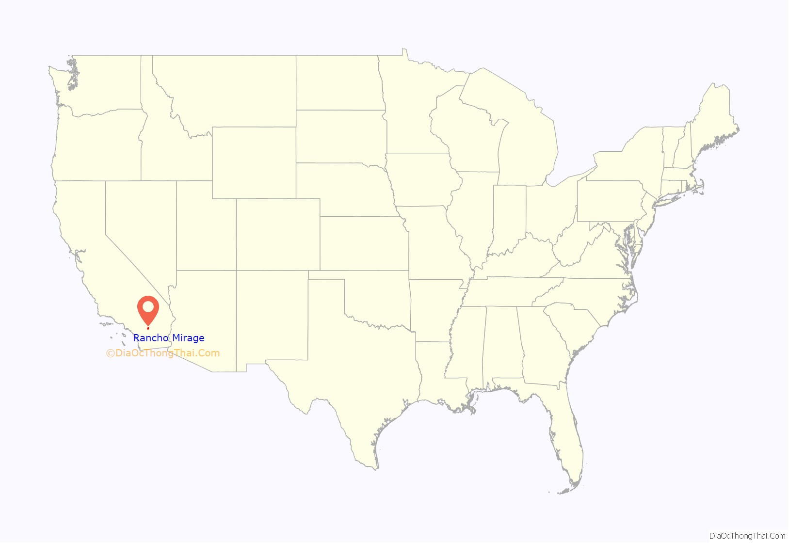
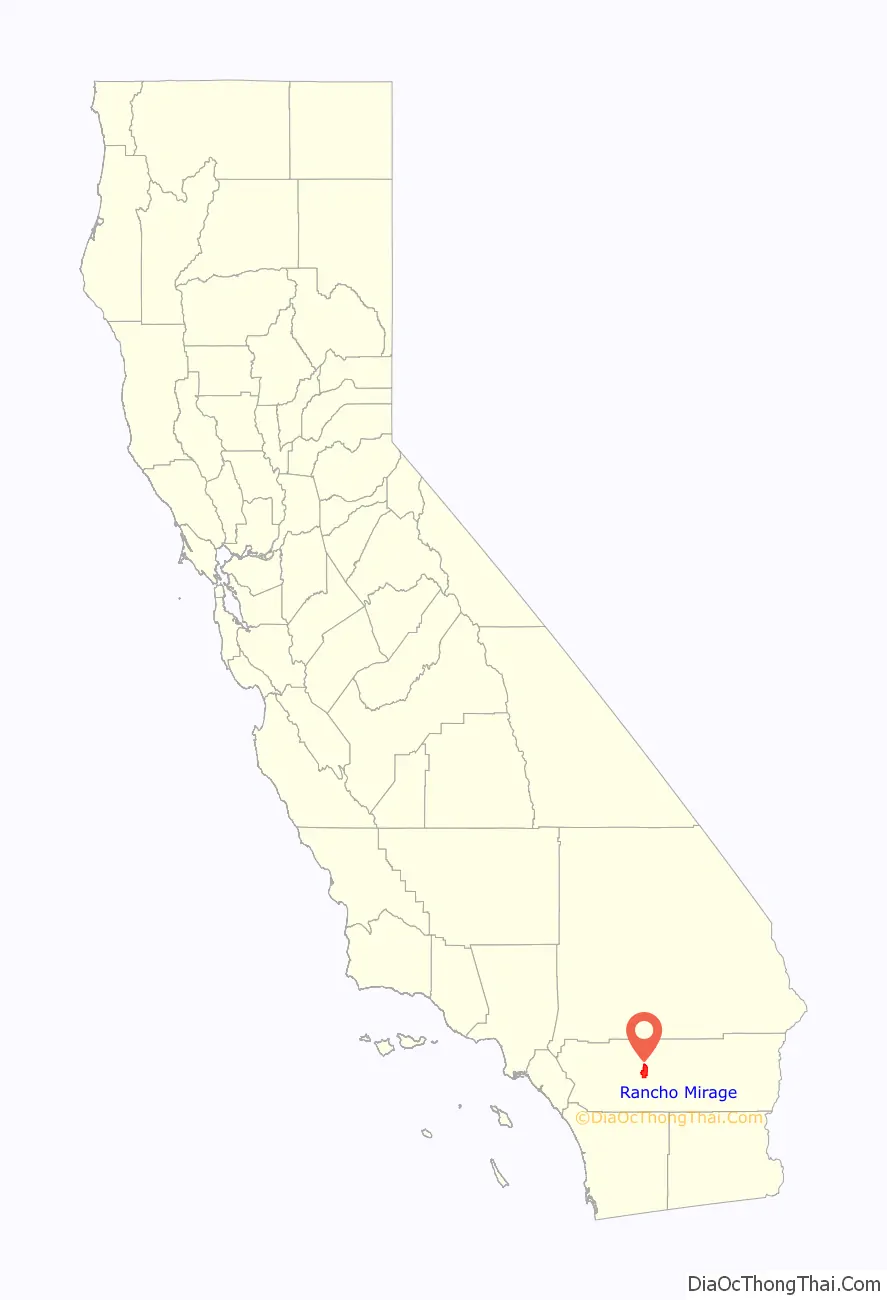
Rancho Mirage location map. Where is Rancho Mirage city?
History
Native Americans came to the area 2,000 years ago. The local tribe in Rancho Mirage is the Agua Caliente Indian tribe of Cahuilla Indians. The tribe was almost annihilated by smallpox in 1862–63 but survived, establishing a resort and casino within the city limits. An ancient Native-American trade route, the Halchidhoma trade route, follows the water holes and water springs along the foothills of the Santa Rosa Mountains. This trail is now partially California State Route 111 in Rancho Mirage. The trade route originally reached from the Pacific Ocean in the west to central Arizona, and was used for centuries for trading, food, and for religious purposes. About 1,000 years ago, the local Cahuilla tribes were introduced to pottery from Native American tribes by the Colorado River. The Spaniards also knew of the Coco-Mariposa Trail in the 1820s when they would send letters by Cahuilla runners along the trail to the mission in Tucson, Arizona. The natural environment in Rancho Mirage has supplied the Cahuilla people with various water sources. Although rare in such arid desert environments, the Cahuilla had access to Magnesia Spring in Magnesia Spring Canyon, which is 1.5 miles from Whitewater River. In addition, a variety of natural springs are situated along the San Andreas Fault line near Indio Hills.
Throughout the 1920s, the area was a desert area dotted with date and grape ranches. In 1928, 160 acres (65 ha) here were purchased by the Southland Land and Realty Company. Access was planned by camel on roads given North-African names, including Tunis Road, Tangier Road, and Sahara Road. The 1929 Depression put an end to the plans. A few years later, a Los Angeles realtor, Lawrence Macomber, purchased hundreds of acres here. Along with Don Cameron, the two began offering property here advertised as “fifteen minutes from Palm Springs, CA.” They were able to attract actor Frank Morgan, among others, until the onset of World War II brought development to an end once again. In 1944, hundreds of acres were bought by Major A. Ronald Button. He described it as “the most wind free area I could find in the desert.” Two years later, in 1946, Henry L. Gogerty established an airstrip here and later launched the Desert Air Hotel and Airpark.
The Annenberg Estate or ‘Sunnylands’, owned by philanthropists Walter and Leonore Annenberg, was popular with the wealthy and powerful, including Frank Sinatra, Bob Hope, Fred Astaire, Ginger Rogers, Patrick Macnee, Zeppo Marx and Mary Martin. Several U.S. Presidents vacationed at the Annenberg estate, including Richard Nixon, Ronald Reagan, and Gerald Ford. President Ford later bought a house in Rancho Mirage and was living there at the time of his death in 2006. The Betty Ford Center, an addiction rehabilitation center, is located in Rancho Mirage at the Eisenhower Medical Center. President Barack Obama also used Sunnylands for summit meetings with world leaders during his administration.
Some of the first places of accommodation to be established were the White Sun Guest Ranch and Wonder Palms Ranch, and later Desert Air Hotel and Thunderbird Ranch in the 1940s. The 320-acre Desert Air Hotel was purchased by the Rancho Las Palmas Country Club in the 1970s. Rancho Las Palmas has Spanish architecture consisting of wood walls, Saltillo tiles, and high ceilings. The resort, which is the city’s third-largest employer, is located on a 249-acre property in the center of Rancho Mirage, across Bob Hope Drive from The River, an outdoor shopping center. It has a 27-hole golf course.
Thunderbird Ranch, which opened in 1946, was purchased by Johnny Dawson, who established Coachella Valley’s first 18-hole golf course. Thunderbird Country Club was established in 1950, and the golf cart or electric golf cart is rumored to have been invented at Thunderbird. Ford Thunderbird is also named for the country club. Tamarisk Country Club soon followed in the 1950s, and later an array of country clubs were established in the city: Desert Island Golf and Country Club in 1971, Sunrise Country Club in 1974, Mission Hills Country Club in 1979, the Club at Morningside (1982), Rancho Mirage Country Club (1985), and Westin Mission Hills Resort and Spa (1987). Rancho Mirage was incorporated in 1973 from a merger of five unincorporated areas known as the “Cove communities” (Rancho Mirage, Desert, Palmas, Tamarisk, and Thunderbird), and had 3,000 permanent residents at the time.
In 2001, the Agua Caliente Band of Cahuilla Indians established the Agua Caliente Casino on the intersection of Bob Hope Drive and Ramon Road off Interstate 10. It was the second casino to be built in the Coachella Valley. The casino is a popular destination for locals, tourists, and gambling enthusiasts. In 2008 the tribal board completed the expansion of the Agua Caliente resort, which includes a 16-story hotel and spa, as well as remodeling the casino and expanding the parking structures. A theater for top-name entertainers opened in 2009. Though the Agua Caliente Resort and Casino was just outside the border of Rancho Mirage in an unincorporated area, the City of Rancho Mirage included the property as part of the city in an agreement with the tribe so they would have access to police and firefighting services.
Rancho Mirage has expanded its economy from one based on seasonal, resort-based golfing and low-paying rentals, to include light industry and commerce near the I-10 and high-end retail centers like The River shopping complex.
A new residential development for senior citizens by Pulte Homes, Inc., known as Del Webb Rancho Mirage, will open in the year 2020. It is the third local development by the company after Sun City Palm Desert and Sun City Shadow Hills in Indio.
In March 2021, it was announced that Rancho Mirage would be the site of first US neighborhood composed completely of 3D-printed, zero net energy homes. The project is a joint effort from companies Palari and Mighty Buildings. It will comprise 15 homes, and are expected to be completed by 2022.
In February 2022, The Walt Disney Company announced that Rancho Mirage will be the location of its first Storyliving by Disney community. Named Cotino, the community will be developed in collaboration with DMB Development of Scottsdale, Arizona.
Etymology
The name is both Spanish (“Rancho”) and French (“Mirage”). One story of the name’s origin relates to a woman of the name Ruth Wheeler who visited Magnesia Falls Canyon and named the ranch she saw in a distance a mirage. The area adopted the name Rancho Mirage in 1934. The City of Rancho Mirage was incorporated under the same name on August 3, 1973.
Presidential history
Rancho Mirage has been nicknamed the “Playground of the Presidents” due to its extensive history of U.S. presidents residing in and visiting the city. For example, President Harry Truman regularly visited the Tamarisk Country Club, while President Dwight D. Eisenhower lived nearby. President Gerald Ford and First Lady Betty Ford were residents of Rancho Mirage for thirty years. The Fords moved to Thunderbird Country Club after leaving office.
Walter and Leonore Annenberg’s estate, Sunnylands, became known as the western White House during the Richard Nixon administration in the 1960s. At the time, the estate also became the biggest single-family home in the county. President Dwight D. Eisenhower also stayed here and President Richard Nixon wrote the last State of the Union here. President Ronald Reagan was also a regular visitor at Sunnylands and Presidents Gerald Ford, Jimmy Carter, Bill Clinton, and George W. Bush have all been visitors here. While President George H. W. Bush had an official summit here with Japanese Prime Minister Toshiki Kaifu in 1990, Queen Elizabeth II of Britain visited in 1980. President Barack Obama spent two days here in 2013 where he visited with President Xi Jinping of China. President Obama then became the eighth U.S. president to having visited Sunnylands. President Ronald Reagan attended eighteen New Year’s Eve celebrations in Rancho Mirage, including every year during the Reagan Administration.
President George H. W. Bush played golf with Bill Clinton in Rancho Mirage throughout the 1990s. President Richard Nixon went to Rancho Mirage a month prior to announcing his resignation from office. Nixon signed the Sunnylands’ guestbook on the day he was issued a full pardon from President Ford. Thunderbird Country Club has hosted presidents such as John F. Kennedy, Lyndon B. Johnson, Richard Nixon, Gerald Ford, George H.W. Bush, and Dwight D. Eisenhower. President Barack Obama visited the country club on Presidents Day in 2020. President Obama hosted three world summits in Rancho Mirage during his presidency. He hosted the first-ever U.S. summit with the Association of Southeast Asian Nations (ASEAN) in Rancho Mirage on February 15–16, 2016. He also hosted King Abdullah II of Jordan here in 2014.
President Donald Trump visited a fundraising event at Porcupine Creek in Rancho Mirage in February 2020.
President Gerald Ford died in 2006 at his home in Rancho Mirage. First Lady Betty Ford died on July 8, 2011, in Rancho Mirage.
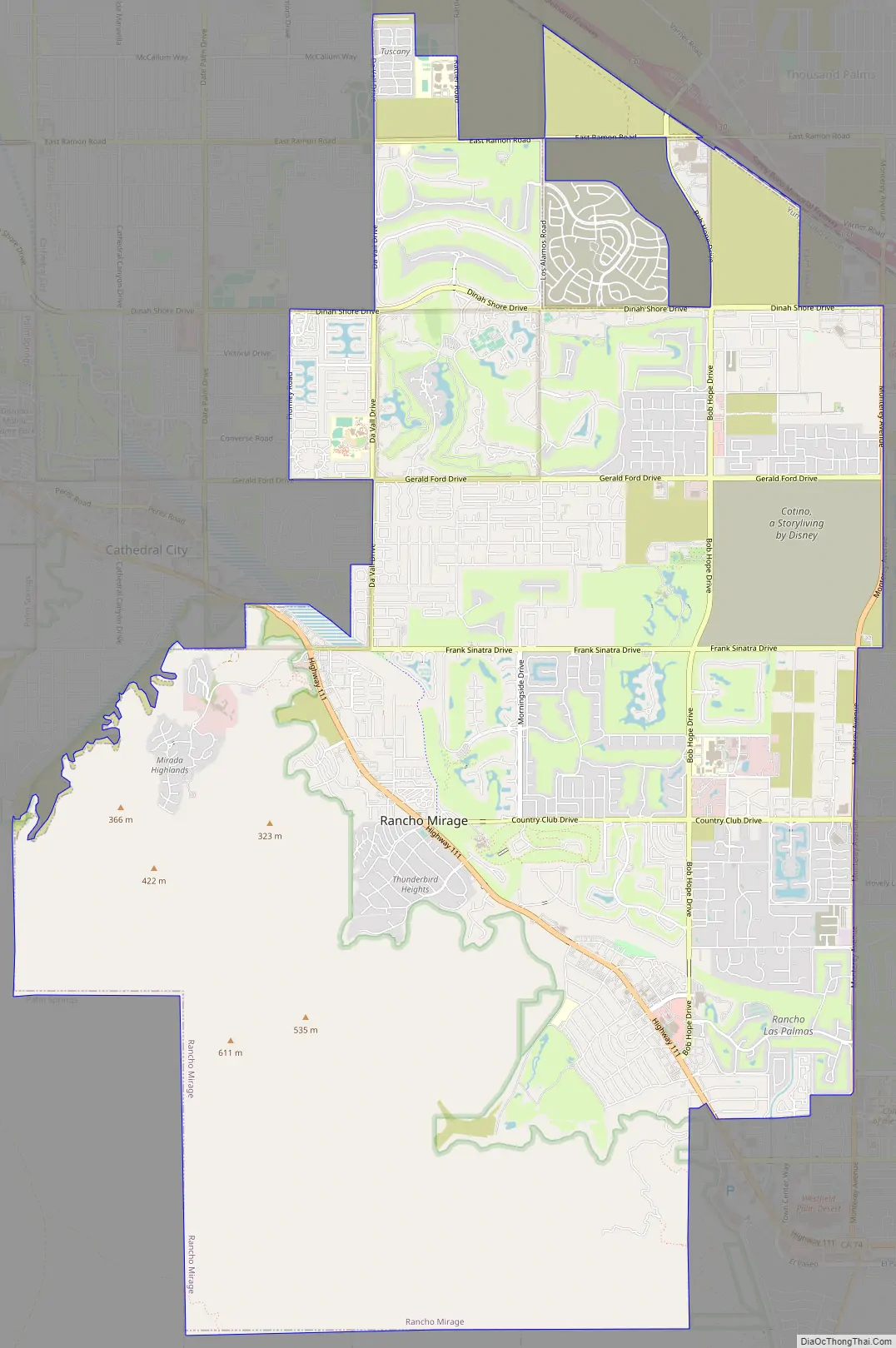
Rancho Mirage Road Map
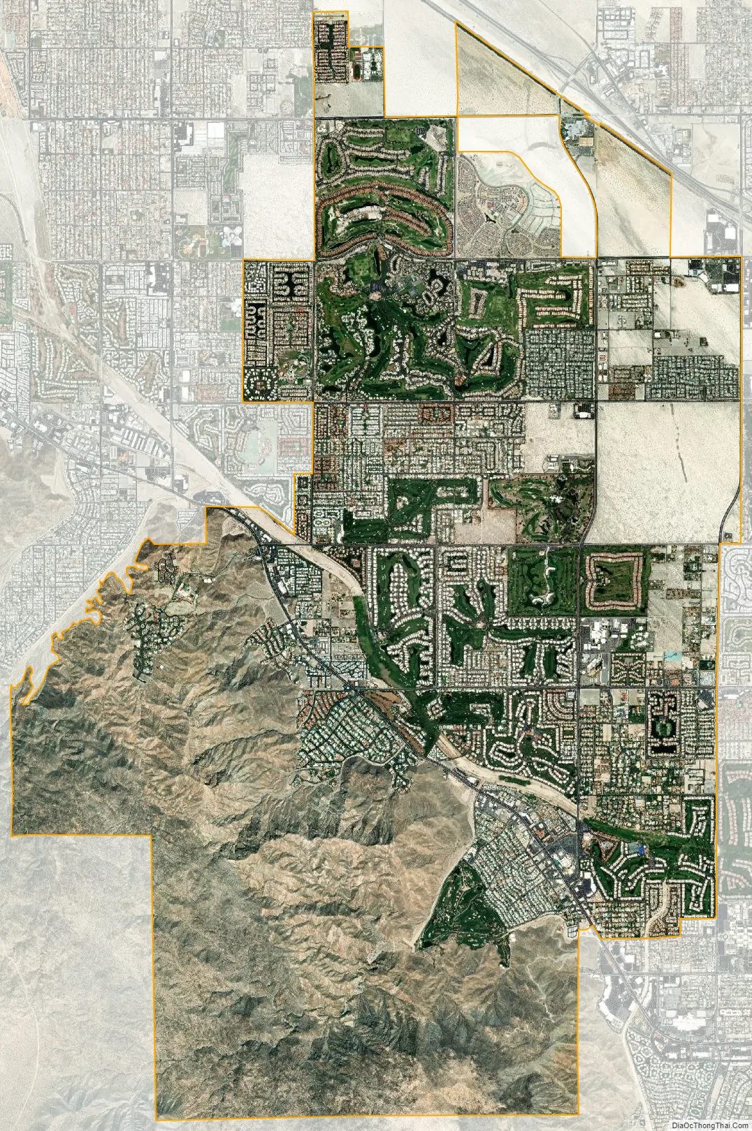
Rancho Mirage city Satellite Map
Geography
According to the United States Census Bureau, the city has a total area of 24.8 square miles (64 km), of which 24.4 square miles (63 km) is land and 0.4 square miles (1.0 km), or 1.57%, is water, including the 10-story Desert Island Hotel-Golf Resort built on an island surrounded by a 25-acre artificial lake.
Whitewater River (Agua Blanco), a perennial stream, flows through the city in a southeasterly direction before discharging into the Salton Sea. Another creek, the Magnesia Spring Creek, is located in Magnesia Spring Canyon where the 40 ft. tall waterfall Magnesia Falls also is found. A flood along Magnesia Spring Creek’s alluvial fan in 1979 led to one death and $7 million in damages. Concrete-lined spillways have since been installed by the U.S. Army Corps of Engineers. Earthquakes are also somewhat common, and on July 8, 1986, an earthquake led to the destruction of 20 buildings and homes, along with big damages to roads and other structures.
A number of street names are named for celebrities, entertainers, and presidents who resided in the city, including Gerald Ford Drive, Ginger Rogers Road, Frank Sinatra Drive (formerly Wonder Palms Road), Bob Hope Drive (formerly Rio del Sol), Kaye Ballard Lane, Danny Kaye Road, Dinah Shore Drive, Dean Martin Drive, and Bing Crosby Drive. Bing Crosby established the Blue Skies Village Mobile Home Park in 1953 and named its streets after celebrities such as Burns and Allen, Jack Benny, Greer Garson, Claudette Colbert, and Barbara Stanwyck.
A stretch of California State Route 111 in Rancho Mirage has earned the moniker “Restaurant Row” as there are over thirty eateries located between Bob Hope Drive and Frank Sinatra Drive. A number of these are located at the River at Rancho Mirage, a 30-acre outdoor shopping center. The area surrounding The River is also known as Downtown Rancho Mirage. On a per-capita basis, the city is home to one eatery for every 240 residents, making it the city in the Coachella Valley with the most restaurants per capita.
Ecology
The native flora is characterized by cacti and shrubs. Creosote bush, Bur sage, Palo verde, Desert willow, Cat’s claw, Mesquite, Screwbean, and Brittle bush are some naturally occurring plant species. The California fan palm, which is the only palm tree native to the region, is found in areas of freshwater sources, including by Magnesia Spring Creek and Whitewater River.
Over 1,000 wild plant species are found in the Coachella Valley. Besides desert flowers, cacti, and palm trees, there are ephemeral flowers, ferns, vines, and shrubs. The vast majority of these species are able to live through extended periods of non to little precipitation, including local cacti species as the California barrel cactus, which is the biggest of the 20 native species of cacti in the Coachella Valley. Several of the local desert species are edible, including cactus fruits from the Beaver tail cactus, California barrel cactus, and the Prickly pear cacti. Fruits and flowers from several Yucca species are also edible, as well as the seed pods and blossoms of the Mesquite. Some local species are poisonous, including Jimsonweed and Locoweed. Springs and streams are home to species such as the California fan palm, which is North America’s largest palm species, along with other common tree species in oasis environments such as the Willow, Fremont’s cottonwood, California sycamore, Honey-pod mesquite, and White alder. Other species include the Smoke tree, Palo verde, Ironwood, Desert willow, Stream orchid, Creosote bush, Burrobush, Brittlebush, Sand verbena, Desert primrose, and Desert sunflower.
The fauna consists of over 20 species of mammals. Some native carnivores include the Gray fox, Coyote, Ringtail cat, Bobcat, and the Desert Kit Fox. Other species include the Southwestern Willow Flycatcher, Bell’s Vireo, Prairie Falcon, and the Peninsular Bighorn Sheep. Another notable species of wildlife is the endemic Coachella Valley fringe-toed lizard. The Sonoran Desert has eleven species of rattlesnakes – more than anywhere else in the world. Other notable species include the Gila monster, Chuckwalla, Horned lizard, Desert iguana, Vulture, Desert tortoise, Scorpion, and Javelina. Black bears are rare, however, they inhabit the surrounding mountains and have been sighted on numerous occasions. Four species of Scorpion are found in the Coachella Valley, none of which are considered dangerous to humans. The most common species is the Dune scorpion or Desert sand scorpion (Paruroctonus mesaensis) but the valley is also home to the Giant hairy scorpion (Hadrurus arizonensis), which is the largest species of scorpion in the United States.
Rancho Mirage has adopted the Peninsular Bighorn Sheep as its “community icon” and its official city symbol. The city has also adopted a bighorn ram as its official city logo. The Peninsular Bighorn Sheep has been on the U.S. federal list of endangered species since 1998 (or 2004). In 2002, the city invested $1.2 million in constructing a 3.5-mile fence to separate the rams from civilization. The 8-ft. mesh fence was installed between the California State Route 111 and the peaks of the Santa Rosa Mountains. When the city was incorporated in 1973, 1,200 sheep lived in the Peninsular Ranges which consist of the San Jacinto and Santa Rosa Mountains. By 1995, the number of sheep was 276 but reached 400 in 2002.
The fauna consists of species adapted to desert, temperature extremes, and to lack of moisture. 450 vertebrate species have been recorded in the Coachella Valley including 347 species of birds, 58 species of mammals, 40 species of reptiles, and eight species of amphibians. The largest native mammal, the Bighorn sheep, can reach 200 pounds in weight. Large predators include the Bobcat, Mountain lion, Kit fox, Ring-tailed cat, Coyote, and Gray fox. Some other species include the Antelope ground squirrel, Roadrunners, Side-blotched lizard, and several species of scorpions, centipedes, and rattlesnakes. Some bird species, including the White-crowned sparrow and Ruby-crowned kinglet, spend winters in the Coachella Valley before flying to colder climates during the hot summer months. The Coachella Valley is home to four endangered or threatened species, including the Desert pupfish, Desert tortoise, Desert slender salamander, and the Coachella Valley fringe-toed lizard. Threatened or endangered species in Rancho Mirage include the Peninsular Bighorn sheep, Fringe-toed lizard, Desert tortoise, Southwestern willow flycatcher, Desert slender salamander, Peregrine falcon, and Least Bell’s vireo.
Climate
Rancho Mirage’s climate is a hot desert climate, with hot and dry summers, often with temperatures reaching 120 °F (49 °C). Winters are short and mild, with chances of night frost occurring only in December and January. Annual precipitation ranges between 3.5–5.5 inches (89–140 mm) and is often the result of winter rainstorms. Rancho Mirage is one of nine cities situated in the Coachella Valley, a 55-mile-long (89 km) valley that is an extension of the Sonoran Desert to the southeast. It is located in the Colorado Desert, which is a name used for the California section of the Sonoran Desert. Climatically, Rancho Mirage is dominated by hot temperatures and perception that averages less than ten inches a year. Even in the coldest month, January, temperatures below 40 °F (4 °C) are rare.
The climate of the Coachella Valley is influenced by the surrounding geography. High mountain ranges on three sides and a south-sloping valley floor all contribute to its unique and year-round warm climate, with the warmest winters in the western United States. Rancho Mirage has an arid climate; its average annual high temperature is 87 °F (31 °C) and average annual low is 63 °F (17 °C) but summer highs above 108 °F (42 °C) are common and sometimes exceed 120 °F (49 °C), while summer night lows often stay above 82 °F (28 °C). Winters are warm with daytime highs between 73–84 °F (23–29 °C). Under 5 inches (130 mm) of annual precipitation are average, with over 350 days of sunshine per year.
See also
Map of California State and its subdivision:- Alameda
- Alpine
- Amador
- Butte
- Calaveras
- Colusa
- Contra Costa
- Del Norte
- El Dorado
- Fresno
- Glenn
- Humboldt
- Imperial
- Inyo
- Kern
- Kings
- Lake
- Lassen
- Los Angeles
- Madera
- Marin
- Mariposa
- Mendocino
- Merced
- Modoc
- Mono
- Monterey
- Napa
- Nevada
- Orange
- Placer
- Plumas
- Riverside
- Sacramento
- San Benito
- San Bernardino
- San Diego
- San Francisco
- San Joaquin
- San Luis Obispo
- San Mateo
- Santa Barbara
- Santa Clara
- Santa Cruz
- Shasta
- Sierra
- Siskiyou
- Solano
- Sonoma
- Stanislaus
- Sutter
- Tehama
- Trinity
- Tulare
- Tuolumne
- Ventura
- Yolo
- Yuba
- Alabama
- Alaska
- Arizona
- Arkansas
- California
- Colorado
- Connecticut
- Delaware
- District of Columbia
- Florida
- Georgia
- Hawaii
- Idaho
- Illinois
- Indiana
- Iowa
- Kansas
- Kentucky
- Louisiana
- Maine
- Maryland
- Massachusetts
- Michigan
- Minnesota
- Mississippi
- Missouri
- Montana
- Nebraska
- Nevada
- New Hampshire
- New Jersey
- New Mexico
- New York
- North Carolina
- North Dakota
- Ohio
- Oklahoma
- Oregon
- Pennsylvania
- Rhode Island
- South Carolina
- South Dakota
- Tennessee
- Texas
- Utah
- Vermont
- Virginia
- Washington
- West Virginia
- Wisconsin
- Wyoming


