Map of Norrie CDP

Map of Norrie CDP

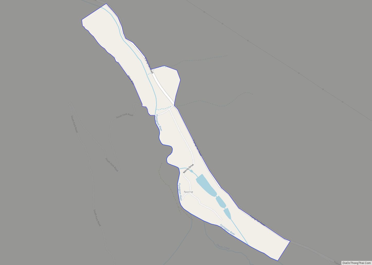
Norrie (also known as the Norrie Colony) is a census-designated place (CDP) located in and governed by Pitkin County, Colorado, United States. The population of the Norrie CDP was 7 at the United States Census 2020. The Meredith post office (Zip Code 81642) serves the area. The CDP is a part of the Glenwood Springs, … Read more

Map of No Name CDP

Map of No Name CDP

No Name is a census-designated place (CDP) in and governed by Garfield County, Colorado, United States. The CDP is a part of the Glenwood Springs, CO Micropolitan Statistical Area. The population of the No Name CDP was 117 at the United States Census 2020. The Glenwood Springs post office (Zip Code 81601) serves the area. … Read more

Map of Norwood town

Map of Norwood town, Colorado

Norwood is a Statutory Town in San Miguel County, Colorado, United States. The population was 535 at the 2020 census. A post office called Norwood has been in operation since 1887. The community was named after Norwood, Missouri, the native home of a first settler. Norwood town overview: Name: Norwood town LSAD Code: 43 LSAD … Read more

Map of Northglenn city

Map of Northglenn city

The City of Northglenn is a home rule municipality located in Adams and Weld counties, Colorado, United States. Northglenn is a part of the Denver–Aurora–Lakewood, CO Metropolitan Statistical Area. As of the 2020 census the city’s population was 38,131. It was built as a master planned community in 1959 by Jordon Perlmutter. The city is … Read more

Map of North Washington CDP

Map of North Washington CDP, Colorado

North Washington is an unincorporated community and a census-designated place (CDP) located in and governed by Adams County, Colorado, United States. The CDP is a part of the Denver–Aurora–Lakewood, CO Metropolitan Statistical Area. The population of the North Washington CDP was 733 at the United States Census 2020. The Denver post office 80216 serves the … Read more

Map of Oak Creek town

Map of Oak Creek town, Colorado

Oak Creek is a Statutory Town in Routt County, Colorado, United States. The population was 889 at the 2020 census. Oak Creek town overview: Name: Oak Creek town LSAD Code: 43 LSAD Description: town (suffix) State: Colorado County: Routt County Elevation: 7,428 ft (2,264 m) Total Area: 0.36 sq mi (0.92 km²) Land Area: 0.36 sq mi (0.92 km²) Water Area: 0.00 sq mi (0.00 km²) … Read more

Map of Nunn town

Map of Nunn town

Nunn is a Statutory Town in Weld County, Colorado, United States. The population was 504 at the 2020 census. A post office called Nunn has been in operation since 1905. The town was named after Tom Nunn, who was credited with preventing a nearby train wreck. Nunn town overview: Name: Nunn town LSAD Code: 43 … Read more

Map of Nucla town

Map of Nucla town

Nucla is a statutory town in Montrose County, Colorado, United States. The population was 585 as of the 2020 census, down from 711 in 2010. Its name comes from the town founders’ intent that it serve as a “nucleus” for the surrounding farms and mines, although it has since come to be associated with the … Read more

Map of Ophir town

Map of Ophir town, Colorado

The historic mining town of Ophir is a home rule municipality governed by a general assembly and is located in San Miguel County, Colorado, United States. Ophir is located two miles from the Ames Hydroelectric Generating Plant, the world’s first hydroelectric plant to supply alternating current electricity for an industrial purpose (mining). The population was … Read more

Map of Olney Springs town

Map of Olney Springs town

Olney Springs is a Statutory Town in Crowley County, Colorado, United States. The population was 315 at the 2020 census. Olney Springs town overview: Name: Olney Springs town LSAD Code: 43 LSAD Description: town (suffix) State: Colorado County: Crowley County Elevation: 4,383 ft (1,336 m) Total Area: 0.24 sq mi (0.62 km²) Land Area: 0.24 sq mi (0.62 km²) Water Area: 0.00 sq mi (0.00 km²) … Read more

Map of Olathe city

Map of Olathe town, Colorado

Olathe is a statutory town in Montrose County, Colorado, United States. The population was 2,019 as of the 2020 census, up from 1,849 at the 2010 census. A post office called Olathe has been in operation since 1896. The community was named after Olathe, Kansas. Olathe town overview: Name: Olathe town LSAD Code: 43 LSAD … Read more

Map of Orchard City town

Map of Orchard City town

Orchard City is a statutory town in Delta County, Colorado, United States. The population was 3,142 at the 2020 census. There are three post offices serving Orchard City: Austin (ZIP code 81410), Cory (ZIP code 81414), Eckert (ZIP code 81418). Orchard City town overview: Name: Orchard City town LSAD Code: 43 LSAD Description: town (suffix) … Read more