Map of Colorado Springs city

Map of Colorado Springs city

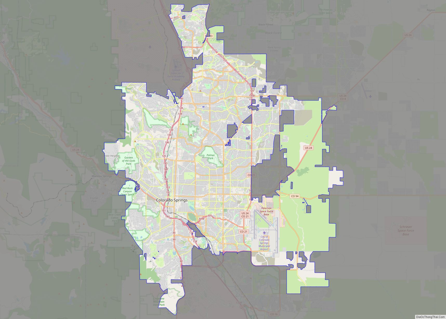
Colorado Springs, coloquially called The Springs, is a home rule municipality in and the county seat of El Paso County, Colorado, United States. It is the largest city in El Paso County, with a population of 478,961 at the 2020 United States Census, a 15.02% increase since 2010. Colorado Springs is the second-most populous city … Read more

Map of Aurora city

Map of Aurora city, Colorado

Aurora (/əˈroʊrə/, /əˈrɔːrə/) is a home rule municipality located in Arapahoe, Adams, and Douglas counties, Colorado, United States. The city’s population was 386,261 at the 2020 United States Census with 336,035 residing in Arapahoe County, 47,720 residing in Adams County, and 2,506 residing in Douglas County. Aurora is the third most populous city in the … Read more

Map of Fort Collins city

Map of Fort Collins city

Fort Collins is a home rule municipality that is the county seat and the most populous municipality of Larimer County, Colorado, United States. The city population was 169,810 at the 2020 census, an increase of 17.94% since 2010. Fort Collins is the principal city of the Fort Collins, CO Metropolitan Statistical Area and is a … Read more

Map of Lakewood city, Colorado

Map of Lakewood city, Colorado

The City of Lakewood is the home rule municipality that is the most populous municipality in Jefferson County, Colorado, United States. The city population was 155,984 at the 2020 U.S. Census, making Lakewood the fifth most populous city in Colorado and the 167th most populous city in the United States. Lakewood is a suburb of … Read more

Map of Thornton city, Colorado

Map of Thornton city, Colorado

The City of Thornton is a home rule municipality located in Adams and Weld counties, Colorado, United States. The city population was 141,867, all in Adams County, at the 2020 United States Census, an increase of +19.44% since the 2010 United States Census. Thornton is the sixth most populous city in Colorado and the 191st … Read more

Map of Arvada city

Map of Arvada city, Colorado

Arvada (/ɑːrˈvædə/) is a home rule municipality located in Jefferson and Adams counties, Colorado, United States. The city population was 124,402 at the 2020 United States Census, with 121,510 residing in Jefferson County and 2,892 residing in Adams County. Arvada is the seventh most populous city in Colorado. The city is a part of the … Read more

Map of Westminster city, Colorado

Map of Westminster city, Colorado

The City of Westminster is a home rule municipality located in Adams and Jefferson counties, Colorado, United States. The city population was 116,317 at the 2020 United States Census with 71,240 residing in Adams County and 45,077 residing in Jefferson County. Westminster is the eighth most populous city in Colorado. The city is a part … Read more

Map of Pueblo city

Map of Pueblo city, Colorado

Pueblo (/ˈpwɛbloʊ/) is a home rule municipality that is the county seat and the most populous municipality of Pueblo County, Colorado, United States. The city population was 111,876 at the 2020 United States Census, making Pueblo the ninth most populous city in Colorado. Pueblo is the principal city of the Pueblo, CO Metropolitan Statistical Area … Read more

Map of Greeley city

Map of Greeley city, Colorado

Greeley is the home rule municipality city that is the county seat and the most populous municipality of Weld County, Colorado, United States. The city population was 108,795 at the 2020 United States Census, an increase of 17.12% since the 2010 United States Census. Greeley is the tenth most populous city in Colorado. Greeley is … Read more

Map of Centennial city

Map of Centennial city, Colorado

Centennial is a home rule municipality located in Arapahoe County, Colorado, United States. The city population was 108,418 at the 2020 United States Census, making Centennial the 11th most populous municipality in Colorado. Centennial is a part of the Denver–Aurora–Lakewood, CO Metropolitan Statistical Area and the Front Range Urban Corridor. Centennial city overview: Name: Centennial … Read more

Map of Boulder city

Map of Boulder city, Colorado

Boulder is a home rule city that is the county seat and most populous municipality of Boulder County, Colorado, United States. The city population was 108,250 at the 2020 United States census, making it the 12th most populous city in Colorado. Boulder is the principal city of the Boulder, CO Metropolitan Statistical Area and an … Read more

Map of Aguilar town

Map of Aguilar town

Aguilar is a Statutory Town located in Las Animas County, Colorado, United States. The town population was 456 at the 2020 United States Census. Cattleman and prominent pioneer José Ramón Aguilar founded the town in 1894. Aguilar town overview: Name: Aguilar town LSAD Code: 43 LSAD Description: town (suffix) State: Colorado County: Las Animas County … Read more