Map of South Windham CDP

Map of South Windham CDP, Connecticut

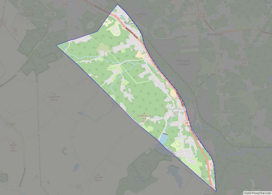
South Windham is a village and census-designated place (CDP) in Windham County, Connecticut, United States. It is located within the town of Windham, Connecticut. The population was 1,421 at the 2010 census. South Windham CDP overview: Name: South Windham CDP LSAD Code: 57 LSAD Description: CDP (suffix) State: Connecticut County: Windham County Elevation: 335 ft (102 m) … Read more

Map of South Coventry CDP

Map of South Coventry CDP

South Coventry is a census-designated place and part of the town of Coventry, Connecticut in Tolland County, Connecticut, United States. The population was 1,483 at the 2010 census. South Coventry CDP overview: Name: South Coventry CDP LSAD Code: 57 LSAD Description: CDP (suffix) State: Connecticut County: Tolland County Elevation: 525 ft (160 m) Total Area: 3.2 sq mi (8.3 km²) … Read more

Map of Somers CDP

Map of Somers CDP, Connecticut

Somers /ˈsʌmərz/ is a town in Tolland County, Connecticut. The town is part of the Capitol Planning Region. The population was 10,255 at the 2020 census. The town center is listed by the U.S. Census Bureau as a census-designated place (CDP). In 2007, Money Magazine listed Somers 53rd on its “100 Best Places to Live”, … Read more

Map of Southwood Acres CDP

Map of Southwood Acres CDP

Southwood Acres is a suburban neighborhood within the town of Enfield in northern Hartford County, Connecticut, United States. The neighborhood is listed as a census-designated place (CDP) by the U.S. Census Bureau and had a population of 7,657 at the 2010 census. Southwood Acres CDP overview: Name: Southwood Acres CDP LSAD Code: 57 LSAD Description: … Read more

Map of Southport CDP

Map of Southport CDP, Connecticut

Southport is a census-designated place (CDP) in the town of Fairfield, Connecticut. It is located along Long Island Sound between Mill River and Sasco Brook, where it borders Westport. As of the 2020 census, it had a population of 1,710. Settled in 1639, Southport center has been designated a local historic district since 1967. In … Read more

Map of South Woodstock CDP

Map of South Woodstock CDP

South Woodstock is a village and census-designated place (CDP) in Woodstock, Windham County, Connecticut, United States. The population was 1,291 at the 2010 census. It is notable as the former home of the now-defunct Annhurst College. South Woodstock CDP overview: Name: South Woodstock CDP LSAD Code: 57 LSAD Description: CDP (suffix) State: Connecticut County: Windham … Read more

Map of Storrs CDP

Map of Storrs CDP

Storrs is a village and census-designated place (CDP) in the town of Mansfield in eastern Tolland County, Connecticut, United States. The village is part of the Capitol Planning Region. The population was 15,979 at the 2020 census. It is dominated economically and demographically by the main campus of the University of Connecticut and the associated … Read more

Map of Stonington borough

Map of Stonington borough, Connecticut

The town of Stonington is located in New London County, Connecticut, United States. Located in the state’s southeastern corner, it includes the borough of Stonington, the villages of Pawcatuck, Lords Point, and Wequetequock, and the eastern halves of the villages of Mystic and Old Mystic (the other halves being in the town of Groton). The … Read more

Map of Stafford Springs CDP

Map of Stafford Springs CDP

Stafford Springs is a census-designated place located in Stafford, Connecticut. The population was 4,780 at the 2020 Census. The village was a borough until November 1991, when it was disincorporated. Located near the source of the Willimantic River, the mill industry grew in the town due to its location and became the largest industry in … Read more

Map of Tariffville CDP

Map of Tariffville CDP

Tariffville is a neighborhood and census-designated place (CDP) in the town of Simsbury in Hartford County, Connecticut, United States. The population was 1,324 at the 2010 census. It is a popular location for whitewater paddlers who use the Farmington River. Part of the original mill village area is included in the Tariffville Historic District, listed … Read more

Map of Suffield Depot CDP

Map of Suffield Depot CDP

Suffield Depot is the name of a census-designated place (CDP) corresponding to the village of Suffield, the primary settlement of the town of Suffield, Connecticut, in Hartford County. The population of the CDP was 1,325 as of the 2010 census. Suffield Depot CDP overview: Name: Suffield Depot CDP LSAD Code: 57 LSAD Description: CDP (suffix) … Read more

Map of Stratford CDP, Connecticut

Map of Stratford CDP, Connecticut

Stratford Downtown is a census-designated place (CDP) corresponding to the town center of Stratford, Fairfield County, Connecticut, United States. U.S. Route 1 (Barnum Avenue) runs east–west through the center of the CDP, and Interstate 95 forms the southeastern border, with access from Exit 32 (West Broad Street) at the southern limit of the CDP and … Read more