Map of Quinebaug CDP

Map of Quinebaug CDP

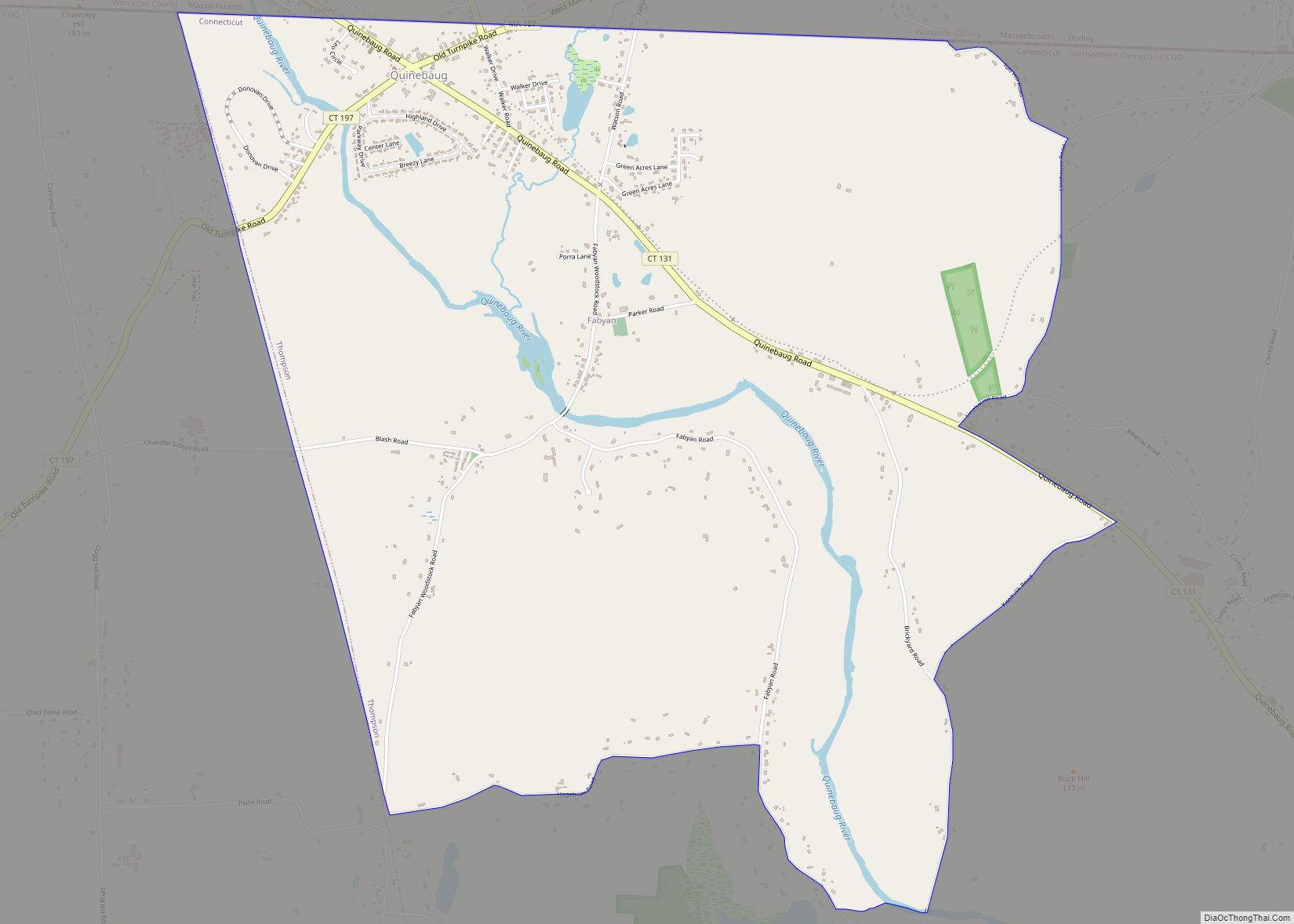
Quinebaug is a village and census-designated place (CDP) in Thompson, a town in Windham County, Connecticut, United States. The population was 1,133 at the 2010 census. Quinebaug CDP overview: Name: Quinebaug CDP LSAD Code: 57 LSAD Description: CDP (suffix) State: Connecticut County: Windham County Elevation: 341 ft (104 m) Total Area: 4.5 sq mi (11.8 km²) Land Area: 4.4 sq mi (11.3 km²) … Read more

Map of Putnam CDP, Connecticut

Map of Putnam CDP, Connecticut

Putnam District is a village and census-designated place (CDP) in Windham County, Connecticut, United States. The CDP was formed when the former city of Putnam disincorporated, and it consists of the main town center of the town of Putnam along the Quinebaug River. The population was 7,214 at the 2010 census. Putnam CDP overview: Name: … Read more

Map of Portland CDP, Connecticut

Map of Portland CDP, Connecticut

Portland is a census-designated place (CDP) comprising the primary village and adjacent residential land in the town of Portland, Middlesex County, Connecticut, United States. It is in the southwest part of the town, bordered to the west and south by the Connecticut River, which forms the border with Cromwell to the west and Middletown to … Read more

Map of Rockville CDP, Connecticut

Map of Rockville CDP, Connecticut

Rockville is a census-designated place and a village of the town of Vernon in Tolland County, Connecticut, United States. The population was 7,474 at the 2010 census. Incorporated as a city in 1889, it has been consolidated with the town of Vernon since 1965. Rockville CDP overview: Name: Rockville CDP LSAD Code: 57 LSAD Description: … Read more

Map of Riverside CDP, Connecticut

Map of Riverside CDP, Connecticut

Riverside is a neighborhood/section in the town of Greenwich in Fairfield County, Connecticut, United States. As of the 2020 census, it had a population of 8,843. The town of Greenwich is one political and taxing body, but consists of several distinct sections or neighborhoods, such as Banksville, Byram, Cos Cob, Glenville, Mianus, Old Greenwich, Riverside, … Read more

Map of Ridgefield CDP

Map of Ridgefield CDP, Connecticut

Ridgefield is a census-designated place (CDP) in Fairfield County, Connecticut, United States. It consists of the primary central village in the town of Ridgefield and surrounding residential areas. As of the 2010 census, the population of the CDP was 7,645, out of 24,638 in the entire town. Ridgefield CDP overview: Name: Ridgefield CDP LSAD Code: … Read more

Map of Sharon CDP

Map of Sharon CDP, Connecticut

Sharon is a census-designated place (CDP) in Litchfield County, Connecticut, United States. It is the primary village within the town of Sharon. As of the 2010 census, the population of the CDP was 729, out of 2,782 in the entire town. Sharon CDP overview: Name: Sharon CDP LSAD Code: 57 LSAD Description: CDP (suffix) State: … Read more

Map of Saybrook Manor CDP

Map of Saybrook Manor CDP

Saybrook Manor is a community [1] and census-designated place (CDP) in Old Saybrook, a town in Middlesex County, Connecticut, United States. The population was 1,127 at the 2020 census. The Saybrook Manor section is generally the area south of U.S. Route 1 between the Westbrook town line and the Oyster River. Saybrook Manor CDP overview: … Read more

Map of Salmon Brook CDP

Map of Salmon Brook CDP

Salmon Brook is the name of a census-designated place (CDP) corresponding to the village of Granby, the primary settlement of the town of Granby, Connecticut, in Hartford County. The population of the CDP was 2,324 as of the 2010 census. Salmon Brook CDP overview: Name: Salmon Brook CDP LSAD Code: 57 LSAD Description: CDP (suffix) … Read more

Map of Simsbury Center CDP

Map of Simsbury Center CDP

Simsbury Center is a census-designated place (CDP) that consists of the central settlement, and the neighborhoods immediately surrounding it, in the town of Simsbury, Connecticut, in the United States. As of the 2010 census, the CDP had a population of 5,836. The core area of the CDP is listed as the Simsbury Center Historic District … Read more

Map of Sherwood Manor CDP

Map of Sherwood Manor CDP

Sherwood Manor is a census-designated place (CDP) within the town of Enfield in Hartford County, Connecticut, United States. The population was 5,410 at the 2010 census. Sherwood Manor CDP overview: Name: Sherwood Manor CDP LSAD Code: 57 LSAD Description: CDP (suffix) State: Connecticut County: Hartford County Elevation: 140 ft (40 m) Total Area: 3.1 sq mi (8.1 km²) Land Area: … Read more

Map of Shelton city

Map of Shelton city, Connecticut

Shelton is a city in Fairfield County, Connecticut, United States. The population was 40,869 at the 2020 United States Census. The city is part of the Naugatuck Valley Planning Region. Shelton city overview: Name: Shelton city LSAD Code: 25 LSAD Description: city (suffix) State: Connecticut County: Fairfield County Elevation: 62 ft (19 m) Total Area: 31.90 sq mi (82.63 km²) … Read more