Map of Fellsmere city

Map of Fellsmere city

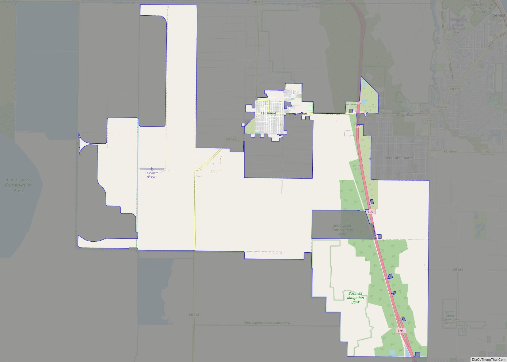
Fellsmere is a city in Indian River County, Florida, United States. It is home of the Fellsmere Frog Leg Festival and the now closed National Elephant Center. Fellsmere is the first place in Florida where women were allowed to vote. In a municipal election on June 19, 1915, resident Zena M. Dreier became the first … Read more

Map of Feather Sound CDP

Map of Feather Sound CDP

Feather Sound is a census-designated place (CDP) in Pinellas County, Florida, United States. The population was 3,420 at the 2010 census. It includes the St. Petersburg-Clearwater International Airport. Feather Sound CDP overview: Name: Feather Sound CDP LSAD Code: 57 LSAD Description: CDP (suffix) State: Florida County: Pinellas County Elevation: 6 ft (2 m) Total Area: 3.43 sq mi (8.88 km²) … Read more

Map of Fanning Springs city

Map of Fanning Springs city

Fanning Springs is a city in Gilchrist and Levy counties in the U.S. state of Florida. The population was 764 at the 2010 census. Fanning Springs city overview: Name: Fanning Springs city LSAD Code: 25 LSAD Description: city (suffix) State: Florida County: Gilchrist County, Levy County Elevation: 30 ft (9 m) Total Area: 5.00 sq mi (12.96 km²) Land Area: … Read more

Map of Ferndale CDP, Florida

Map of Ferndale CDP, Florida

Ferndale is a census-designated place (CDP) in Lake County, Florida, United States. The population was 472 at the 2010 census, up from 233 at the 2000 census. It is part of the Orlando–Kissimmee Metropolitan Statistical Area. Ferndale CDP overview: Name: Ferndale CDP LSAD Code: 57 LSAD Description: CDP (suffix) State: Florida County: Lake County Elevation: … Read more

Map of Fernandina Beach city

Map of Fernandina Beach city

Fernandina Beach is a city in northeastern Florida and the county seat of Nassau County, Florida, United States. It is the northernmost city on Florida’s Atlantic coast, situated on Amelia Island, and is one of the principal municipalities comprising Greater Jacksonville. The area was first inhabited by the Timucuan Indian people. Known as the “Isle … Read more

Map of Fern Park CDP

Map of Fern Park CDP

Fern Park is a census-designated place and a suburban unincorporated community in Seminole County, Florida, United States. The population was 8,318 at the 2000 census. It is part of the Orlando–Kissimmee Metropolitan Statistical Area. Fern Park CDP overview: Name: Fern Park CDP LSAD Code: 57 LSAD Description: CDP (suffix) State: Florida County: Seminole County Elevation: … Read more

Map of Fish Hawk CDP

Map of Fish Hawk CDP

Fish Hawk (or FishHawk) is an unincorporated area and census-designated place (CDP) in Hillsborough County, Florida, United States. It is a suburb of Tampa, Florida, and includes a portion of the community of Lithia. As of the 2020 census, the CDP had a population of 24,625. The place name is derived from Little Fishhawk Creek, … Read more

Map of Fidelis CDP

Map of Fidelis CDP

Fidelis is an unincorporated community and census-designated place in Santa Rosa County, Florida, United States. Its population was 156 as of the 2010 census. Florida State Road 87 passes through the community. Fidelis CDP overview: Name: Fidelis CDP LSAD Code: 57 LSAD Description: CDP (suffix) State: Florida County: Santa Rosa County Elevation: 256 ft (78 m) Total … Read more

Map of Ferry Pass CDP

Map of Ferry Pass CDP

Ferry Pass is a census-designated place (CDP) in Escambia County, Florida. It is a community in Pensacola, and is located north of Pensacola City Limits. As of the 2010 United States Census, the population was 28,921. The University of West Florida, located in Ferry Pass, is the only university located in the Pensacola Metropolitan Area. … Read more

Map of Flagler Beach city

Map of Flagler Beach city

Flagler Beach is a city in Flagler County in the U.S. state of Florida. The population was 4,484 at the 2010 census. Flagler Beach is part of the Deltona–Daytona Beach–Ormond Beach, FL metropolitan statistical area. It is named for oil tycoon and Florida railroad developer Henry Flagler, who was a key figure in the development … Read more

Map of Five Points CDP, Florida

Map of Five Points CDP, Florida

Five Points is a census-designated place (CDP) in Columbia County, Florida, United States. The population was 1,265 at the 2010 census. Five Points CDP overview: Name: Five Points CDP LSAD Code: 57 LSAD Description: CDP (suffix) State: Florida County: Columbia County Elevation: 167 ft (51 m) Total Area: 2.50 sq mi (6.46 km²) Land Area: 2.49 sq mi (6.46 km²) Water Area: 0.00 sq mi … Read more

Map of Fisher Island CDP

Map of Fisher Island CDP

Fisher Island is a census-designated place in Miami-Dade County, Florida, United States, located on a barrier island of the same name. Since 2015, Fisher Island has the highest per capita income of any place in the United States. As of the 2020 census, the population was 561. Named for automotive parts pioneer and beach real … Read more