Fisher Island is a census-designated place in Miami-Dade County, Florida, United States, located on a barrier island of the same name. Since 2015, Fisher Island has the highest per capita income of any place in the United States. As of the 2020 census, the population was 561.
Named for automotive parts pioneer and beach real estate developer Carl G. Fisher, who once owned it, Fisher Island is three miles off the shore of mainland South Florida. No road or causeway connects to the island, which is only accessible by private boat, helicopter, or ferry. Once a one-family island home of the Vanderbilts, and later several other millionaires, it was sold for development in the 1960s. The property sat vacant for well over 15 years before development began for very limited and restrictive multi-family use.
| Name: | Fisher Island CDP |
|---|---|
| LSAD Code: | 57 |
| LSAD Description: | CDP (suffix) |
| State: | Florida |
| County: | Miami-Dade County |
| Elevation: | 10 ft (3 m) |
| Total Area: | 0.27 sq mi (0.69 km²) |
| Land Area: | 0.24 sq mi (0.62 km²) |
| Water Area: | 0.03 sq mi (0.07 km²) |
| Total Population: | 561 |
| Population Density: | 2,327.80/sq mi (899.47/km²) |
| ZIP code: | 33109 (Miami Beach) |
| Area code: | 305 |
| FIPS code: | 1222375 |
| GNISfeature ID: | 1853250 |
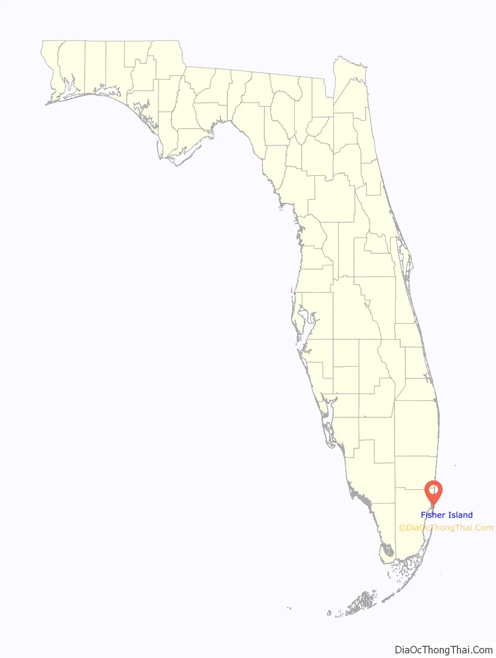
Online Interactive Map
Click on ![]() to view map in "full screen" mode.
to view map in "full screen" mode.
Fisher Island location map. Where is Fisher Island CDP?

History
Fisher Island was separated from the barrier island which became Miami Beach in 1905, when Government Cut was dredged across the northern end of the island. Construction of Fisher Island began in 1919 when Carl G. Fisher, a land developer, purchased the property from businessman and real estate developer Dana A. Dorsey, southern Florida’s first African-American millionaire. In 1925 William Kissam Vanderbilt II traded a luxury yacht to Fisher for ownership of the island.
After Vanderbilt’s death in 1944, ownership of the island passed to U.S. Steel heir Edward Moore. Moore died in the early 1950s, and Gar Wood, the millionaire inventor of hydraulic construction equipment, bought it. Wood, a speedboat enthusiast, kept the island a one-family retreat. In 1963, Wood sold to a development group that included local Key Biscayne millionaire Bebe Rebozo, Miami native and United States Senator George Smathers, and then former U.S. Vice President Richard Nixon, who had promised to leave politics. During his subsequent presidency from 1968 to 1973, and during the Watergate scandal, Nixon maintained a home on nearby Key Biscayne known as the “Key Biscayne Whitehouse” that was the former residence of Senator Smathers and next door to Rebozo, but none of the three ever resided on Fisher Island.
The Rosenstiel School of Marine and Atmospheric Science (RSMAS) of the University of Miami maintained the Comparative Sedimentology Laboratory on Fisher Island from 1972 to 1990 under the leadership of Robert Ginsburg.
After years of legal battles and changes in ownership, further development on the island was finally started in the 1980s, with architecture matching the original 1920s Spanish style mansions. Although no longer a one-family island, in 2005, Fisher Island still remains somewhat inaccessible to the public and uninvited guests, and is as exclusive by modern standards as it was in the days of the Vanderbilts, providing similar refuge and retreat for its residents. The island contains mansions, a hotel, several apartment buildings, an observatory, and a private marina. Boris Becker, Oprah Winfrey, and Mel Brooks are among the celebrities with homes on the island.
In 2005, the island attempted to incorporate as a town, but the Miami-Dade County Commission did not support this initiative.
Controversies
In 2006, the Service Employees International Union began organizing the workers on Fisher Island in preparation for a petition for recognition as those employees’ bargaining representative. The campaign culminated on June 15, 2007, with a march to the mainland ferry terminal that ended with a worker’s arrest. The New York Times wrote an exposé on the situation. In the article, residents were portrayed as not caring about the welfare of the community, but residents disputed this characterization, insisting that the island included financially successful, compassionate people who had established several charitable activities on the island, provided health insurance to their employees and were involved in various arts organizations in the Miami-Dade area. The union argued that the wages provided by the island were too low for employees to care for their families and that the health insurance provided was out of the reach of most island employees.
The Fisher Island bankruptcy case
One of the last developable parcels of land on the island, a 15-acre (6.1 ha) site approved for residential development facing the shipping channel that separates the island from Miami Beach, was for a number of years subject to a protracted legal battle between Inna Gudavadze, the widow of the late Georgian billionaire Badri Patarkatsishvili, and investors aligned with his distant relative and former business associate, Joseph Kay.
A judgment handed down by the United States District Court for the Southern District of Florida on October 16, 2013, upheld in the US a previous 2010 judgement from the Supreme Court of Gibraltar that comprehensively dismissed the “wholly unconvincing” case brought by Joseph Kay. The development then moved forward, under the supervision of Inna Gudavadze and the Patarkatsishvili family.
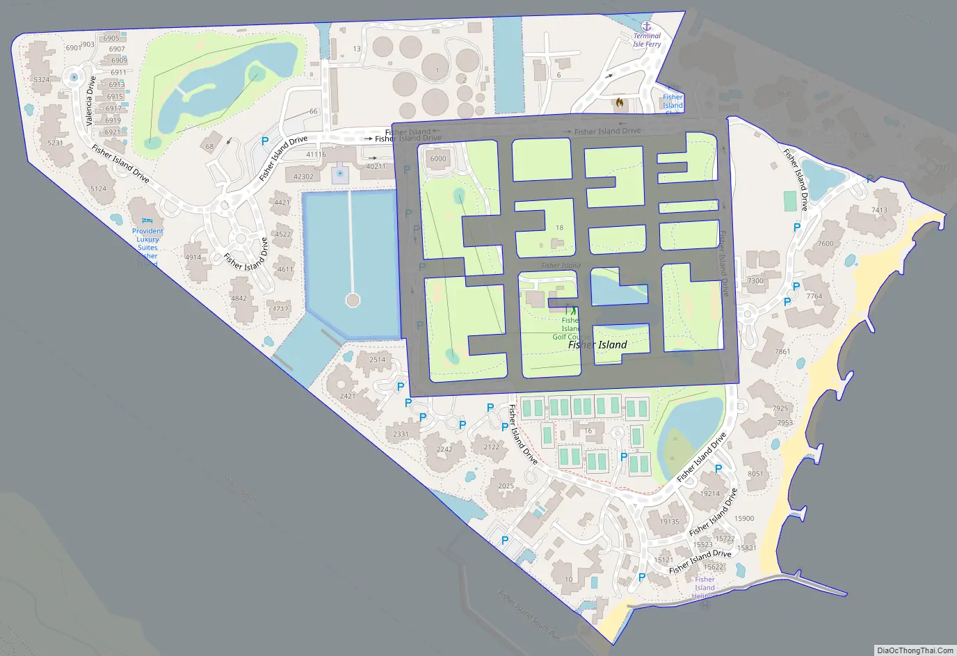
Fisher Island Road Map
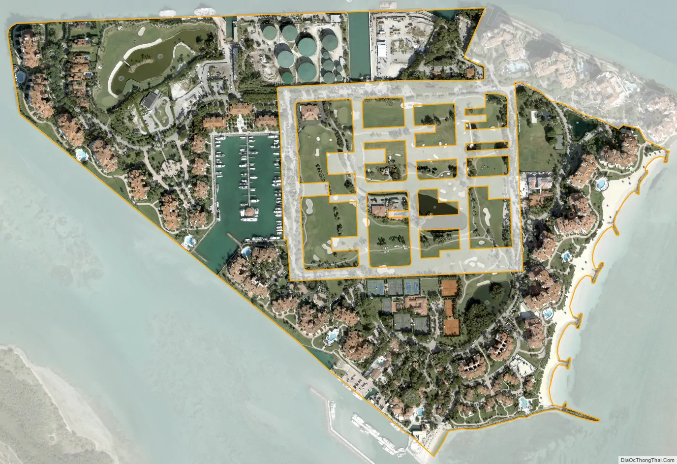
Fisher Island city Satellite Map
Geography
Fisher Island is located 3 miles (5 km) east of downtown Miami at 25°45′41″N 80°8′39″W / 25.76139°N 80.14417°W / 25.76139; -80.14417. It is bordered to the north, across Government Cut, by the city of Miami Beach, and to the south, across Norris Cut, by Virginia Key, within the Miami city limits. Biscayne Bay is to the west, and the Atlantic Ocean is to the east.
The entire island has a total area of 0.362 sq mi (0.94 km), of which 0.267 square miles (0.69 km) are within the CDP, the rest being part of the city of Miami Beach.
See also
Map of Florida State and its subdivision:- Alachua
- Baker
- Bay
- Bradford
- Brevard
- Broward
- Calhoun
- Charlotte
- Citrus
- Clay
- Collier
- Columbia
- Desoto
- Dixie
- Duval
- Escambia
- Flagler
- Franklin
- Gadsden
- Gilchrist
- Glades
- Gulf
- Hamilton
- Hardee
- Hendry
- Hernando
- Highlands
- Hillsborough
- Holmes
- Indian River
- Jackson
- Jefferson
- Lafayette
- Lake
- Lee
- Leon
- Levy
- Liberty
- Madison
- Manatee
- Marion
- Martin
- Miami-Dade
- Monroe
- Nassau
- Okaloosa
- Okeechobee
- Orange
- Osceola
- Palm Beach
- Pasco
- Pinellas
- Polk
- Putnam
- Saint Johns
- Saint Lucie
- Santa Rosa
- Sarasota
- Seminole
- Sumter
- Suwannee
- Taylor
- Union
- Volusia
- Wakulla
- Walton
- Washington
- Alabama
- Alaska
- Arizona
- Arkansas
- California
- Colorado
- Connecticut
- Delaware
- District of Columbia
- Florida
- Georgia
- Hawaii
- Idaho
- Illinois
- Indiana
- Iowa
- Kansas
- Kentucky
- Louisiana
- Maine
- Maryland
- Massachusetts
- Michigan
- Minnesota
- Mississippi
- Missouri
- Montana
- Nebraska
- Nevada
- New Hampshire
- New Jersey
- New Mexico
- New York
- North Carolina
- North Dakota
- Ohio
- Oklahoma
- Oregon
- Pennsylvania
- Rhode Island
- South Carolina
- South Dakota
- Tennessee
- Texas
- Utah
- Vermont
- Virginia
- Washington
- West Virginia
- Wisconsin
- Wyoming


