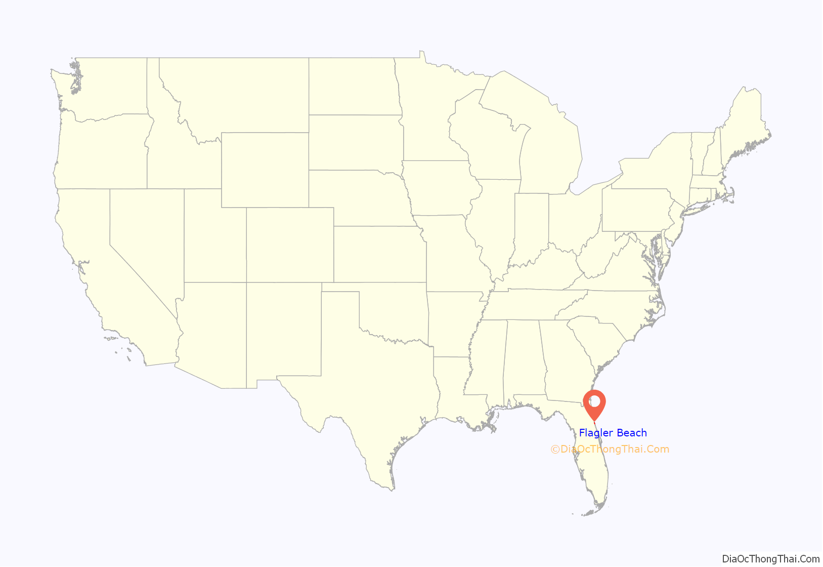
Flagler Beach is a city in Flagler County in the U.S. state of Florida. The population was 4,484 at the 2010 census.
Flagler Beach is part of the Deltona–Daytona Beach–Ormond Beach, FL metropolitan statistical area. It is named for oil tycoon and Florida railroad developer Henry Flagler, who was a key figure in the development of East Florida as resort and vacation destinations.
| Name: | Flagler Beach city |
|---|---|
| LSAD Code: | 25 |
| LSAD Description: | city (suffix) |
| State: | Florida |
| County: | Flagler County, Volusia County |
| Incorporated: | April, 1925 |
| Elevation: | 10 ft (3 m) |
| Total Area: | 4.09 sq mi (10.58 km²) |
| Land Area: | 3.58 sq mi (9.28 km²) |
| Water Area: | 0.50 sq mi (1.30 km²) 9.8% |
| Total Population: | 5,160 |
| Population Density: | 1,439.73/sq mi (555.83/km²) |
| ZIP code: | 32136 |
| Area code: | 386 |
| FIPS code: | 1222550 |
| GNISfeature ID: | 0307132 |
| Website: | http://www.cityofflaglerbeach.com |
Online Interactive Map
Click on ![]() to view map in "full screen" mode.
to view map in "full screen" mode.
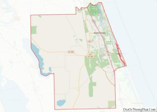
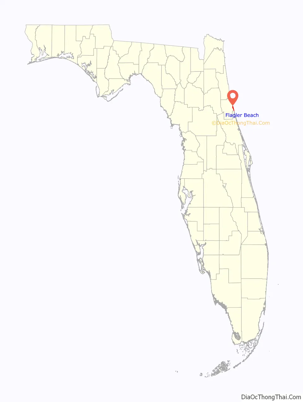
Flagler Beach location map. Where is Flagler Beach city?
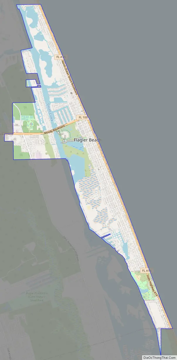
Flagler Beach Road Map
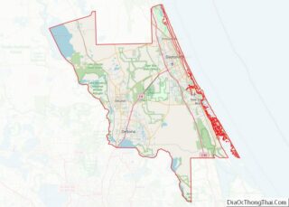
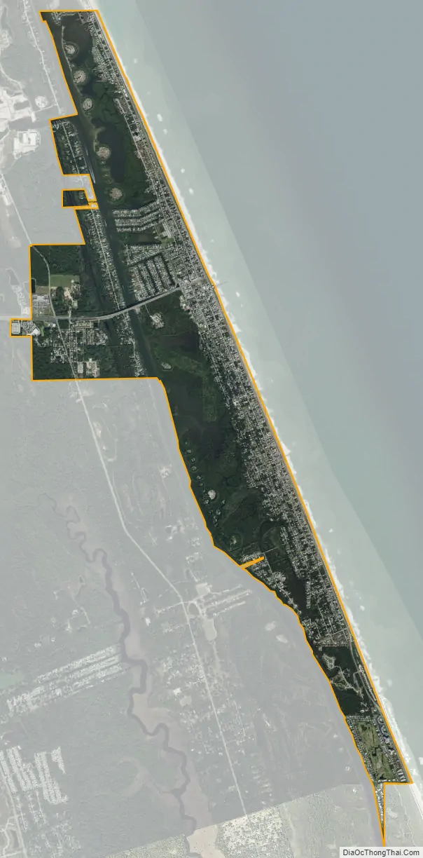
Flagler Beach city Satellite Map
Geography
Flagler Beach is located at 29°28′27″N 81°07′37″W / 29.474079°N 81.126987°W / 29.474079; -81.126987.
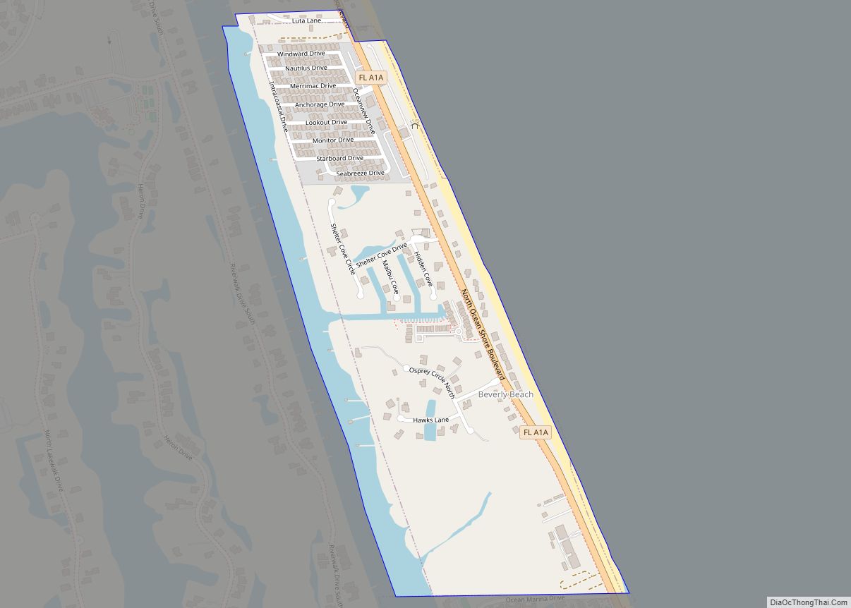
According to the United States Census Bureau, the city has a total area of 4.1 square miles (10.6 km). 3.7 square miles (9.5 km) of it is land and 0.39 square miles (1.0 km) of it (9.80%) is water.
The Ocean Palm Villas South subdivision east of the Intracoastal Waterway is the only portion of Flagler Beach in Volusia County.
Florida State Road A1A travels through Flagler Beach along an approximate north-south axis. The road suffered significant damage during Hurricane Matthew, due to coastal erosion facilitated by a storm surge.
See also
Map of Florida State and its subdivision:- Alachua
- Baker
- Bay
- Bradford
- Brevard
- Broward
- Calhoun
- Charlotte
- Citrus
- Clay
- Collier
- Columbia
- Desoto
- Dixie
- Duval
- Escambia
- Flagler
- Franklin
- Gadsden
- Gilchrist
- Glades
- Gulf
- Hamilton
- Hardee
- Hendry
- Hernando
- Highlands
- Hillsborough
- Holmes
- Indian River
- Jackson
- Jefferson
- Lafayette
- Lake
- Lee
- Leon
- Levy
- Liberty
- Madison
- Manatee
- Marion
- Martin
- Miami-Dade
- Monroe
- Nassau
- Okaloosa
- Okeechobee
- Orange
- Osceola
- Palm Beach
- Pasco
- Pinellas
- Polk
- Putnam
- Saint Johns
- Saint Lucie
- Santa Rosa
- Sarasota
- Seminole
- Sumter
- Suwannee
- Taylor
- Union
- Volusia
- Wakulla
- Walton
- Washington
- Alabama
- Alaska
- Arizona
- Arkansas
- California
- Colorado
- Connecticut
- Delaware
- District of Columbia
- Florida
- Georgia
- Hawaii
- Idaho
- Illinois
- Indiana
- Iowa
- Kansas
- Kentucky
- Louisiana
- Maine
- Maryland
- Massachusetts
- Michigan
- Minnesota
- Mississippi
- Missouri
- Montana
- Nebraska
- Nevada
- New Hampshire
- New Jersey
- New Mexico
- New York
- North Carolina
- North Dakota
- Ohio
- Oklahoma
- Oregon
- Pennsylvania
- Rhode Island
- South Carolina
- South Dakota
- Tennessee
- Texas
- Utah
- Vermont
- Virginia
- Washington
- West Virginia
- Wisconsin
- Wyoming