Map of Key Colony Beach city

Map of Key Colony Beach city

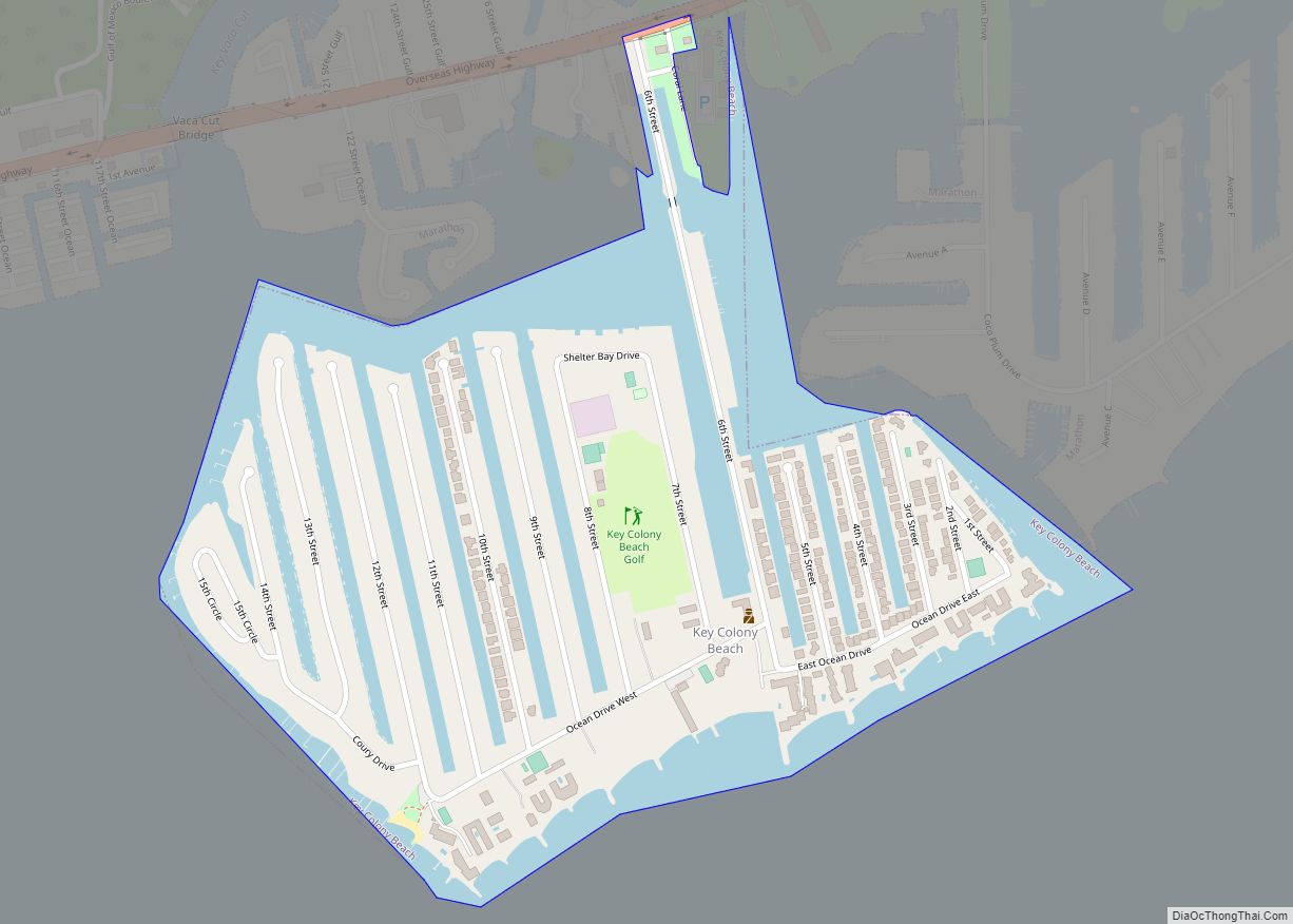
Key Colony Beach is a municipality in the middle of the Florida Keys, Monroe County, Florida, United States. The population was 790 at the 2020 census. Key Colony Beach city overview: Name: Key Colony Beach city LSAD Code: 25 LSAD Description: city (suffix) State: Florida County: Monroe County Elevation: 3 ft (1 m) Total Area: 0.65 sq mi (1.68 km²) … Read more

Map of Key Biscayne village

Map of Key Biscayne village

Key Biscayne is an island town in Miami-Dade County, Florida, United States. The population was 14,809 at the 2020 census, up from 12,344 in 2010. Key Biscayne village overview: Name: Key Biscayne village LSAD Code: 47 LSAD Description: village (suffix) State: Florida County: Miami-Dade County Incorporated: June 18, 1991 Elevation: 3 ft (1 m) Total Area: 1.71 sq mi … Read more

Map of Kenwood Estates CDP

Map of Kenwood Estates CDP

Kenwood Estates is a census-designated place (CDP) in Palm Beach County, Florida, United States. Its population was 1,435 as of the 2020 census. Kenwood Estates is located between Greenacres and Palm Springs; State Road 809 (Military Trail) passes through the community. More specifically, the CDP is defined from Attleboro Avenue westward to Haverhill Road, while … Read more

Map of Key Vista CDP

Map of Key Vista CDP

Key Vista is an unincorporated community and census-designated place in Pasco County, Florida, United States. Its population was 1,757 as of the 2010 census. Key Vista CDP overview: Name: Key Vista CDP LSAD Code: 57 LSAD Description: CDP (suffix) State: Florida County: Pasco County Elevation: 10 ft (3 m) Total Area: 0.755 sq mi (1.96 km²) Land Area: 0.755 sq mi (1.96 km²) … Read more

Map of Key Largo CDP

Map of Key Largo CDP

Key Largo is an unincorporated area and census-designated place in Monroe County, Florida, United States, located on the island of Key Largo in the upper Florida Keys. The population was 12,447 at the 2020 census, up from 10,433 in 2010. The name comes from the Spanish Cayo Largo, or “long key”. It is both the … Read more

Map of Keystone Heights city

Map of Keystone Heights city

Keystone Heights is a city located in southwestern Clay County, Florida, United States. The population of the city was 1,446 at the 2020 census and increased to 1,478 in 2021. The city’s name is derived from the state of Pennsylvania‘s nickname, the “Keystone State”. Keystone Heights is the southwestern most city in the Jacksonville metropolitan … Read more

Map of La Crosse city

Map of La Crosse town, Florida

La Crosse town overview: Name: La Crosse town LSAD Code: 43 LSAD Description: town (suffix) State: Florida County: Alachua County FIPS code: 1237300 Online Interactive Map La Crosse online map. Source: Basemap layers from Google Map, Open Street Map (OSM), Arcgisonline, Wmflabs. Boundary Data from Database of Global Administrative Areas. La Crosse location map. Where … Read more

Map of Kissimmee city

Map of Kissimmee city

Kissimmee (/kɪˈsɪmi/ (listen) kih-SIM-ee) is the largest city and county seat of Osceola County, Florida, United States. As of the 2020 census, the population was 79,226. It is a Principal City of the Orlando-Kissimmee-Sanford, Florida, Metropolitan Statistical Area, which had a 2020 population of 2,673,376. The Census Bureau defines an urban area with Kissimmee as … Read more

Map of Keystone CDP, Florida

Map of Keystone CDP, Florida

Keystone is an unincorporated census-designated place in Hillsborough County, Florida, United States. The Keystone area was first settled in the middle 1800s by the W.M. Mobley Family who migrated from Savannah, Georgia. The region has evolved from citrus and farming into a rural retreat of many lake homes and ranches. The population was 24,039 at … Read more

Map of Lady Lake town

Map of Lady Lake town

Lady Lake is a town in Lake County, Florida, United States. The population was 13,926 at the 2010 census. As of 2019, the population recorded by the U.S. Census Bureau is 16,020. It is part of the Orlando–Kissimmee–Sanford Metropolitan Statistical Area. Area history is exhibited at the Lady Lake Historical Society Museum. Lady Lake town … Read more

Map of Lacoochee CDP

Map of Lacoochee CDP

Lacoochee is a census-designated place (CDP) in Pasco County, Florida, United States. The population was 1,345 at the 2000 census. Lacoochee CDP overview: Name: Lacoochee CDP LSAD Code: 57 LSAD Description: CDP (suffix) State: Florida County: Pasco County Elevation: 72 ft (22 m) Total Area: 2.87 sq mi (7.42 km²) Land Area: 2.85 sq mi (7.39 km²) Water Area: 0.01 sq mi (0.03 km²) Total Population: … Read more

Map of LaBelle city

Map of LaBelle city

LaBelle is a city in and the county seat of Hendry County, Florida, United States. The population was 4,640 at the 2010 census, up from 4,210 at the 2000 census. It was named for Laura June Hendry and Carrie Belle Hendry, daughters of pioneer cattleman Francis Asbury Hendry. LaBelle hosts the annual Swamp Cabbage Festival, … Read more