Kissimmee (/kɪˈsɪmi/ (listen) kih-SIM-ee) is the largest city and county seat of Osceola County, Florida, United States. As of the 2020 census, the population was 79,226. It is a Principal City of the Orlando-Kissimmee-Sanford, Florida, Metropolitan Statistical Area, which had a 2020 population of 2,673,376. The Census Bureau defines an urban area with Kissimmee as the principal city, which is separated from the Orlando urban area. The Kissimmee–St. Cloud, FL urban area had a 2020 population of 418,404, making it the 100th largest in the United States.
| Name: | Kissimmee city |
|---|---|
| LSAD Code: | 25 |
| LSAD Description: | city (suffix) |
| State: | Florida |
| County: | Osceola County |
| Incorporated: | 1883 |
| Elevation: | 72 ft (22 m) |
| Land Area: | 21.50 sq mi (55.69 km²) |
| Water Area: | 0.70 sq mi (1.81 km²) 3.7% |
| Population Density: | 3,684.76/sq mi (1,422.67/km²) |
| ZIP code: | 34741-34747, 34758-34759 |
| Area code: | 321, 407 |
| FIPS code: | 1236950 |
| GNISfeature ID: | 2404839 |
| Website: | www.kissimmee.gov |
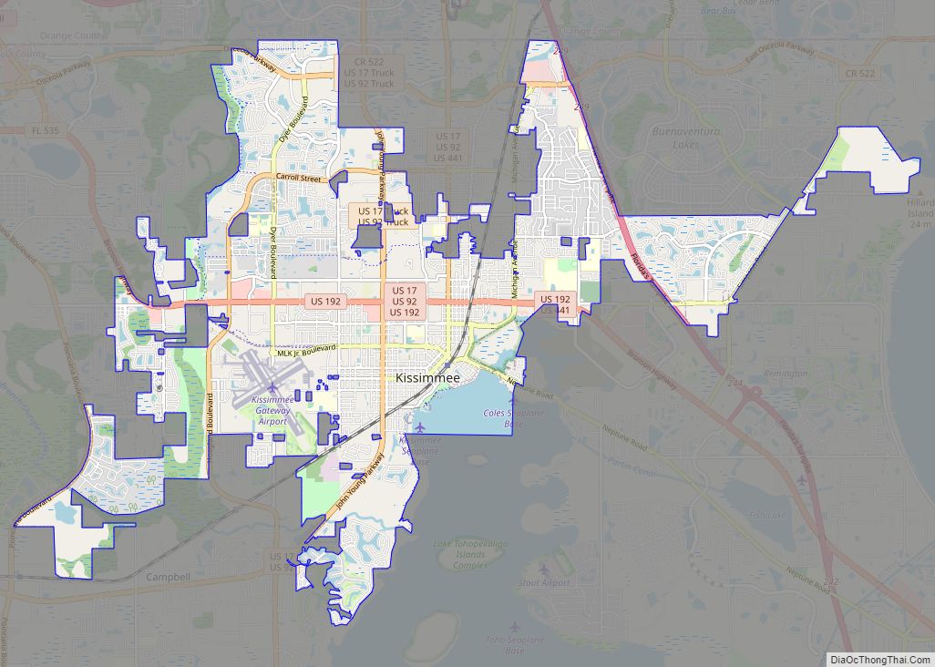
Online Interactive Map
Click on ![]() to view map in "full screen" mode.
to view map in "full screen" mode.
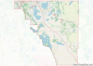
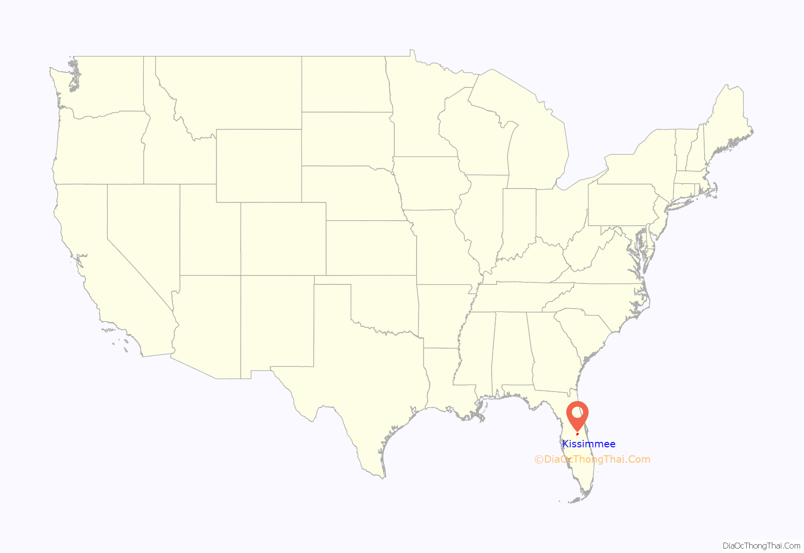
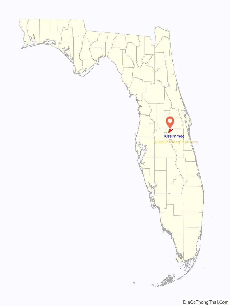
Kissimmee location map. Where is Kissimmee city?
History
This area was originally named Allendale, after Confederate Major J. H. Allen who operated the first cargo steamboat along the Kissimmee River—the Mary Belle. It was renamed Kissimmee when incorporated as a city in 1883. The modern town, which is the county seat of Osceola County, was founded before the Civil War by the Bass, Johnson and Overstreet families. The etymology of the name Kissimmee is debated, apart from general agreement that it is Native American in origin. Its growth can be credited to Hamilton Disston of Philadelphia, who based his four-million acre (8,000 km) drainage operation out of the small town. Disston had contracted with the financially wobbly state of Florida to drain its southern lands, for which he would own half of all he successfully drained. This deal made Disston the largest single landowner in the United States.
Disston’s dredging and land speculation required a small steamboat industry to transport people and goods along the new waterway. The Kissimmee shipyard was responsible for building most of these large steamships, which were just one jump ahead of civilization—with Kissimmee as the jumping off point. Concurrently, the South Florida Railroad was growing and extended the end of its line from Sanford down to Kissimmee, making the town on Lake Tohopekaliga a transportation hub for Central Florida. On February 12, 1885, the Florida Legislature incorporated the Kissimmee City Street Railway.
But the heyday of Kissimmee was short-lived. Expanding railroads began to challenge the steamships for carrying freight and passengers. By 1884, the South Florida Railroad, now part of the Plant System, had extended its tracks to Tampa. The Panic of 1893 was the worst depression the U.S. had experienced up to that time, crushing land speculation and unsound debt. Hamilton Disston closed his Kissimmee land operation. Consecutive freezes in 1894 and 1895 wiped out the citrus industry. The freezes, combined with South Florida’s growth and the relocation of steamship operations to Lake Okeechobee, left Kissimmee dependent on open range cattle ranching.
Kissimmee had a population of 4,310 in 1950. At that point there was some citrus packing as well as the ranching.
Ranching remained an important part of the local economy until the opening of nearby Walt Disney World in 1971. After that, tourism and development supplanted cattle ranching to a large measure. However, even though the Disney facility took over much of the open range cattle lands, cattle ranches still operate nearby, particularly in the southern part of Osceola County.
The 1998 Kissimmee tornado outbreak killed dozens of people in the area. On August 13, 2004, Hurricane Charley passed through Kissimmee with winds in excess of 100 miles per hour, damaging homes and buildings, toppling trees and cutting electrical power to the entire city. Kissimmee Utility Authority restored power to 54 percent of the residents in the first 72 hours; 85 percent were restored within one week. Service was restored to all customers on August 28. Three weeks after Hurricane Charley, the area was struck by Hurricane Frances, followed by Hurricane Jeanne three weeks after Frances.
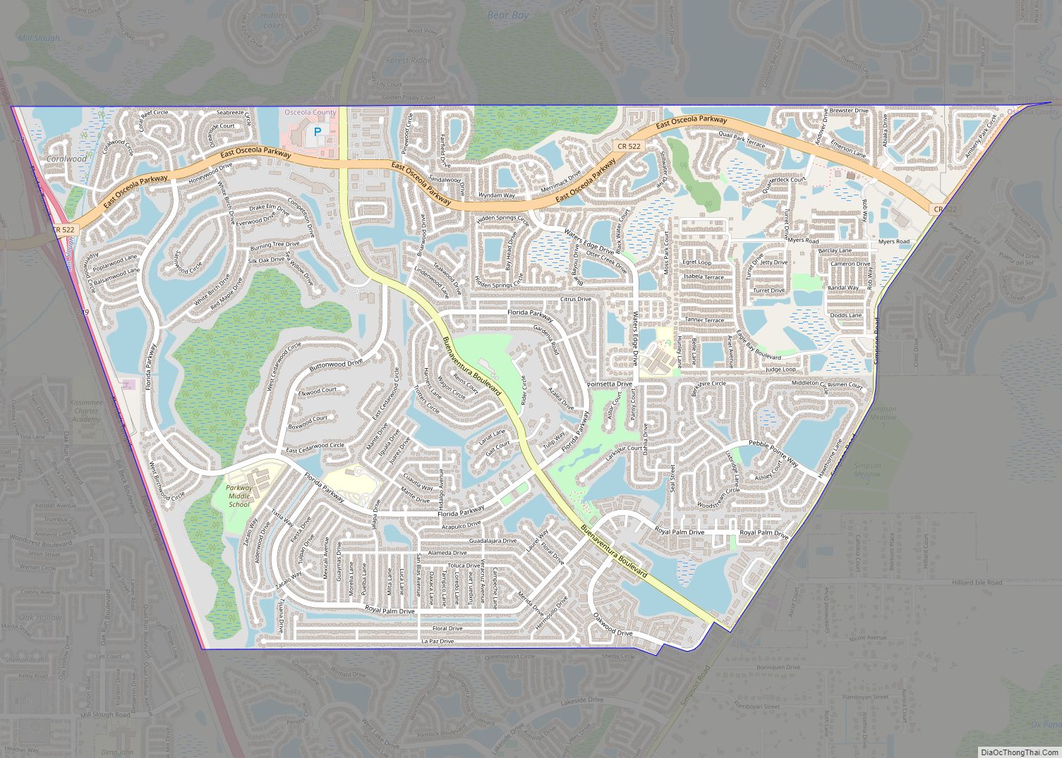
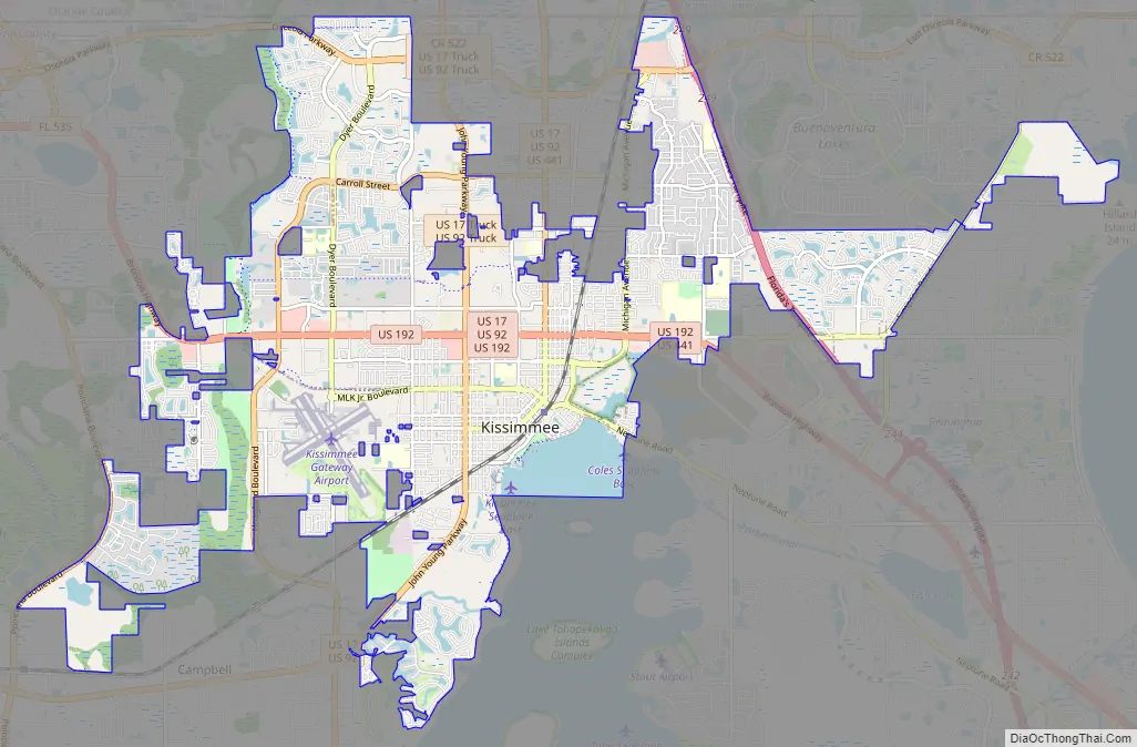
Kissimmee Road Map
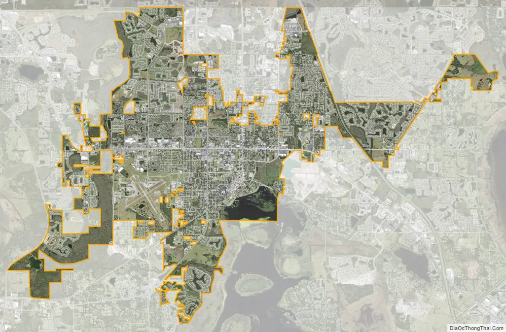
Kissimmee city Satellite Map
Geography
According to the United States Census Bureau, the city has a total area of 17.32 square miles (44.9 km), of which 16.7 square miles (43 km) is land and 0.6 square miles (2 km) is water (3.7%). Kissimmee and the city of St. Cloud are the only incorporated settlements in the county. The cities lie in proximity to each other along U.S. Highways 192 and 441.
A large geographical area of unincorporated Osceola County also refers to their area as Kissimmee. This includes most of the 192 corridor west of the city border to Highway 27, areas north of the city to Hunters Creek, and areas south of the city to Poinciana.
The city is mostly built on deep sand which is poorly drained in its natural state. The most common soil series is Myakka.
City water resources
Drained by the Kissimmee River, the city is situated on the northwest shore of Lake Tohopekaliga (locally called Lake Toho, West Lake Toho, or simply West Lake) in central Florida. Shingle Creek, largely considered the headwaters of the Everglades, also runs through the city. Shingle Creek features a popular canoe/kayak trail that runs from Steffe Landing on US 192 and ends in Lake Tohopekaliga.
Downtown
The downtown area lies near the intersection of U.S. Highway 17/92 and U.S. Highway 192. The downtown of Kissimmee does not possess any big skyscrapers; most of the buildings are two or three stories high. The biggest and the tallest building in the downtown is the Osceola County courthouse. The main thoroughfare follows along Highway 17/Highway 92 through the city’s center and is a combination of three streets: Main Street, Broadway Street, and Emmett Street. The downtown area consists largely of restaurants, small shops, and historic residences. The University of Central Florida has a business incubator located in the area that is an important part of the economic engine downtown.
Climate
The climate in this area is characterized by hot, humid summers and generally mild, dry, and sunny winters. According to the Köppen climate classification system, Kissimmee has a humid subtropical climate (Cfa).
See also
Map of Florida State and its subdivision:- Alachua
- Baker
- Bay
- Bradford
- Brevard
- Broward
- Calhoun
- Charlotte
- Citrus
- Clay
- Collier
- Columbia
- Desoto
- Dixie
- Duval
- Escambia
- Flagler
- Franklin
- Gadsden
- Gilchrist
- Glades
- Gulf
- Hamilton
- Hardee
- Hendry
- Hernando
- Highlands
- Hillsborough
- Holmes
- Indian River
- Jackson
- Jefferson
- Lafayette
- Lake
- Lee
- Leon
- Levy
- Liberty
- Madison
- Manatee
- Marion
- Martin
- Miami-Dade
- Monroe
- Nassau
- Okaloosa
- Okeechobee
- Orange
- Osceola
- Palm Beach
- Pasco
- Pinellas
- Polk
- Putnam
- Saint Johns
- Saint Lucie
- Santa Rosa
- Sarasota
- Seminole
- Sumter
- Suwannee
- Taylor
- Union
- Volusia
- Wakulla
- Walton
- Washington
- Alabama
- Alaska
- Arizona
- Arkansas
- California
- Colorado
- Connecticut
- Delaware
- District of Columbia
- Florida
- Georgia
- Hawaii
- Idaho
- Illinois
- Indiana
- Iowa
- Kansas
- Kentucky
- Louisiana
- Maine
- Maryland
- Massachusetts
- Michigan
- Minnesota
- Mississippi
- Missouri
- Montana
- Nebraska
- Nevada
- New Hampshire
- New Jersey
- New Mexico
- New York
- North Carolina
- North Dakota
- Ohio
- Oklahoma
- Oregon
- Pennsylvania
- Rhode Island
- South Carolina
- South Dakota
- Tennessee
- Texas
- Utah
- Vermont
- Virginia
- Washington
- West Virginia
- Wisconsin
- Wyoming