Map of New Smyrna Beach city

Map of New Smyrna Beach city

New Smyrna Beach is a city in Volusia County, Florida, United States, located on the central east coast of the state, with the Atlantic Ocean to the east. Its population is 30,142 in 2020 by the United States Census Bureau. The downtown section of the city is located on the west side of the Indian … Read more

Map of New Port Richey city

Map of New Port Richey city

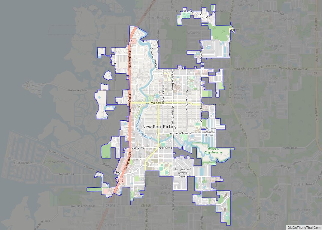
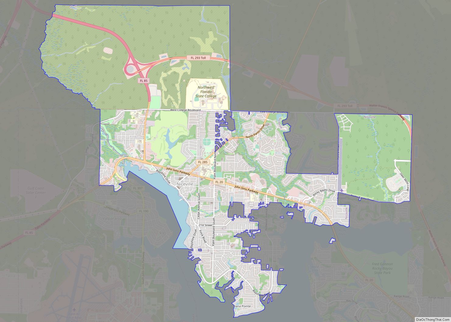
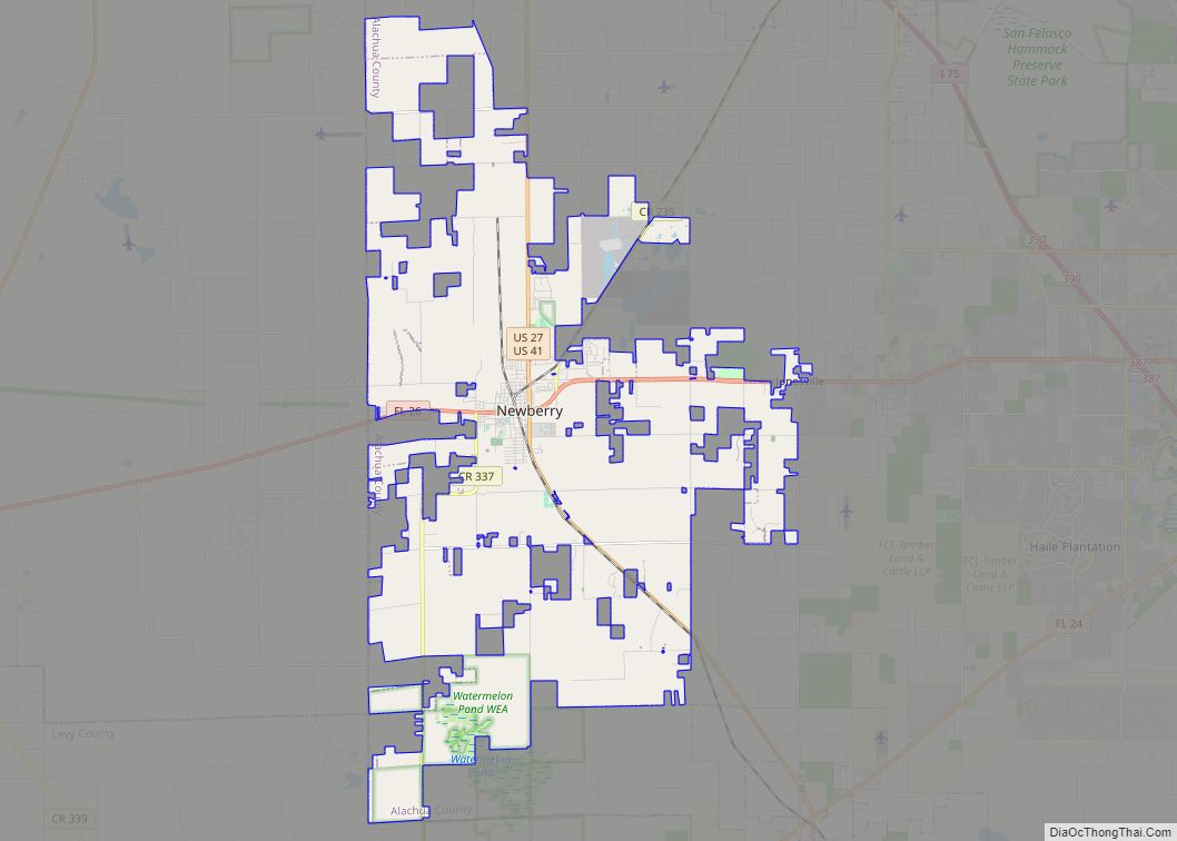
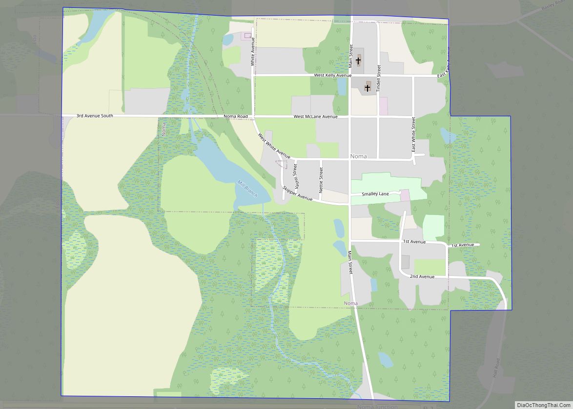
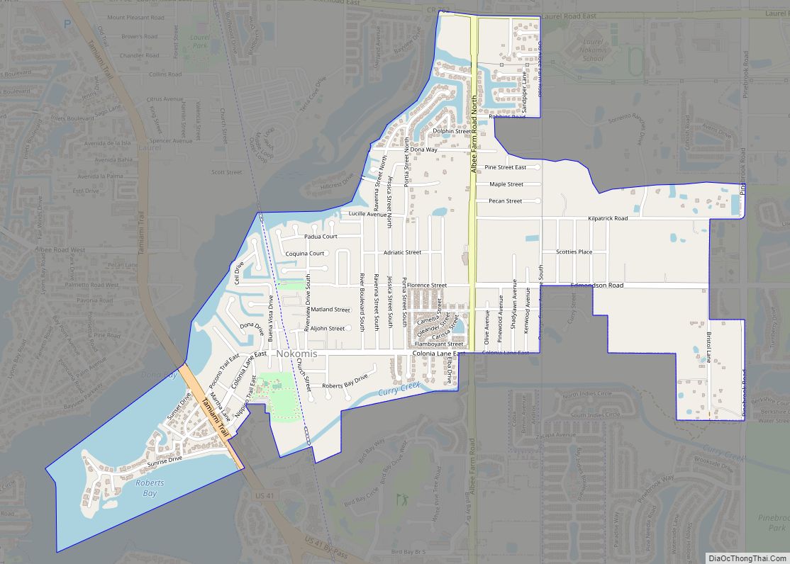
New Port Richey is a city in Pasco County, Florida, United States. It is a suburban city included in the Tampa-St. Petersburg-Clearwater, Florida Metropolitan Statistical Area. The population was counted at 16,728 in the 2020 census. New Port Richey city overview: Name: New Port Richey city LSAD Code: 25 LSAD Description: city (suffix) State: Florida … Read more

Map of New Port Richey East CDP

Map of New Port Richey East CDP

New Port Richey East is an unincorporated census-designated place in Pasco County, Florida, United States adjacent to New Port Richey. The population was 9,916 at the 2000 census. New Port Richey East CDP overview: Name: New Port Richey East CDP LSAD Code: 57 LSAD Description: CDP (suffix) State: Florida County: Pasco County Total Area: 3.87 sq mi … Read more

Map of Nobleton CDP

Map of Nobleton CDP

Nobleton is an unincorporated community and census-designated place (CDP) in Hernando County, Florida, United States. The population was 282 at the 2010 census, up from 160 at the 2000 census. Nobleton CDP overview: Name: Nobleton CDP LSAD Code: 57 LSAD Description: CDP (suffix) State: Florida County: Hernando County Elevation: 59 ft (18 m) Total Area: 0.20 sq mi (0.52 km²) … Read more

Map of Niceville city

Map of Niceville city

Niceville is a city in Okaloosa County, Florida, United States, located near Eglin Air Force Base on Boggy Bayou that opens into Choctawhatchee Bay. The population was 11,684 at the 2000 census. The 2010 census population for Niceville was 12,749. Niceville is part of the Fort Walton Beach–Crestview–Destin Metropolitan Statistical Area. Niceville city overview: Name: … Read more

Map of Newberry city

Map of Newberry city, Florida

Newberry is a city located in the southwest corner of Alachua County, Florida, United States. The population was 7,342 as of the 2020 Census. Much of the city borders neighboring Gilchrist County, to the west. The current Mayor is Jordan Marlowe. Developed as a mining and railroad town in the late 19th century, since the … Read more

Map of Noma town

Map of Noma town

Noma is a town in Holmes County, Florida, United States. The population was 211 at the 2010 census. Noma town overview: Name: Noma town LSAD Code: 43 LSAD Description: town (suffix) State: Florida County: Holmes County Elevation: 180 ft (55 m) Total Area: 1.09 sq mi (2.83 km²) Land Area: 1.07 sq mi (2.76 km²) Water Area: 0.03 sq mi (0.07 km²) Total Population: 208 Population … Read more

Map of Nokomis CDP

Map of Nokomis CDP, Florida

Nokomis is an unincorporated town in Sarasota County and a census-designated place (CDP) along the Gulf Coast of Florida, United States, located south of Osprey and just north of Venice. The town has access to the coast through Nokomis Public Beach and Casey Key. The town’s population was 3,167 at the 2010 census. It is … Read more

Map of Nocatee CDP

Map of Nocatee CDP

Nocatee /ˈnɒkətiː/ is an unincorporated planned community located primarily in northern St. Johns County, Florida and a census-designated place (CDP). The community blends a variety of neighborhoods with schools, parks, recreation, offices, shopping, and restaurants. As of 2020, the community consists of twenty-two neighborhoods, some of which are specialized for certain age groups. Part of … Read more

Map of North DeLand CDP

Map of North DeLand CDP

North DeLand is a census-designated place (CDP) in Volusia County, Florida, United States. The population was 1,510 at the 2020 census. North DeLand CDP overview: Name: North DeLand CDP LSAD Code: 57 LSAD Description: CDP (suffix) State: Florida County: Volusia County Elevation: 79 ft (24 m) Total Area: 0.53 sq mi (1.36 km²) Land Area: 0.53 sq mi (1.36 km²) Water Area: 0.00 sq mi … Read more

Map of North Brooksville CDP

Map of North Brooksville CDP

North Brooksville is a census-designated place (CDP) in Hernando County, Florida, United States. The population was 3,544 at the 2010 census. It is a suburb included in the Tampa-St. Petersburg-Clearwater, Florida Metropolitan Statistical Area. North Brooksville CDP overview: Name: North Brooksville CDP LSAD Code: 57 LSAD Description: CDP (suffix) State: Florida County: Hernando County Elevation: … Read more

Map of North Bay Village city

Map of North Bay Village city

North Bay Village is a city located in Miami-Dade County, Florida. As of the 2020 census, the city had a total population of 8,159. North Bay Village is located at 25°50′44″N 80°09′13″W / 25.845574°N 80.153543°W / 25.845574; -80.153543. According to the United States Census Bureau, the city has a total area of 0.837 square miles … Read more