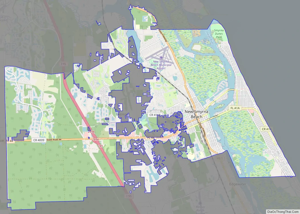
New Smyrna Beach is a city in Volusia County, Florida, United States, located on the central east coast of the state, with the Atlantic Ocean to the east. Its population is 30,142 in 2020 by the United States Census Bureau. The downtown section of the city is located on the west side of the Indian River and the Indian River Lagoon system. The Coronado Beach Bridge crosses the Intracoastal Waterway just south of Ponce de Leon Inlet, connecting the mainland with the beach on the coastal barrier island.
The surrounding area offers many opportunities for outdoor recreation; these include fishing, sailing, motorboating, golfing, and hiking. Visitors participate in water sports of all kinds, including swimming, scuba diving, kitesurfing, and surfing. In July 2009, New Smyrna Beach was ranked number nine on the list of “best surf towns” in Surfer. It was recognized as “one of the world’s top 20 surf towns” by National Geographic in 2012. It has also been dubbed “The Shark Bite Capital of the World.”
| Name: | New Smyrna Beach city |
|---|---|
| LSAD Code: | 25 |
| LSAD Description: | city (suffix) |
| State: | Florida |
| County: | Volusia County |
| Elevation: | 7 ft (2 m) |
| Land Area: | 37.79 sq mi (97.88 km²) |
| Water Area: | 3.49 sq mi (9.05 km²) |
| Population Density: | 797.58/sq mi (307.95/km²) |
| Area code: | 386 |
| FIPS code: | 1248625 |
| GNISfeature ID: | 0287692 |
| Website: | www.cityofnsb.com |
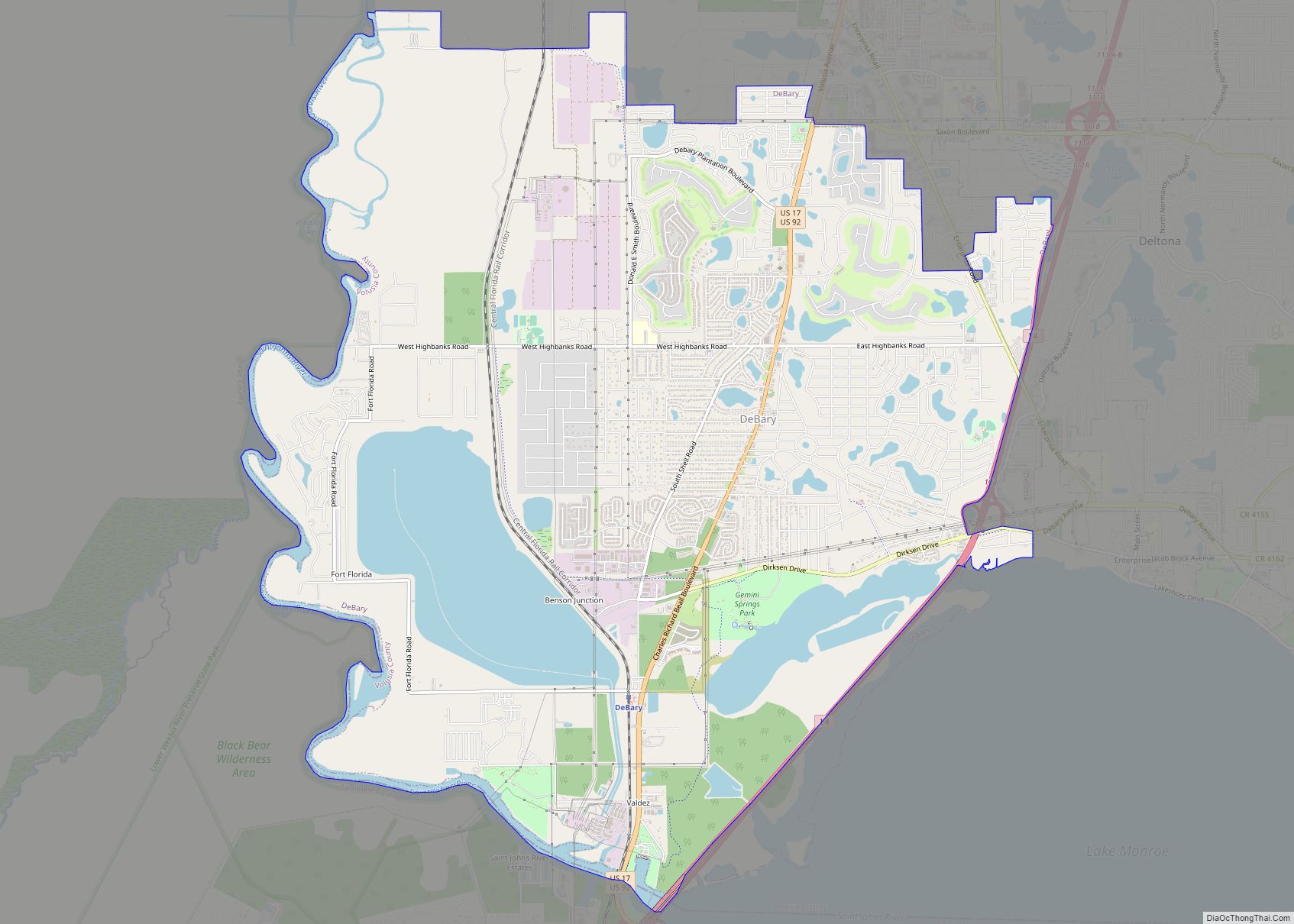
Online Interactive Map
Click on ![]() to view map in "full screen" mode.
to view map in "full screen" mode.
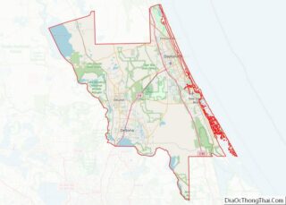
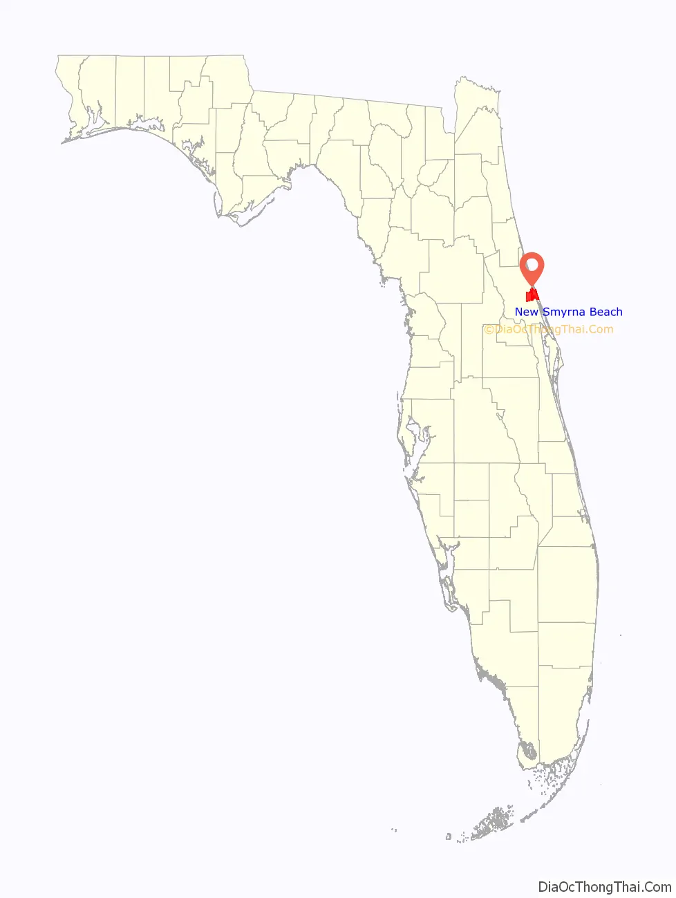
New Smyrna Beach location map. Where is New Smyrna Beach city?

History
The area was first settled by Europeans in 1768, when Scottish physician Dr. Andrew Turnbull, a friend of James Grant, the governor of British East Florida, established the colony of New Smyrna. Dr. Turnbull had married Gracia Dura Bin (some sources give her name as Maria Gracia Rubini), the daughter of a Greek London merchant from the Ottoman city of Smyrna (modern-day İzmir in Turkey) and named the settlement in honor of his wife’s birthplace, and the homeland of some of those in his future labor force who were Greek from the Mani peninsula. No one had previously attempted to settle so many people at one time in a town in North America.
Turnbull recruited about 1,300 settlers, intending for them to grow hemp, sugarcane, and indigo, as well as to produce rum, at his plantation on the northeastern Atlantic coast of Florida. The majority of the colonists came from Menorca (historically called “Minorca” in English), one of the Mediterranean Balearic Islands of Spain, and were of Catalan culture and language. Around 500 or so came from the Mani peninsula of Greece.
Although the colony produced relatively large amounts of processed indigo in its first few years of operation, it eventually collapsed after suffering major losses due to insect-borne diseases and Indian raids, and growing tensions caused by mistreatment of the colonists on the part of Turnbull and his overseers. The survivors, about 600 in number, marched nearly 70 miles north on the King’s Road and relocated to St. Augustine, where their descendants live to this day. In 1783, East and West Florida were returned to the Spanish, and Turnbull abandoned his colony to retire in Charleston, South Carolina.
The St. Photios Greek Orthodox National Shrine on St. George Street in St. Augustine honors the Greeks among the settlers of New Smyrna; they were the first Greek Orthodox followers in North America. The historical exhibit adjoining the chapel tells the story of their plight, with accompanying exhibits, and of their contributions to the city.
Central Florida remained sparsely populated by white settlers well into the 19th century, and it was frequently raided by Seminole Indians trying to protect their territory. United States troops fought against them in the Seminole Wars, but they were never completely dislodged.
During the Civil War, on March 23, 1862, portions of the 3rd Florida Infantry Regiment defeated a small U.S. naval force that was attempting to land near New Smyrna. Later on, in 1863, the “Stone Wharf” was shelled by Union gunboats.
In 1887, when New Smyrna was incorporated, it had a population of 150. In 1892, Henry Flagler provided service to the town via his Florida East Coast Railway. This led to a rapid increase in the area’s population. Its economy grew as tourism was added to its citrus and commercial fishing industries.
During Prohibition in the 1920s, the city and its river islands were popular sites for moonshine stills and hideouts for rum runners, who came from the Bahamas through Mosquito Inlet, now Ponce de León Inlet. “New Smyrna” became “New Smyrna Beach” in 1947, when the city annexed the seaside community of Coronado Beach. Today, it is a resort town of over 20,000 permanent residents.
Like St. Augustine, established by the Spanish, New Smyrna has been under the rule of four “flags”: the British, Spanish, United States (from 1821, with ratification of the Adams–Onís Treaty), and the Confederate Jack. After the end of the Civil War in 1865, it returned with Florida to the United States.
New Smyrna Beach Road Map
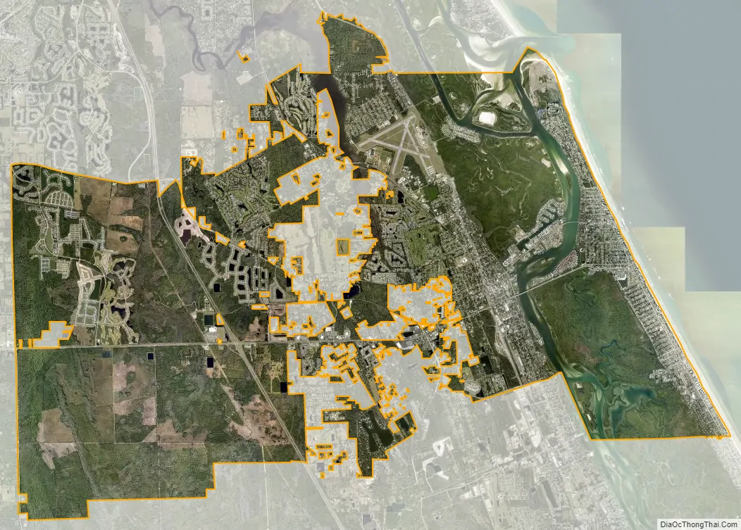
New Smyrna Beach city Satellite Map
Geography
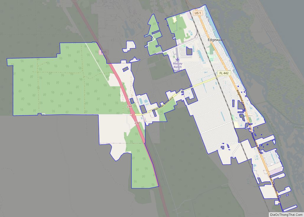
New Smyrna Beach’s motto is cygnus inter anates, which is Latin for “a swan among ducks.” The city is located in the so-called “Fun Coast” region of the state of Florida, a regional term created by the Daytona Beach/Halifax area Chamber of Commerce. This coincides with the local area code, 386, which spells FUN on touchtone phones. According to the United States Census Bureau, it has a total area of 37.8 square miles (98.0 km); 34.6 square miles (89.7 km) of it are land, and 0.31 square miles (0.8 km) of it (8.46%) is covered by water. It is bordered by the city of Port Orange to the northwest, unincorporated Volusia County to the north, the census-designated place of Samsula-Spruce Creek to the west, and the cities of Edgewater and Bethune Beach and the Canaveral National Seashore to the south. Bounded on the east by the Atlantic Ocean, New Smyrna Beach is on the Indian River. The city is connected to other parts of the state by Interstate 95, U.S. Route 1, and State Road 44.
See also
Map of Florida State and its subdivision:- Alachua
- Baker
- Bay
- Bradford
- Brevard
- Broward
- Calhoun
- Charlotte
- Citrus
- Clay
- Collier
- Columbia
- Desoto
- Dixie
- Duval
- Escambia
- Flagler
- Franklin
- Gadsden
- Gilchrist
- Glades
- Gulf
- Hamilton
- Hardee
- Hendry
- Hernando
- Highlands
- Hillsborough
- Holmes
- Indian River
- Jackson
- Jefferson
- Lafayette
- Lake
- Lee
- Leon
- Levy
- Liberty
- Madison
- Manatee
- Marion
- Martin
- Miami-Dade
- Monroe
- Nassau
- Okaloosa
- Okeechobee
- Orange
- Osceola
- Palm Beach
- Pasco
- Pinellas
- Polk
- Putnam
- Saint Johns
- Saint Lucie
- Santa Rosa
- Sarasota
- Seminole
- Sumter
- Suwannee
- Taylor
- Union
- Volusia
- Wakulla
- Walton
- Washington
- Alabama
- Alaska
- Arizona
- Arkansas
- California
- Colorado
- Connecticut
- Delaware
- District of Columbia
- Florida
- Georgia
- Hawaii
- Idaho
- Illinois
- Indiana
- Iowa
- Kansas
- Kentucky
- Louisiana
- Maine
- Maryland
- Massachusetts
- Michigan
- Minnesota
- Mississippi
- Missouri
- Montana
- Nebraska
- Nevada
- New Hampshire
- New Jersey
- New Mexico
- New York
- North Carolina
- North Dakota
- Ohio
- Oklahoma
- Oregon
- Pennsylvania
- Rhode Island
- South Carolina
- South Dakota
- Tennessee
- Texas
- Utah
- Vermont
- Virginia
- Washington
- West Virginia
- Wisconsin
- Wyoming