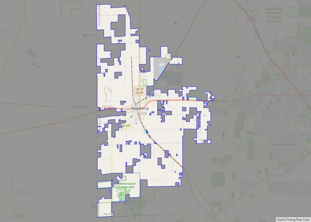
Newberry is a city located in the southwest corner of Alachua County, Florida, United States. The population was 7,342 as of the 2020 Census. Much of the city borders neighboring Gilchrist County, to the west. The current Mayor is Jordan Marlowe.
Developed as a mining and railroad town in the late 19th century, since the mid-20th century it has developed new commodity crops for agriculture. In 1984 Freddie Warmack was elected as its first black mayor, gaining 60% of the white vote. The city’s historic district is listed on the National Register of Historic Places. Since 2019, Newberry’s city commission has included a National Development Officer for the right-wing John Birch Society.
| Name: | Newberry city |
|---|---|
| LSAD Code: | 25 |
| LSAD Description: | city (suffix) |
| State: | Florida |
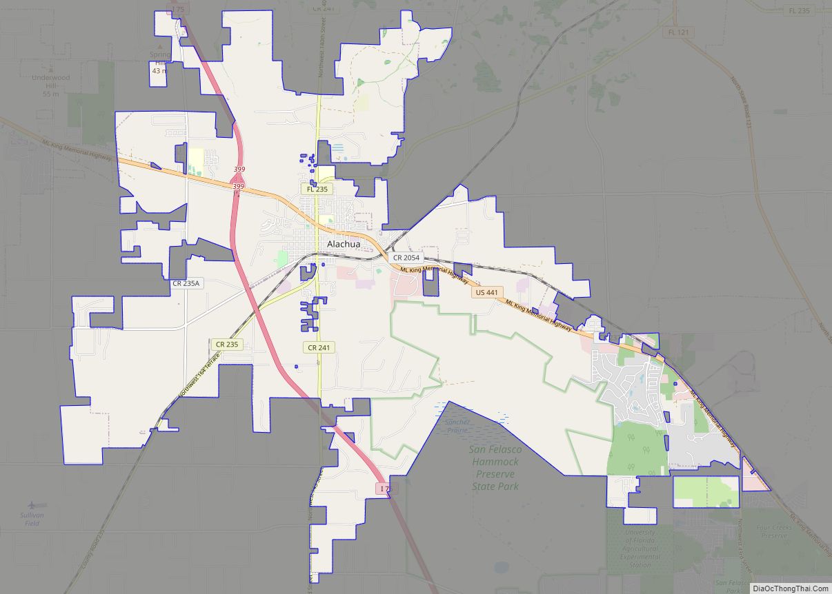
| County: | Alachua County |
| Elevation: | 75 ft (23 m) |
| Total Area: | 59.90 sq mi (155.15 km²) |
| Land Area: | 58.85 sq mi (152.42 km²) |
| Water Area: | 1.05 sq mi (2.73 km²) |
| Total Population: | 7,342 |
| Population Density: | 124.76/sq mi (48.17/km²) |
| ZIP code: | 32669 |
| Area code: | 352 |
| FIPS code: | 1248200 |
| GNISfeature ID: | 0307635 |
| Website: | www.newberryfl.gov |
Online Interactive Map
Click on ![]() to view map in "full screen" mode.
to view map in "full screen" mode.
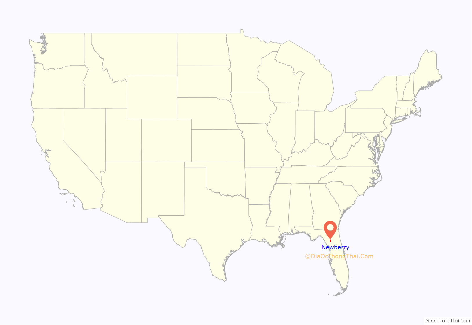
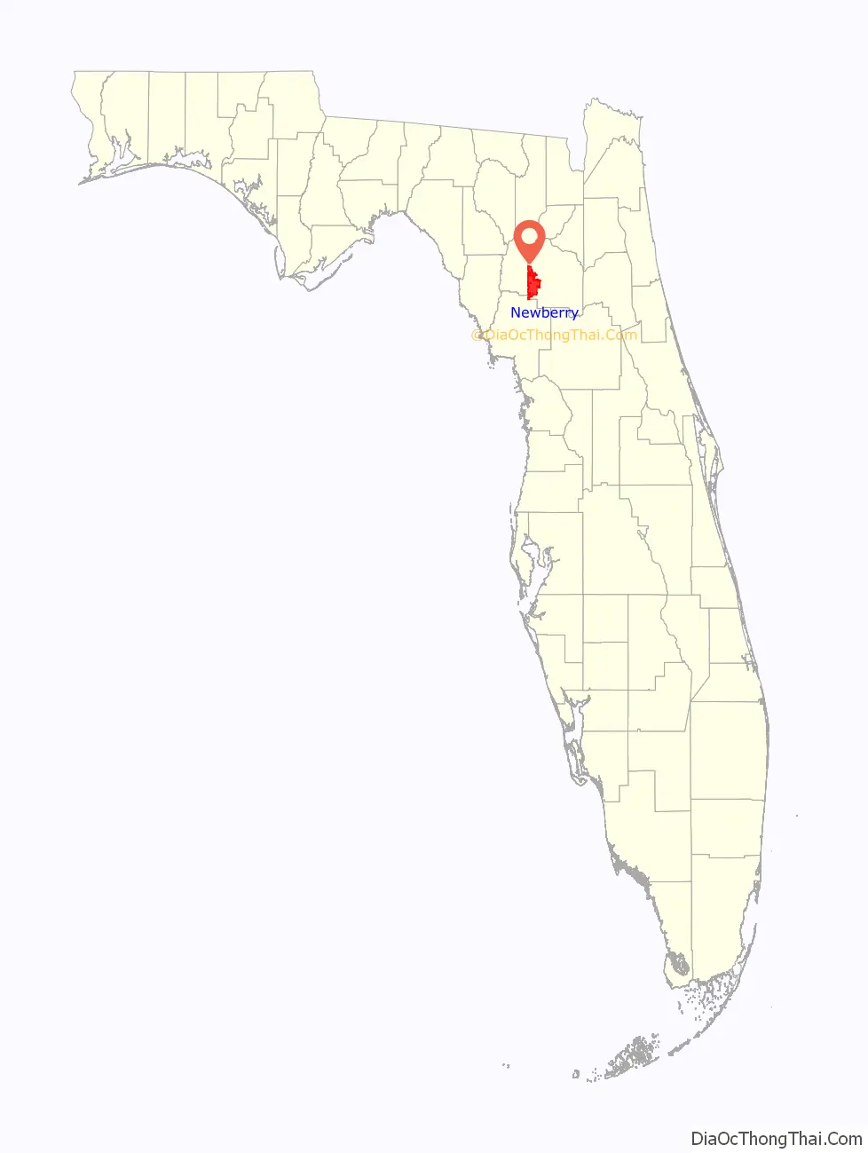
Newberry location map. Where is Newberry city?
History
Newberry developed as a mining town after phosphate was discovered in the western part of Alachua County in the 1880s. In 1893, the Savannah, Florida, and Western Railway was extended southward from High Springs to Newberry, leading to its development as a railroad town and trading center. A post office established in March 1894 was named Newton, but changed to Newberry in August of that year.
In this period, racial violence against blacks rose in Alachua County, where lynchings took place to enforce white supremacy. A total of 21 people, 19 of them black, were lynched in the county between 1891 and 1926.
By 1896 there were fourteen mines operating nearby. Newberry had hotels, boarding houses, and saloons to accommodate the area’s transient and sometimes unruly population. The demand for phosphate ended abruptly in 1914 when war was declared against Germany, the principal customer for Newberry’s phosphate. This caused a loss of jobs in the area, and social tensions rose.
The community turned from phosphate production to agriculture and new commodity crops. It was particularly successful in producing watermelons. The Watermelon Festival, first held in 1946 in the year after the end of World War II, continues to be celebrated as an annual event.
Race relations have improved in the town since the late 20th century. Residents elected Freddie Warmack as its first black mayor in 1984; he gained 60% of the white vote.
In 1987 Newberry’s Historic District was officially listed on the National Register of Historic Places.
Lynchings
On August 19, 1916, what are called the Newberry Six lynchings took place, when three black men, including a minister, and two black women were killed by a white mob in a mass hanging; another man was shot. They had allegedly helped the escape of another African-American man, Boisy Long. He was accused of hog stealing and shooting two men. Filmmaker Patricia Hilliard-Nunn, who is working on a documentary about African Americans in Alachua County, has studied these events. She believes that another three persons may have been lynched in association with the Boisy Long incident, either hanged, as were the Six, or shot to death.
Newberry Road Map
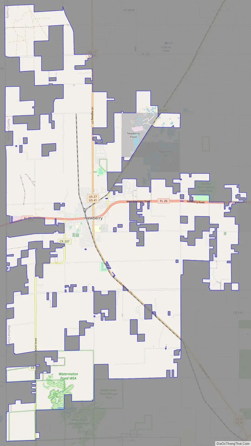
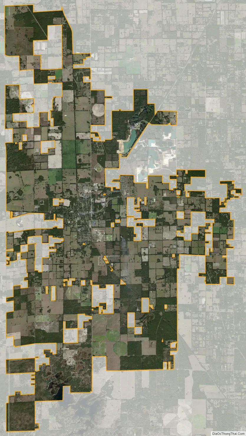
Newberry city Satellite Map
Geography
Newberry is located at 29°38′23″N 82°36′31″W / 29.639605°N 82.608715°W / 29.639605; -82.608715.
According to the United States Census Bureau, the city has a total area of 54.6 square miles (141.3 km), of which 53.5 square miles (138.6 km) is land and 1.0 square mile (2.7 km) (1.93%) is water.
See also
Map of Florida State and its subdivision:- Alachua
- Baker
- Bay
- Bradford
- Brevard
- Broward
- Calhoun
- Charlotte
- Citrus
- Clay
- Collier
- Columbia
- Desoto
- Dixie
- Duval
- Escambia
- Flagler
- Franklin
- Gadsden
- Gilchrist
- Glades
- Gulf
- Hamilton
- Hardee
- Hendry
- Hernando
- Highlands
- Hillsborough
- Holmes
- Indian River
- Jackson
- Jefferson
- Lafayette
- Lake
- Lee
- Leon
- Levy
- Liberty
- Madison
- Manatee
- Marion
- Martin
- Miami-Dade
- Monroe
- Nassau
- Okaloosa
- Okeechobee
- Orange
- Osceola
- Palm Beach
- Pasco
- Pinellas
- Polk
- Putnam
- Saint Johns
- Saint Lucie
- Santa Rosa
- Sarasota
- Seminole
- Sumter
- Suwannee
- Taylor
- Union
- Volusia
- Wakulla
- Walton
- Washington
- Alabama
- Alaska
- Arizona
- Arkansas
- California
- Colorado
- Connecticut
- Delaware
- District of Columbia
- Florida
- Georgia
- Hawaii
- Idaho
- Illinois
- Indiana
- Iowa
- Kansas
- Kentucky
- Louisiana
- Maine
- Maryland
- Massachusetts
- Michigan
- Minnesota
- Mississippi
- Missouri
- Montana
- Nebraska
- Nevada
- New Hampshire
- New Jersey
- New Mexico
- New York
- North Carolina
- North Dakota
- Ohio
- Oklahoma
- Oregon
- Pennsylvania
- Rhode Island
- South Carolina
- South Dakota
- Tennessee
- Texas
- Utah
- Vermont
- Virginia
- Washington
- West Virginia
- Wisconsin
- Wyoming