Map of University Park CDP

Map of University Park CDP, Florida

University Park CDP overview: Name: University Park CDP LSAD Code: 57 LSAD Description: CDP (suffix) State: Florida County: Miami-Dade County FIPS code: 1273287 Online Interactive Map University Park online map. Source: Basemap layers from Google Map, Open Street Map (OSM), Arcgisonline, Wmflabs. Boundary Data from Database of Global Administrative Areas. University Park location map. Where … Read more

Map of Union Park CDP

Map of Union Park CDP

Union Park is a census-designated place (CDP) in Orange County, Florida, United States. The population was 10,452 at the 2020 census. It is part of the Orlando–Kissimmee Metropolitan Statistical Area. The ZIP codes for Union Park are 32817 and 32825. The community is southwest of the University of Central Florida. Union Park CDP overview: Name: … Read more

Map of University CDP

Map of University CDP, Florida

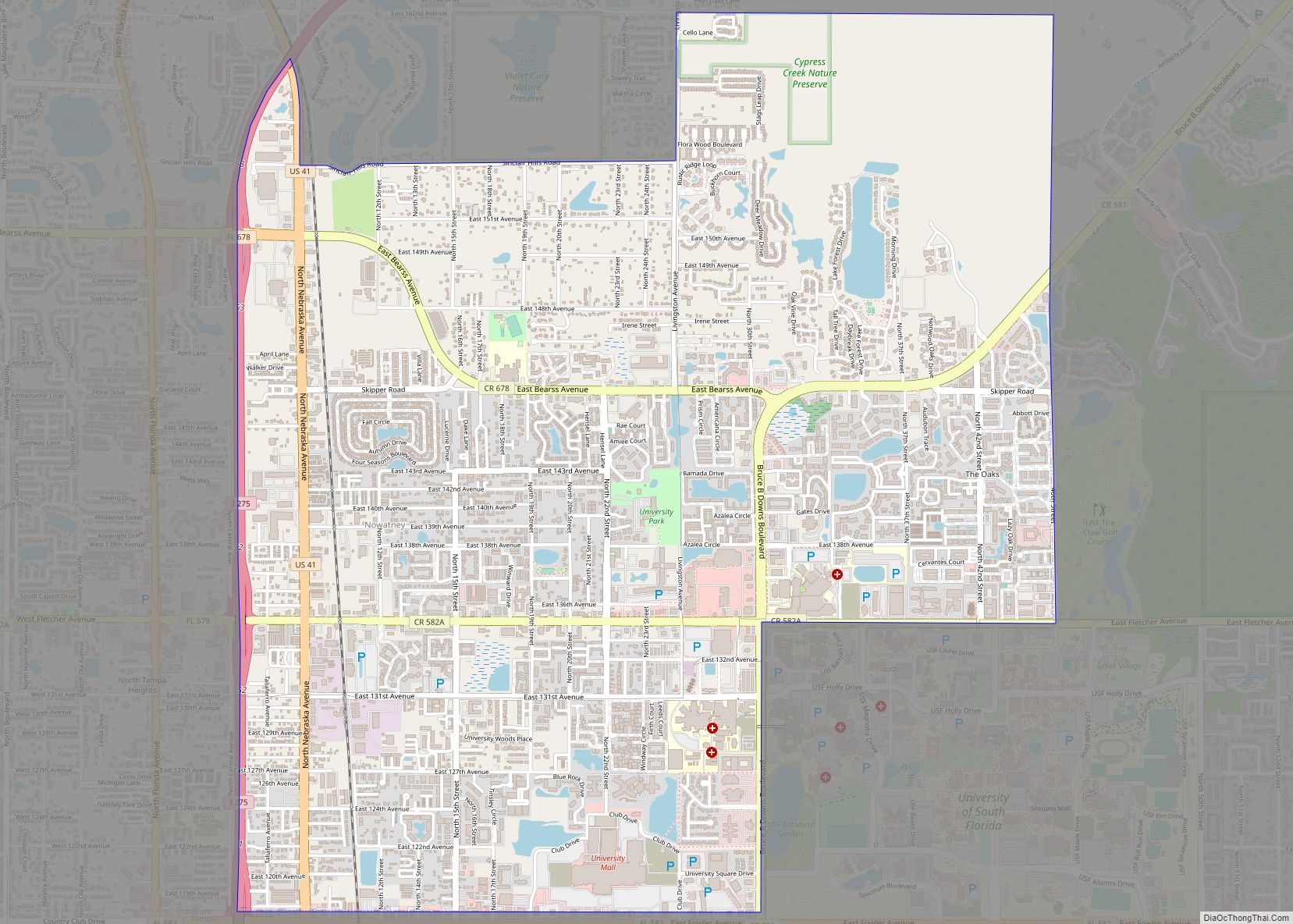
University is an unincorporated census-designated place in Hillsborough County, Florida, United States. The population was 41,163 at the 2010 census, up from 30,736 at the 2000 census. The University of South Florida is located just southeast of the community, within the Tampa city limits. The community is also known as “University West”, mainly due to … Read more

Map of Valrico CDP

Map of Valrico CDP

Valrico is a census-designated place (CDP) in Hillsborough County, Florida, United States. The population was 35,545 at the 2010 census, up from 6,582 at the 2000 census. Valrico CDP overview: Name: Valrico CDP LSAD Code: 57 LSAD Description: CDP (suffix) State: Florida County: Hillsborough County Elevation: 56 ft (17 m) Total Area: 14.22 sq mi (36.84 km²) Land Area: 13.81 sq mi … Read more

Map of Valparaiso city

Map of Valparaiso city, Florida

Valparaiso is a city in Okaloosa County, Florida, United States. As of the 2010 census, the city population was 5,036. According to the U.S. Census Bureau’s 2018 estimates, the city had a population of 5,195. It is part of the Fort Walton Beach–Crestview–Destin Metropolitan Statistical Area. Valparaiso city overview: Name: Valparaiso city LSAD Code: 25 … Read more

Map of Upper Grand Lagoon CDP

Map of Upper Grand Lagoon CDP

Upper Grand Lagoon is a census-designated place (CDP) in Bay County, Florida, United States. The population was 13,963 at the 2010 census. It is part of the Panama City–Lynn Haven–Panama City Beach Metropolitan Statistical Area. Upper Grand Lagoon CDP overview: Name: Upper Grand Lagoon CDP LSAD Code: 57 LSAD Description: CDP (suffix) State: Florida County: … Read more

Map of Venice city

Map of Venice city, Florida

Venice is a city in Sarasota County, Florida, United States. The city includes what locals call “Venice Island”, a portion of the mainland that is accessed via bridges over the artificially created Intracoastal Waterway. The city is located in Southwest Florida. As of the 2020 Census, the city had a population of 25,463. Venice is … Read more

Map of Venice Gardens CDP

Map of Venice Gardens CDP

Venice Gardens is a census-designated place (CDP) in Sarasota County, Florida, United States. The population was 7,104 at the 2010 census. It is part of the Bradenton–Sarasota–Venice Metropolitan Statistical Area. Venice Gardens CDP overview: Name: Venice Gardens CDP LSAD Code: 57 LSAD Description: CDP (suffix) State: Florida County: Sarasota County Elevation: 13 ft (4 m) Total Area: … Read more

Map of Vamo CDP

Map of Vamo CDP

Vamo is a census-designated place (CDP) in Sarasota County, Florida, United States. The population was 4,727 at the 2010 census. It is part of the Bradenton–Sarasota–Venice Metropolitan Statistical Area. Vamo CDP overview: Name: Vamo CDP LSAD Code: 57 LSAD Description: CDP (suffix) State: Florida County: Sarasota County Elevation: 13 ft (4 m) Total Area: 1.10 sq mi (2.84 km²) Land … Read more

Map of Vero Beach city

Map of Vero Beach city

Vero Beach is a city and the county seat of Indian River County, Florida, United States. After Sebastian, Vero Beach is the second most populous city in Indian River County. Abundant in beaches and wildlife, Vero Beach is located on Florida’s Treasure Coast. It is thirty-four miles south of Melbourne. According to the U.S. Census … Read more

Map of Vero Beach South CDP

Map of Vero Beach South CDP

Vero Beach South is a census-designated place (CDP) in Indian River County, Florida, United States. The population was 23,092 at the 2010 census. It is part of the Sebastian–Vero Beach Metropolitan Statistical Area. Vero Beach South CDP overview: Name: Vero Beach South CDP LSAD Code: 57 LSAD Description: CDP (suffix) State: Florida County: Indian River … Read more

Map of Vernon city, Florida

Map of Vernon city, Florida

Vernon is a city in Washington County, Florida. The population was 687 at the 2010 census; according to the U.S. Census Bureau’s 2018 estimates, the city had a population of 690. Vernon is named for George Washington’s Virginia home, Mount Vernon. The pioneer town was the site of a major Indian settlement. Vernon held the … Read more