Map of Wekiwa Springs CDP

Map of Wekiwa Springs CDP

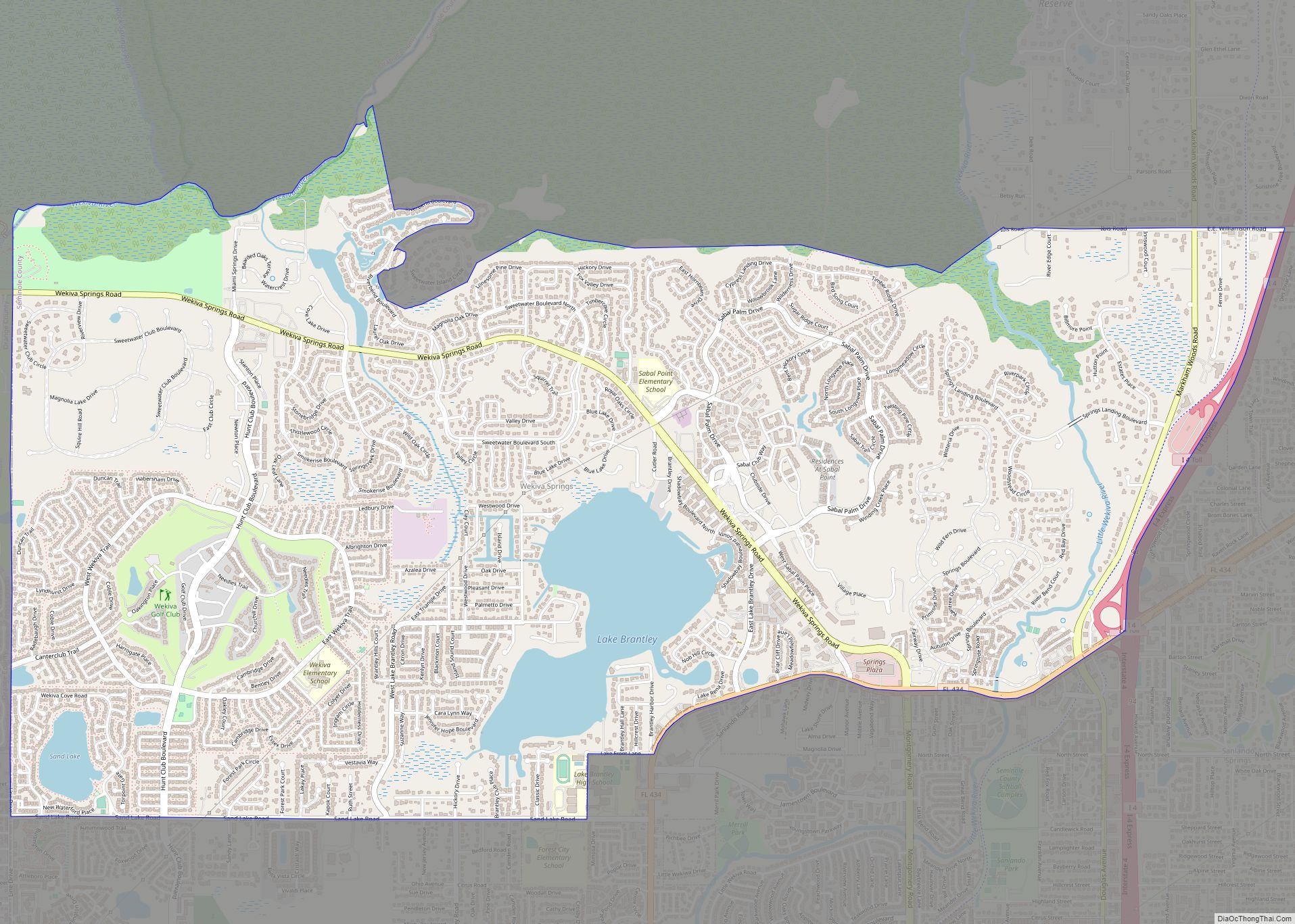
Wekiwa Springs is a census-designated place and an unincorporated area in Seminole County, Florida, United States. The population was 23,169 at the 2000 census. It is part of the Orlando–Kissimmee–Sanford, Florida Metropolitan Statistical Area. Wekiwa Springs CDP overview: Name: Wekiwa Springs CDP LSAD Code: 57 LSAD Description: CDP (suffix) State: Florida County: Seminole County Elevation: … Read more

Map of Weeki Wachee city

Map of Weeki Wachee city

Weeki Wachee city overview: Name: Weeki Wachee city LSAD Code: 25 LSAD Description: city (suffix) State: Florida County: Hernando County FIPS code: 1275625 Online Interactive Map Weeki Wachee online map. Source: Basemap layers from Google Map, Open Street Map (OSM), Arcgisonline, Wmflabs. Boundary Data from Database of Global Administrative Areas. Weeki Wachee location map. Where … Read more

Map of Weeki Wachee Gardens CDP

Map of Weeki Wachee Gardens CDP

Weeki Wachee Gardens is a census-designated place (CDP) in Hernando County, Florida, United States. The population was 1,146 at the 2010 census. Weeki Wachee Gardens CDP overview: Name: Weeki Wachee Gardens CDP LSAD Code: 57 LSAD Description: CDP (suffix) State: Florida County: Hernando County Elevation: 3 ft (1 m) Total Area: 1.41 sq mi (3.64 km²) Land Area: 1.25 sq mi (3.25 km²) … Read more

Map of Wesley Chapel CDP

Map of Wesley Chapel CDP, Florida

Wesley Chapel is a census-designated place in Pasco County, Florida, United States. Wesley Chapel is a suburb in the Tampa Bay Area. Wesley Chapel originated in the mid-1800s as a cohesive community of settlers who demonstrated a uniquely rural authenticity and independence of spirit. Evidence of Native American presence in the area has been documented … Read more

Map of Wellington village, Florida

Map of Wellington village, Florida

Wellington is a village just west of West Palm Beach in Palm Beach County and 66 mi (106 km) north of Miami. As of 2019, the city had a population of 65,398 according to U.S. Census Bureau estimates, making it the most populous village in the state. It is the fifth largest municipality in Palm Beach County … Read more

Map of Welaka town

Map of Welaka town

Welaka is a town situated on the St. Johns River in Putnam County, Florida, United States. The population was 701 as of the 2010 census. According to the U.S. Census Bureau’s 2018 estimates, the town had a population of 712. The town is part of the Palatka Micropolitan Statistical Area. Welaka town overview: Name: Welaka … Read more

Map of West Lealman CDP

Map of West Lealman CDP

West Lealman is a census-designated place (CDP) in Pinellas County, Florida, United States. The population was 15,651 at the 2010 census. Prior to 2010, West Lealman was part of a larger CDP named West and East Lealman. West Lealman CDP overview: Name: West Lealman CDP LSAD Code: 57 LSAD Description: CDP (suffix) State: Florida County: … Read more

Map of West DeLand CDP

Map of West DeLand CDP

West DeLand is a census-designated place (CDP) in Volusia County, Florida, United States. The population was 3,908 at the 2020 census. West DeLand CDP overview: Name: West DeLand CDP LSAD Code: 57 LSAD Description: CDP (suffix) State: Florida County: Volusia County Elevation: 49 ft (15 m) Total Area: 2.15 sq mi (5.57 km²) Land Area: 2.15 sq mi (5.57 km²) Water Area: 0.00 sq mi … Read more

Map of West Bradenton CDP

Map of West Bradenton CDP

West Bradenton is an unincorporated area and census-designated place (CDP) in Manatee County, Florida, United States. The population was 4,247 at the 2020 census. It is part of the Bradenton–Sarasota–Venice Metropolitan Statistical Area. West Bradenton CDP overview: Name: West Bradenton CDP LSAD Code: 57 LSAD Description: CDP (suffix) State: Florida County: Manatee County Elevation: 16 ft … Read more

Map of West Miami city

Map of West Miami city

West Miami is a city in Miami-Dade County, Florida, United States. The population was 7,233 at the 2020 census, up from 5,965 in 2010. West Miami city overview: Name: West Miami city LSAD Code: 25 LSAD Description: city (suffix) State: Florida County: Miami-Dade County Incorporated: April 7, 1947 Elevation: 9 ft (3 m) Total Area: 0.71 sq mi (1.84 km²) … Read more

Map of West Melbourne city

Map of West Melbourne city

West Melbourne is a city in Brevard County, Florida, United States. It was created in 1959 to stop the area from being annexed into the city of Melbourne. As of the 2010 United States Census, the population was 18,355, reflecting an increase of 8,531 from the 9,824 counted in the 2000 Census. In 1970, the … Read more

Map of West Little River CDP

Map of West Little River CDP

West Little River is a census-designated place (CDP) in Miami-Dade County, Florida, United States. The population was 34,128 at the 2020 census. Most of West Little River was originally a neighborhood of the city of Miami when it was annexed into the city in 1925. With the arrival of the Great Depression, Miami gave up … Read more