Map of Lewisville city, Idaho

Map of Lewisville city, Idaho

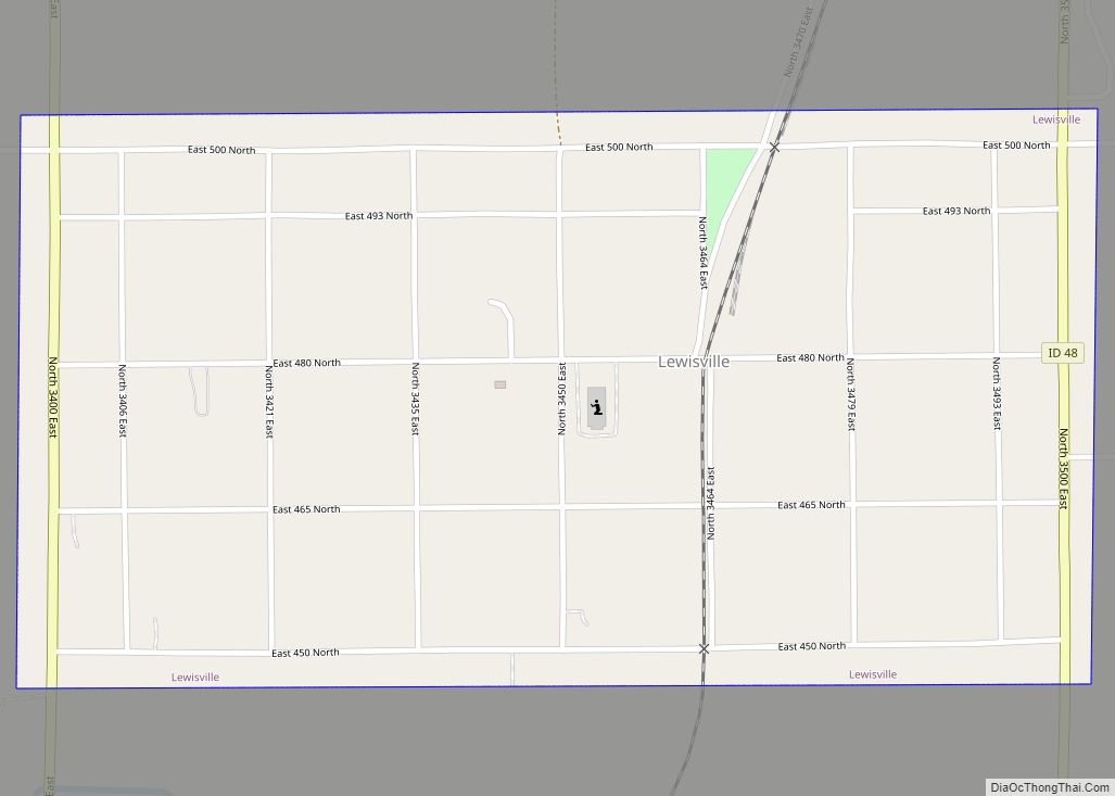
Lewisville is a city in Jefferson County, Idaho, United States. The population was 458 at the 2010 census. Lewisville is part of the Idaho Falls Metropolitan Statistical Area. Lewisville city overview: Name: Lewisville city LSAD Code: 25 LSAD Description: city (suffix) State: Idaho County: Jefferson County Elevation: 4,800 ft (1,463 m) Total Area: 0.60 sq mi (1.56 km²) Land Area: … Read more

Map of Malad City city

Map of Malad City

Malad City (also commonly known as Malad) is the only city in Oneida County, Idaho, United States. Its population was 2,095 at the 2010 census, down from 2,158 in 2000. The city is named after the nearby Malad River, the name being French for “sickly”. Malad City is located along Interstate 15 on the east … Read more

Map of Mackay city

Map of Mackay city

Mackay /mæˈkiː/ (listen)) is a town in Custer County, Idaho, United States. The population was 439 at the 2020 census. The town is pronounced “Mackie” with the accent on the first syllable. Mackay city overview: Name: Mackay city LSAD Code: 25 LSAD Description: city (suffix) State: Idaho County: Custer County Elevation: 5,906 ft (1,800 m) Total Area: … Read more

Map of Lowman CDP

Map of Lowman CDP

Lowman is a small unincorporated rural census-designated place in the western United States, located in Boise County, Idaho. It is nestled along the north bank of the South Fork of the Payette River in the central part of the state, at an elevation of 3,800 feet (1,160 m) above sea level. As of the 2010 census, … Read more

Map of McCall city

Map of McCall city

McCall is a resort town on the western edge of Valley County, Idaho, United States. Named after its founder, Tom McCall, it is situated on the southern shore of Payette Lake, near the center of the Payette National Forest. The population was 2,991 as of the 2010 census, up from 2,084 in 2000. Originally a … Read more

Map of Marsing city

Map of Marsing city

Marsing is a city in Owyhee County, Idaho, United States. The population was 1,031 at the time of the 2010 census. It is part of the Boise metropolitan area. Marsing city overview: Name: Marsing city LSAD Code: 25 LSAD Description: city (suffix) State: Idaho County: Owyhee County Elevation: 2,300 ft (700 m) Total Area: 0.69 sq mi (1.79 km²) Land … Read more

Map of Malta city

Map of Malta city, Idaho

Malta is a village in Cassia County, Idaho, United States. The population was 193 at the 2010 census. It is part of the Burley, Idaho Micropolitan Statistical Area. Malta city overview: Name: Malta city LSAD Code: 25 LSAD Description: city (suffix) State: Idaho County: Cassia County Elevation: 4,518 ft (1,377 m) Total Area: 1.38 sq mi (3.58 km²) Land Area: … Read more

Map of Menan city

Map of Menan city

Menan is a city in Jefferson County, Idaho, United States. It is part of the Idaho Falls, Idaho Metropolitan Statistical Area. The population was 741 at the 2010 census. Menan city overview: Name: Menan city LSAD Code: 25 LSAD Description: city (suffix) State: Idaho County: Jefferson County Elevation: 4,806 ft (1,465 m) Total Area: 1.03 sq mi (2.67 km²) Land … Read more

Map of Melba city

Map of Melba city

Melba is a city in Canyon County, Idaho. The population was 513 at the time of the 2010 census, up from 439 in 2000. It is part of the Boise metropolitan area. Melba city overview: Name: Melba city LSAD Code: 25 LSAD Description: city (suffix) State: Idaho County: Canyon County Elevation: 2,667 ft (813 m) Total Area: … Read more

Map of McCammon city

Map of McCammon city

McCammon is a city in Bannock County, Idaho, United States. It is part of the Pocatello, Idaho Metropolitan Statistical Area’. The population was 809 at the 2010 census. In 1892, McCammon became the junction point between the Oregon Short Line Railroad and Utah and Northern Railway, and city gained the nickname Junction City. McCammon city … Read more

Map of Minidoka city

Map of Minidoka city

Minidoka is a city in Minidoka County, Idaho, United States. The population was 86 at the 2020 census, down from 112 in 2010. It is part of the Burley, Idaho Micropolitan Statistical Area. Over two thirds of the population of Minidoka identify as Hispanic or Latino. Minidoka city overview: Name: Minidoka city LSAD Code: 25 … Read more

Map of Midvale city

Map of Midvale city, Idaho

Midvale is a city in Washington County, Idaho, United States. The population was 171 at the 2010 census, rising to 193 as of 2020. Midvale city overview: Name: Midvale city LSAD Code: 25 LSAD Description: city (suffix) State: Idaho County: Washington County Elevation: 2,543 ft (775 m) Total Area: 2.64 sq mi (6.84 km²) Land Area: 2.57 sq mi (6.66 km²) Water Area: … Read more