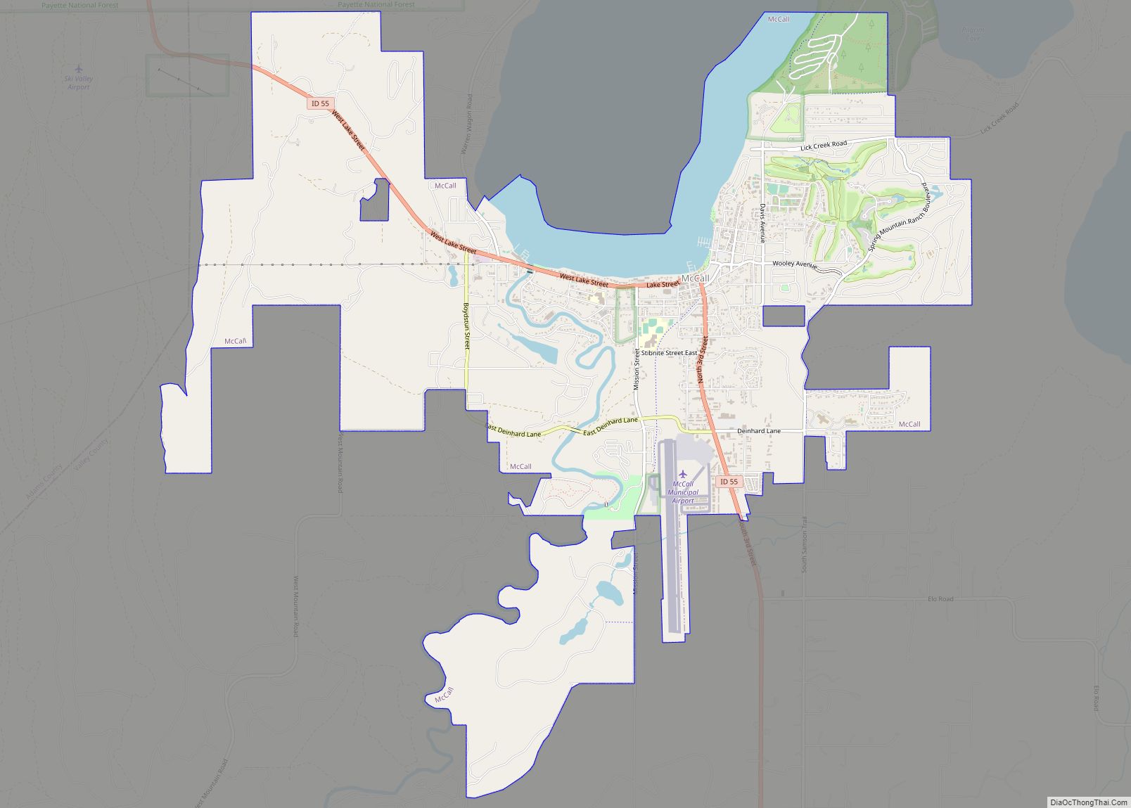
McCall is a resort town on the western edge of Valley County, Idaho, United States. Named after its founder, Tom McCall, it is situated on the southern shore of Payette Lake, near the center of the Payette National Forest. The population was 2,991 as of the 2010 census, up from 2,084 in 2000.
Originally a logging community whose last sawmill closed in 1977, McCall is now an all-season tourist destination for outdoor recreation. The resort town is known for its Winter Carnival, extended winters, and one of the highest average snowfalls in the state.
| Name: | McCall city |
|---|---|
| LSAD Code: | 25 |
| LSAD Description: | city (suffix) |
| State: | Idaho |
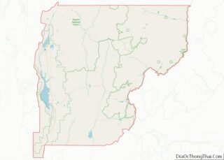
| County: | Valley County |
| Incorporated: | 19 July 1911 (town) |
| Elevation: | 5,013 ft (1,528 m) |
| Total Area: | 9.92 sq mi (25.7 km²) |
| Land Area: | 9.06 sq mi (23.5 km²) |
| Water Area: | 0.86 sq mi (2.2 km²) |
| Total Population: | 2,991 |
| Population Density: | 396.98/sq mi (153.27/km²) |
| ZIP code: | 83635, 83638 |
| Area code: | 208, 986 |
| FIPS code: | 1648790 |
| GNISfeature ID: | 0396862 |
| Website: | www.mccall.id.us |
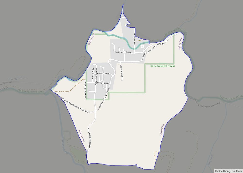
Online Interactive Map
Click on ![]() to view map in "full screen" mode.
to view map in "full screen" mode.
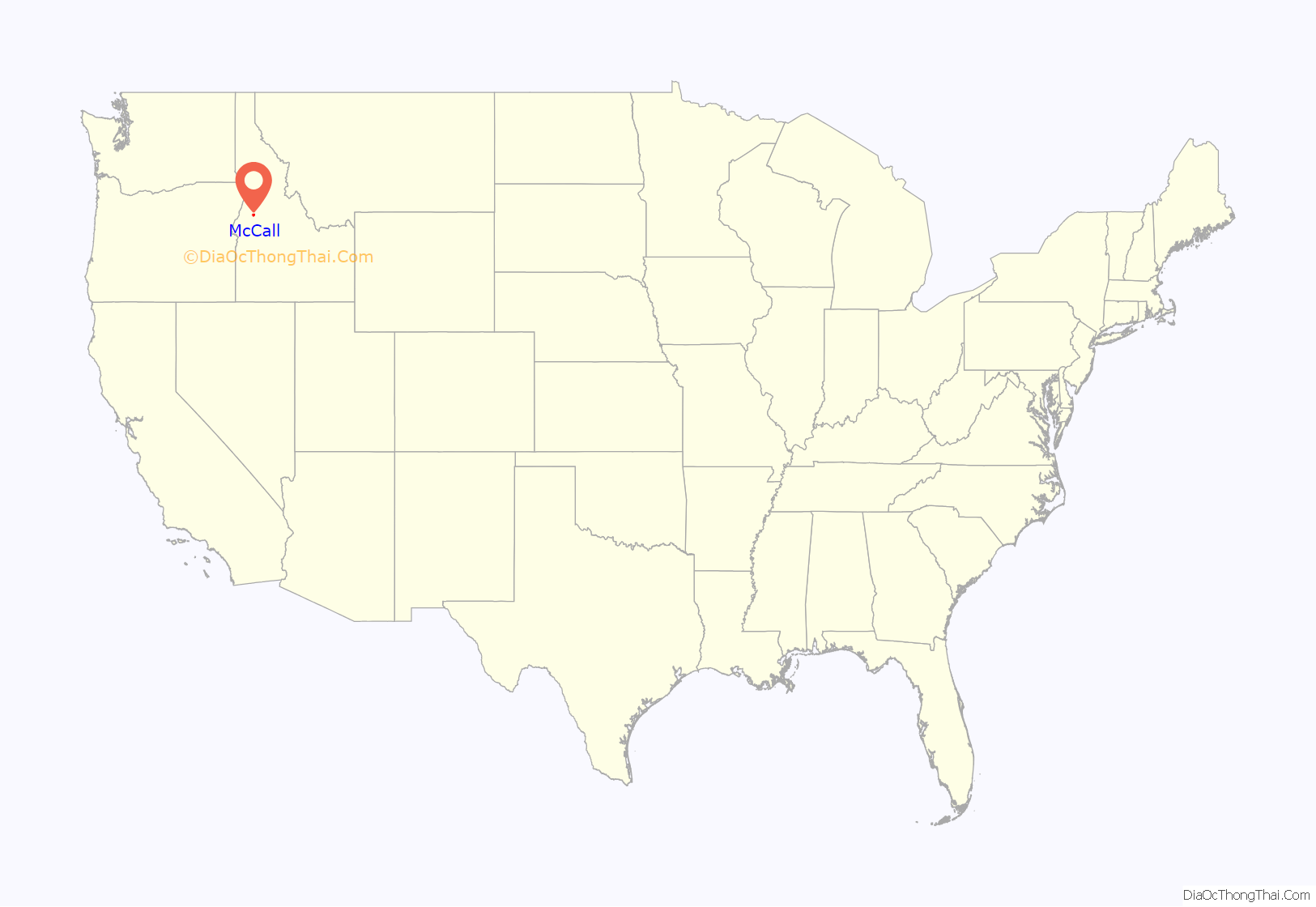
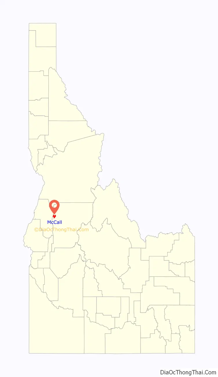
McCall location map. Where is McCall city?
History
Native Americans were the first inhabitants of the McCall area. Three tribes, the Tukudika (a sub-band of the Shoshone known as the “Sheepeaters”), the Shoshone, and the Nez Perce inhabited the land primarily in the summer and migrated during the harsh winter months.
In the early 19th century, mountain men including the nomadic French Canadian fur trapper François Payette, Jim Bridger, Peter Skene Ogden, and Jedediah Smith passed through the area.
During the 1860s, miners temporarily named the settlement “Lake City”, but only alluvial gold was discovered, so the temporary establishment was abandoned as most mining activity moved north to the town of Warren.
The settlement of McCall was established by Thomas and Louisa McCall in 1889. For a cabin and assumed rights to the 160 acres (0.65 km) of land, they traded a team of horses with Sam Dever, who held the squatter rights. Tom, his wife, four sons and a daughter lived in the cabin located on the shore of the lake, near present-day Hotel McCall. He established a school, hotel, saloon, and post office, and named himself postmaster. McCall purchased a sawmill from the Warren Dredging company and later sold it to the Hoff & Brown Lumber Company, which would become a major employer until its closure in 1977.
During this time Anneas “Jews Harp Jack” Wyatte provided the first recreational sailboat rides around the lake for tourists and advertised in Boise’s Idaho Statesman a “30-foot sailing yacht for the use of parties who might visit the lake”. The Statesman referred to McCall as a “pleasure resort.”
Tourism continued in the early 20th century. In June 1902, the Boydstun Hotel in nearby Lardo opened as a “place to stay and camp on Payette Lake”. In 1906, Charlie Nelson opened a tented camping area known as Sylvan Beach Resort along the west side of Payette Lake. In 1907, Lardo Inn opened for business. The arrival of the Oregon Short Line Railroad (a subsidiary of the Union Pacific Railroad) in 1914 secured McCall as a viable community and tourist destination. The Town of McCall was officially incorporated on 19 July 1911.
The town’s annual winter carnival started in 1923–24. Reports vary between hundreds to thousands of tourists visiting the festivities.
The beauty of McCall and Payette Lake drew attention from Hollywood in 1938 when it was selected as the filming location for the Academy Award-nominated Northwest Passage, starring Spencer Tracy, Robert Young, and Walter Brennan. The film, released in 1940, was set during the French and Indian War of 1755–63 in eastern North America, Idaho’s forests substituting for the woods of New England and the Upper Midwest.
In 1943, the U.S. Forest Service opened the McCall smokejumper base, one of eight smokejumper training bases in the nation. The site includes a smokejumper training unit, paraloft, dispatch office, and the McCall air tanker base at the airport.
After World War II, a consortium of businessmen and doctors from Lewiston, 150 miles (240 km) to the north, decided that McCall and the lake were an ideal recreation site and thus the town was transformed from lumber to tourism. The iconic Shore Lodge opened on 3 July 1948, at Shellworth Beach on Payette Lake. The lodge became McCall’s centerpiece for the next 51 years. Shore Lodge management and shareholders intentionally created a resort-style lodge that was a cozy and intimate place for locals and tourists, contrasting with the glamor and glitz of the other famous Idaho lodge in Sun Valley. It was turned into a private club in 1999, then it re-opened to the public in 2008. One of Shore Lodge’s first summer employees was University of Idaho student John Ascuaga of Notus, who worked as a bellhop learning the business from the bottom up and was to go on to found the Nugget hotel, convention center, and casino in Sparks, Nevada, one of the largest and most successful in the Reno, Nevada area.
In 1965, a 1,000 acres (4.0 km) peninsula 2 miles (3 km) outside of McCall became Ponderosa State Park, home to large old-growth trees.
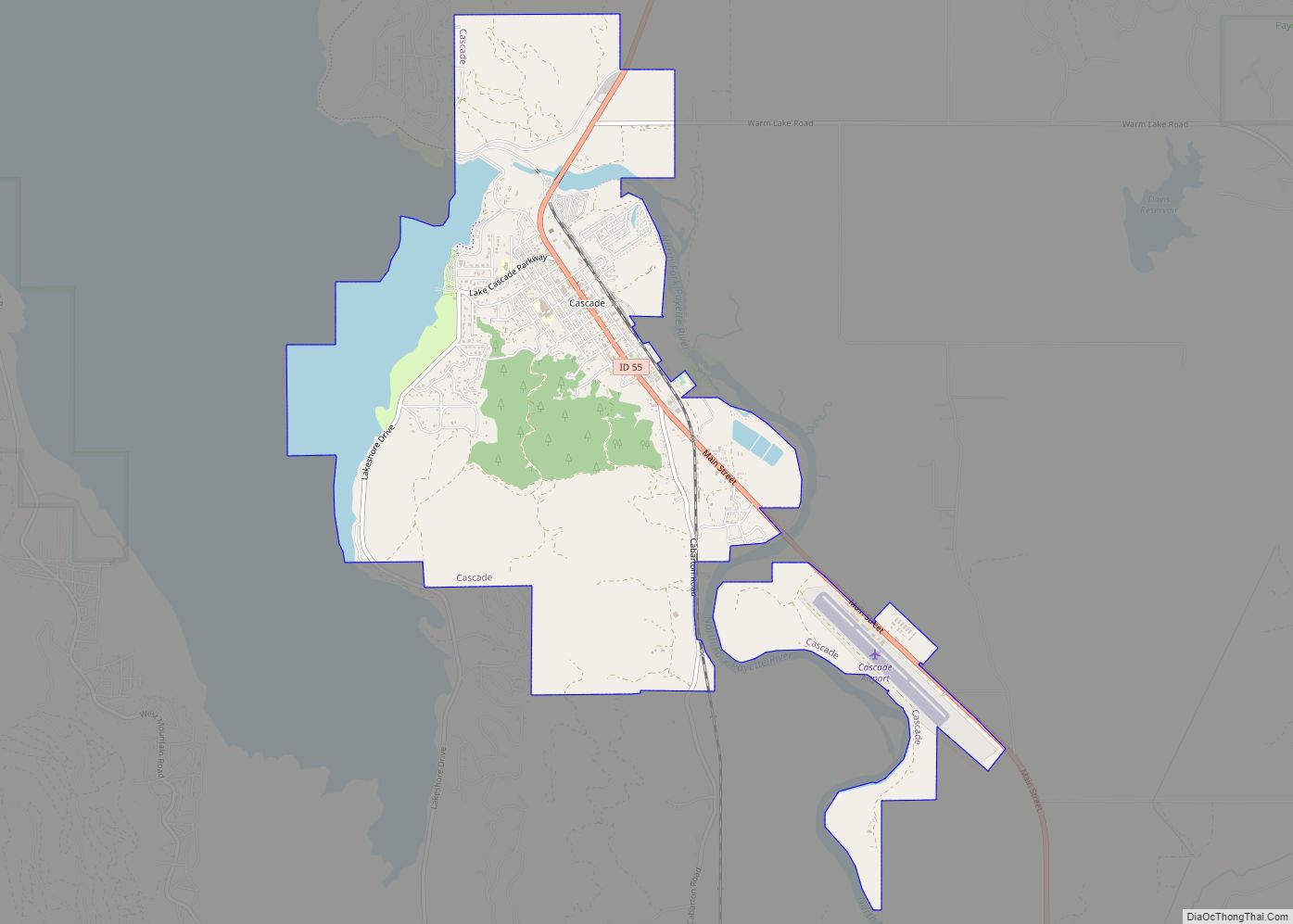
McCall Road Map
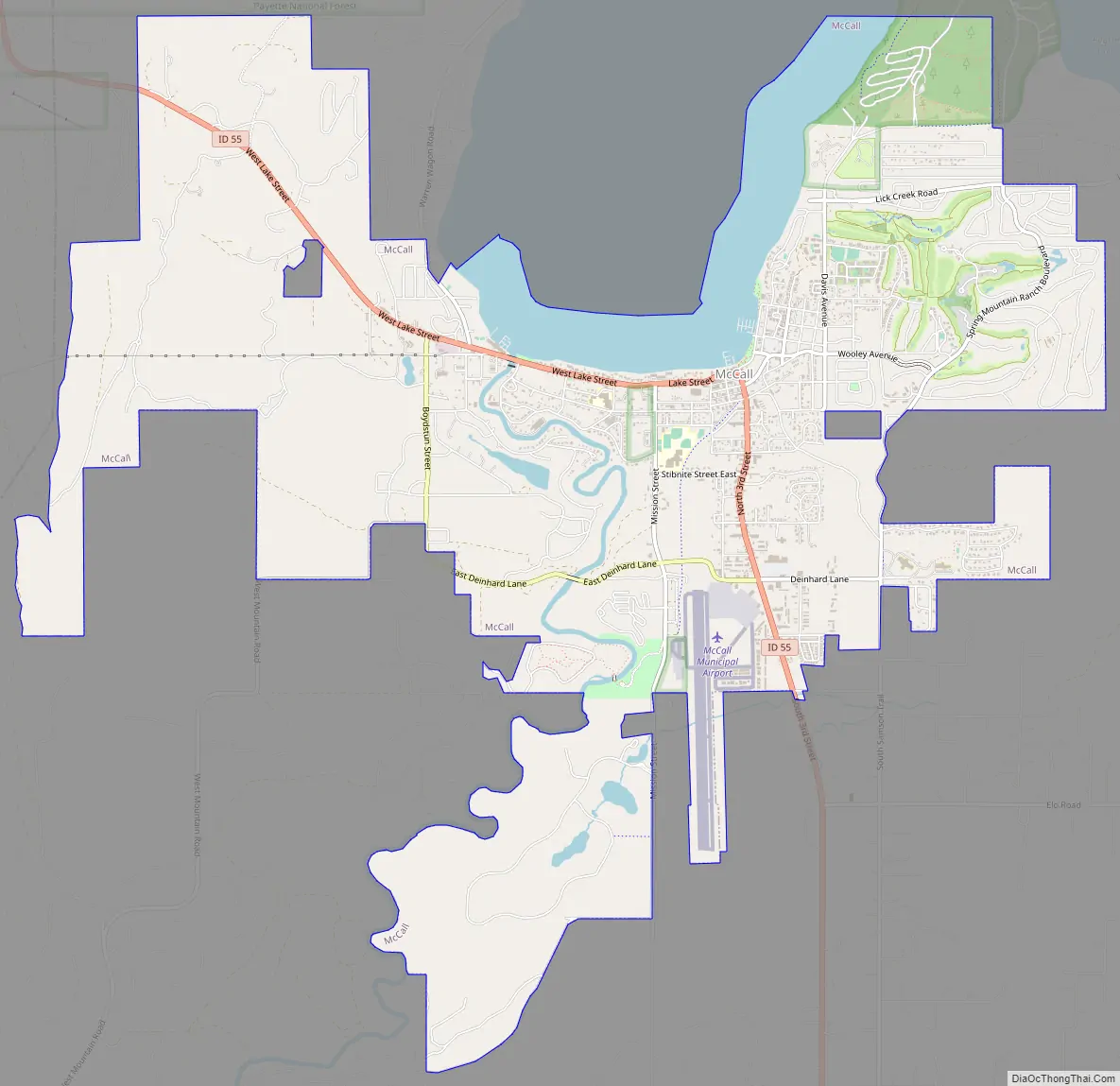
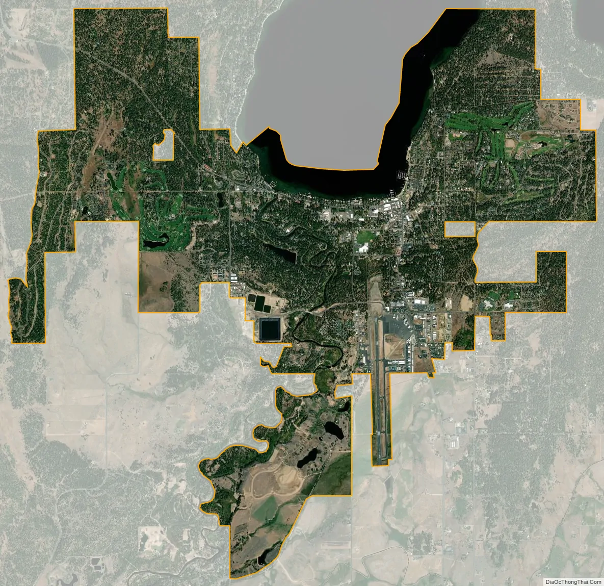
McCall city Satellite Map
Geography
McCall is located at 44°54′39″N 116°6′11″W / 44.91083°N 116.10306°W / 44.91083; -116.10306 (44.910906, -116.103087), at an elevation of 5,013 feet (1,528 m) above sea level.
According to the United States Census Bureau, the city has a total area of 9.924 square miles (25.70 km), of which, 9.061 square miles (23.47 km) is land and 0.863 square miles (2.24 km) is water.
See also
Map of Idaho State and its subdivision:- Ada
- Adams
- Bannock
- Bear Lake
- Benewah
- Bingham
- Blaine
- Boise
- Bonner
- Bonneville
- Boundary
- Butte
- Camas
- Canyon
- Caribou
- Cassia
- Clark
- Clearwater
- Custer
- Elmore
- Franklin
- Fremont
- Gem
- Gooding
- Idaho
- Jefferson
- Jerome
- Kootenai
- Latah
- Lemhi
- Lewis
- Lincoln
- Madison
- Minidoka
- Nez Perce
- Oneida
- Owyhee
- Payette
- Power
- Shoshone
- Teton
- Twin Falls
- Valley
- Washington
- Alabama
- Alaska
- Arizona
- Arkansas
- California
- Colorado
- Connecticut
- Delaware
- District of Columbia
- Florida
- Georgia
- Hawaii
- Idaho
- Illinois
- Indiana
- Iowa
- Kansas
- Kentucky
- Louisiana
- Maine
- Maryland
- Massachusetts
- Michigan
- Minnesota
- Mississippi
- Missouri
- Montana
- Nebraska
- Nevada
- New Hampshire
- New Jersey
- New Mexico
- New York
- North Carolina
- North Dakota
- Ohio
- Oklahoma
- Oregon
- Pennsylvania
- Rhode Island
- South Carolina
- South Dakota
- Tennessee
- Texas
- Utah
- Vermont
- Virginia
- Washington
- West Virginia
- Wisconsin
- Wyoming