Map of Westville village, Illinois

Map of Westville village, Illinois

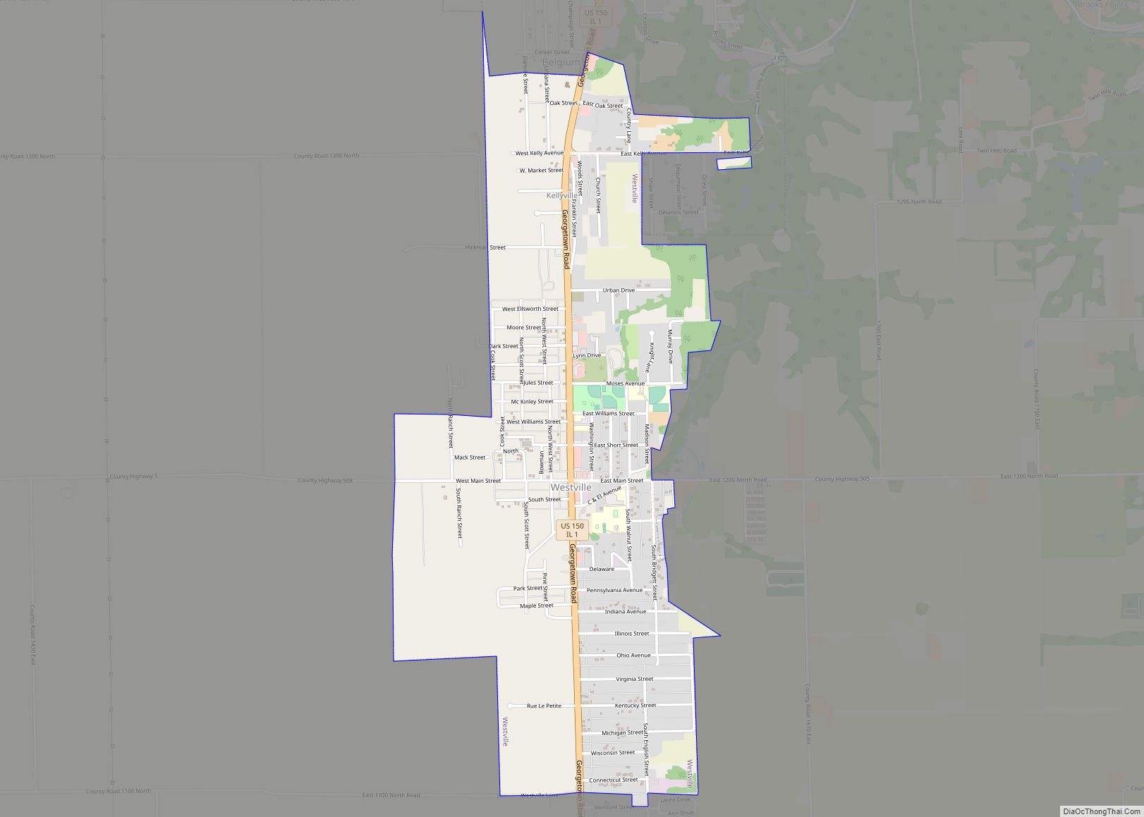
Westville is a village in Georgetown Township, Vermilion County, Illinois, United States. It is part of the Danville, Illinois Metropolitan Statistical Area. The population was 3,202 at the 2010 census, and 2,990 in 2018. Westville village overview: Name: Westville village LSAD Code: 47 LSAD Description: village (suffix) State: Illinois County: Vermilion County Elevation: 673 ft (205 m) … Read more

Map of Westmont village, Illinois

Map of Westmont village, Illinois

Westmont is a village in DuPage County, Illinois, United States. Located approximately 18 miles (29 km) west of the Chicago Loop in the southeastern portion of DuPage County, Westmont is a community of 5.03 square miles in area with a 2020 population of 24,429. Westmont village overview: Name: Westmont village LSAD Code: 47 LSAD Description: village … Read more

Map of White City village, Illinois

Map of White City village, Illinois

White City is a village in Macoupin County, Illinois, United States. The population was 212 as of the 2020 census. White City village overview: Name: White City village LSAD Code: 47 LSAD Description: village (suffix) State: Illinois County: Macoupin County Elevation: 652 ft (199 m) Total Area: 1.22 sq mi (3.15 km²) Land Area: 1.21 sq mi (3.14 km²) Water Area: 0.00 sq mi (0.01 km²) … Read more

Map of Wheeling city

Map of Wheeling village, Illinois

Wheeling is a village in Cook and Lake counties in the U.S. state of Illinois. A suburb of Chicago, it is primarily in Cook County, approximately 23 mi (37 km) northwest of downtown Chicago. Per the 2020 census, the population was 39,137. Wheeling is named for Wheeling, West Virginia. Wheeling village overview: Name: Wheeling village LSAD Code: … Read more

Map of Wheeler village

Map of Wheeler village, Illinois

Wheeler is a village in Jasper County, Illinois, United States. The population was 147 at the 2010 census. Wheeler village overview: Name: Wheeler village LSAD Code: 47 LSAD Description: village (suffix) State: Illinois County: Jasper County Elevation: 577 ft (176 m) Total Area: 0.58 sq mi (1.49 km²) Land Area: 0.58 sq mi (1.49 km²) Water Area: 0.00 sq mi (0.00 km²) Total Population: 96 Population … Read more

Map of White Hall city, Illinois

Map of White Hall city, Illinois

White Hall is a city in Greene County, Illinois, United States. The population was 2,520 at the 2010 census. White Hall city overview: Name: White Hall city LSAD Code: 25 LSAD Description: city (suffix) State: Illinois County: Greene County Elevation: 574 ft (175 m) Total Area: 2.63 sq mi (6.82 km²) Land Area: 2.58 sq mi (6.68 km²) Water Area: 0.06 sq mi (0.15 km²) Total … Read more

Map of Whiteash CDP

Map of Whiteash CDP

Whiteash CDP overview: Name: Whiteash CDP LSAD Code: 57 LSAD Description: CDP (suffix) State: Illinois County: Williamson County FIPS code: 1781165 Online Interactive Map Whiteash online map. Source: Basemap layers from Google Map, Open Street Map (OSM), Arcgisonline, Wmflabs. Boundary Data from Database of Global Administrative Areas. Whiteash location map. Where is Whiteash CDP? Whiteash … Read more

Map of White Heath CDP

Map of White Heath CDP

White Heath is an unincorporated census-designated place in Piatt County, Illinois, United States. As of the 2010 census, its population was 290. White Heath CDP overview: Name: White Heath CDP LSAD Code: 57 LSAD Description: CDP (suffix) State: Illinois County: Piatt County Elevation: 702 ft (214 m) Total Area: 0.347 sq mi (0.90 km²) Land Area: 0.347 sq mi (0.90 km²) Water Area: … Read more

Map of Williamsville village

Map of Williamsville village, Illinois

Williamsville is a village in Sangamon County, Illinois, United States. The population was 1,476 at the 2010 census, and 1,491 at a 2018 estimate. It is part of the Springfield, Illinois Metropolitan Statistical Area. Williamsville village overview: Name: Williamsville village LSAD Code: 47 LSAD Description: village (suffix) State: Illinois County: Sangamon County Elevation: 598 ft (182 m) … Read more

Map of Williamson village, Illinois

Map of Williamson village, Illinois

Williamson is a village in Madison County, Illinois, United States. The population was 183 at the 2020 census, down from 230 in 2010. Williamson village overview: Name: Williamson village LSAD Code: 47 LSAD Description: village (suffix) State: Illinois County: Madison County Elevation: 604 ft (184 m) Total Area: 1.22 sq mi (3.16 km²) Land Area: 1.17 sq mi (3.03 km²) Water Area: 0.05 sq mi … Read more

Map of Williamsfield village

Map of Williamsfield village

Williamsfield is a village in Knox County, Illinois, United States. The population was 578 at the 2010 census. It is part of the Galesburg Micropolitan Statistical Area. Williamsfield village overview: Name: Williamsfield village LSAD Code: 47 LSAD Description: village (suffix) State: Illinois County: Knox County Elevation: 702 ft (214 m) Total Area: 1.23 sq mi (3.19 km²) Land Area: 1.23 sq mi … Read more

Map of Willow Springs village

Map of Willow Springs village, Illinois

Willow Springs is a village in Cook County, Illinois, with a small portion in DuPage County. The village was founded in 1892, and was named for the springs along the Des Plaines River. Per the 2020 census, the population was 5,857. Willow Springs village overview: Name: Willow Springs village LSAD Code: 47 LSAD Description: village … Read more