Map of Forest Park village, Illinois
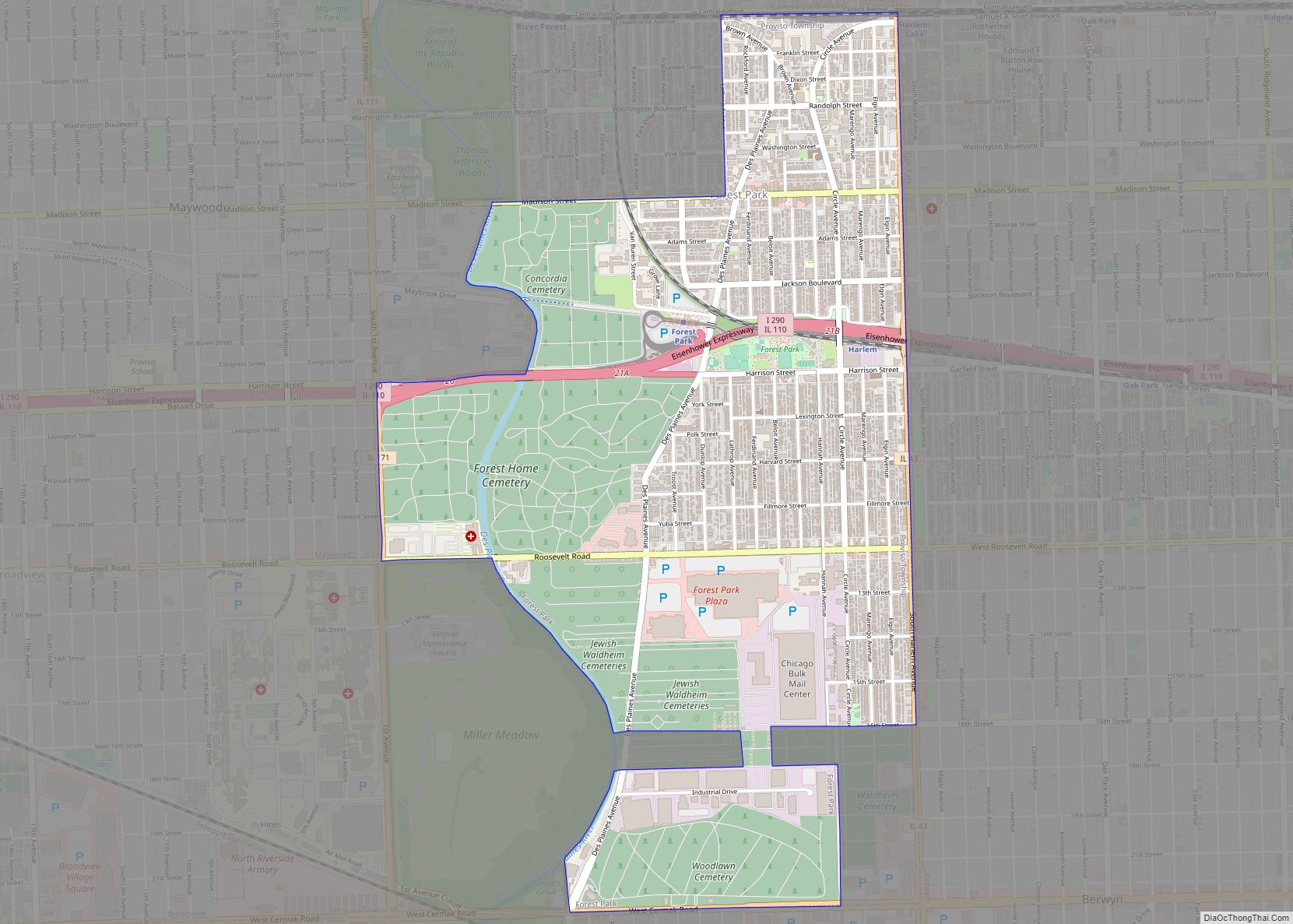
Forest Park (formerly Harlem) is a village in Cook County, Illinois, a suburb of Chicago, United States. The population was 14,339 at the 2020 census. The Forest Park terminal on the CTA Blue Line is the line’s western terminus, located on the Eisenhower Expressway at Des Plaines Avenue. This makes it one of only two ... Read more
Map of Forest Park village, Illinois
Map of Forreston village
Forreston is a village in Ogle County, Illinois, United States. The population was 1,446 at the 2010 census, down from 1,469 in 2000. Forreston village overview: Name: Forreston village LSAD Code: 47 LSAD Description: village (suffix) State: Illinois County: Ogle County Elevation: 938 ft (286 m) Total Area: 0.94 sq mi (2.44 km²) Land Area: 0.94 sq mi (2.44 km²) Water Area: 0.00 sq mi ... Read more
Map of Forreston village
Map of Forrest village
Forrest is a village in Livingston County, Illinois, United States. The population was 1,220 at the 2010 census. Forrest village overview: Name: Forrest village LSAD Code: 47 LSAD Description: village (suffix) State: Illinois County: Livingston County Elevation: 683 ft (208 m) Total Area: 0.65 sq mi (1.68 km²) Land Area: 0.65 sq mi (1.68 km²) Water Area: 0.00 sq mi (0.00 km²) Total Population: 1,041 Population ... Read more
Map of Forrest village
Map of Fox Lake Hills CDP
Fox Lake Hills CDP overview: Name: Fox Lake Hills CDP LSAD Code: 57 LSAD Description: CDP (suffix) State: Illinois County: Lake County FIPS code: 1727455 Online Interactive Map Fox Lake Hills online map. Source: Basemap layers from Google Map, Open Street Map (OSM), Arcgisonline, Wmflabs. Boundary Data from Database of Global Administrative Areas. Fox Lake ... Read more
Map of Fox Lake Hills CDP
Map of Forsyth village, Illinois
Forsyth is a village in Macon County, Illinois, United States. Its population was 3,734 at the 2020 census, up from 3,490 in 2010. It is included in the Decatur, Illinois Metropolitan Statistical Area. Forsyth village overview: Name: Forsyth village LSAD Code: 47 LSAD Description: village (suffix) State: Illinois County: Macon County Elevation: 676 ft (206 m) Total ... Read more
Map of Forsyth village, Illinois
Map of Fox Lake village, Illinois
Fox Lake is a village in Grant and Antioch townships in Lake County, Illinois and Burton Township, McHenry County, Illinois, United States. The population was 10,978 at the 2020 census. It is located approximately 57 miles north of Chicago. Fox Lake village overview: Name: Fox Lake village LSAD Code: 47 LSAD Description: village (suffix) State: ... Read more
Map of Fox Lake village, Illinois
Map of Fox River Grove village
Fox River Grove (FRG) is a village in Algonquin Township, McHenry County and Cuba Township, Lake County, Illinois, United States. As per 2020 census, the population was 4,702. In 1919, the village of Fox River Grove was officially incorporated, becoming the ninth village in McHenry County. The Grove is situated along the southern shore of ... Read more
Map of Fox River Grove village
Map of Frankfort village, Illinois
Frankfort is a village in Will County and Cook County in the U.S. state of Illinois. It is a southern suburb of Chicago, and is approximately 28 miles (45 km) south of the city. As of the 2020 census, the population was 20,296. Frankfort’s historic downtown area contains the Frankfort Grainery, Breidert Green, and a ... Read more
Map of Frankfort village, Illinois
Map of Frankfort Square CDP
Frankfort Square is a census-designated place (CDP) in Will County, Illinois, United States. Per the 2020 census, the population was 8,968. Frankfort Square CDP overview: Name: Frankfort Square CDP LSAD Code: 57 LSAD Description: CDP (suffix) State: Illinois County: Will County Elevation: 709 ft (216 m) Total Area: 2.50 sq mi (6.47 km²) Land Area: 2.50 sq mi (6.47 km²) Water Area: 0.00 sq mi ... Read more
Map of Frankfort Square CDP
Map of Franklin Park village, Illinois
Franklin Park is a village in Cook County, Illinois, United States. The population was 18,467 at the 2020 census, up from 18,333 at the 2010 census. It was named for real estate broker Lesser Franklin who bought acres of the area when it was a majority of farming fields. Franklin Park village overview: Name: Franklin ... Read more
Map of Franklin Park village, Illinois
Map of Franklin Grove village
Franklin Grove is a village in Lee County, Illinois, United States. The population was 1,021 at the 2010 census, down from 1,052 in 2000. Franklin Grove village overview: Name: Franklin Grove village LSAD Code: 47 LSAD Description: village (suffix) State: Illinois County: Lee County Total Area: 0.43 sq mi (1.11 km²) Land Area: 0.43 sq mi (1.11 km²) Water Area: 0.00 sq mi ... Read more
Map of Franklin Grove village
Map of Freeburg village, Illinois
Freeburg is a village in St. Clair County, Illinois, United States. Located within Greater St. Louis, it is a southeastern exurb with many residents commuting to Downtown St. Louis or the Belleville area for employment. As of 2010, Freeburg had a population of 4,354. Freeburg village overview: Name: Freeburg village LSAD Code: 47 LSAD Description: ... Read more
Map of Freeburg village, Illinois