Map of Heyworth village

Map of Heyworth village

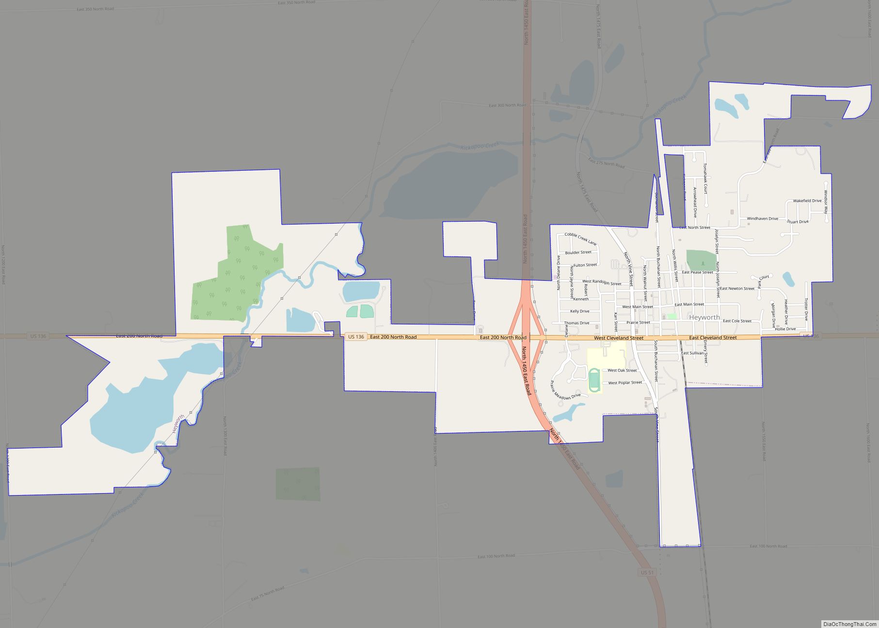
Heyworth is a village in McLean County, Illinois, United States. It was founded in 1859. As of the 2020 census, Heyworth had a population of 2,791. It is part of the Bloomington–Normal Metropolitan Statistical Area. Heyworth village overview: Name: Heyworth village LSAD Code: 47 LSAD Description: village (suffix) State: Illinois County: McLean County Elevation: 712 ft … Read more

Map of Highland Park city, Illinois

Map of Highland Park city, Illinois

Highland Park is a suburban city located in the southeastern part of Lake County, Illinois, United States, about 25 miles (40 km) north of downtown Chicago. Per the 2020 census, the population was 30,176. Highland Park is one of several municipalities located on the North Shore of the Chicago metropolitan area. Highland Park city overview: Name: … Read more

Map of Hidalgo village

Map of Hidalgo village, Illinois

Hidalgo is a village in Jasper County, Illinois, United States. The population was 106 at the 2010 census. Hidalgo village overview: Name: Hidalgo village LSAD Code: 47 LSAD Description: village (suffix) State: Illinois County: Jasper County Elevation: 581 ft (177 m) Total Area: 0.34 sq mi (0.89 km²) Land Area: 0.34 sq mi (0.89 km²) Water Area: 0.00 sq mi (0.00 km²) Total Population: 111 Population … Read more

Map of Highwood city

Map of Highwood city, Illinois

Highwood is a North Shore suburb of Chicago in Moraine Township, Lake County, Illinois, United States. As of the 2020 census, the population was 5,074. It is known for its entertainment, restaurants, bars, and festivals. Highwood city overview: Name: Highwood city LSAD Code: 25 LSAD Description: city (suffix) State: Illinois County: Lake County Total Area: … Read more

Map of Highland city, Illinois

Map of Highland city, Illinois

Highland is a city in Madison County, Illinois, United States. The population was 9,991 at the 2020 census. Highland began as a Swiss settlement and derived its name from later German immigrants. Highland is a sister city of Sursee in Switzerland. Highland is a part of the Metro-East region of the Greater St. Louis metropolitan … Read more

Map of Hillsboro city, Illinois

Map of Hillsboro city, Illinois

Hillsboro is a city in and the county seat of Montgomery County, Illinois, United States. The population was 5,902 at the 2020 census. Hillsboro city overview: Name: Hillsboro city LSAD Code: 25 LSAD Description: city (suffix) State: Illinois County: Montgomery County Elevation: 587 ft (179 m) Total Area: 10.17 sq mi (26.35 km²) Land Area: 8.42 sq mi (21.82 km²) Water Area: 1.75 sq mi … Read more

Map of Hillcrest village

Map of Hillcrest village, Illinois

Hillcrest is a village located in Ogle County, Illinois, United States. The 2010 census lists its population at 1,326, up from 1,158 in 2000. Hillcrest village overview: Name: Hillcrest village LSAD Code: 47 LSAD Description: village (suffix) State: Illinois County: Ogle County Elevation: 830 ft (250 m) Total Area: 3.55 sq mi (9.19 km²) Land Area: 3.55 sq mi (9.19 km²) Water Area: … Read more

Map of Hillside village

Map of Hillside village, Illinois

Hillside is a village in Cook County, Illinois, United States. As of the 2020 census it had a population of 8,320. Hillside village overview: Name: Hillside village LSAD Code: 47 LSAD Description: village (suffix) State: Illinois County: Cook County Total Area: 3.17 sq mi (8.20 km²) Land Area: 3.17 sq mi (8.20 km²) Water Area: 0.00 sq mi (0.00 km²) Total Population: 8,320 Population … Read more

Map of Hillsdale village

Map of Hillsdale village, Illinois

Hillsdale is a village in Rock Island County, Illinois, United States. The population was 523 at the 2010 census. Hillsdale village overview: Name: Hillsdale village LSAD Code: 47 LSAD Description: village (suffix) State: Illinois County: Rock Island County Total Area: 0.68 sq mi (1.75 km²) Land Area: 0.65 sq mi (1.68 km²) Water Area: 0.03 sq mi (0.07 km²) Total Population: 531 Population Density: … Read more

Map of Hinckley village

Map of Hinckley village, Illinois

Hinckley is a village in Squaw Grove Township, DeKalb County, Illinois, United States. The population was 2006 at the 2020 census, a slight decline from 2,070 at the 2010 census. Hinckley village overview: Name: Hinckley village LSAD Code: 47 LSAD Description: village (suffix) State: Illinois County: DeKalb County Total Area: 0.85 sq mi (2.21 km²) Land Area: 0.85 sq mi … Read more

Map of Hillview village

Map of Hillview village, Illinois

Hillview is a village in Greene County, Illinois, United States. The population was 193 at the 2010 census. Hillview village overview: Name: Hillview village LSAD Code: 47 LSAD Description: village (suffix) State: Illinois County: Greene County Elevation: 446 ft (136 m) Total Area: 0.82 sq mi (2.11 km²) Land Area: 0.82 sq mi (2.11 km²) Water Area: 0.00 sq mi (0.00 km²) Total Population: 94 Population … Read more

Map of Hinsdale village

Map of Hinsdale village, Illinois

Hinsdale is a village in Cook and DuPage counties in the U.S. state of Illinois. Hinsdale is a western suburb of Chicago. The population was 17,395 at the 2020 census, most of whom lived in DuPage County. The town’s ZIP code is 60521. The town has a rolling, wooded topography, with a downtown, and is … Read more