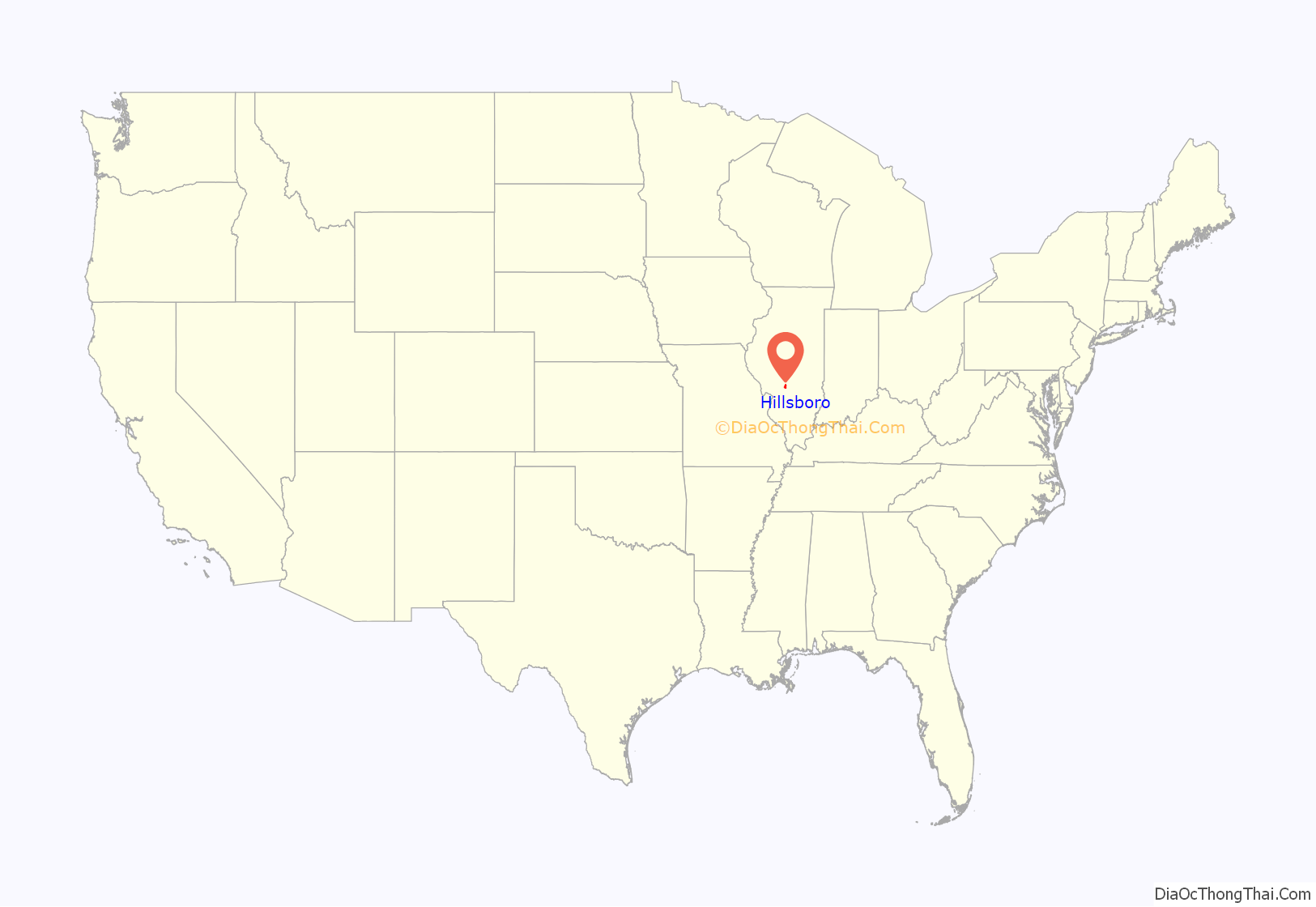
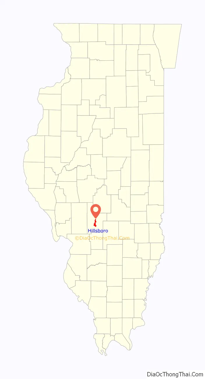
Hillsboro is a city in and the county seat of Montgomery County, Illinois, United States. The population was 5,902 at the 2020 census.
| Name: | Hillsboro city |
|---|---|
| LSAD Code: | 25 |
| LSAD Description: | city (suffix) |
| State: | Illinois |
| County: | Montgomery County |
| Elevation: | 587 ft (179 m) |
| Total Area: | 10.17 sq mi (26.35 km²) |
| Land Area: | 8.42 sq mi (21.82 km²) |
| Water Area: | 1.75 sq mi (4.53 km²) |
| Total Population: | 5,902 |
| Population Density: | 700.62/sq mi (270.50/km²) |
| ZIP code: | 62049 |
| Area code: | 217 |
| FIPS code: | 1735047 |
| GNISfeature ID: | 2394386 |
| Website: | www.hillsboroillinois.net |
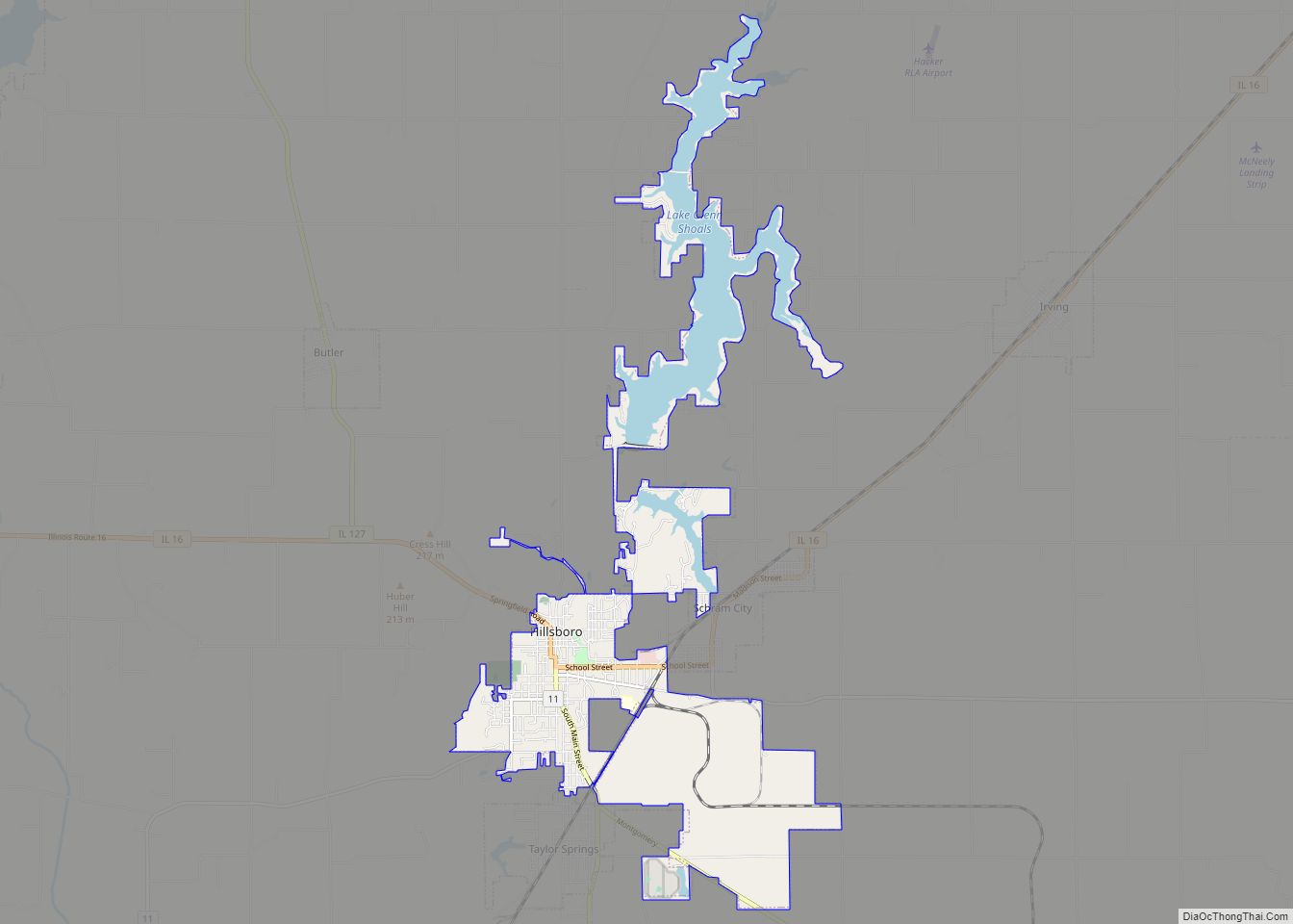
Online Interactive Map
Click on ![]() to view map in "full screen" mode.
to view map in "full screen" mode.
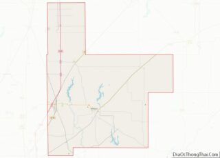
Hillsboro location map. Where is Hillsboro city?
History
The community was founded in 1823 and incorporated on March 26, 1913.
There is some doubt about the origin of the city’s name. The local terrain is quite hilly, as a result of the drainage of the Shoal Creek watershed, causing widespread belief that this is the name’s source. Alternatively, there is the belief that it was named for Hillsborough, North Carolina, the home of some of the early settlers, including Hiram Rountree and John Nussman.
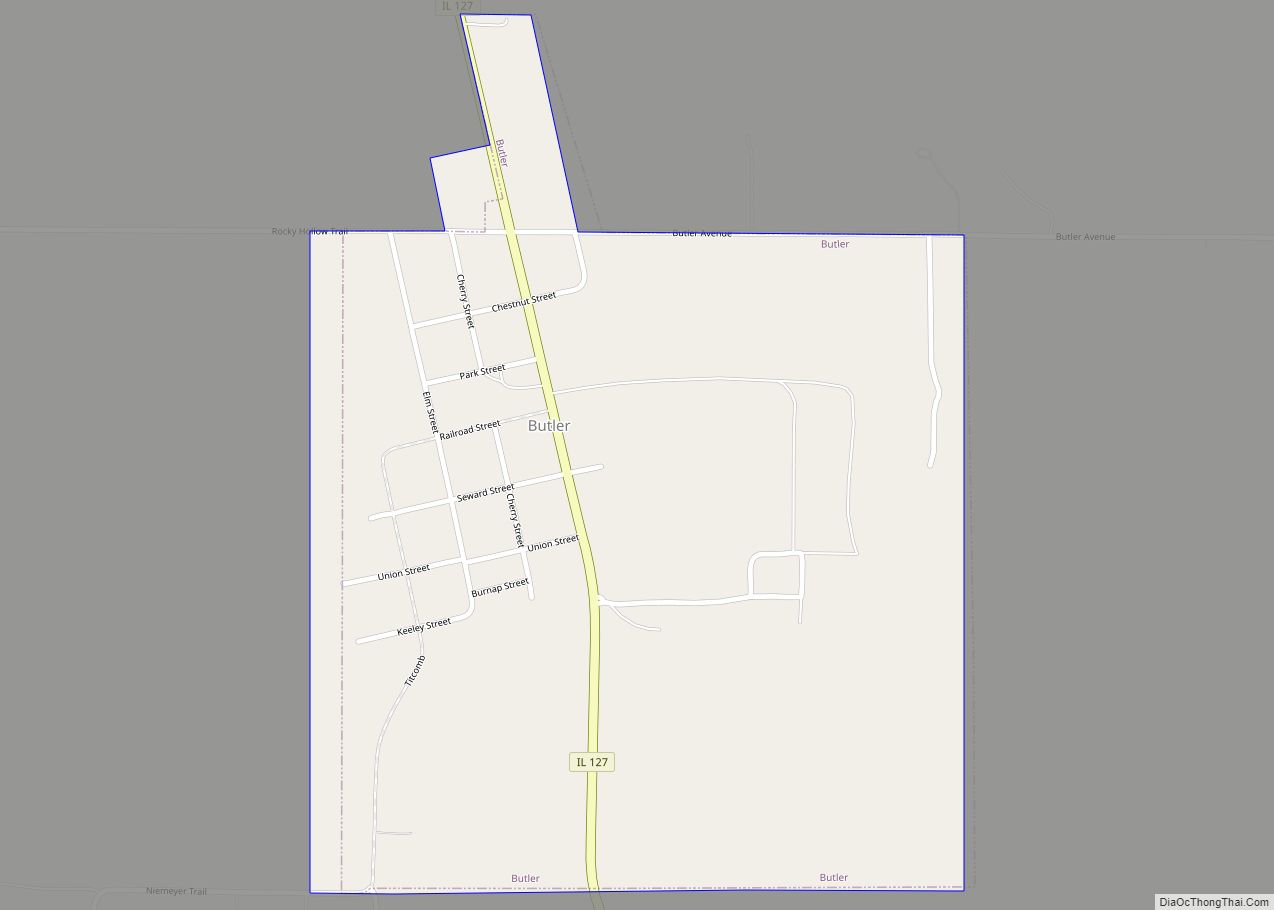
Hillsboro Road Map
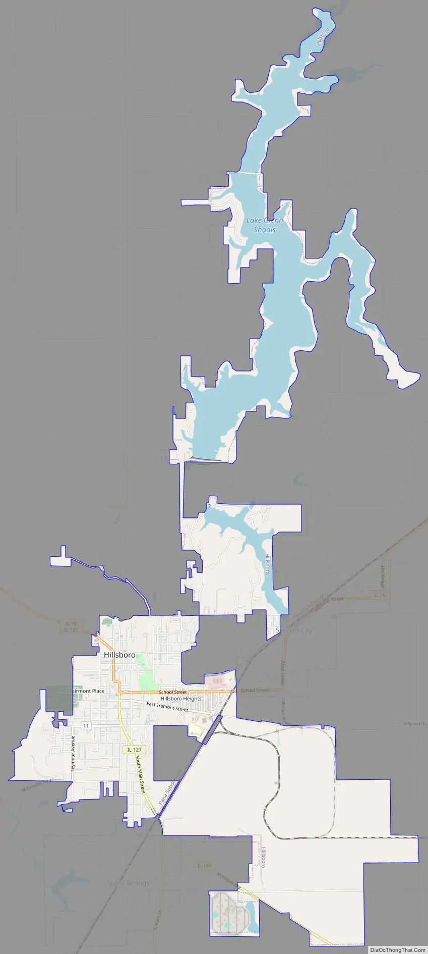
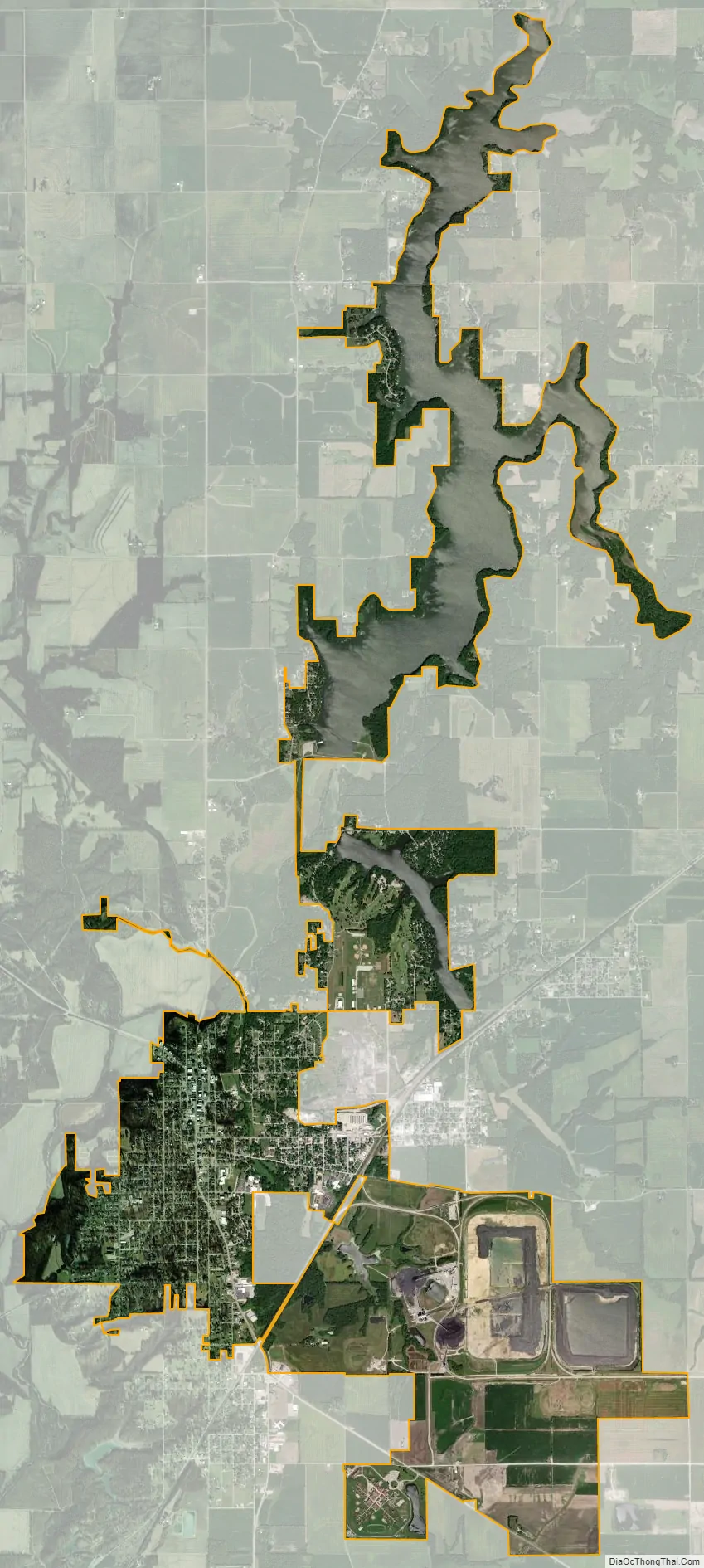
Hillsboro city Satellite Map
Geography
Hillsboro is located south of the center of Montgomery County at 39°9′54″N 89°29′4″W / 39.16500°N 89.48444°W / 39.16500; -89.48444 (39.164973, −89.484572). It is bordered to the east by Schram City and to the south by Taylor Springs.
Illinois Route 16 passes through the city center, leading west 9 miles (14 km) to Litchfield and northeast 28 miles (45 km) to Pana. Illinois Route 127 enters Hillsboro from the northwest with IL 16 but continues south as Vandalia Road; IL 127 leads north-northwest 12 miles (19 km) to Raymond and south 20 miles (32 km) to Greenville. Vandalia is 27 miles (43 km) to the southeast via Illinois Route 185.
According to the U.S. Census Bureau, Hillsboro has a total area of 10.4 square miles (27 km), of which 8.7 square miles (23 km) are land and 1.8 square miles (4.7 km), or 16.84%, are water. The Middle Fork of Shoal Creek passes just west of the city limits, flowing south toward the Kaskaskia River. Lake Glenn Shoals, north of the city, is a reservoir on the Middle Fork, and the Hillsboro city limits extend north more than 6 miles (10 km) to encompass the lake. Lake Hillsboro is a smaller reservoir on a tributary of the Middle Fork, northeast of the city center.
Climate
See also
Map of Illinois State and its subdivision:- Adams
- Alexander
- Bond
- Boone
- Brown
- Bureau
- Calhoun
- Carroll
- Cass
- Champaign
- Christian
- Clark
- Clay
- Clinton
- Coles
- Cook
- Crawford
- Cumberland
- De Kalb
- De Witt
- Douglas
- Dupage
- Edgar
- Edwards
- Effingham
- Fayette
- Ford
- Franklin
- Fulton
- Gallatin
- Greene
- Grundy
- Hamilton
- Hancock
- Hardin
- Henderson
- Henry
- Iroquois
- Jackson
- Jasper
- Jefferson
- Jersey
- Jo Daviess
- Johnson
- Kane
- Kankakee
- Kendall
- Knox
- La Salle
- Lake
- Lake Michigan
- Lawrence
- Lee
- Livingston
- Logan
- Macon
- Macoupin
- Madison
- Marion
- Marshall
- Mason
- Massac
- McDonough
- McHenry
- McLean
- Menard
- Mercer
- Monroe
- Montgomery
- Morgan
- Moultrie
- Ogle
- Peoria
- Perry
- Piatt
- Pike
- Pope
- Pulaski
- Putnam
- Randolph
- Richland
- Rock Island
- Saint Clair
- Saline
- Sangamon
- Schuyler
- Scott
- Shelby
- Stark
- Stephenson
- Tazewell
- Union
- Vermilion
- Wabash
- Warren
- Washington
- Wayne
- White
- Whiteside
- Will
- Williamson
- Winnebago
- Woodford
- Alabama
- Alaska
- Arizona
- Arkansas
- California
- Colorado
- Connecticut
- Delaware
- District of Columbia
- Florida
- Georgia
- Hawaii
- Idaho
- Illinois
- Indiana
- Iowa
- Kansas
- Kentucky
- Louisiana
- Maine
- Maryland
- Massachusetts
- Michigan
- Minnesota
- Mississippi
- Missouri
- Montana
- Nebraska
- Nevada
- New Hampshire
- New Jersey
- New Mexico
- New York
- North Carolina
- North Dakota
- Ohio
- Oklahoma
- Oregon
- Pennsylvania
- Rhode Island
- South Carolina
- South Dakota
- Tennessee
- Texas
- Utah
- Vermont
- Virginia
- Washington
- West Virginia
- Wisconsin
- Wyoming