Highland Park is a suburban city located in the southeastern part of Lake County, Illinois, United States, about 25 miles (40 km) north of downtown Chicago. Per the 2020 census, the population was 30,176. Highland Park is one of several municipalities located on the North Shore of the Chicago metropolitan area.
| Name: | Highland Park city |
|---|---|
| LSAD Code: | 25 |
| LSAD Description: | city (suffix) |
| State: | Illinois |
| County: | Lake County |
| Founded: | 1869 |
| Total Area: | 12.28 sq mi (31.79 km²) |
| Land Area: | 12.24 sq mi (31.71 km²) |
| Water Area: | 0.03 sq mi (0.08 km²) |
| Total Population: | 30,176 |
| Population Density: | 2,464.96/sq mi (951.72/km²) |
| FIPS code: | 1734722 |
| Website: | cityhpil.com |
Online Interactive Map
Click on ![]() to view map in "full screen" mode.
to view map in "full screen" mode.
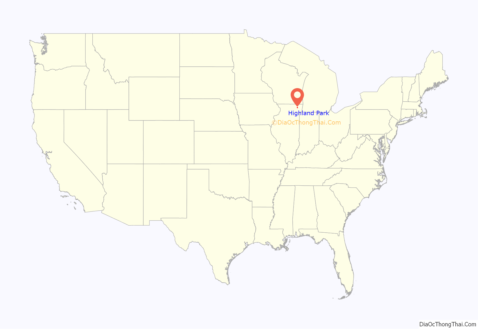
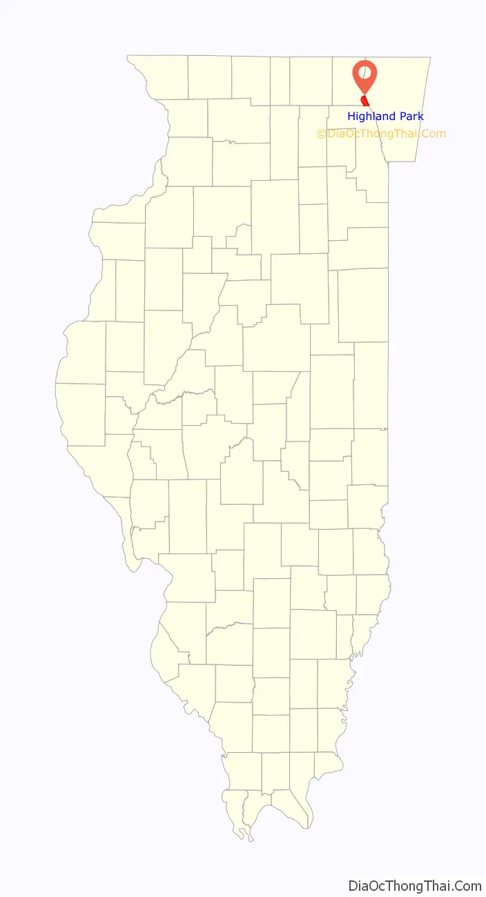
Highland Park location map. Where is Highland Park city?
History
A traveler in the area in 1833 described visiting a village of bark-covered structures where he ate roasted corn with a chief named Nic-sa-mah at a site likely located south of present-day Clavey Road and east of the Edens Expressway.
In 1847, two German immigrants, John Hettinger and John Peterman founded a town along Lake Michigan, which they called St. John’s. Soon, the town was abandoned, due to questions regarding ownership of the land. Three years later, another German Immigrant, Jacob Clinton Bloom, founded Port Clinton, which happened to be just south of St. John’s. Port Clinton was described by Elijah Middlebrook Haines as “one of the most promising villages in the city”. In 1854, a lighthouse was built in Port Clinton, thanks to funding by the US Congress and sponsorships from Illinois representatives. Despite having a functioning lighthouse with a keeper, a pier, sawmill, and a plank road, Port Clinton did not have a train station in 1855. In 1860, Port Clinton stopped growing as a town, and the lighthouse was shut down.
In 1867, ten men purchased Highland Park for $39,198.70. They were the original stockholders of the Highland Park Building Company. Following construction of the Chicago and Milwaukee Railroad, a depot was established at Highland Park and a plat, extending south to Central Avenue, was laid out in 1856. At that point, Highland Park was settled on mostly scattered farms and undeveloped forested land. Highland Park was established as a city on March 11, 1869, with a population of 500, and evolved from the two settlements of St. John and Port Clinton; St. John’s Avenue and Port Clinton Square are named after the settlements. Highland Park was named from its parklike setting at a lofty elevation relative to the lake, and was given its name from Walter S. Gurnee. The town annexed the village of Ravinia in 1899.
From its establishment in 1869 until November 1, 1900, Highland Park was a “dry” community, in which the sale of alcoholic drinks was prohibited.
In 2013, Highland Park passed an ordinance banning assault weapons within the city. In 2015, the U.S. Court of Appeals for the Seventh Circuit upheld the ban, and later that year, the U.S. Supreme Court allowed the ruling to stand.
On July 4, 2022, a mass shooting occurred at a Fourth of July parade in Highland Park, killing seven people and injuring dozens more. A suspect was apprehended hours later and charged with first-degree murder.
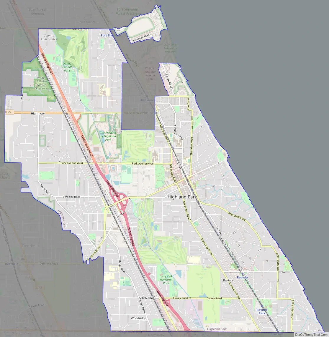
Highland Park Road Map
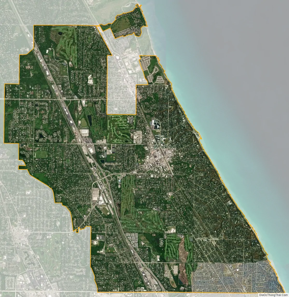
Highland Park city Satellite Map
Geography
According to the United States Census Bureau, the city has a total area of 12.2 square miles (31.7 km), of which 12.2 square miles (31.6 km) is land and 0.039 square miles (0.1 km), or 0.27%, is water. Its geographic features include a 100-foot-high (30 m) bluff running along 6 miles (10 km) of Lake Michigan shoreline and deep, wooded ravines extending up to 1 mile (1.6 km) inland. Elevations range from 580 to 725 feet (177 to 221 m) above sea level.
See also
Map of Illinois State and its subdivision:- Adams
- Alexander
- Bond
- Boone
- Brown
- Bureau
- Calhoun
- Carroll
- Cass
- Champaign
- Christian
- Clark
- Clay
- Clinton
- Coles
- Cook
- Crawford
- Cumberland
- De Kalb
- De Witt
- Douglas
- Dupage
- Edgar
- Edwards
- Effingham
- Fayette
- Ford
- Franklin
- Fulton
- Gallatin
- Greene
- Grundy
- Hamilton
- Hancock
- Hardin
- Henderson
- Henry
- Iroquois
- Jackson
- Jasper
- Jefferson
- Jersey
- Jo Daviess
- Johnson
- Kane
- Kankakee
- Kendall
- Knox
- La Salle
- Lake
- Lake Michigan
- Lawrence
- Lee
- Livingston
- Logan
- Macon
- Macoupin
- Madison
- Marion
- Marshall
- Mason
- Massac
- McDonough
- McHenry
- McLean
- Menard
- Mercer
- Monroe
- Montgomery
- Morgan
- Moultrie
- Ogle
- Peoria
- Perry
- Piatt
- Pike
- Pope
- Pulaski
- Putnam
- Randolph
- Richland
- Rock Island
- Saint Clair
- Saline
- Sangamon
- Schuyler
- Scott
- Shelby
- Stark
- Stephenson
- Tazewell
- Union
- Vermilion
- Wabash
- Warren
- Washington
- Wayne
- White
- Whiteside
- Will
- Williamson
- Winnebago
- Woodford
- Alabama
- Alaska
- Arizona
- Arkansas
- California
- Colorado
- Connecticut
- Delaware
- District of Columbia
- Florida
- Georgia
- Hawaii
- Idaho
- Illinois
- Indiana
- Iowa
- Kansas
- Kentucky
- Louisiana
- Maine
- Maryland
- Massachusetts
- Michigan
- Minnesota
- Mississippi
- Missouri
- Montana
- Nebraska
- Nevada
- New Hampshire
- New Jersey
- New Mexico
- New York
- North Carolina
- North Dakota
- Ohio
- Oklahoma
- Oregon
- Pennsylvania
- Rhode Island
- South Carolina
- South Dakota
- Tennessee
- Texas
- Utah
- Vermont
- Virginia
- Washington
- West Virginia
- Wisconsin
- Wyoming


