Map of Oneida city

Map of Oneida city, Illinois

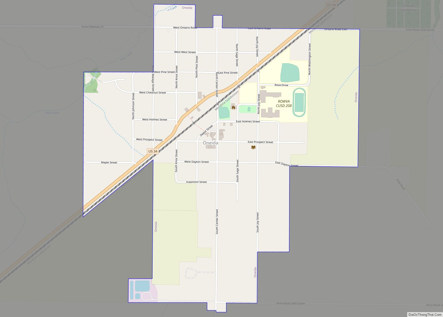
Oneida is a city in Knox County, Illinois, United States. The population was 700 at the 2010 census, down from 750 in 2000. It is part of the Galesburg Micropolitan Statistical Area. Oneida city overview: Name: Oneida city LSAD Code: 25 LSAD Description: city (suffix) State: Illinois County: Knox County Founded: 1854 Elevation: 817 ft (249 m) … Read more

Map of Orangeville village

Map of Orangeville village, Illinois

Orangeville is a village in Stephenson County, Illinois, United States. The town’s sign lists the population at 800 as of January 2021. The population in 2020 was 738. The population according to the 2010 census was 793, up from 751 in 2000. Using the 2020 population of 738 Orangeville is the 741st largest city in … Read more

Map of Oquawka village

Map of Oquawka village

Oquawka is a village in Henderson County, Illinois, United States. The population was 1,371 at the 2010 census. It is the county seat of Henderson County. Oquawka is part of the Burlington, IA–IL Micropolitan Statistical Area. Oquawka village overview: Name: Oquawka village LSAD Code: 47 LSAD Description: village (suffix) State: Illinois County: Henderson County Elevation: … Read more

Map of Oregon city

Map of Oregon city, Illinois

Oregon (/ˈɒrəɡɑːn/ oar-ə-GAHN) is a city in and the county seat of Ogle County, Illinois, United States. The population was 3,721 in 2010. Oregon city overview: Name: Oregon city LSAD Code: 25 LSAD Description: city (suffix) State: Illinois County: Ogle County Founded: 1833 Elevation: 709 ft (216 m) Total Area: 2.00 sq mi (5.17 km²) Land Area: 1.93 sq mi (4.99 km²) Water … Read more

Map of Oreana village

Map of Oreana village

Oreana is a village in Macon County, Illinois, United States, which had a population of 891 at the 2020 census. It is included in the Decatur, Illinois Metropolitan Statistical Area. Oreana village overview: Name: Oreana village LSAD Code: 47 LSAD Description: village (suffix) State: Illinois County: Macon County Elevation: 687 ft (209 m) Total Area: 0.47 sq mi (1.21 km²) … Read more

Map of Orion village

Map of Orion village

Orion (/ˈoʊriːˌən/ OR-ee-on) is a village in Henry County, Illinois, United States. The population was 1,861 at the 2010 census. It is the site for transmitters for many of the Quad Cities’ radio and television stations, including KLJB, KWQC-TV, WMWC-TV, WQAD-TV, WQPT-TV and KQIN. FM radio station transmitters include WLKU and WXLP. Orion village overview: … Read more

Map of Orient city, Illinois

Map of Orient city, Illinois

Orient is a city in Franklin County, Illinois, United States. As of the 2010 census, the city population was 358, up from 296 at the 2000 census. Orient city overview: Name: Orient city LSAD Code: 25 LSAD Description: city (suffix) State: Illinois County: Franklin County Elevation: 476 ft (145 m) Total Area: 0.75 sq mi (1.95 km²) Land Area: 0.74 sq mi … Read more

Map of Orland Park village

Map of Orland Park village

Orland Park is a village in Cook County, Illinois, United States, with a small portion in Will County. The village is a suburb of Chicago. Per the 2020 census, Orland Park had a population of 58,703. Located 25 miles (40 km) southwest of Chicago, Orland Park is close to several interstate highways, with the I-80 east-west … Read more

Map of Orland Hills village

Map of Orland Hills village

Orland Hills (formerly Westhaven) is a village in Cook County, Illinois, United States. Per the 2020 census, the population was 6,893. Orland Hills village overview: Name: Orland Hills village LSAD Code: 47 LSAD Description: village (suffix) State: Illinois County: Cook County Incorporated: June 30, 1961 Total Area: 1.15 sq mi (2.98 km²) Land Area: 1.15 sq mi (2.96 km²) Water Area: … Read more

Map of Ottawa city

Map of Ottawa city, Illinois

Ottawa is a city in and the county seat of LaSalle County, Illinois, United States. It is located at the confluence of the navigable Fox River and Illinois River, the latter being a conduit for river barges and connects Lake Michigan at Chicago, to the Mississippi River, and North America’s 25,000 mile river system. The … Read more

Map of Oswego village

Map of Oswego village, Illinois

Oswego /ɒsˈwiːɡoʊ/ is a village within the Chicago Metropolitan Area located in Kendall and Will Counties, Illinois, United States. Per the 2020 census, the population was 34,485. Oswego is the largest municipality in Kendall County. It is a suburb of Chicago, Illinois. Oswego village overview: Name: Oswego village LSAD Code: 47 LSAD Description: village (suffix) … Read more

Map of Owaneco village

Map of Owaneco village

Owaneco is a village in Christian County, Illinois, United States. The population was 209 at the 2020 census. Owaneco village overview: Name: Owaneco village LSAD Code: 47 LSAD Description: village (suffix) State: Illinois County: Christian County Elevation: 620 ft (190 m) Total Area: 0.46 sq mi (1.19 km²) Land Area: 0.46 sq mi (1.19 km²) Water Area: 0.00 sq mi (0.00 km²) Total Population: 209 Population … Read more