Oregon (/ˈɒrəɡɑːn/ oar-ə-GAHN) is a city in and the county seat of Ogle County, Illinois, United States. The population was 3,721 in 2010.
| Name: | Oregon city |
|---|---|
| LSAD Code: | 25 |
| LSAD Description: | city (suffix) |
| State: | Illinois |
| County: | Ogle County |
| Founded: | 1833 |
| Elevation: | 709 ft (216 m) |
| Total Area: | 2.00 sq mi (5.17 km²) |
| Land Area: | 1.93 sq mi (4.99 km²) |
| Water Area: | 0.07 sq mi (0.18 km²) |
| Total Population: | 3,604 |
| Population Density: | 1,870.26/sq mi (722.10/km²) |
| Area code: | 815 |
| FIPS code: | 1756484 |
| Website: | cityoforegon.org |
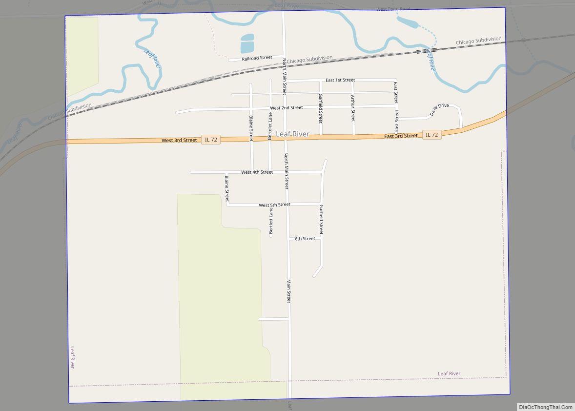
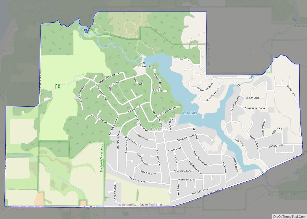
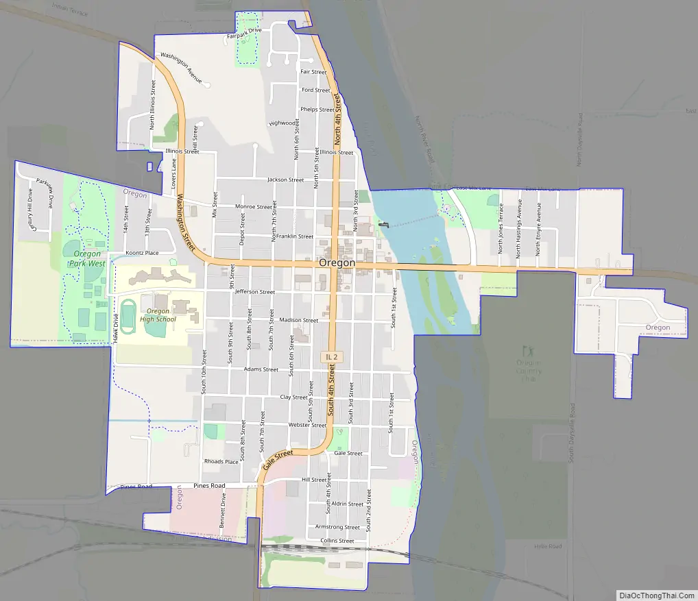
Online Interactive Map
Click on ![]() to view map in "full screen" mode.
to view map in "full screen" mode.
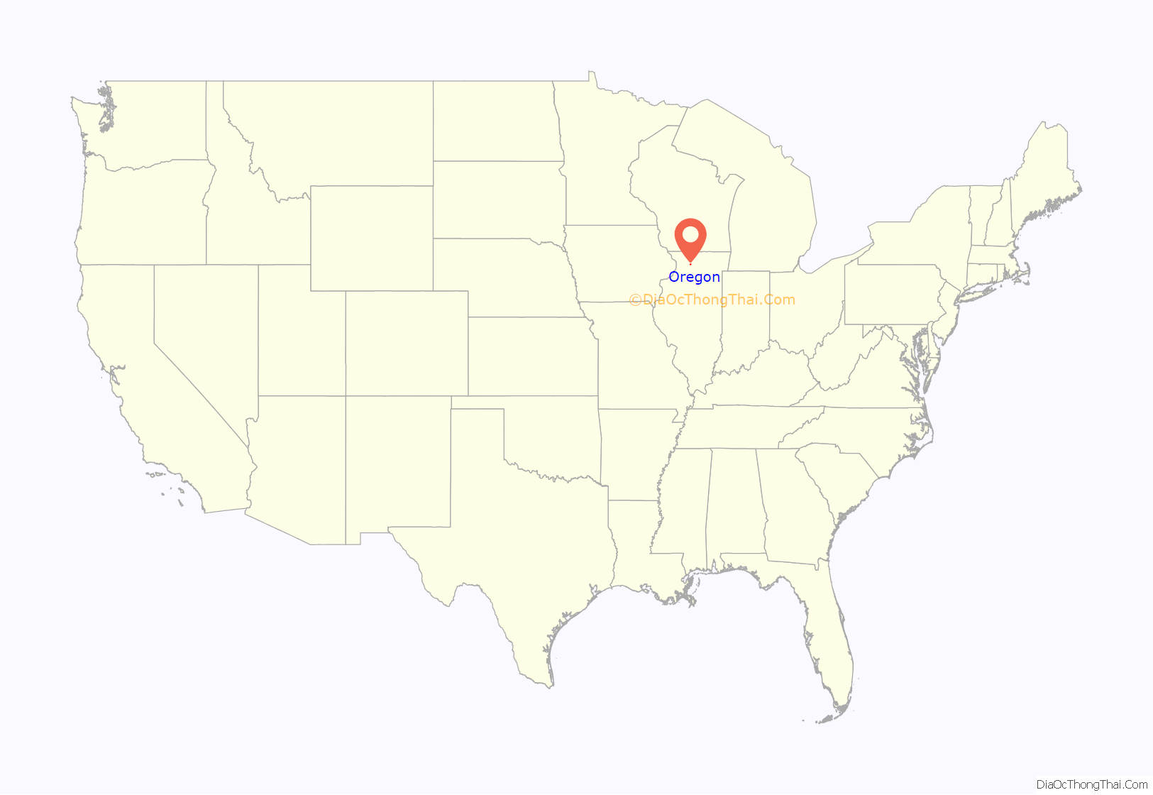
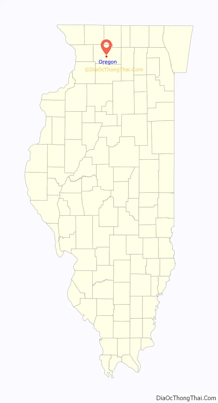
Oregon location map. Where is Oregon city?
History
The land Oregon, Illinois was founded on was previously held by the Potawatomi and Winnebago Indian tribes. In fact, later, settlers discovered that the area contained a large number of Indian mounds, most 10–12 feet (3.0–3.7 m) in diameter.
Ogle County was a New England settlement. The original founders of Oregon and Rochelle consisted entirely of settlers from New England. These people were “Yankees”, that is to say they were descended from the English Puritans who settled New England in the 1600s. They were part of a wave of New England farmers who headed west into what was then the wilds of the Northwest Territory during the early 1800s. Most of them arrived as a result of the completion of the Erie Canal. When they arrived in what is now Bureau County there was nothing but a virgin forest and wild prairie, the New Englanders laid out farms, constructed roads, erected government buildings and established post routes. They brought with them many of their Yankee New England values, such as a passion for education, establishing many schools as well as staunch support for abolitionism. They were mostly members of the Congregationalist Church though some were Episcopalian. Culturally Bureau County, like much of northern Illinois would be culturally very continuous with early New England culture, for most of its history.
The first European to visit the land was pioneer John Phelps. Phelps first visited the area in 1829 and returned in 1833 hoping to find a suitable site to settle. Phelps found a forest and river-fed valley which impressed him enough that he built his cabin there. Other pioneers followed Phelps to this site, and Phelps helped create the first church, school, grocery store, blacksmith shop, and post office in Oregon. By December 4, 1838, due in large part to the efforts of Phelps and his brothers B.T. Phelps and G.W. Phelps, the land was claimed, subdivided and certified by the Ogle County clerk as Oregon City. The name Oregon means “River of the West”.
In 1839, Oregon City was renamed Florence after a visitor compared the scenic beauty of the Rock River to the Italian city of the same name. Florence was used for only about three years when the city opted to revert to its original name, without the word “city,” in 1843. By 1847 the town had a general store, sawmill, ferry, 44 households and a population of 225. The population continued to grow through the 1850s and 1860s, a fact demonstrated by the increasing number of churches in those decades and the building of a railroad in 1871. Industry followed the railroad and Oregon became home to an oatmeal mill, furniture factory, chair factory, flour mill and a foundry, Paragon Foundry, which operated until the 1960s.
The city of Oregon was first organized under an act of the Illinois General Assembly which was approved on April 1, 1869. By the 1870s the town of Oregon and nearby area was home to around 2,000 people. James Gale was elected the city’s first mayor on March 21, 1870 and four other men, Christian Lehman, W.W. Bennett, George M. Dwight and George P. Jacobs, were chosen as aldermen. On March 29, 1873 the city was reorganized because of an act of the Illinois legislature which allowed the municipalities to incorporate as cities and villages. In 1920, the Oregon City Hall was constructed on the perimeter of the city’s commercial district and it has been the center of city government ever since. The Ogle County Courthouse was built in 1891 on the corner of Washington Street and Fourth Street (Illinois Route 64 and Illinois Route 2).
Between 1908 and 1911, on a site just north of the city, sculptor Lorado Taft erected a 50-foot tall statue he had designed and originally named The Eternal Indian. Located on a bluff overlooking the Rock River valley, the sculpture is now known as the Black Hawk Statue, named after Black Hawk, a chief of the Sauk Indian tribe that once inhabited the area.
The city of Oregon annexed nearby Daysville, Illinois, in 1993.
Oregon Road Map
Oregon city Satellite Map

Geography
According to the 2010 census, Oregon has a total area of 2.028 square miles (5.25 km), of which 1.96 square miles (5.08 km) (or 96.65%) is land and 0.068 square miles (0.18 km) (or 3.35%) is water.
See also
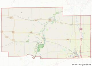
Map of Illinois State and its subdivision:- Adams
- Alexander
- Bond
- Boone
- Brown
- Bureau
- Calhoun
- Carroll
- Cass
- Champaign
- Christian
- Clark
- Clay
- Clinton
- Coles
- Cook
- Crawford
- Cumberland
- De Kalb
- De Witt
- Douglas
- Dupage
- Edgar
- Edwards
- Effingham
- Fayette
- Ford
- Franklin
- Fulton
- Gallatin
- Greene
- Grundy
- Hamilton
- Hancock
- Hardin
- Henderson
- Henry
- Iroquois
- Jackson
- Jasper
- Jefferson
- Jersey
- Jo Daviess
- Johnson
- Kane
- Kankakee
- Kendall
- Knox
- La Salle
- Lake
- Lake Michigan
- Lawrence
- Lee
- Livingston
- Logan
- Macon
- Macoupin
- Madison
- Marion
- Marshall
- Mason
- Massac
- McDonough
- McHenry
- McLean
- Menard
- Mercer
- Monroe
- Montgomery
- Morgan
- Moultrie
- Ogle
- Peoria
- Perry
- Piatt
- Pike
- Pope
- Pulaski
- Putnam
- Randolph
- Richland
- Rock Island
- Saint Clair
- Saline
- Sangamon
- Schuyler
- Scott
- Shelby
- Stark
- Stephenson
- Tazewell
- Union
- Vermilion
- Wabash
- Warren
- Washington
- Wayne
- White
- Whiteside
- Will
- Williamson
- Winnebago
- Woodford
- Alabama
- Alaska
- Arizona
- Arkansas
- California
- Colorado
- Connecticut
- Delaware
- District of Columbia
- Florida
- Georgia
- Hawaii
- Idaho
- Illinois
- Indiana
- Iowa
- Kansas
- Kentucky
- Louisiana
- Maine
- Maryland
- Massachusetts
- Michigan
- Minnesota
- Mississippi
- Missouri
- Montana
- Nebraska
- Nevada
- New Hampshire
- New Jersey
- New Mexico
- New York
- North Carolina
- North Dakota
- Ohio
- Oklahoma
- Oregon
- Pennsylvania
- Rhode Island
- South Carolina
- South Dakota
- Tennessee
- Texas
- Utah
- Vermont
- Virginia
- Washington
- West Virginia
- Wisconsin
- Wyoming