Map of Maize city

Map of Maize city

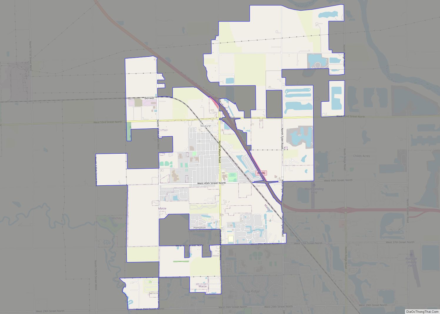
Maize is a city in Sedgwick County, Kansas, United States, and a suburb of Wichita. As of the 2020 census, the population of the city was 5,735. The name Maize, derived from a Native American word for “corn”, was named because it is located within the Corn Belt. Maize city overview: Name: Maize city LSAD … Read more

Map of Maple Hill city

Map of Maple Hill city

Maple Hill is a city in Wabaunsee County, Kansas, United States. As of the 2020 census, the population of the city was 631. Maple Hill city overview: Name: Maple Hill city LSAD Code: 25 LSAD Description: city (suffix) State: Kansas County: Wabaunsee County Founded: 1882 Incorporated: 1908 Elevation: 974 ft (297 m) Total Area: 0.24 sq mi (0.63 km²) Land … Read more

Map of Manter city

Map of Manter city

Manter is a city in Stanton County, Kansas, United States. As of the 2020 census, the population of the city was 132. Manter city overview: Name: Manter city LSAD Code: 25 LSAD Description: city (suffix) State: Kansas County: Stanton County Incorporated: 1924 Elevation: 3,491 ft (1,064 m) Total Area: 0.24 sq mi (0.63 km²) Land Area: 0.24 sq mi (0.63 km²) Water Area: … Read more

Map of Mankato city

Map of Mankato city, Kansas

Mankato is a city in and the county seat of Jewell County, Kansas, United States. As of the 2020 census, the population of the city was 836. Mankato city overview: Name: Mankato city LSAD Code: 25 LSAD Description: city (suffix) State: Kansas County: Jewell County Founded: 1870s Incorporated: 1880 Elevation: 1,772 ft (540 m) Total Area: 0.97 sq mi … Read more

Map of Marion city, Kansas

Map of Marion city, Kansas

Marion is a city in, and the county seat of, Marion County, Kansas, United States. It was named in honor of Francis Marion, a brigadier general of the American Revolutionary War, known as the “Swamp Fox”. As of the 2020 census, the population of the city was 1,922. Marion city overview: Name: Marion city LSAD … Read more

Map of Marienthal CDP

Map of Marienthal CDP

Marienthal is an unincorporated community in Wichita County, Kansas, United States. As of the 2020 census, the population of the community and nearby areas was 64. Marienthal CDP overview: Name: Marienthal CDP LSAD Code: 57 LSAD Description: CDP (suffix) State: Kansas County: Wichita County Elevation: 3,215 ft (980 m) Total Area: 64 ZIP code: 67863 Area code: … Read more

Map of Mapleton city, Kansas

Map of Mapleton city, Kansas

Mapleton is a city in Bourbon County, Kansas, United States. As of the 2020 census, the population of the city was 96. Mapleton city overview: Name: Mapleton city LSAD Code: 25 LSAD Description: city (suffix) State: Kansas County: Bourbon County Founded: 1857 Incorporated: 1905 Elevation: 886 ft (270 m) Total Area: 0.50 sq mi (1.30 km²) Land Area: 0.50 sq mi (1.28 km²) … Read more

Map of Matfield Green city

Map of Matfield Green city

Matfield Green is a city in Chase County, Kansas, United States. As of the 2020 census, the population of the city was 49. It is located along K-177 highway. Matfield Green city overview: Name: Matfield Green city LSAD Code: 25 LSAD Description: city (suffix) State: Kansas County: Chase County Incorporated: 1924 Elevation: 1,306 ft (398 m) Total … Read more

Map of Marysville city, Kansas

Map of Marysville city, Kansas

Marysville is a city in and the county seat of Marshall County, Kansas, United States. As of the 2020 census, the population of the city was 3,447. Marysville city overview: Name: Marysville city LSAD Code: 25 LSAD Description: city (suffix) State: Kansas County: Marshall County Incorporated: 1861 Elevation: 1,161 ft (354 m) Total Area: 4.61 sq mi (11.94 km²) Land … Read more

Map of Marquette city, Kansas

Map of Marquette city, Kansas

Marquette is a city in McPherson County, Kansas, United States. As of the 2020 census, the population of the city was 599. It is located between K-4 and the Smoky Hill River. Marquette city overview: Name: Marquette city LSAD Code: 25 LSAD Description: city (suffix) State: Kansas County: McPherson County Founded: 1874 Incorporated: 1874 Elevation: … Read more

Map of McConnell AFB CDP

Map of McConnell AFB CDP

McConnell Air Force Base (IATA: IAB, ICAO: KIAB, FAA LID: IAB) is a United States Air Force base located four miles (6 km) southeast of the central business district of Wichita, a city in Sedgwick County, Kansas, United States. The airbase was named in honor of the brothers Fred and Thomas McConnell of Wichita, who had … Read more

Map of Mayfield city

Map of Mayfield city, Kansas

Mayfield is a city in Sumner County, Kansas, United States. As of the 2020 census, the population of the city was 75. Mayfield city overview: Name: Mayfield city LSAD Code: 25 LSAD Description: city (suffix) State: Kansas County: Sumner County Founded: 1880s Incorporated: 1927 Elevation: 1,283 ft (391 m) Total Area: 0.30 sq mi (0.77 km²) Land Area: 0.30 sq mi (0.77 km²) … Read more