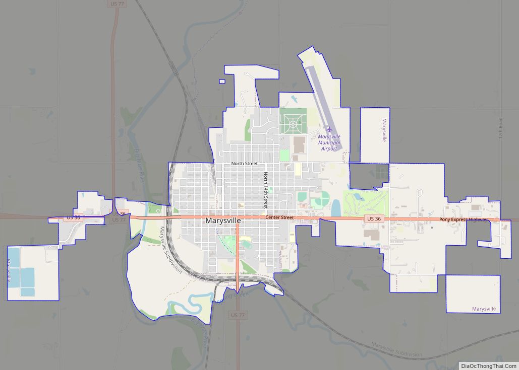
Marysville is a city in and the county seat of Marshall County, Kansas, United States. As of the 2020 census, the population of the city was 3,447.
| Name: | Marysville city |
|---|---|
| LSAD Code: | 25 |
| LSAD Description: | city (suffix) |
| State: | Kansas |
| County: | Marshall County |
| Incorporated: | 1861 |
| Elevation: | 1,161 ft (354 m) |
| Total Area: | 4.61 sq mi (11.94 km²) |
| Land Area: | 4.58 sq mi (11.86 km²) |
| Water Area: | 0.03 sq mi (0.08 km²) |
| Total Population: | 3,447 |
| Population Density: | 750/sq mi (290/km²) |
| ZIP code: | 66508, 66555 |
| Area code: | 785 |
| FIPS code: | 2045050 |
| Website: | cityofmarysvilleks.com |
Online Interactive Map
Click on ![]() to view map in "full screen" mode.
to view map in "full screen" mode.
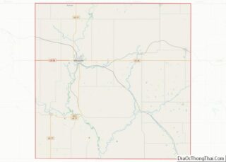
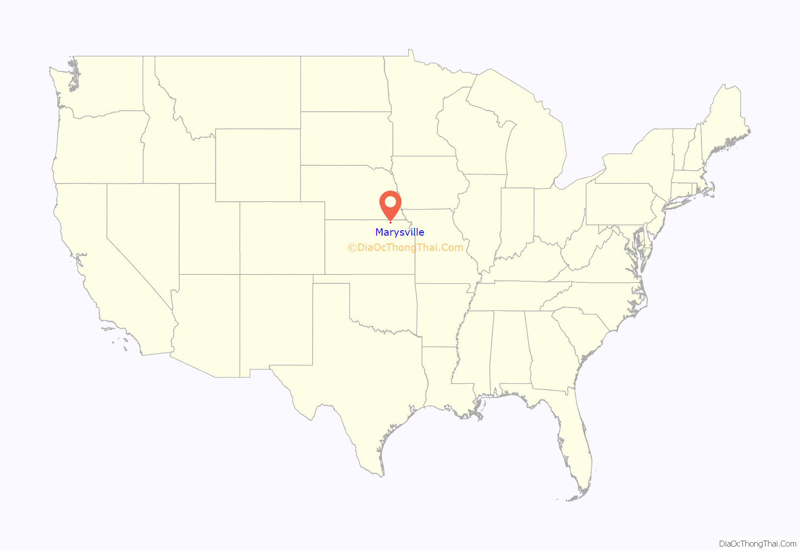
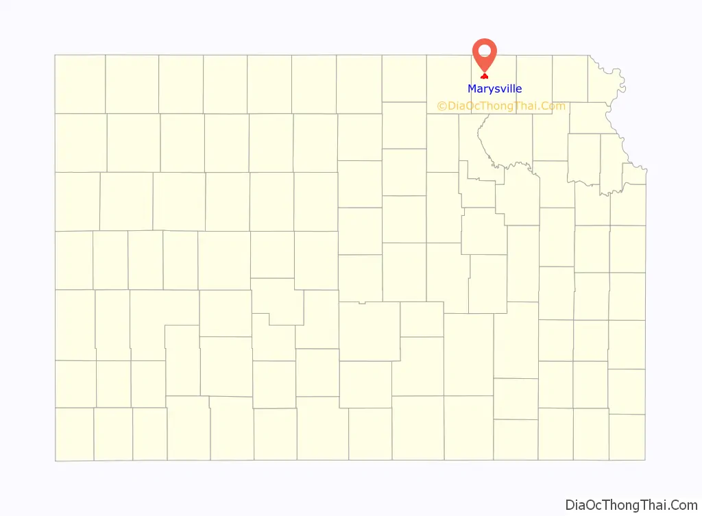
Marysville location map. Where is Marysville city?
History
Marysville was laid out in 1855 by Francis J. Marshall, and designated in that same year the county seat. It was incorporated as a city in 1861.
Marysville was located on the Oregon Trail and the route of the Pony Express, the St. Joe Road, the Overland Stage, The Military Road, and the Otoe-Missouria Trail. British explorer Richard Francis Burton en route to California in 1860 noted: “Passing by Marysville, in old maps Palmetto City, a country-town which thrives by selling whiskey to ruffians of all descriptions …” The old Pony Express Station still stands in downtown Marysville. In Beyond the Mississippi (1867), Albert D. Richardson, who passed through Marysville in 1860, wrote that the town—which was named after the Border Ruffian Marshall’s wife—”had 50 houses and was famed for whisky and shooting affrays.”
Marysville owed much of its prosperity to the Union Pacific Railroad, which became a major employer. But as the city grew along the railroad most of the community was across the tracks from a good part of downtown. As rail traffic increased, vehicular delays were estimated at 7.5 to 8 hours per day at the five grade crossings, which also affected emergency vehicles. In 2006 the main line was moved out of the center of town to a bypass to the south and west, with grade separations for US-36 and US-77.
Marysville is also known as the “Black Squirrel City” due to an isolated community of all-black squirrels that make their homes in the town. The squirrels are said to be the result of escapees from a traveling circus.
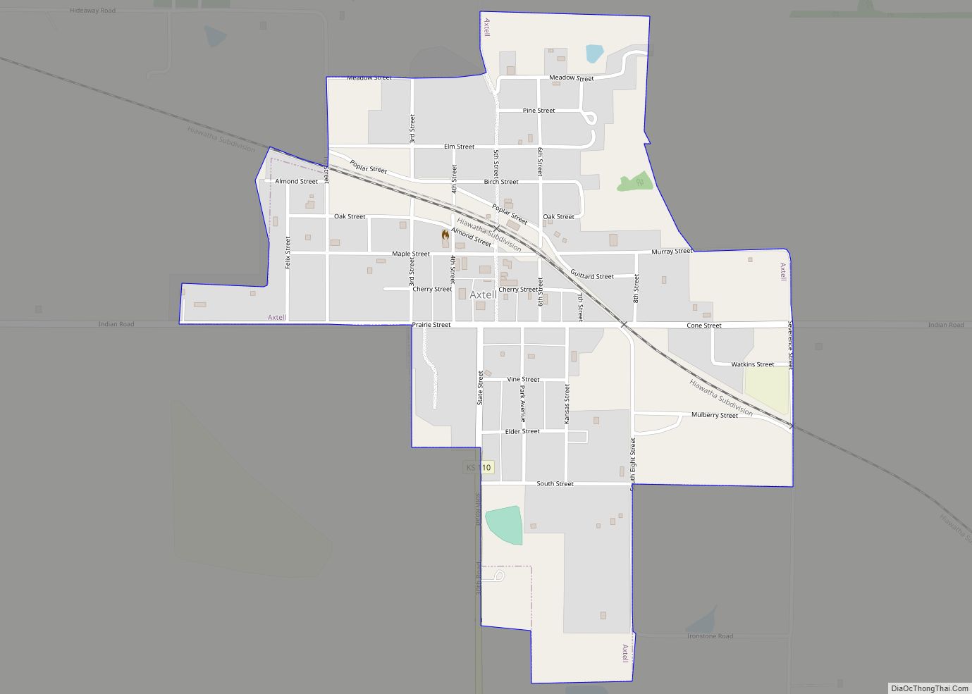
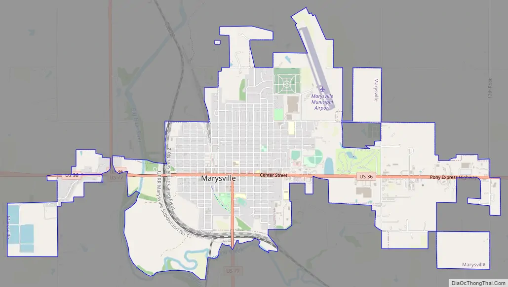
Marysville Road Map
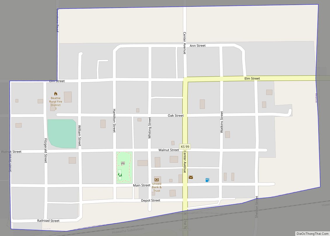
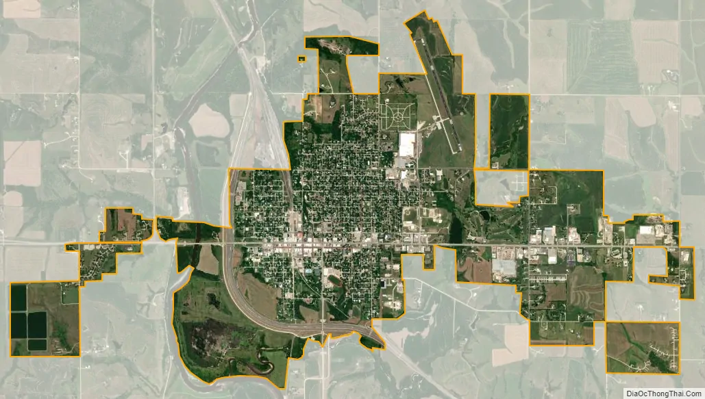
Marysville city Satellite Map
Geography
Marysville is located in northeast Kansas near the Nebraska border, about 75 miles (120 km) northwest of the Kansas capital of Topeka and 67 miles (108 km) south of Lincoln, Nebraska. According to the United States Census Bureau, the city has a total area of 4.62 square miles (11.97 km), of which 4.58 square miles (11.86 km) is land and 0.04 square miles (0.10 km) is water.
See also
Map of Kansas State and its subdivision:- Allen
- Anderson
- Atchison
- Barber
- Barton
- Bourbon
- Brown
- Butler
- Chase
- Chautauqua
- Cherokee
- Cheyenne
- Clark
- Clay
- Cloud
- Coffey
- Comanche
- Cowley
- Crawford
- Decatur
- Dickinson
- Doniphan
- Douglas
- Edwards
- Elk
- Ellis
- Ellsworth
- Finney
- Ford
- Franklin
- Geary
- Gove
- Graham
- Grant
- Gray
- Greeley
- Greenwood
- Hamilton
- Harper
- Harvey
- Haskell
- Hodgeman
- Jackson
- Jefferson
- Jewell
- Johnson
- Kearny
- Kingman
- Kiowa
- Labette
- Lane
- Leavenworth
- Lincoln
- Linn
- Logan
- Lyon
- Marion
- Marshall
- McPherson
- Meade
- Miami
- Mitchell
- Montgomery
- Morris
- Morton
- Nemaha
- Neosho
- Ness
- Norton
- Osage
- Osborne
- Ottawa
- Pawnee
- Phillips
- Pottawatomie
- Pratt
- Rawlins
- Reno
- Republic
- Rice
- Riley
- Rooks
- Rush
- Russell
- Saline
- Scott
- Sedgwick
- Seward
- Shawnee
- Sheridan
- Sherman
- Smith
- Stafford
- Stanton
- Stevens
- Sumner
- Thomas
- Trego
- Wabaunsee
- Wallace
- Washington
- Wichita
- Wilson
- Woodson
- Wyandotte
- Alabama
- Alaska
- Arizona
- Arkansas
- California
- Colorado
- Connecticut
- Delaware
- District of Columbia
- Florida
- Georgia
- Hawaii
- Idaho
- Illinois
- Indiana
- Iowa
- Kansas
- Kentucky
- Louisiana
- Maine
- Maryland
- Massachusetts
- Michigan
- Minnesota
- Mississippi
- Missouri
- Montana
- Nebraska
- Nevada
- New Hampshire
- New Jersey
- New Mexico
- New York
- North Carolina
- North Dakota
- Ohio
- Oklahoma
- Oregon
- Pennsylvania
- Rhode Island
- South Carolina
- South Dakota
- Tennessee
- Texas
- Utah
- Vermont
- Virginia
- Washington
- West Virginia
- Wisconsin
- Wyoming