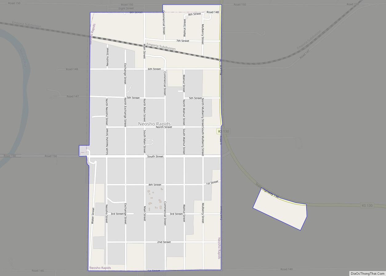
Map of Netawaka city

Map of Netawaka city

Netawaka is a city in Jackson County, Kansas, United States. As of the 2020 census, the population of the city was 139. Netawaka city overview: Name: Netawaka city LSAD Code: 25 LSAD Description: city (suffix) State: Kansas County: Jackson County Founded: 1866 Elevation: 1,155 ft (352 m) Total Area: 0.97 sq mi (2.51 km²) Land Area: 0.97 sq mi (2.51 km²) Water Area: … Read more

Map of New Strawn city

Map of New Strawn city

New Strawn is a city in Coffey County, Kansas, United States. As of the 2020 census, the population of the city was 414. New Strawn city overview: Name: New Strawn city LSAD Code: 25 LSAD Description: city (suffix) State: Kansas County: Coffey County Incorporated: 1970 Elevation: 1,106 ft (337 m) Total Area: 0.83 sq mi (2.15 km²) Land Area: 0.79 sq mi … Read more

Map of New Cambria city

Map of New Cambria city, Kansas

New Cambria is a city in Saline County, Kansas, United States. As of the 2020 census, the population of the city was 106. New Cambria city overview: Name: New Cambria city LSAD Code: 25 LSAD Description: city (suffix) State: Kansas County: Saline County Founded: 1800s Incorporated: 1913 Elevation: 1,194 ft (364 m) Total Area: 0.18 sq mi (0.46 km²) Land … Read more

Map of New Albany city, Kansas

Map of New Albany city, Kansas

New Albany is a city in Wilson County, Kansas, United States. As of the 2020 census, the population of the city was 57. New Albany city overview: Name: New Albany city LSAD Code: 25 LSAD Description: city (suffix) State: Kansas County: Wilson County Founded: 1866 Incorporated: 1907 Elevation: 896 ft (273 m) Total Area: 0.18 sq mi (0.48 km²) Land … Read more

Map of Niotaze city

Map of Niotaze city

Niotaze is a city in Chautauqua County, Kansas, United States. As of the 2020 census, the population of the city was 90. Niotaze city overview: Name: Niotaze city LSAD Code: 25 LSAD Description: city (suffix) State: Kansas County: Chautauqua County Incorporated: 1910 Elevation: 755 ft (230 m) Total Area: 0.37 sq mi (0.96 km²) Land Area: 0.37 sq mi (0.96 km²) Water Area: … Read more

Map of Nickerson city

Map of Nickerson city, Kansas

Nickerson is a city in Reno County, Kansas, United States. As of the 2020 census, the population of the city was 1,058. It was named in honor of Thomas Nickerson, former president of Atchison, Topeka and Santa Fe Railway. Nickerson city overview: Name: Nickerson city LSAD Code: 25 LSAD Description: city (suffix) State: Kansas County: … Read more

Map of Newton city, Kansas

Map of Newton city, Kansas

Newton is a city in and the county seat of Harvey County, Kansas, United States. As of the 2020 census, the population of the city was 18,602. Newton is located 25 miles (40 km) north of Wichita. The city of North Newton is located immediately north and exists as a separate political entity. Newton is located … Read more

Map of Norton city

Map of Norton city, Kansas

Norton is a city in, and the county seat of, Norton County, Kansas, United States. As of the 2020 census, the population of the city was 2,747. Norton city overview: Name: Norton city LSAD Code: 25 LSAD Description: city (suffix) State: Kansas County: Norton County Incorporated: 1885 Elevation: 2,313 ft (705 m) Total Area: 1.91 sq mi (4.94 km²) Land … Read more

Map of North Newton city

Map of North Newton city

North Newton is a city in Harvey County, Kansas, United States. As of the 2020 census, the population of the city was 1,814. It is located between the north side of the city of Newton (separate entity) and the south side of Interstate I-135. North Newton is home of Bethel College. North Newton city overview: … Read more

Map of Norcatur city

Map of Norcatur city

Norcatur is a city in Decatur County, Kansas, United States. As of the 2020 census, the population of the city was 159. Norcatur city overview: Name: Norcatur city LSAD Code: 25 LSAD Description: city (suffix) State: Kansas County: Decatur County Founded: 1885 Incorporated: 1901 Elevation: 2,644 ft (806 m) Total Area: 1.00 sq mi (2.58 km²) Land Area: 1.00 sq mi (2.58 km²) … Read more

Map of Oak Hill city, Kansas

Map of Oak Hill city, Kansas

Oak Hill is a city in Clay County, Kansas, United States. As of the 2020 census, the population of the city was 24. Oak Hill city overview: Name: Oak Hill city LSAD Code: 25 LSAD Description: city (suffix) State: Kansas County: Clay County Incorporated: 1925 Elevation: 1,266 ft (386 m) Total Area: 0.05 sq mi (0.13 km²) Land Area: 0.05 sq mi … Read more

Map of Norwich city, Kansas

Map of Norwich city, Kansas

Norwich is a city in Kingman County, Kansas, United States. As of the 2020 census, the population of the city was 444. Norwich city overview: Name: Norwich city LSAD Code: 25 LSAD Description: city (suffix) State: Kansas County: Kingman County Founded: 1885 Incorporated: 1886 Elevation: 1,493 ft (455 m) Total Area: 0.40 sq mi (1.04 km²) Land Area: 0.40 sq mi (1.04 km²) … Read more